 Highlights:
- Cold air settles in
- 1st accumulating snow of the season
- Active northwest flow pattern remains
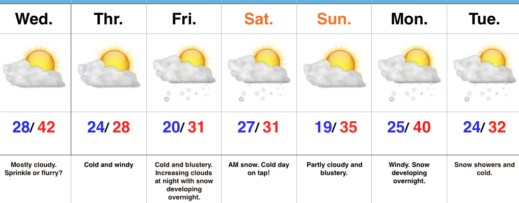
Unseasonably Cold…Northwest winds helped usher in a much colder air mass Tuesday behind an early morning frontal passage. While a couple of flurries are possible Wednesday, we’re mostly dry through the midweek stretch. We’ll notice resurgent cold and wind Wednesday night into Thursday. Heavy winter gear will be warranted.
Eyes will then turn to an approaching clipper system in what’s just the beginning of a busy northwest flow regime. We expect clouds to increase Friday evening and snow to develop overnight, continuing into the day Saturday. Given the dynamics in play, we still circle this period for the first accumulating snow event of the season. Sure enough, latest model data is also trending snowier during this timeframe. Another snow event looms late Monday into Tuesday with fresh arctic air drilling south early next week…
Upcoming 7-Day Precipitation Forecast:
- Snowfall: 1″ – 3″
- Rainfall: 0.00″
