Type: Impactful Wintry Weather

What: Accumulating snow; mixed wintry precipitation
When: Sunday evening through Monday
Temperatures: Lower to middle 30s, falling into the lower to middle 20s Monday night
Wind: East 10 to 15 MPH, shifting to the north Monday night with gusts to 25 MPH
Blowing/ Drifting: Minimal
Pavement Impacts: Plowing and salting will be required.

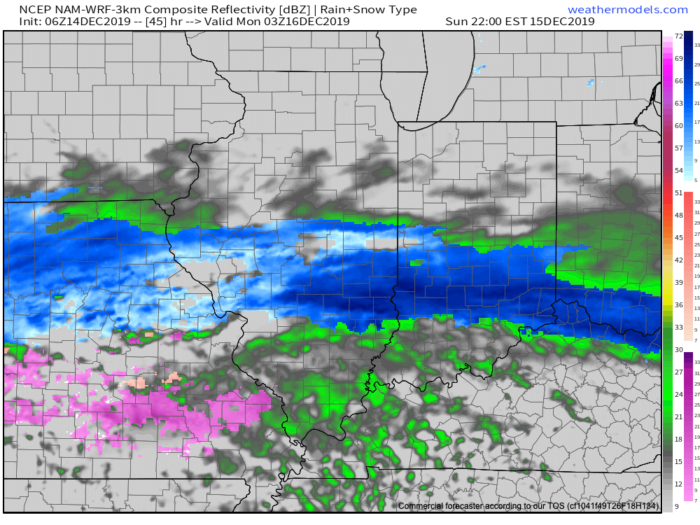
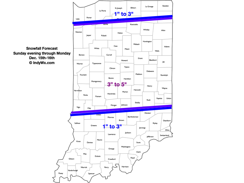
Sunday will feature a thickening and lowering cloud deck through the afternoon hours and this foretells what’s to come by evening. An expanding area of snow will overspread southern Indiana early evening and push into central/ north-central Indiana by mid-to-late evening, continuing into Sunday night. This will be the 1st of 2 rounds of wintry precipitation that will likely result in “plowable” accumulations for a good chunk of central Indiana come Monday evening. There will likely be a “lull” in the wintry precipitation Monday morning, but we anticipate widespread wintry precipitation to return late morning through the afternoon and into the evening hours Monday. In and around Indianapolis and points north, this 2nd round of precipitation should also primarily take the form of snow, but we think southern Indiana will have a period of sleet and potentially a cold rain across far southern Indiana before transitioning back to snow before ending. Because of this, we think southern Indiana will fall into the 1″ to 3″ range for storm totals. Much colder air will pour into the state Monday evening as winds shift to the north/ northwest and gust up to 25 MPH. Snow will pull out of the state from west to east late Monday night. Due to the timing of this storm, big impacts are expected to the morning and evening rush hours Monday.
Confidence: High
Next Update: 2:30p Saturday
