
You must be logged in to view this content. Click Here to become a member of IndyWX.com for full access. Already a member of IndyWx.com All-Access? Log-in here.
Category: Wintry Mix
Permanent link to this article: https://indywx.com/video-negative-naos-chilly-early-april-impacts/
Mar 01
VIDEO: March Roaring In Like A Lion…
You must be logged in to view this content. Click Here to become a member of IndyWX.com for full access. Already a member of IndyWx.com All-Access? Log-in here.
Permanent link to this article: https://indywx.com/video-march-roaring-in-like-a-lion/
Feb 09
Periods Of Wintry Precipitation This Weekend…
You must be logged in to view this content. Click Here to become a member of IndyWX.com for full access. Already a member of IndyWx.com All-Access? Log-in here.
Permanent link to this article: https://indywx.com/periods-of-wintry-precipitation-this-weekend/
Feb 07
Heavy Snow Up North To Close The Work Week; Wintry Weekend…
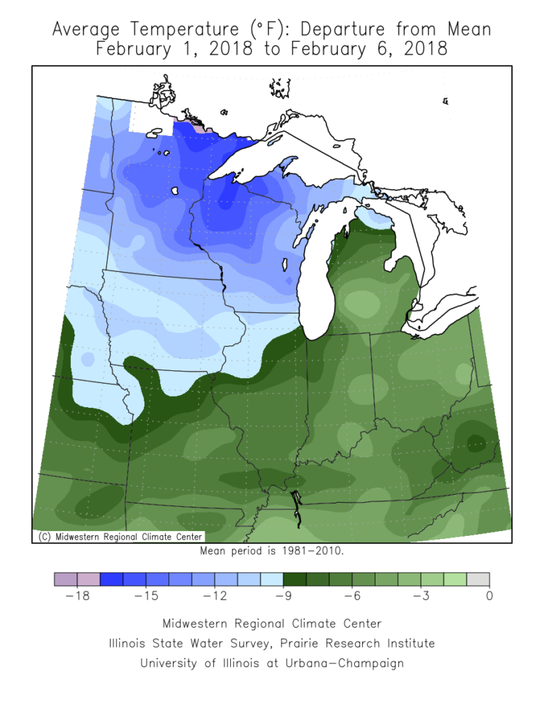
Areas of light snow and flurries will impact north-central Indiana Thursday morning, especially north of Indianapolis. This won’t amount to much and most of our Thursday will be free of snow, along with continued unseasonably cold temperatures. Speaking of the cold, Indianapolis is running 7° below average, month-to-date.
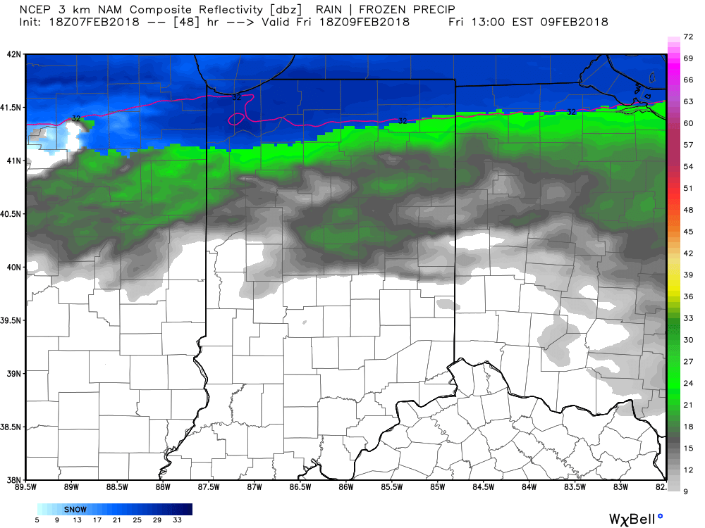
 Looking ahead, a rather prolonged and significant snow event is setting up shop across northern Indiana. We forecast snow to begin falling Thursday night before becoming heavy at times Friday. A tight thermal gradient will aid in the combination of ingredients to produce hefty snowfall across far northern IN and also provide a brief break from the cold, locally, Friday afternoon (forecasting highs into the 40s here). With that said, if your travels take you north, prepare for significant travel disruptions with the heavy snow.
 A cold front will drop south into central Indiana overnight Friday into Saturday. At the same time, a couple of disturbances will ride northeast along the front. This will result in periods of light wintry precipitation across central Indiana over the upcoming weekend. Initially, this should be rather insignificant with a mix of light rain and perhaps some light sleet or light freezing rain Saturday.
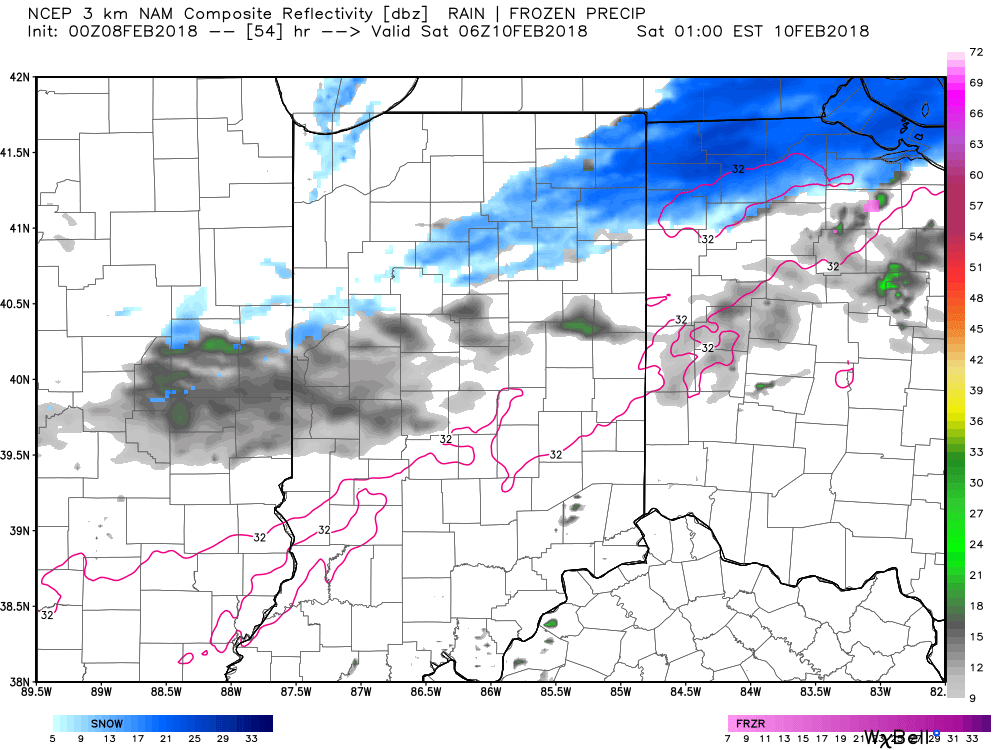 However, as our airmass becomes progressively colder Saturday night into Sunday things will become more interesting. At the same time, a final wave of energy will lift northeast, spreading moisture into the colder air mass. We forecast more widespread wintry precipitation to engulf central Indiana Saturday night into Sunday. A wintry mix of sleet and snow is possible early on before transitioning to all snow Sunday morning. A period of accumulating snow is expected Sunday and we’ll fine tune numbers as we move closer.
 Looking further ahead, an active time of things will continue as the battle remains between cold centering itself across the northern Plains into the Lakes and Ohio Valley and resistance from the southeast ridge. This will continue to lead to a busy period of weather across the region, including storm systems that will come along every couple of days.
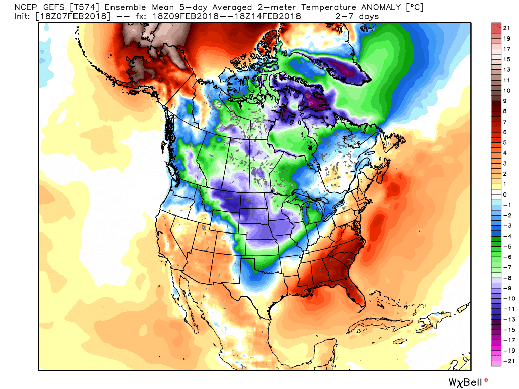 We continue to think things are aligning in a fashion that should result in a significant period of cold developing during the second half of February into March this year. We note the teleconnections continue to trend in cold directions and the MJO is also rolling along into the colder phases. We have a long, long ways to go this winter and think some headline events remain on the table as we close the month and open March. Time will tell.
Permanent link to this article: https://indywx.com/heavy-snow-up-north-to-close-the-work-week-wintry-weekend/
Jan 24
Slow Going This Morning…
Freezing drizzle and areas of light snow will continue into the early afternoon hours before we finally begin to dry things out.
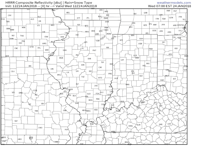 Temperatures are in the upper 20s for most central Indiana communities this morning and it’s not until we get into the early to mid afternoon hours when we anticipate temperatures to climb to around freezing. As a result, slick conditions (especially side streets and back roads) can be expected into the afternoon and evening hours.
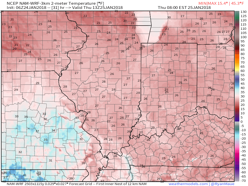
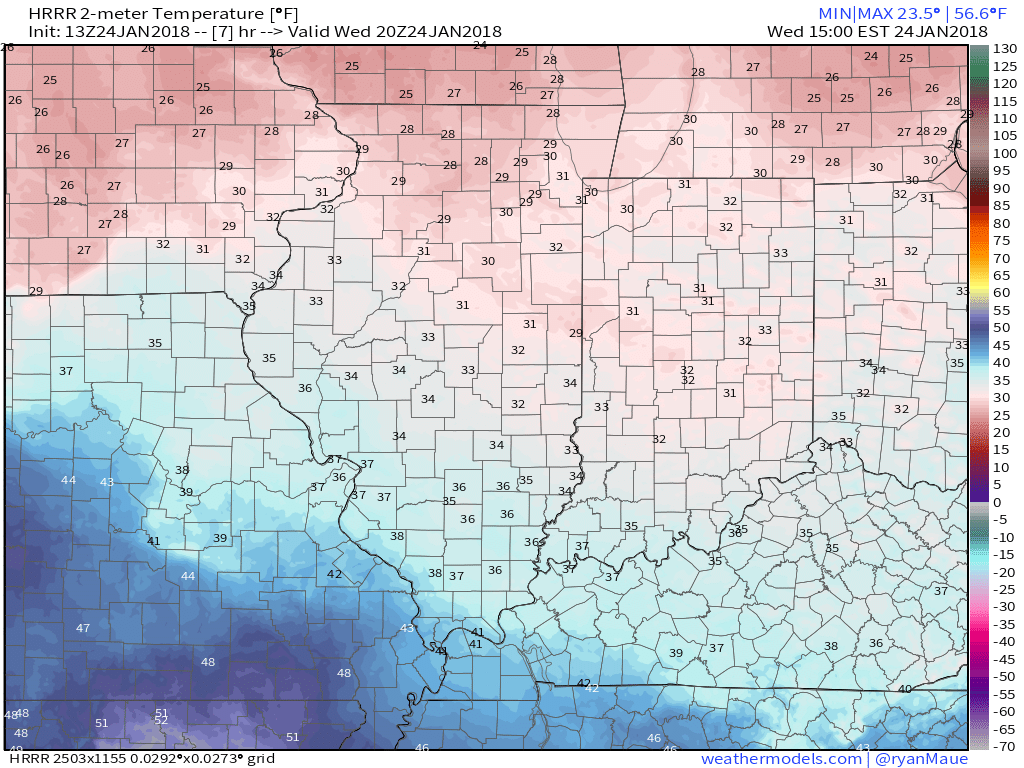 Overnight lows tonight will fall into the lower to middle 20s so re-freezing and slick spots on area roadways can be expected into Thursday morning.
 Thankfully, a southwesterly air flow and new warming trend will develop through the day Thursday, along with a return of sunshine!
 Much more later today on the developing new cold pattern…
Permanent link to this article: https://indywx.com/slow-going-this-morning/