You must be logged in to view this content. Click Here to become a member of IndyWX.com for full access. Already a member of IndyWx.com All-Access? Log-in here.
You must be logged in to view this content. Click Here to become a member of IndyWX.com for full access. Already a member of IndyWx.com All-Access? Log-in here.
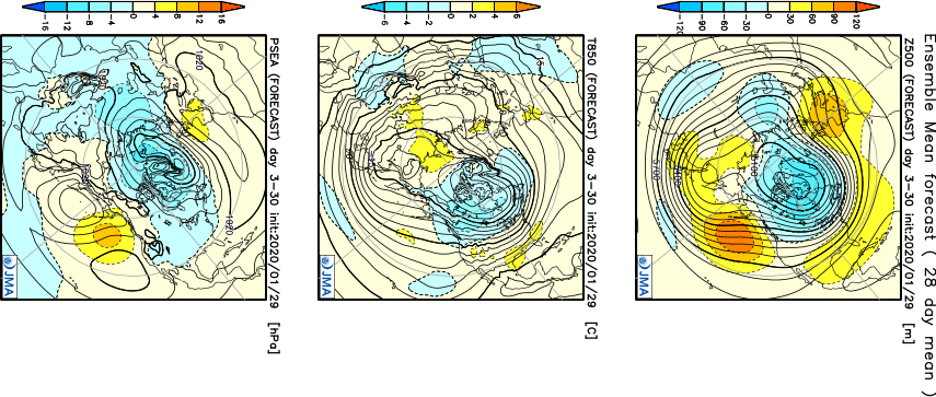
Before we dig into the reasoning behind our February forecast, here’s what a few of the longer range models are suggesting the month will provide:
JMA
The JMA keeps the most persistent warmth confined to the southern and southeastern regions. The model would suggest our immediate area will be in a “battle zone,” including heavier than normal precipitation for the month.
CFSv2
The CFSv2 is bullish on a warm eastern half of the country with cold confined to the west. The modeled mean southwesterly air flow would result in well above average precipitation across our region, including an active storm track.
European Weeklies
Similar to the data above, the new European Weeklies show the most persistent cold west with warmth dominating the southeast and at times into the Ohio Valley for the month of February.
February features “average” temperatures rising from a high of 37° on the 1st to 45° on the 29th. Average lows rise from 21° to 28° by the end of the month. IND averages 2.32″ of rainfall and 6.5″ of snow during the month.
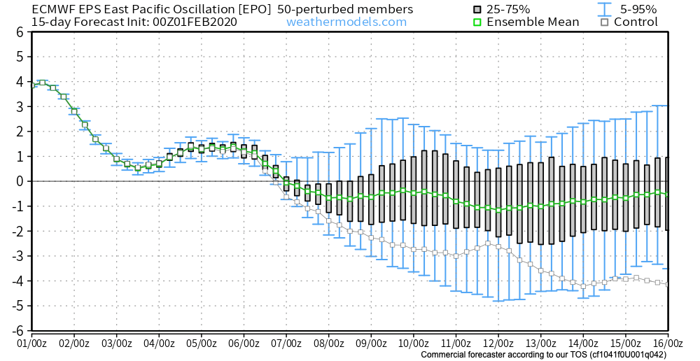
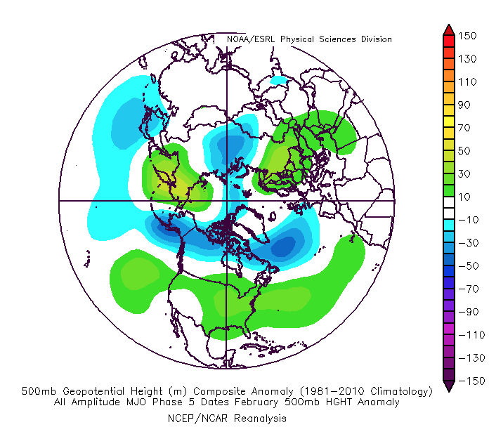
As we look at February 2020, we have an interesting battle on our hands. Latest EPO trends are negative and that is a cold signal, potentially significantly so if the current trends continue. That said, it’s also important to note that many times throughout January, medium to long range negative EPO trends didn’t materialize, and, accordingly, warmth dominated.
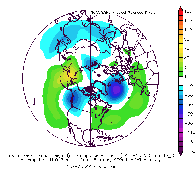
To make things more complicated, the latest MJO plots are bullish on warmth persisting, overall, for the the better part of the month. Note the trends to take things back into Phases 4-5. This would promote the tendency towards more of a persistent eastern ridge (similar to what the European and CFSv2 show above).
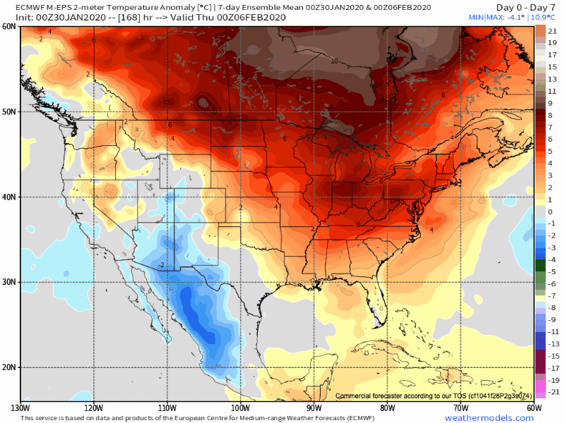
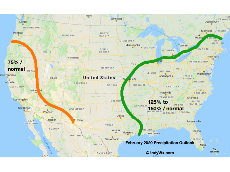
While our forecast will show a significantly warmer than average month, we also believe snowfall will run near average. The reason has to do with a battle ground that we anticipate sets up across the Ohio Valley throughout the majority of the month. At times, even marginally cold air will create challenges. Case in point will be the middle and latter part of this upcoming week. This will likely set the tone for the month ahead: warmer than average with well above average precipitation/ near normal snowfall. The other concern has to do with the threat of sleet/ freezing rain events. Late winter and early spring can prove to be troublesome with the kind of ‘mean’ pattern that lies ahead as shallow cold air at the surface undercuts. This will be something to keep close tabs on moving forward.
After a surge of warmth engulfs the region during the early part of the week, a cold front will sag south into the central Ohio Valley Tuesday night into Wednesday.
An upper level ridge will provide a brief taste of spring to open the week.
This front will result in an expanding shield of rain Monday night into Tuesday across all of central Indiana.
Rain will increase across the area Monday evening.
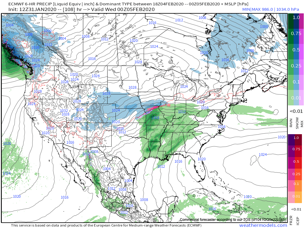
As we progress through Tuesday evening, the frontal boundary will likely sag south, allowing colder air to filter in (at least at the lowest levels of the atmosphere) across north-central parts of the Ohio Valley. As another slug of moisture moves northeast along the frontal boundary, precipitation is expected to once again become widespread Tuesday night into Wednesday. With the colder air oozing in, a mixture of sleet and freezing rain is a possibility across northern IL, IN, and OH. The precise placement of the front will determine whether or not more of central Indiana can get in on the “excitement” of this icy mixture during the aforementioned time period.
It’ll be wise to pay attention to forecast details during the weekend for the Tuesday and Wednesday time period- especially if you have travel plans north.
As this takes place, the upper ridge will get “beaten back” into the 2nd half of the work week. It’s important to note, however, that there will likely still be enough resistance from the upper level ridge that the cold front will get hung up along or just east of the spine of the Appalachians in the Thursday-Friday time frame.
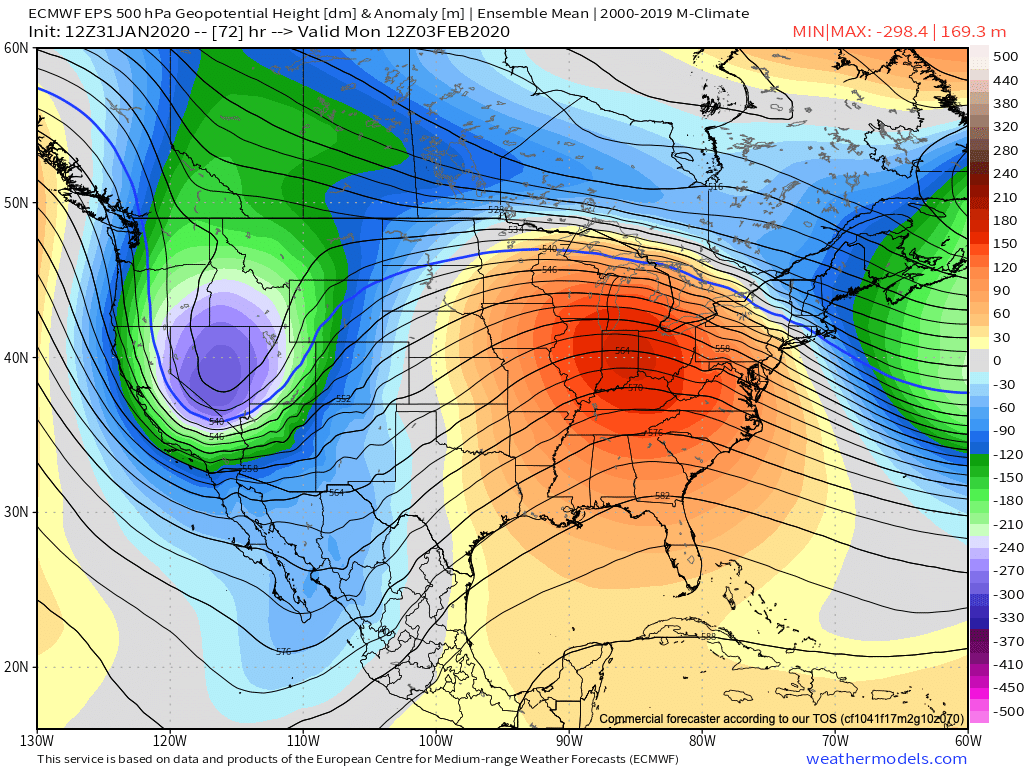
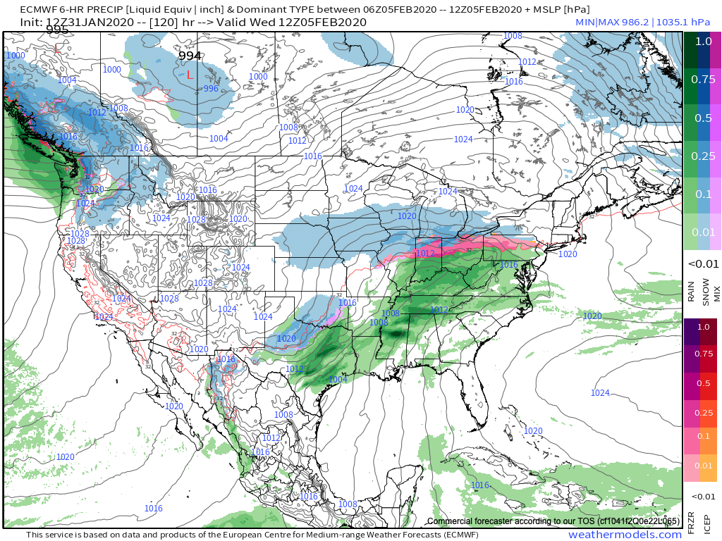
As this transpires, yet another wave of energy will move up along the pressing boundary. Accordingly, precipitation should once again blossom in response of this wave of low pressure moving northeast. While the European (shown below) wants to keep things east of the immediate region, it’s wise not to write this system off from this distance. Not only does other data show the threat locally, but it’s all too often where storm systems “correct” further west as time draws closer to said event…
While this week has been relatively boring in the weather department, things will change in significant fashion next week. Whether or not those changes can deliver “wintry goods” is TBD…
You must be logged in to view this content. Click Here to become a member of IndyWX.com for full access. Already a member of IndyWx.com All-Access? Log-in here.