Category: Wintry Mix

Time To Beat The Drum A Little Louder On Next Week?

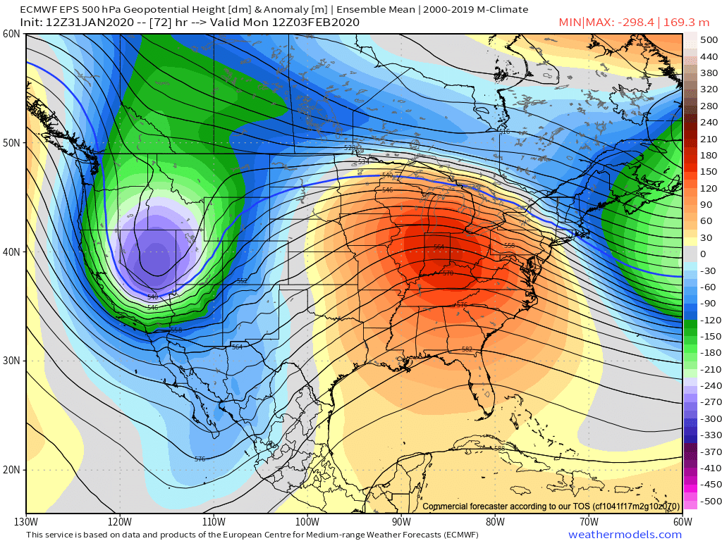
After a surge of warmth engulfs the region during the early part of the week, a cold front will sag south into the central Ohio Valley Tuesday night into Wednesday.

An upper level ridge will provide a brief taste of spring to open the week.

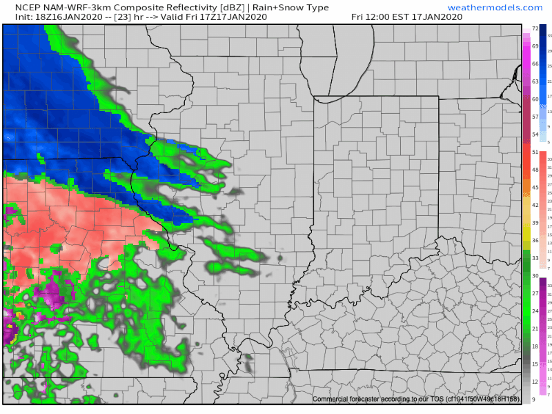
This front will result in an expanding shield of rain Monday night into Tuesday across all of central Indiana.

Rain will increase across the area Monday evening.

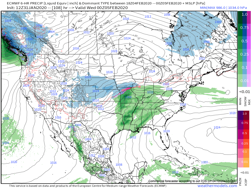
As we progress through Tuesday evening, the frontal boundary will likely sag south, allowing colder air to filter in (at least at the lowest levels of the atmosphere) across north-central parts of the Ohio Valley. As another slug of moisture moves northeast along the frontal boundary, precipitation is expected to once again become widespread Tuesday night into Wednesday. With the colder air oozing in, a mixture of sleet and freezing rain is a possibility across northern IL, IN, and OH. The precise placement of the front will determine whether or not more of central Indiana can get in on the “excitement” of this icy mixture during the aforementioned time period.

It’ll be wise to pay attention to forecast details during the weekend for the Tuesday and Wednesday time period- especially if you have travel plans north.

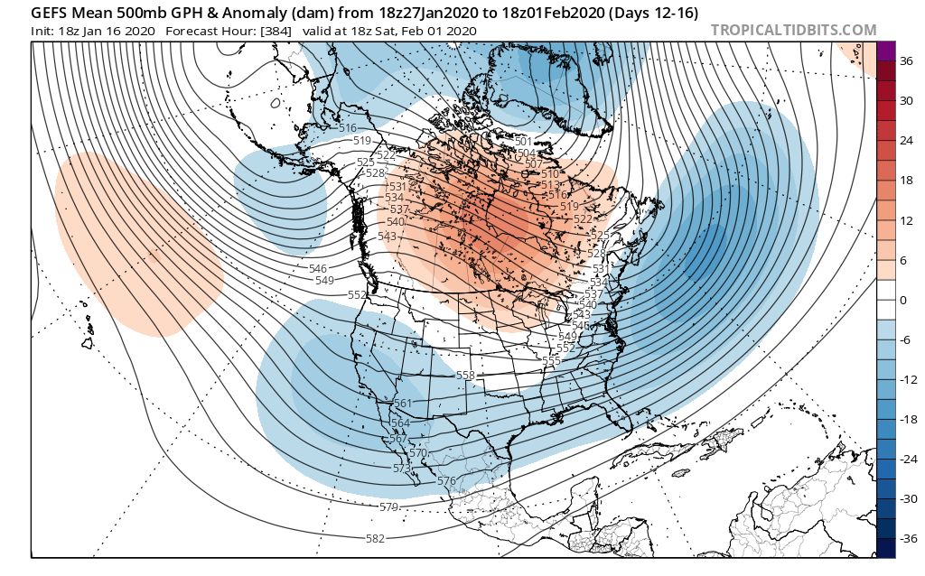
As this takes place, the upper ridge will get “beaten back” into the 2nd half of the work week. It’s important to note, however, that there will likely still be enough resistance from the upper level ridge that the cold front will get hung up along or just east of the spine of the Appalachians in the Thursday-Friday time frame.

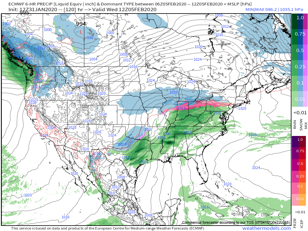
As this transpires, yet another wave of energy will move up along the pressing boundary. Accordingly, precipitation should once again blossom in response of this wave of low pressure moving northeast. While the European (shown below) wants to keep things east of the immediate region, it’s wise not to write this system off from this distance. Not only does other data show the threat locally, but it’s all too often where storm systems “correct” further west as time draws closer to said event…

While this week has been relatively boring in the weather department, things will change in significant fashion next week. Whether or not those changes can deliver “wintry goods” is TBD…

Stay tuned.

Permanent link to this article: https://indywx.com/time-to-beat-the-drum-a-little-louder-on-next-week/

January Review; Looking Ahead To A Busy Week In Front Of Us…

You must be logged in to view this content. Click Here to become a member of IndyWX.com for full access.  Already a member of IndyWx.com All-Access?  Log-in here.

Permanent link to this article: https://indywx.com/january-review-looking-ahead-to-a-busy-week-in-front-of-us/

VIDEO: More Active Times On The Horizon…

You must be logged in to view this content. Click Here to become a member of IndyWX.com for full access.  Already a member of IndyWx.com All-Access?  Log-in here.

Permanent link to this article: https://indywx.com/video-more-active-times-on-the-horizon/

VIDEO: Short-Term Update On Tonight’s Sleet And Freezing Rain…

You must be logged in to view this content. Click Here to become a member of IndyWX.com for full access.  Already a member of IndyWx.com All-Access?  Log-in here.

Permanent link to this article: https://indywx.com/video-short-term-update-on-tonights-sleet-and-freezing-rain/

Wintry Mix Tomorrow Evening; Fresh Long Range Fun…

Friday will dawn dry, but the mid and high level cloud canopy will be a sign of things to come. These clouds will lower and thicken through the day and eventually give way to a wintry mix by evening. While there may initially be a period of snow (especially north of Indianapolis), the majority of the “overrunning” precipitation should fall as a mixture of sleet and freezing rain. In and around Indianapolis and points north, a light “glaze” of ice is possible Friday evening of up to .10″ (after the possibility of a coating of snow).

Dry air will likely have to be overcome at first, but a burst of snow is possible into the city around 5p to 6p before the transition over to the sleet and freezing rain mixture. Eventually, the icy mixture will transition to a cold rain prior to sunrise Saturday.

MUCH colder air will pour into the state Saturday evening with temperatures falling into the 10s prior to midnight Sunday morning and wind chills into the single digits.

As we look longer term, we don’t see any reason to alter our ongoing thoughts of a colder pattern taking hold, overall, over the upcoming 10-14 day period (and likely into the first half of Feb.). We’ve covered our reasoning in previous posts (Phase 7 of the MJO, positive PNA, neutral EPO, etc.). What’s interesting to note is the rather stark difference in the handling of the EPO between the negative GEFS and positive EPS. The likely end result will be somewhere in between; hence our neutral EPO forecast. At the end of the day, it’s really not the EPO, PNA, or NAO that will drive the mean pattern, but the MJO. And with that said, Phase 7 of the MJO features a cold, stormy look.

The high latitude blocking screams for an active storm track across our neck of the woods (as does the slightly positive PNA and neutral EPO). Sure enough, the latest modeling is going towards this stormy look (active southern stream) in the medium to long range period.

A great mentor once taught me to always be leery of ridges over Hudson Bay in the winter time. Time and time again, this pattern setup results in fairly widespread winter storm events through the Lower 48 and we think there is increased potential in this sometime during the Jan. 25-31 time period. While there’s no way to be specific, just keep a mental note in the back of your mind for this threat.

In closing, a review of the latest JMA Weeklies shows a significantly different pattern than what we’ve grown accustomed to as of late taking up residence through the bulk of the upcoming 3-4 weeks. Given the above, it would be tough to argue this look…

Week 1
Week 2
Weeks 3-4

Fresh video update will hit in the AM with new thoughts around tomorrow evening’s winter weather maker.

Permanent link to this article: https://indywx.com/wintry-mix-tomorrow-evening-fresh-long-range-fun/