Published Friday, 10.04.24 Well, well, well, here we are again. Is this finally the winter where we can shake the snow drought? It’s been since the winter of ’13-’14 that…
You must be logged in to view this content. Click Here to become a member of IndyWX.com for full access. Already a member of IndyWx.com All-Access? Log-in here.
Updated 09.03.24 @ 3:05p The year continues to fly by. Now that we’re officially into meteorological fall, I wanted to take a moment to share a few brief early thoughts…
You must be logged in to view this content. Click Here to become a member of IndyWX.com for full access. Already a member of IndyWx.com All-Access? Log-in here.
In the short term, there’s really nothing of significance to discuss. We have no changes to our thinking that February opens on an unusually dry and mild note. In fact, we don’t forecast our next opportunity of measurable precipitation until late next week or next weekend.
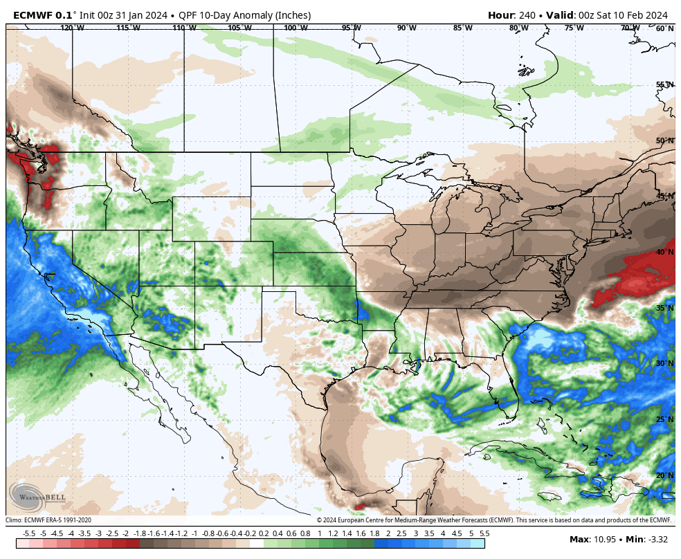
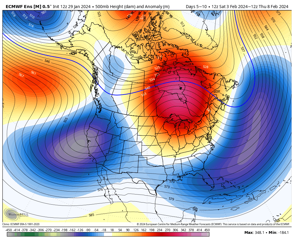
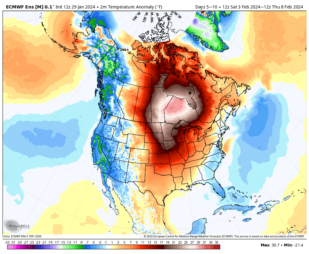
Upcoming 10-day precipitation anomalies Upcoming 10-day temperature anomalies
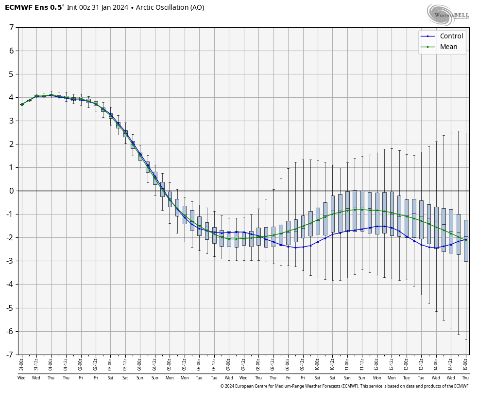
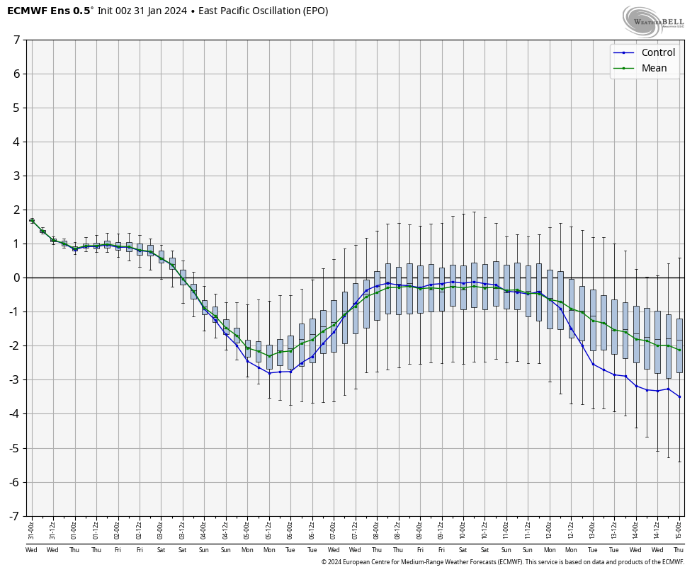
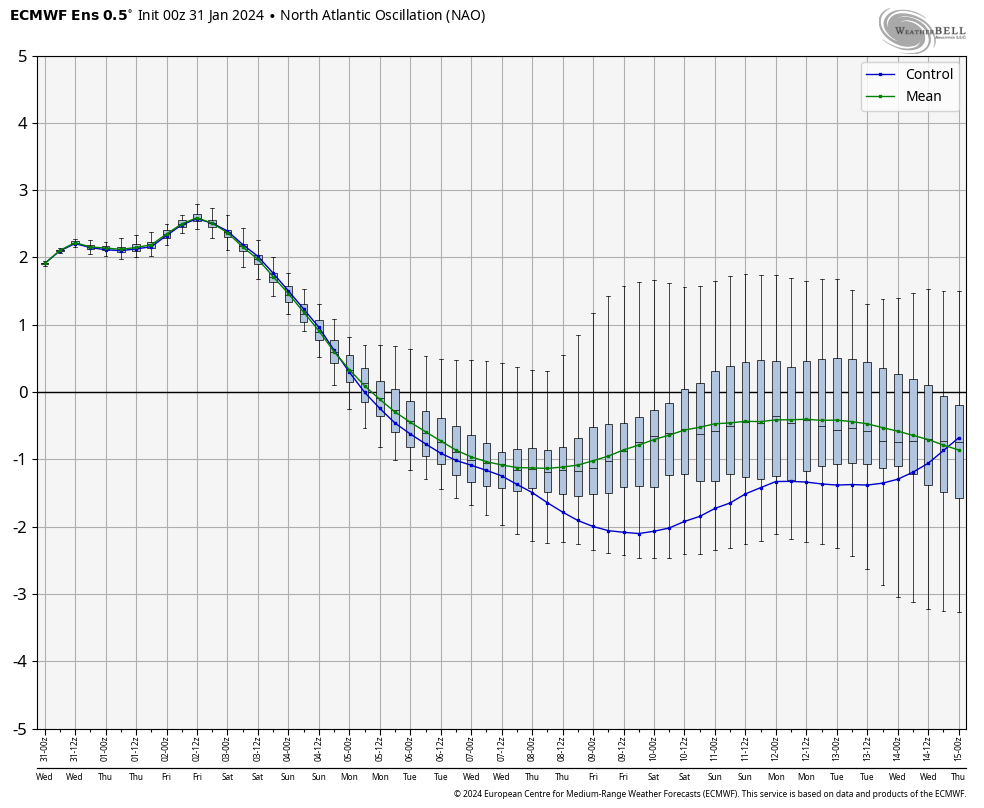
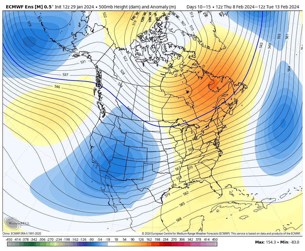
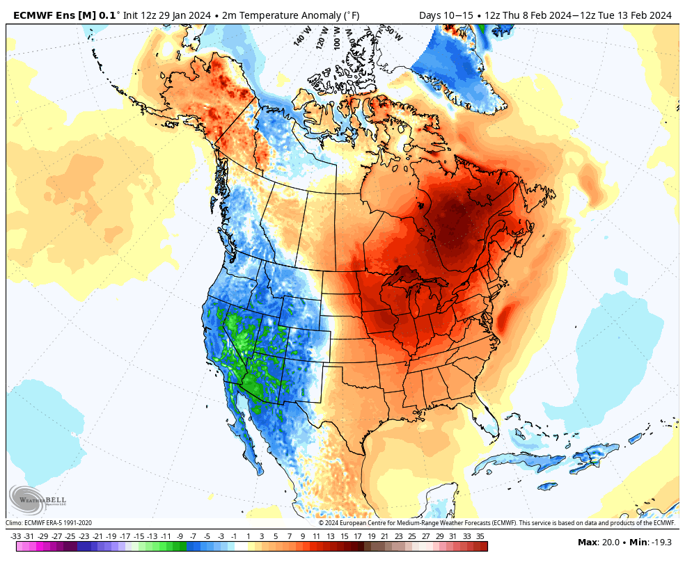
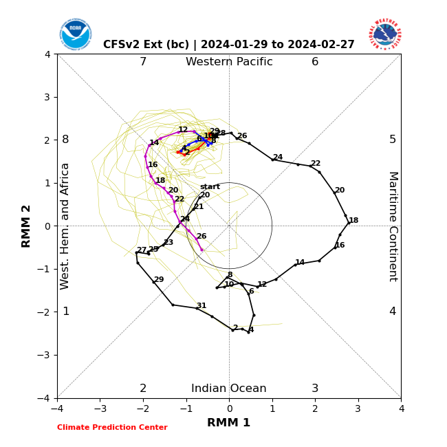
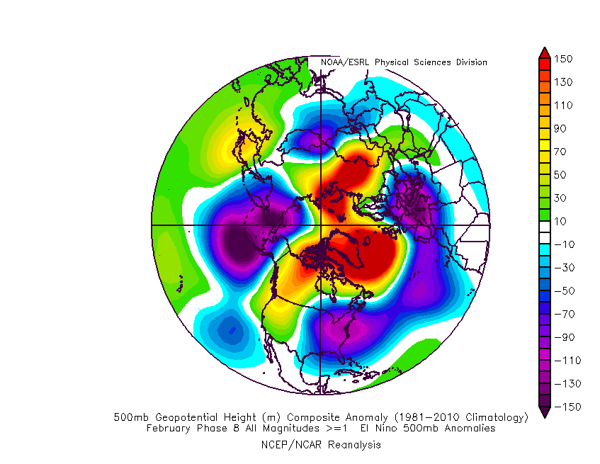
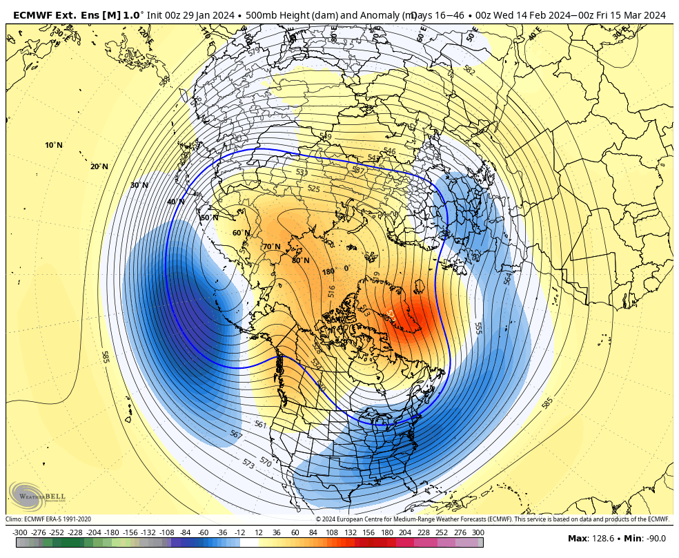
Despite the well earned thaw that we’ll enjoy now, winter is far from over. In fact, not only do we forecast a return to a cold, wintry pattern around Feb 10th (give or take a day or two), but it’s easy to build a case that this should be a more prolonged cold blast when compared to its January predecessor. The reason? Alignment with the teleconnection suite (emphasizing the anticipated strong negative NAO). We also anticipate the MJO getting into Phase 8 by mid-month which opens up the window for the potential of more extreme cold.
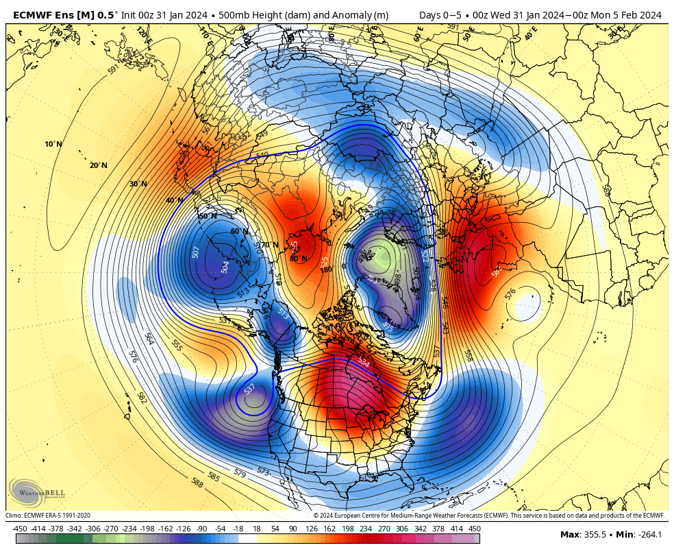
To no surprise, the latest ensemble data is pointing towards where the pattern is heading once past the first 1/3 of February.
Once we lock into the colder pattern, thinking here is we’ll remain locked in with an overall cold signal to close Feb and open March (first 10-14 days). It may be a “rubber band” type pattern. Cold to open before an abrupt flip to significantly warmer (hot?) conditions for the second half of March.
Let’s get to the headline right out of the gate: Winter is far, far from over. While we don’t have any significant changes to our ongoing long range pattern ideas, I did want to touch on the overall regime for February into March during this evening’s discussion.
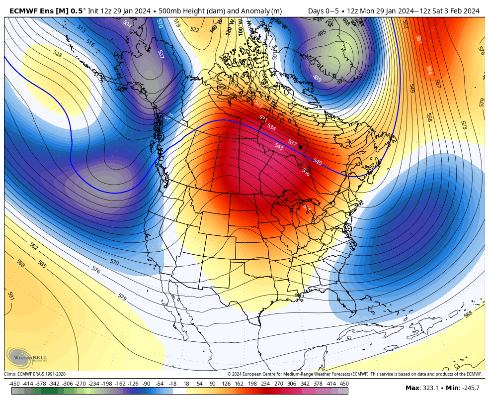
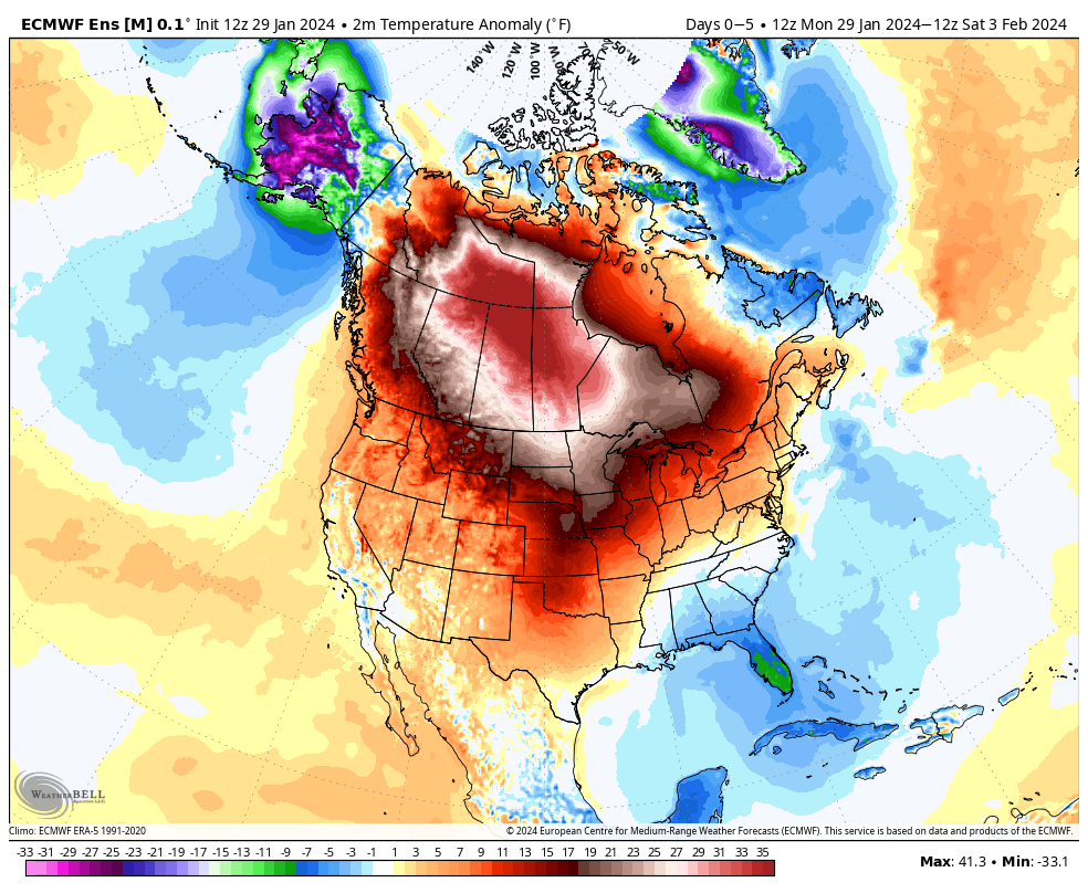
Subsequently, we’re also continuing to lean into the milder than normal pattern that will be with us as we close January and navigate the first 1/3 of February. Today’s medium range model data backs this up well.
Day 1-5
Days 5-10
Days 10-15
Overall, the next couple of weeks should also result in a drier than normal pattern, locally.
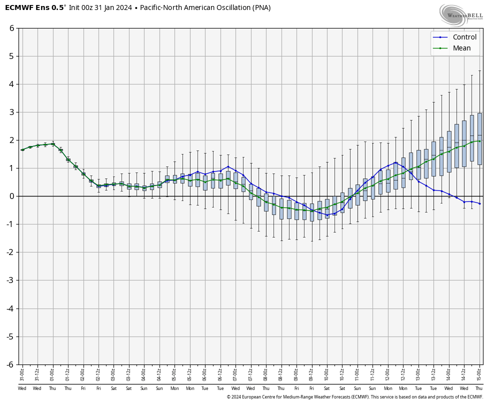
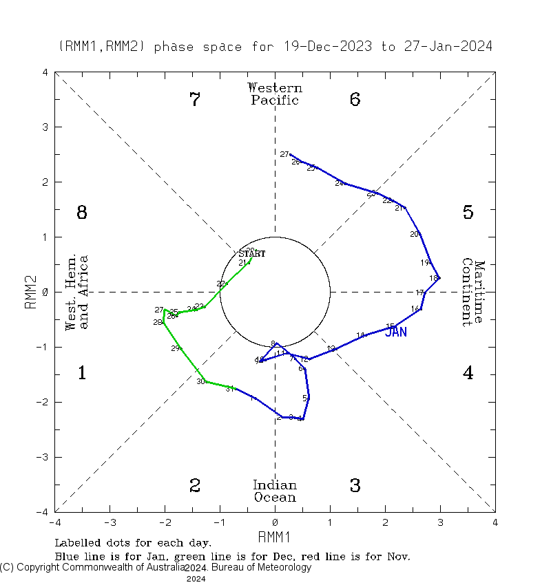
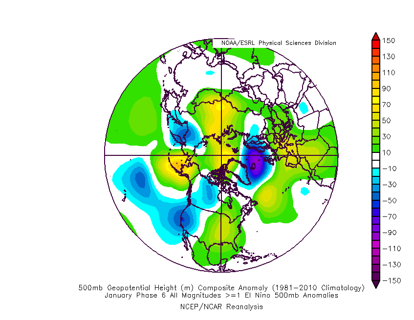
It should come as no surprise given the teleconnection suite (all in warm phases, with the exception of the PNA which will result in cooler anomalies at times across the Southeast region). We note these same teleconnections shifting towards the colder phases around, or just before the 10th of February. The Madden-Julian Oscillation also is in the notorious warm phases.
Before 2/10, any cold will be fleeting and nothing significant given the time of year. Overall, an unseasonably mild pattern will dominate.
Post 2/10, we’re going to see a shift towards colder times. A lot of this has to do with the alignment amongst the teleconnections. Throw in the MJO heading into the frigid (for this time of year) Phase 8 and you have the potential to eventually see the pattern deliver the magnitude of cold we just saw come late February. (In case you missed it, we already set the bar on the type of cold we envision developing late February).
Given the NAO heading into the tank by this point, there’s fear this particular round of cold would likely have more staying power than it’s January predecessor. “Phase 8 MJO WITH a strongly negative NAO?” Look out below…
Interestingly, the NEW European Weeklies are going right to this set-up and perhaps the most bullish I’ve seen over a 30-day period from this distance. Winter is far, far from over, indeed.
Permanent link to this article: https://indywx.com/steady-as-she-goes-no-need-to-change-ongoing-ideas-of-milder-than-normal-open-to-february-followed-by-cold-wintry-pattern-thereafter/
Overall, we don’t have any changes to our ongoing ideas from last night’s video. If you didn’t have an opportunity to catch that, we encourage you to do so as it highlights our medium and long range thoughts in more detail.
The focus will change from one of ice to periods of rain (and dense fog) through the remainder of the week. We note multiple waves of more widespread rain that will ride into central Indiana over the next few days. While it won’t rain the entire time, an extended period of gloomy conditions will unfortunately be with us as we navigate the next few days and kick off the weekend.
Periods of rain can be expected through the remainder of the week.
Speaking of the weekend, we continue to closely monitor an area of low pressure that appears to take a classic track for a heavy snow dump around these parts. The problem? Cold air is fleeting and it’ll take the perfect combination of track, timing, and precipitation rates to generate anything meaningful from a wintry standpoint, locally. As of now, we favor this “sweet spot” to lay just north of our immediate area, but we’ll continue to closely monitor.
That brings us to our final point this morning and that’s wanting to ensure we drive home the idea here of an overall milder to significantly milder than normal pattern over the upcoming 10-14 days as a whole. While we’re incredibly bullish on winter’s return, we’re equally as impressed by this overall milder signal in the short to medium term.