VIDEO: Preliminary 2019-2020 Winter Idea…
You must be logged in to view this content. Click Here to become a member of IndyWX.com for full access. Already a member of IndyWx.com All-Access? Log-in here.
You must be logged in to view this content. Click Here to become a member of IndyWX.com for full access. Already a member of IndyWx.com All-Access? Log-in here.
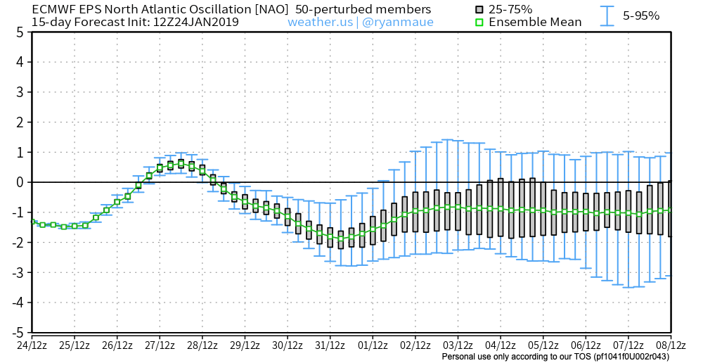
We’ll save our short-term discussions for the severe and high-impact arctic outbreak on deck and focus our attention in this post to the upcoming several weeks. In short, we don’t expect the cold pattern to break anytime soon. Could there be a day or two of “relaxation?” Yes, but from an overall perspective, confidence is higher than normal on the colder than average pattern continuing through the month of February.
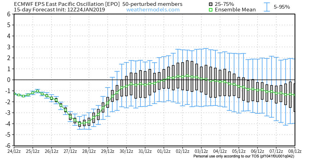
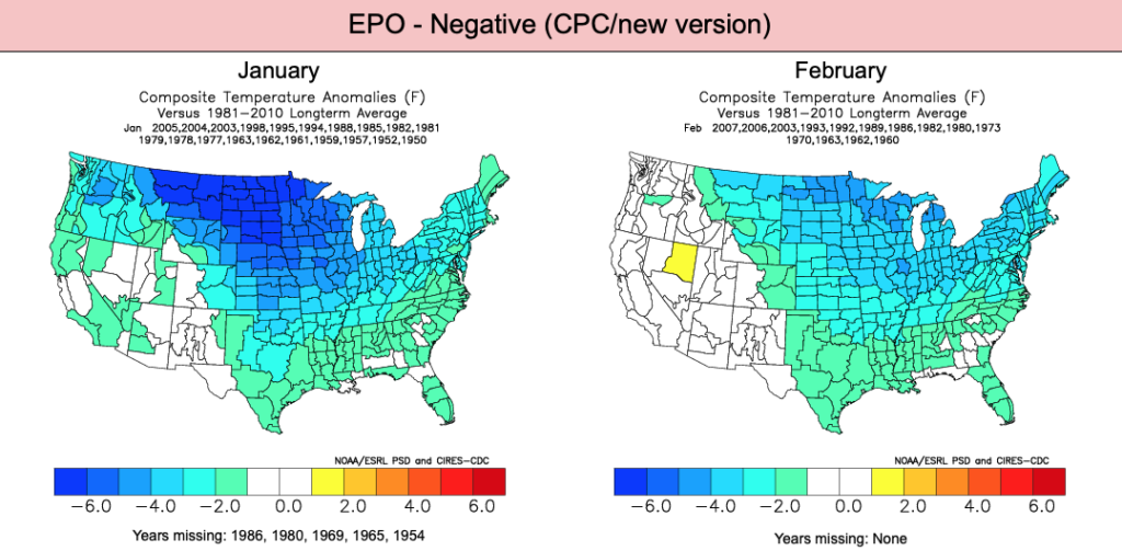
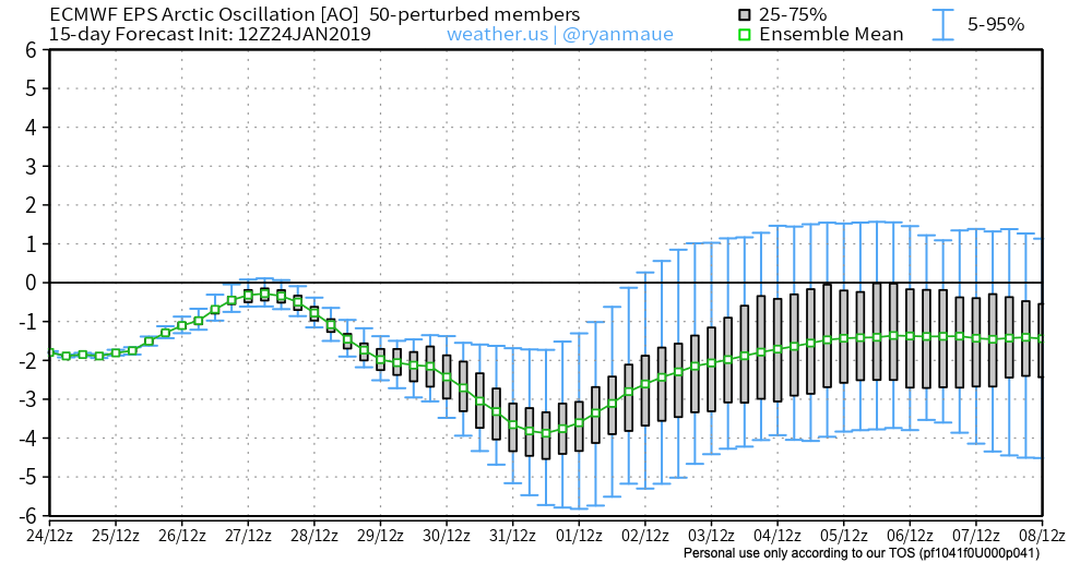
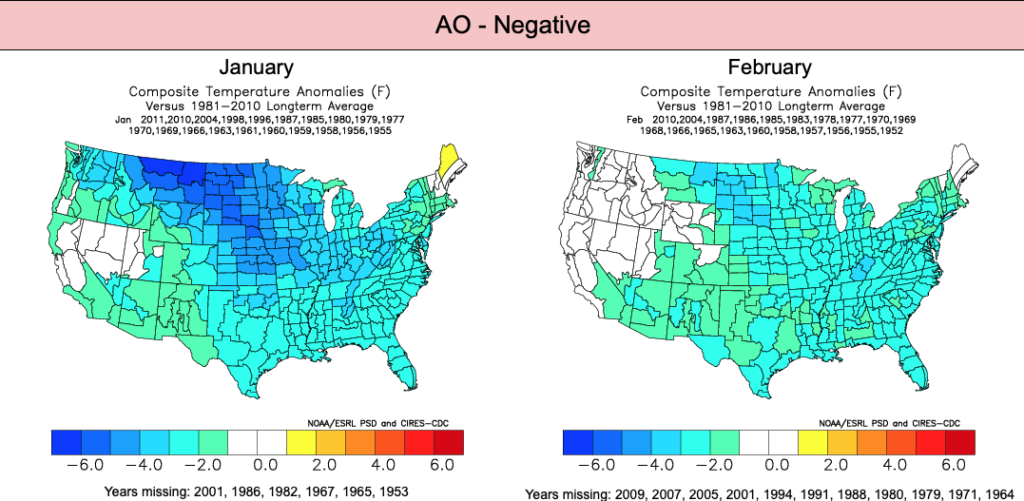
Let’s dig in to the teleconnections:
EPO
AO
NAO

PNA
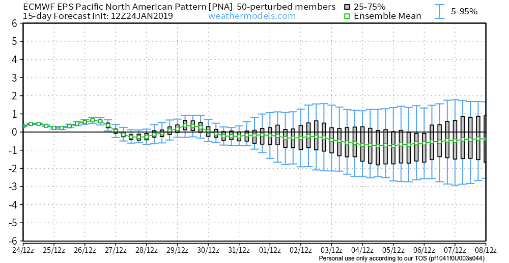
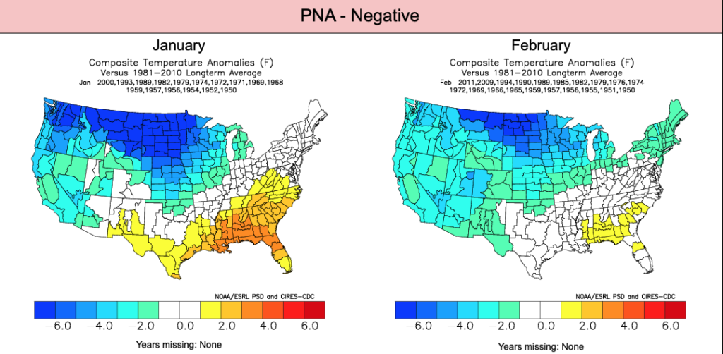
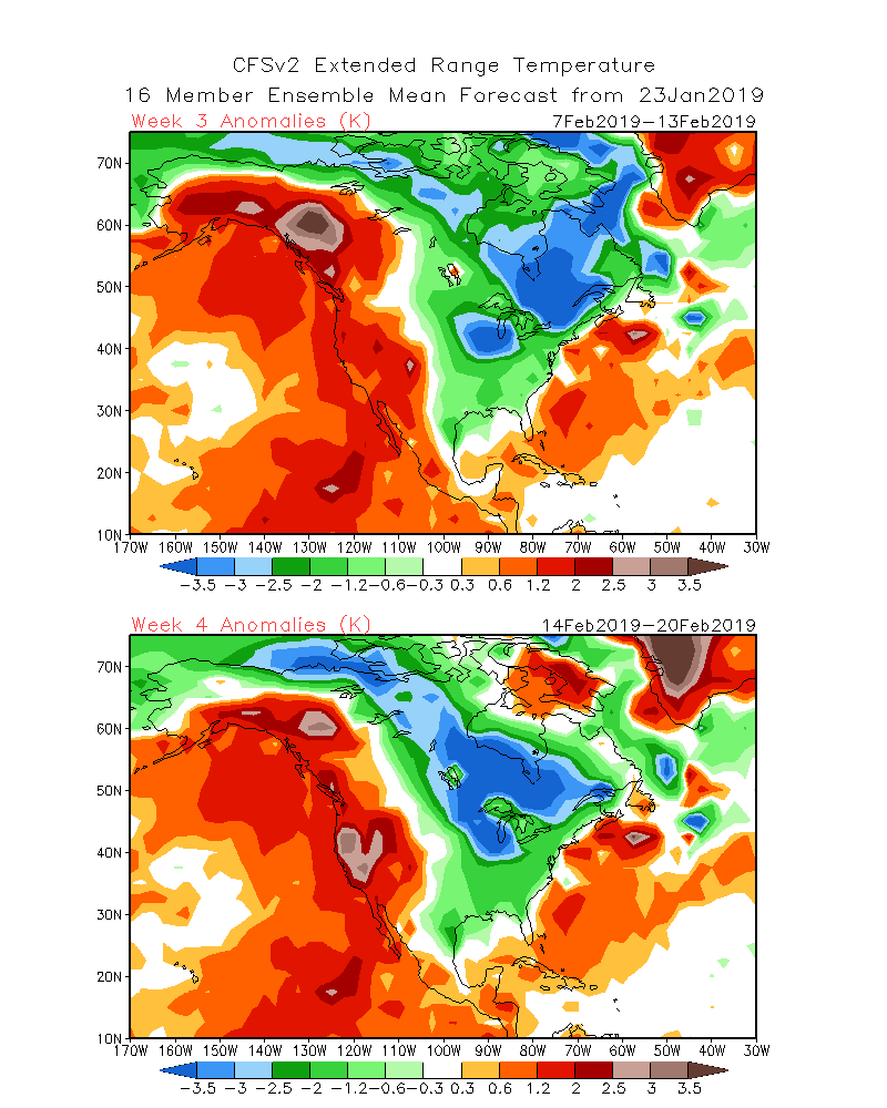
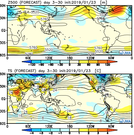
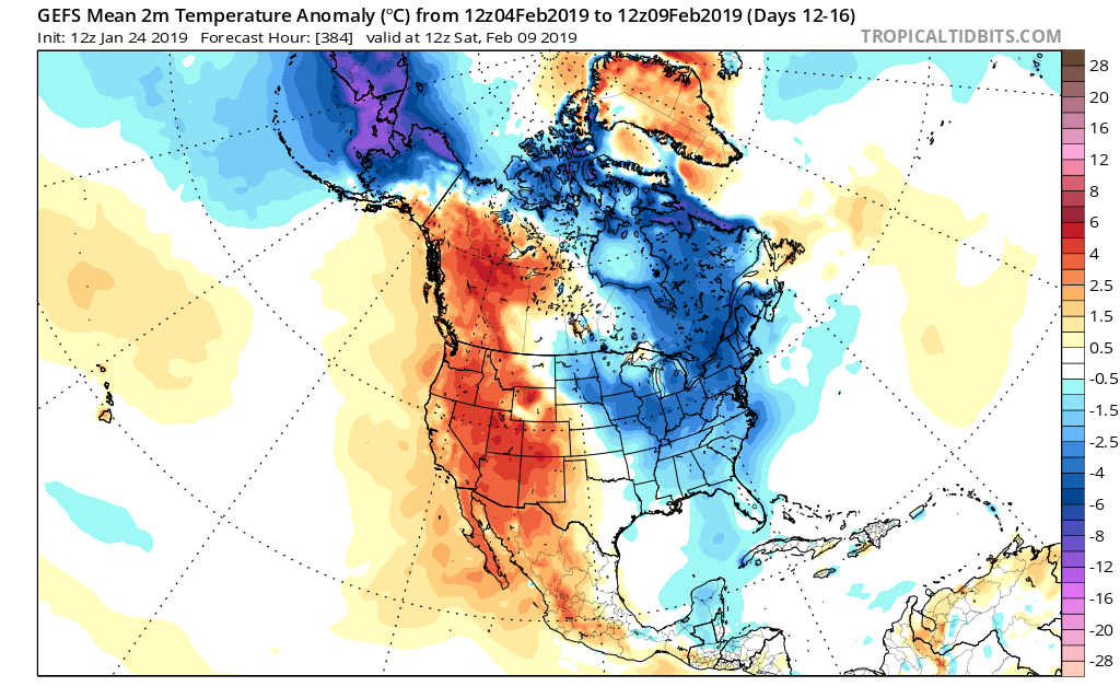
Given the teleconnections in agreement pointing towards a cold pattern, it shouldn’t come as a surprise that the majority of data is also on the cold train as we flip the page into February:
CFSv2 Weeklies
Weeks 1 & 2
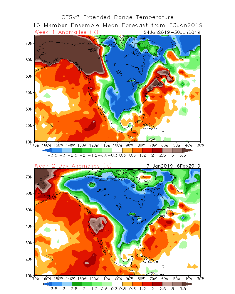
Weeks 3 & 4
JMA Weekly
GEFS
While we aren’t licensed to show the European Weeklies, the new update runs with a cold pattern into early March. This falls in line with the overall consensus of longer range data, backed up by teleconnections.
Though not nearly at the amplitude of a few weeks ago, the MJO (Madden-Julian Oscillation) is forecast to move through Phases 5 and 6 in the coming weeks before going back into the “null” phase.
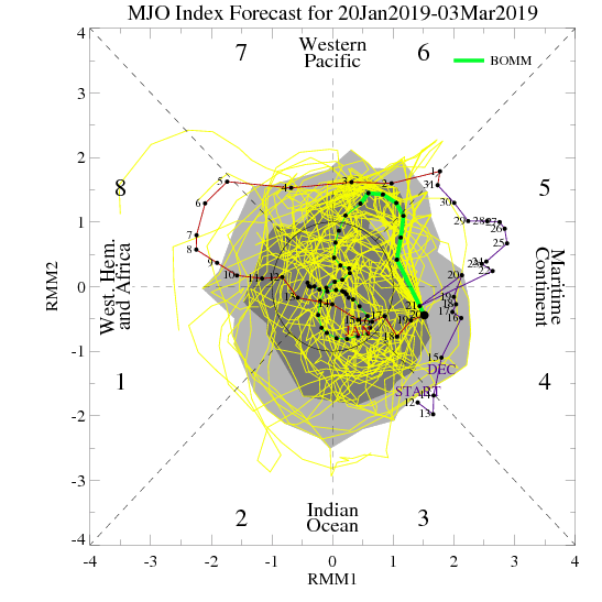
Phases 5 and 6 this time of year would suggest colder anomalies are more likely around our neck of the woods:
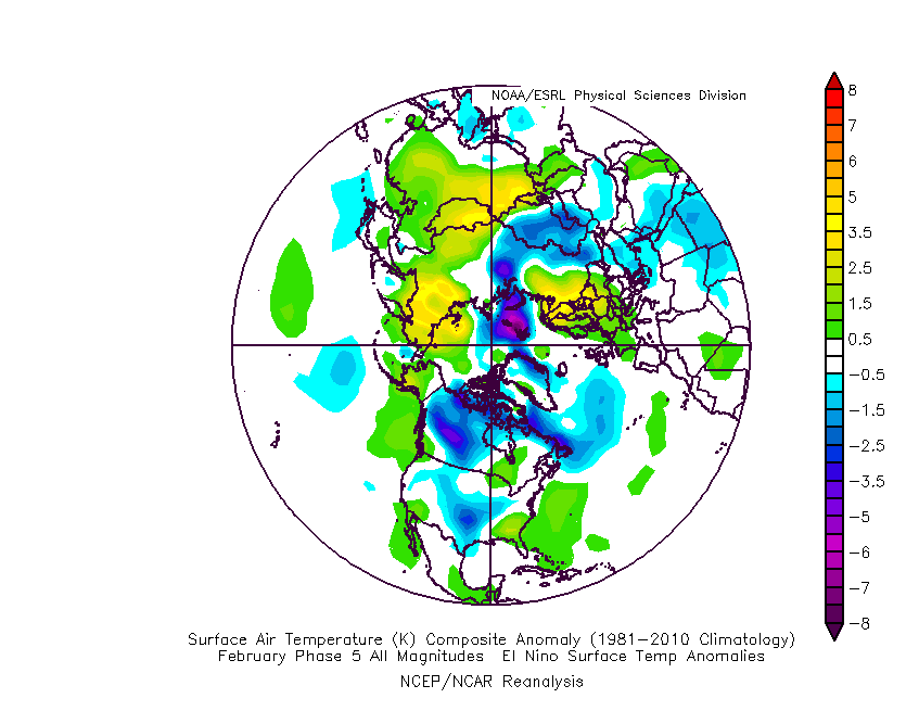
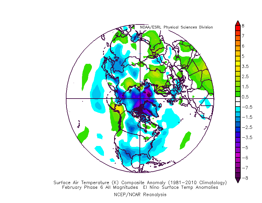
Given the above, we continue to think a colder than average “2nd half” of winter looms for the region. We lean heavily on the NAO, EPO, and AO state(s) this time of year and all would point towards a cold time of things moving forward, overall. The latest European Weeklies are interesting from a couple of fronts- initially very cold and then progressively stormy. The idea here is that we remain quite wintry through February and into early March before this pattern breaks. While we may not see a “repeat” visit of the Vortex, it wouldn’t surprise us to see another major arctic outbreak again this winter (after next week), but that likely comes later, and towards the end of the game before we snap into spring.
Buckle up; we think we have a long way to go this winter…
Daily, we’re receiving questions around if and when winter will show up. While admittedly later than originally thought here, we’ve never been in the camp of “throwing the towel” in on winter. Our winter outlook that includes below normal cold and near average snowfall remains unchanged.
Before we get into some of our reasons why we think winter will show up (and likely make up for lost time), the upcoming week will remain much warmer than average.
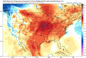
We’re tracking (3) storm systems that will deal the region rain over the upcoming week:
As a whole, rainfall amounts won’t be particularly impressive for most, with 7-day totals between 0.25″ to 0.75″ for central portions of the state. Heavier amounts can be expected across southern areas.

Now, let’s look ahead to some potentially colder times. Before moving forward, it’s important that we recognize models have attempted once already to drive in a wholesale pattern change to colder (originally thought to be underway now). Perhaps it’s a case of “delayed, but not denied.” There’s a lot going on behind the scenes:
There are significant changes brewing in the arctic/ higher latitudes that have to raise an eyebrow at the very least.
Today
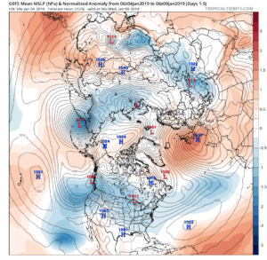
Mid-January
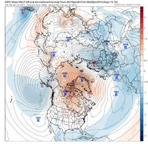
Note the higher pressures building over the upcoming 10-14 days in the arctic regions.
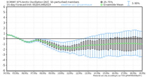
Not surprisingly, the models begin to tank the AO.
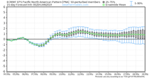
The PNA rises…
Something that also lends credence to a potential pattern shift is the recent SOI drop.
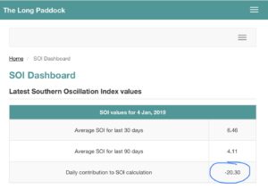
This would tend to suggest that an active storm track may be in place as the more bonafide cold shift is underway.
The moral of the story? Despite the milder period being extended a couple weeks longer than originally thought, there’s still a lot on the table this winter. It’s far too early to think winter’s over before it’s really even begun for most. We expect to see increasingly wintry conditions show up around the middle of January…
Stay tuned.
Our 2018-2019 Winter Outlook is now available! Much more later this weekend around both short term and longer range items of “interest!” Happy Black Friday to all!
You must be logged in to view this content. Click Here to become a member of IndyWX.com for full access. Already a member of IndyWx.com All-Access? Log-in here.
You must be logged in to view this content. Click Here to become a member of IndyWX.com for full access. Already a member of IndyWx.com All-Access? Log-in here.