Updated 11.11.21 @ 6:55a
The long running idea here (since summer) has been one that has thought a rather sharp and significant colder pattern would emerge around Thanksgiving to help kick-start a fast start to meteorological winter. Guidance shows a couple of chilly air masses poised to settle into the region over the upcoming couple of weeks.
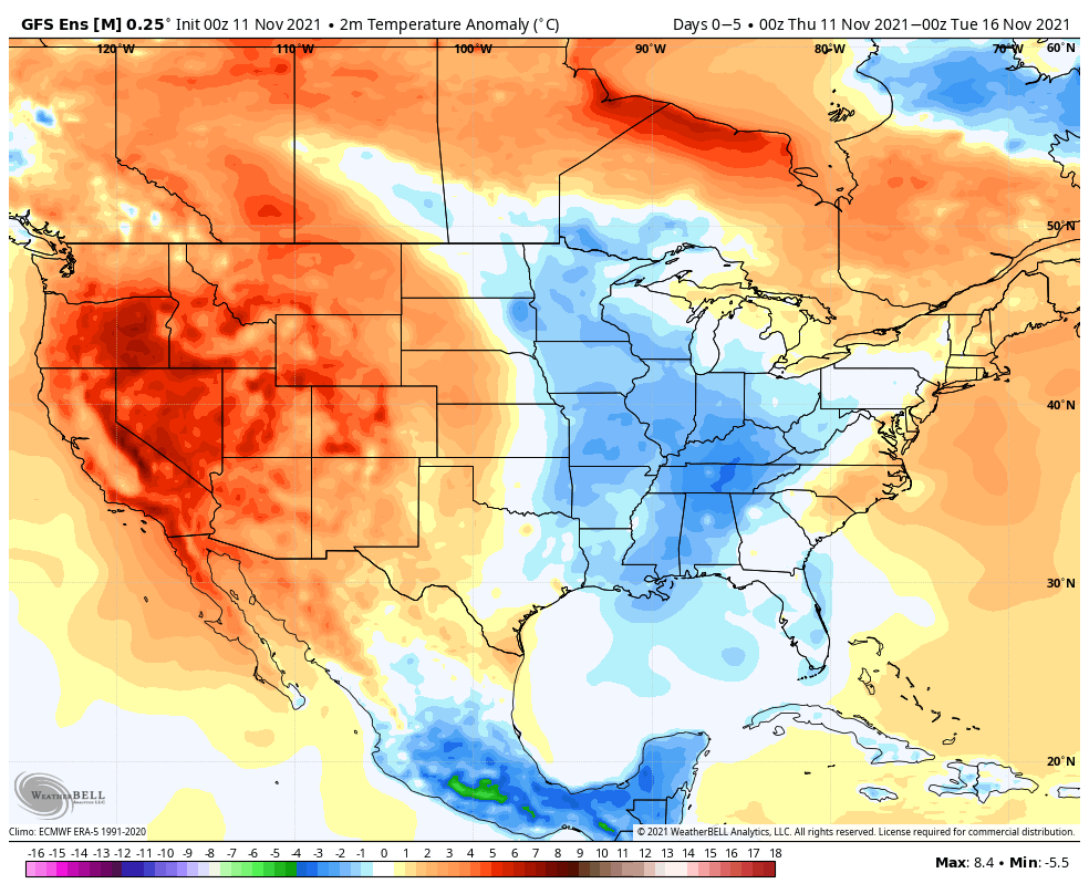
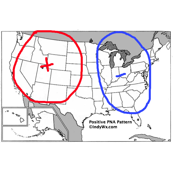
The coldest air of the season so far (lower 20s) awaits next week, but notice that guidance takes a transient approach with these colder shots. That’s for good reason when you look at the teleconnections. We’re still waiting on the PNA and EPO (MJO remains off the playing field- for now) to align in a manner that will drive a persistent cold pattern, but over the next couple of weeks, it doesn’t appear this will be the case. For those wanting a persistent cold pattern, you want to root for a positive PNA to compliment a negative EPO.
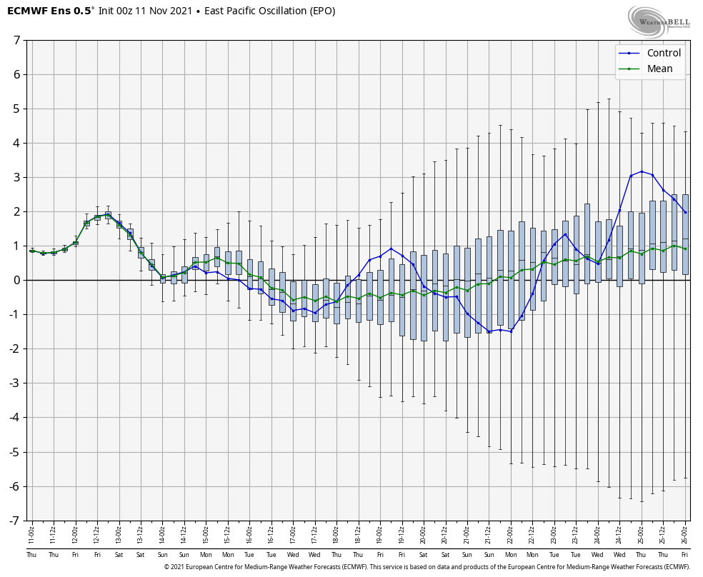
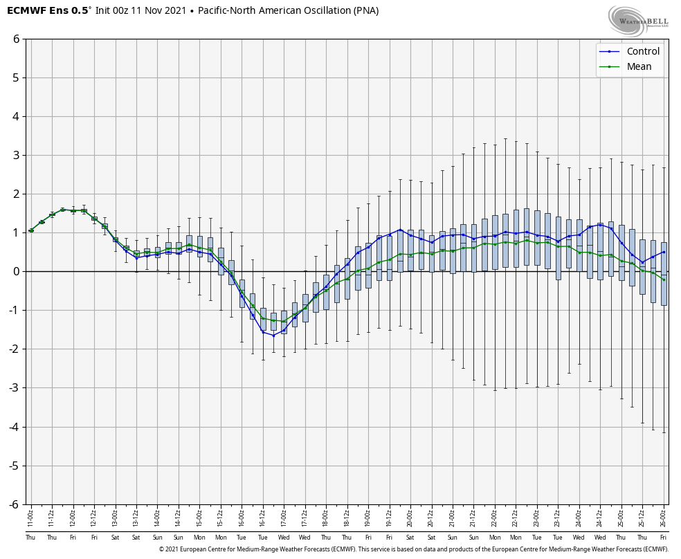
Rest assured the idea here isn’t changing regarding the fast and cold start to meteorological winter, but we’re rapidly approaching the period where this idea will be put to test. If by Thanksgiving week we still don’t see the movement expected with the EPO and PNA then it’ll be time to look for a Plan B.
One additional element with this is that we believe the MJO will become a driver in the expected cold start to the season (a byproduct of the sea surface temperature configuration and 2nd year Nina). It’ll be interesting to see if we can get the MJO out of the neutral phase and into position to make an impact driving an expected more persistent cold regime.
Potential is high in this setup. Now it’s time to simply sit back, wait, and watch for the hours of research back in the summer to either come to fruition or flop. 😃