
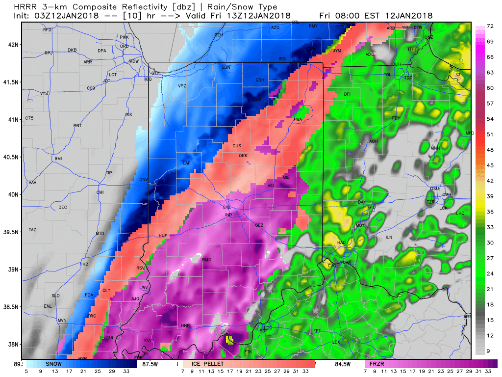
Just wanted to touch base on some of the latest data this evening and concern is growing around an extended period of freezing rain and sleet that will develop within a few hours, continuing through the morning rush for the majority of central Indiana. Some of our high resolution data is suggesting significant amounts of freezing rain overnight- in some cases more than one quarter inch across southwestern and central portions of the state. This is enough to create concern for the potential of downed tree limbs and power lines in spots.
Forecast radar (time stamp at 4a below) shows widespread freezing rain developing during the overnight, including the greater Indianapolis area.
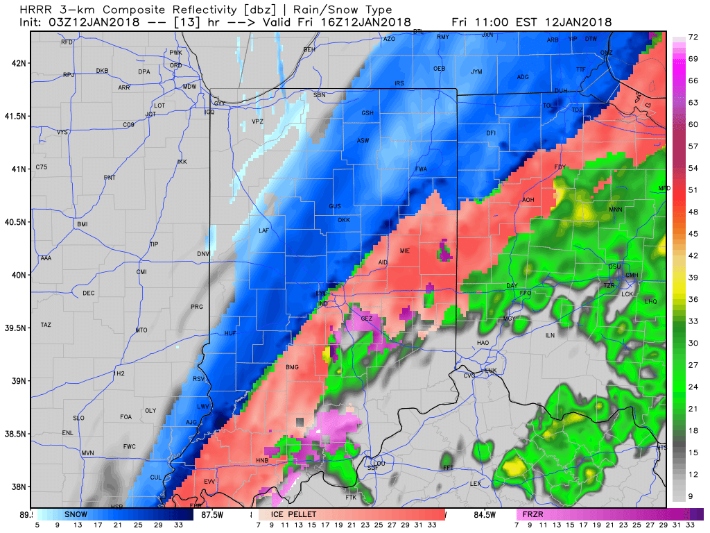
 The model finally suggests that freezing rain will begin to transition to sleet around the morning rush hour.
 An icy mixture of sleet and freezing rain is expected to transition to snow late morning into the early afternoon hours across the region.
 We suggest ensuring you charge your electronic devices and cell phones tonight in the event you lose power overnight or Friday morning. We’ll hope for a faster transition to sleet and snow than data currently suggests, but the concern is certainly present this evening for an impactful ice storm for portions of southwestern and central Indiana.
The morning commute Friday will be heavily impacted and if you don’t have to travel we recommend remaining indoors.
 Highlights:
 Dry conditions will return Saturday along with a much colder feel. Quiet times won’t last long as another snow system will quickly begin to impact the state Sunday evening into Monday. Widespread steady snow is expected to develop and will actually be a more uniform, bigger, event for most of the viewing area. We’ll add in wind and arctic air which will lead to blowing and drifting issues as the day progresses Monday into Tuesday. Here’s our first call for additional snow amounts Sunday evening-Monday.
 The forecast period will wrap up dry and bitterly cold. With a fresh snowpack down, it’s safe to say we’ll add at least another night to the sub-zero “club!”
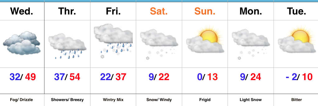 Highlights: