You must be logged in to view this content. Click Here to become a member of IndyWX.com for full access. Already a member of IndyWx.com All-Access? Log-in here.
You must be logged in to view this content. Click Here to become a member of IndyWX.com for full access. Already a member of IndyWx.com All-Access? Log-in here.
You must be logged in to view this content. Click Here to become a member of IndyWX.com for full access. Already a member of IndyWx.com All-Access? Log-in here.
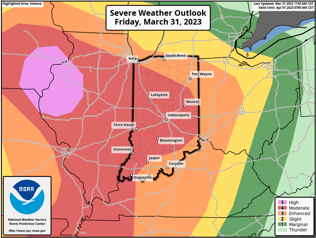
The talented folks over at the Storm Prediction Center have increased the Day 1 severe threat to now include most of the state in a Moderate (level 4 out 5) risk. It should also be pointed out that all modes of severe weather are in play, including tornadoes, some of which could be long track.
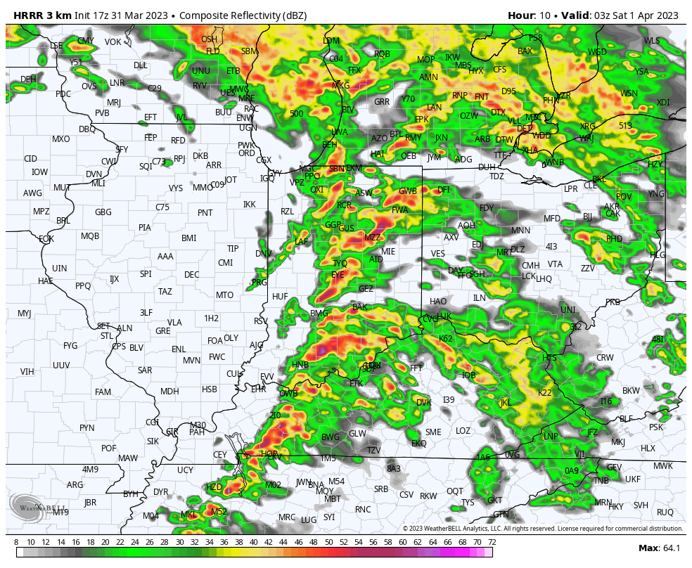
We continue to believe discrete cells will begin to fire later this evening (targeting initiation between 4p and 6p) across the state and it won’t take much for these to begin to show signs of rotation. If you don’t have to travel tonight, we recommend making it a night in and keeping tuned to the latest watches and warnings that will be sure to come.
As we progress deeper into the evening and early overnight hours, that’s when we expect a squall line, capable of producing damaging straight line winds, to march across the state from west to east. We bracket the hours of 10p to 2a west to east for impacts. In addition to the heightened damaging wind threat, it’s possible some of the embedded cells within the line will try and rotate, leading to a spin up tornado potential within the advancing line, especially for western and central parts of the state.
No need for panic or alarm, these events take place every year around these parts. Just ensure to review your severe weather plan and stay tuned to local media for the latest warnings that will be issued later this afternoon and into the evening.
You must be logged in to view this content. Click Here to become a member of IndyWX.com for full access. Already a member of IndyWx.com All-Access? Log-in here.