Briefly Warmer; Blustery Close To The Week With Rain And A Few Storms…

Updated 10.11.23 @ 7:42a

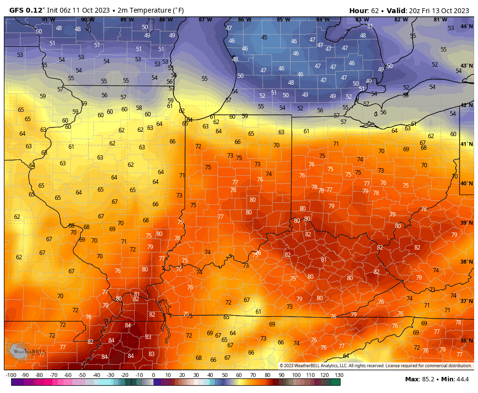
A cold front and associated area of low pressure will move through the Ohio Valley as we close the week. Briefly warmer air will surge north into the region Thursday and Friday with temperatures flirting with 80° both days.
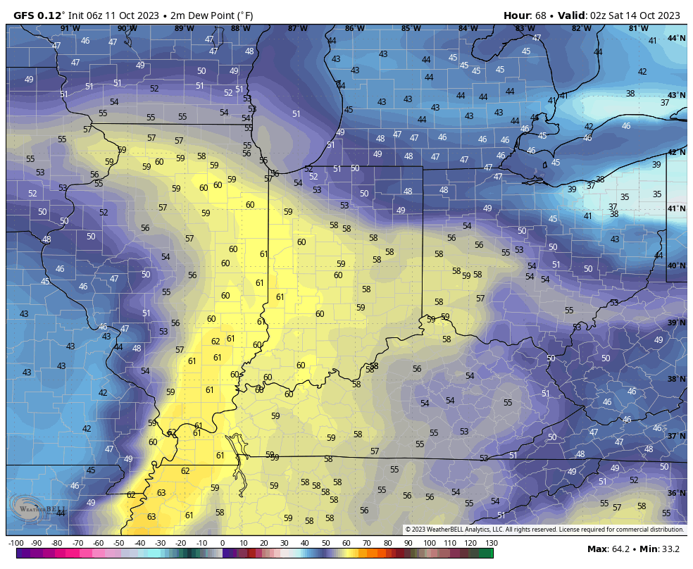
Moisture levels will also increase as dew points creep up closer towards 60°.
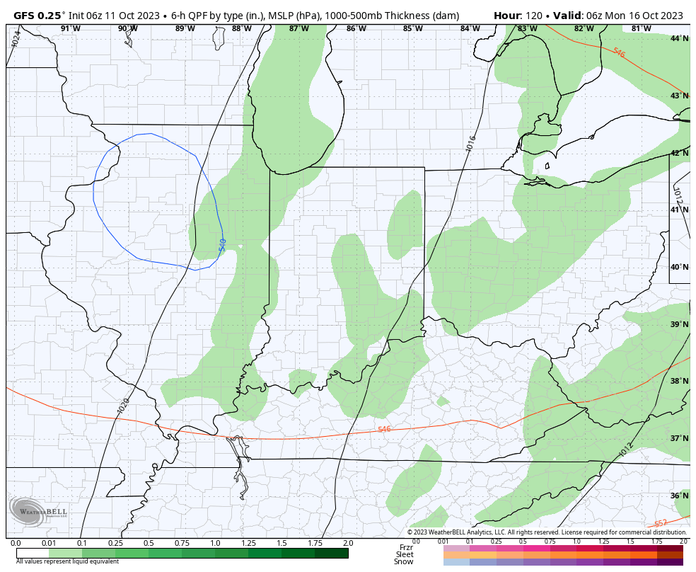
A weakening area of rain and embedded storms will rumble into the state late Friday and Friday night. Widespread severe weather isn’t expected but the Storm Prediction Center outlines the far western portion of the state in a marginal risk, primarily for a wind threat. We still bracket 0.25” to 0.75” rain potential.

Speaking of wind, non-thunderstorm gusts towards 30 MPH can be expected Friday and Saturday.

With the cold core upper low hanging around, additional spotty showers, mixed with graupel, can be expected over the weekend into early next week.

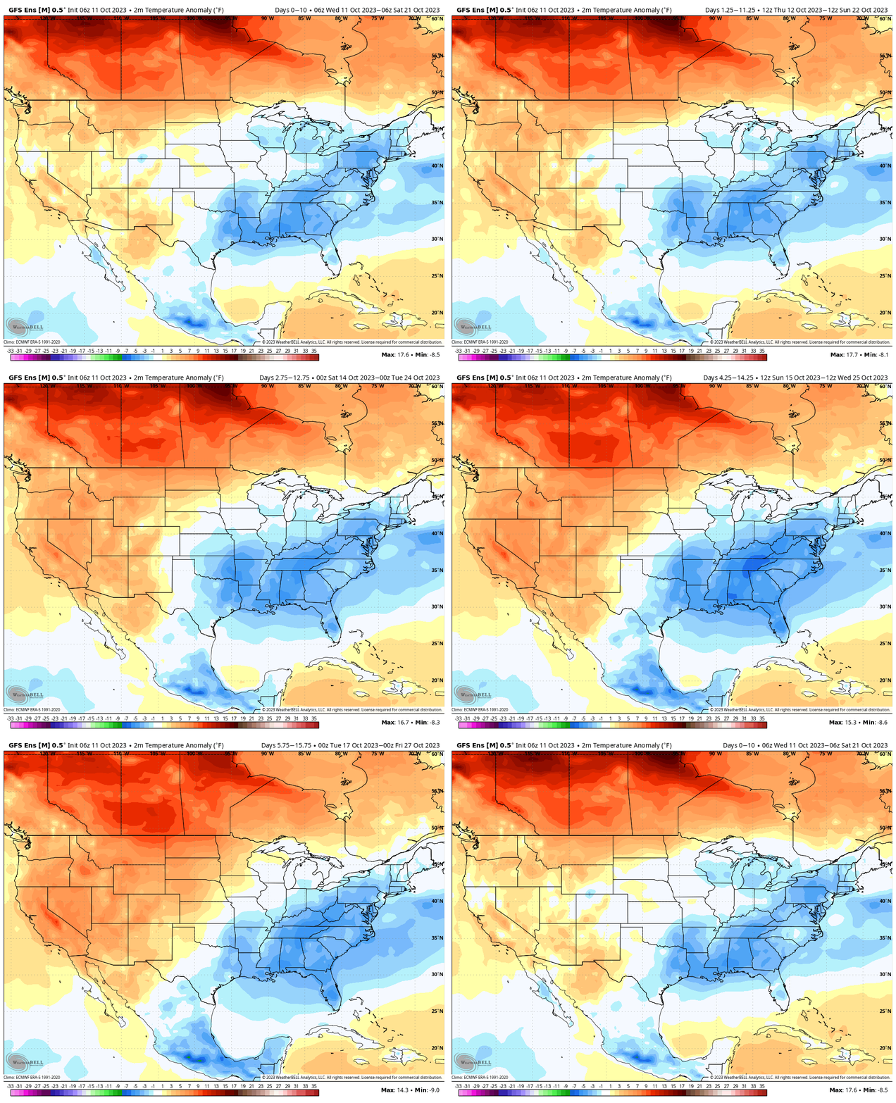
The theme over the next couple weeks is for cooler than normal conditions to dominate overall.
What Goes Up Must Come Down…

Updated 10.02.23 @ 7:44a

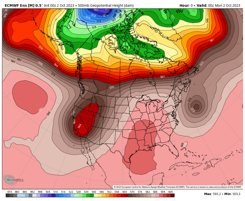
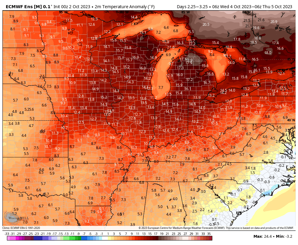
“Severe” clear dominates weather headlines in the short-term. This and the unseasonably warm pattern we’re currently enjoying is a byproduct of an omega blocking pattern. Look for plentiful sunshine and afternoon highs 10° to 15° + above average through Wednesday. The combination of our dry airmass and longer nights will still allow for comfortably cool lows (mid to upper 50s).

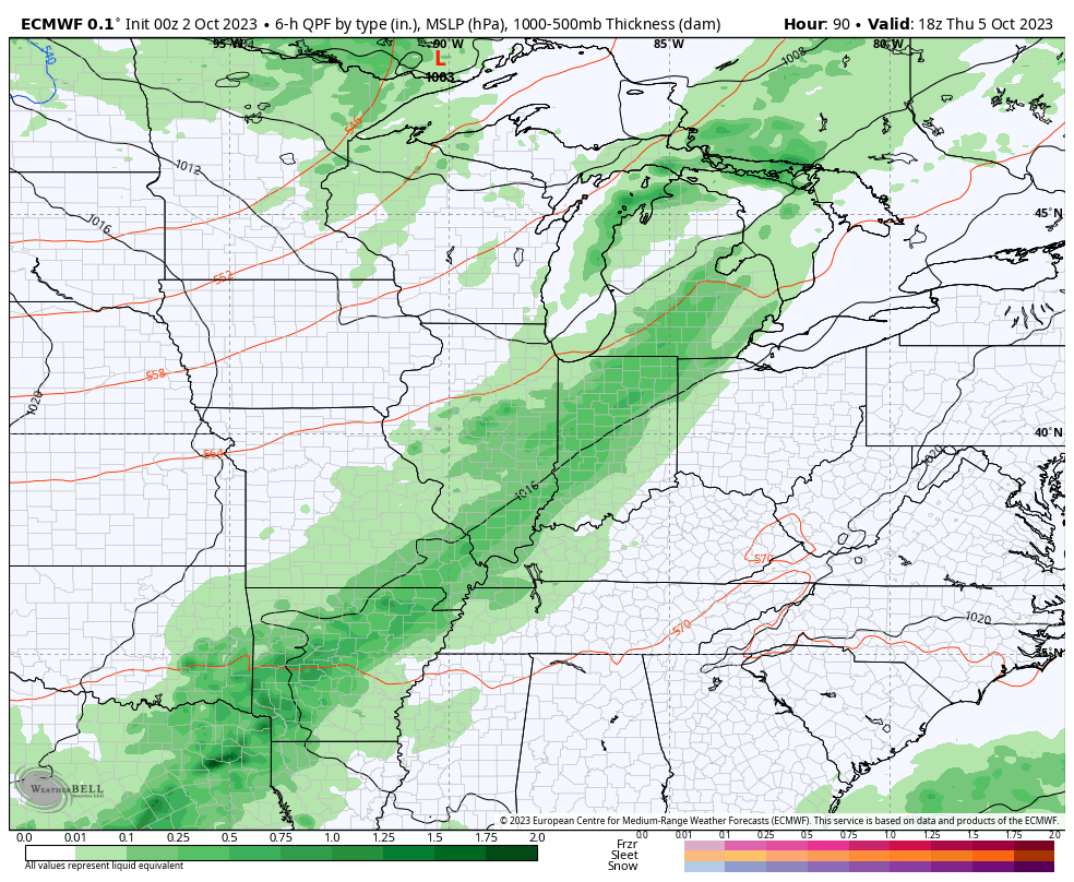
A game changing cold front will come plowing through the region Thursday morning. Models have upped the ante a bit with respect to moisture return. We now believe scattered to numerous showers (embedded thunder) will arrive Thursday morning, continuing into the afternoon and early evening hours. Rainfall totals of 0.25″ to 0.75″ seem like a good bet now with this FROPA, with local amounts to 1″. A secondary front will pass Friday night and Saturday morning with even chillier air behind the boundary. Winds will also turn gusty as we open the weekend. By early next week, patchy frost is possible for areas outside of the city, itself.

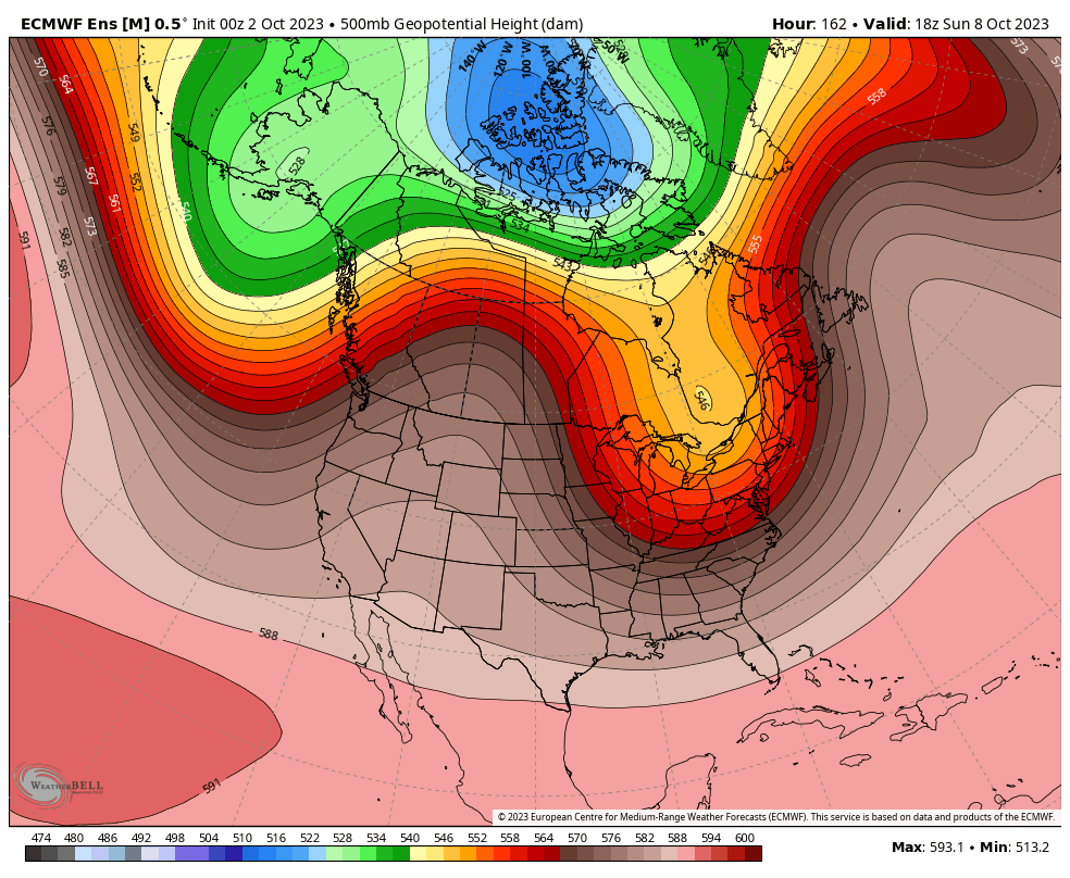
The bigger “shock” to the system will likely come from the swing in daytime highs. Those unseasonably warm readings will take a nose dive and result in temperatures close to 10° below normal over the weekend into early next week.