Updated 12.05.23 @ 6:23a Novelty flakes for some and a cold light rain for others will give way to briefly cooler air as we go into tonight and Wednesday morning…
You must be logged in to view this content. Click Here to become a member of IndyWX.com for full access. Already a member of IndyWx.com All-Access? Log-in here.
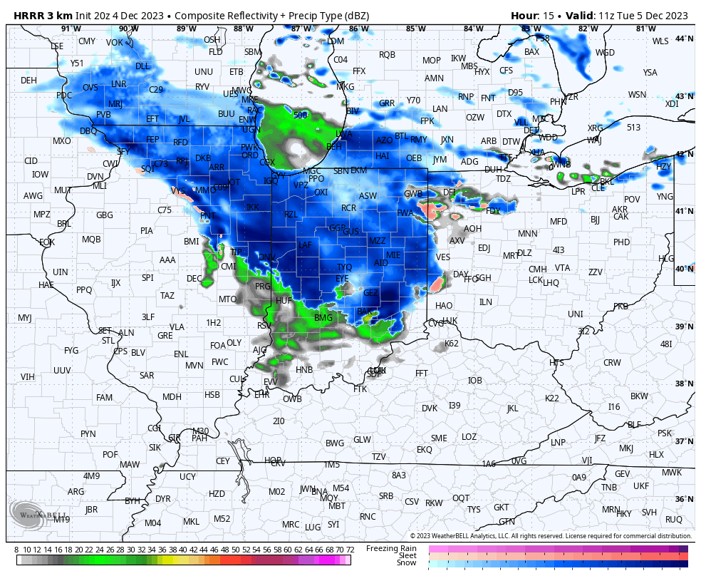
1.) Our clipper system is still on track to deliver a wintry mix of a cold rain and wet snow to central Indiana during the predawn hours Tuesday, continuing into the mid and late morning. We don’t have any changes from this morning’s video update. Thinking is that this is primarily a wet snow event from in and around Indianapolis and points north, including the potential of a coating to a dusting of snow in/ around the city with 0.50″ to 1″ type accumulation of wet snow across north-central Indiana (including northern Indy ‘burbs, such as Whitestown, Zionsville, Westfield, Carmel, and Fishers). Pavement issues aren’t anticipated due to the marginally cold temperatures in place and recent mild air, but slushy accumulation on grassy and elevated surfaces is likely in the areas mentioned above.
Most of the “system” precipitation should be out of here by lunchtime with a chance of a few scattered snow showers returning to north-central Indiana and into Indianapolis Wednesday morning with the weak cold air advection (CAA).
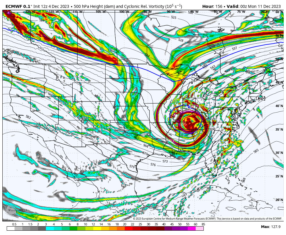
2.) After a seasonably chilly midweek, temperatures will “zoom” into the 50s and even approach 60 before we close the work week out. This is in response to an aggressive southwesterly air flow ahead of an approaching and strengthening surface low pressure system that already has the weather community “buzzin'” several days in advance. While the pattern is conducive for a rapidly deepening area of low pressure advancing from the Ark-la-tex region northeast across the Ohio Valley and Great Lakes, there are still many more questions than answers before we can provide anything concrete with respect to p-type, including potential snow numbers.
The hesitancy in leaning in stronger to this event from a winter perspective, locally, is the lack of cold air available to tap into. That’s not to say this storm will have to generate all of the cold on its own, but we’ll have to have a rapid strengthener to help aid in the cold production if anything meaningful is to transpire on the winter front. All of that said, it’s safe to say that a widespread, wind-whipped precipitation event is becoming increasingly likely this weekend. While the initial lean is still mostly “wet vs. white” for central Indiana, we’ll be watching trends very carefully.
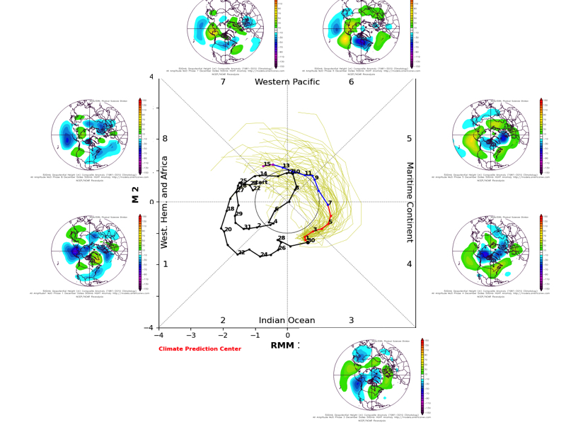
3.) With each passing day, we receive more questions on the weather pattern around the holidays, and understandably so. The key to a sizable shift to more sustained cold and winter weather opportunities lies squarely on the MJO, in our opinion. I’ll include the image we posted here last week below showing the overall MJO evolution into the 2nd half of December. It’s certainly not unreasonable to think that the progression into the colder phases should happen when you extrapolate this out.
Long story short, we have no changes in our idea of a colder shift taking place with the overall pattern around (give or take a day or 2) 12/20.
Updated 12.04.23 @ 7:43a A clipper will dive southeast across Indiana Tuesday morning. This will help precipitation overspread the region during the predawn hours and though temperatures will only be…
You must be logged in to view this content. Click Here to become a member of IndyWX.com for full access. Already a member of IndyWx.com All-Access? Log-in here.
Updated 11.30.23 @ 7:44a Clouds will increase through the afternoon and give way to light rain by evening. That rain will grow more widespread and heavier in nature as we…
You must be logged in to view this content. Click Here to become a member of IndyWX.com for full access. Already a member of IndyWx.com All-Access? Log-in here.
Updated 11.27.23 @ 7:45a A true arctic air mass will settle over head today and lead to the coldest air of the season through Tuesday. Wind chills will fall to…
You must be logged in to view this content. Click Here to become a member of IndyWX.com for full access. Already a member of IndyWx.com All-Access? Log-in here.