VIDEO: Rambling Around On A Wednesday Evening…
You must be logged in to view this content. Click Here to become a member of IndyWX.com for full access. Already a member of IndyWx.com All-Access? Log-in here.
You must be logged in to view this content. Click Here to become a member of IndyWX.com for full access. Already a member of IndyWx.com All-Access? Log-in here.
After a night of freezing rain, many roadways throughout central IN remain glazed over and hazardous as of this update. If you absolutely don’t have to travel today, please don’t. Allow road crews to do their job. Additionally, we have growing concerns of a new round of freezing rain to sleet and eventually snow tonight. Lingering moisture on roadways will result in “flash freeze” conditions and treacherous travel tonight into Sunday.
First, a tip of the hat to short-term modeling, including the NAM, for suggesting we’d have a very difficult time eroding the shallow arctic air at the surface across most of central IN today. While we never bought into the mid/ upper 50s idea the GFS and Euro were once suggesting, we did initially think 40s were in store today. Forget about it. Mid to potentially upper 30s are the best we can do today and temperatures will crash this evening as not one, but two, arctic fronts push through central IN. Even if we didn’t have additional precipitation inbound tonight, “flash freeze” conditions would develop from lingering moisture and lead to renewed problems on area roadways. Throw in another wave of low pressure riding along the pressing arctic front and a whole slew of problems will develop yet again from a freezing and frozen precipitation perspective.
Note the incredible temperature gradient from downstate to central and northern Indiana early this afternoon.
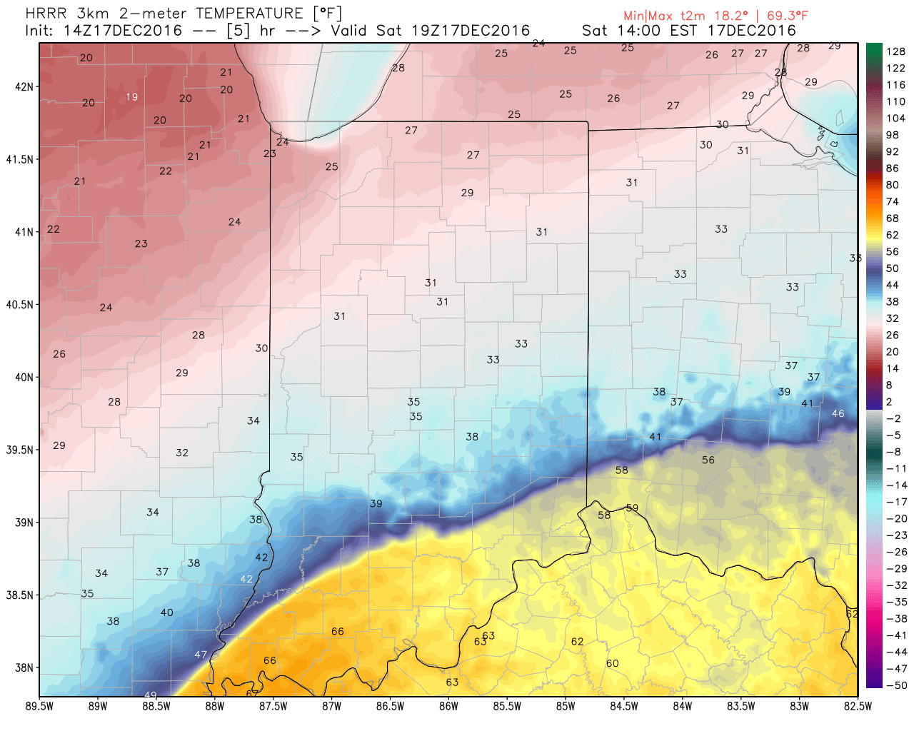 The heavy, dense, arctic air will win out as evening turns into nighttime. Indianapolis is back to the freezing mark around 6p and into the 20s by 9p.
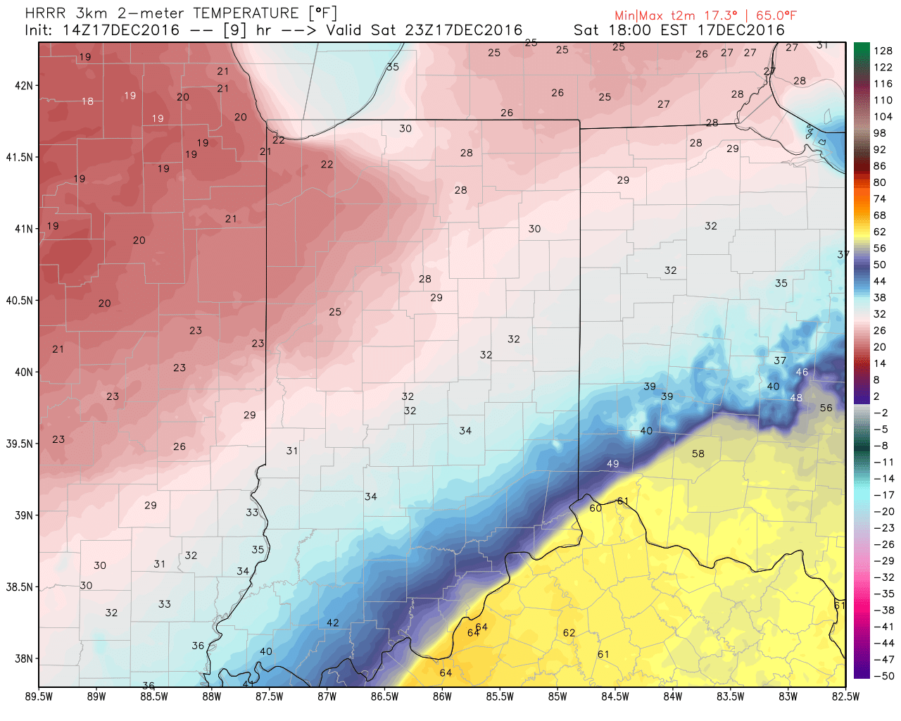
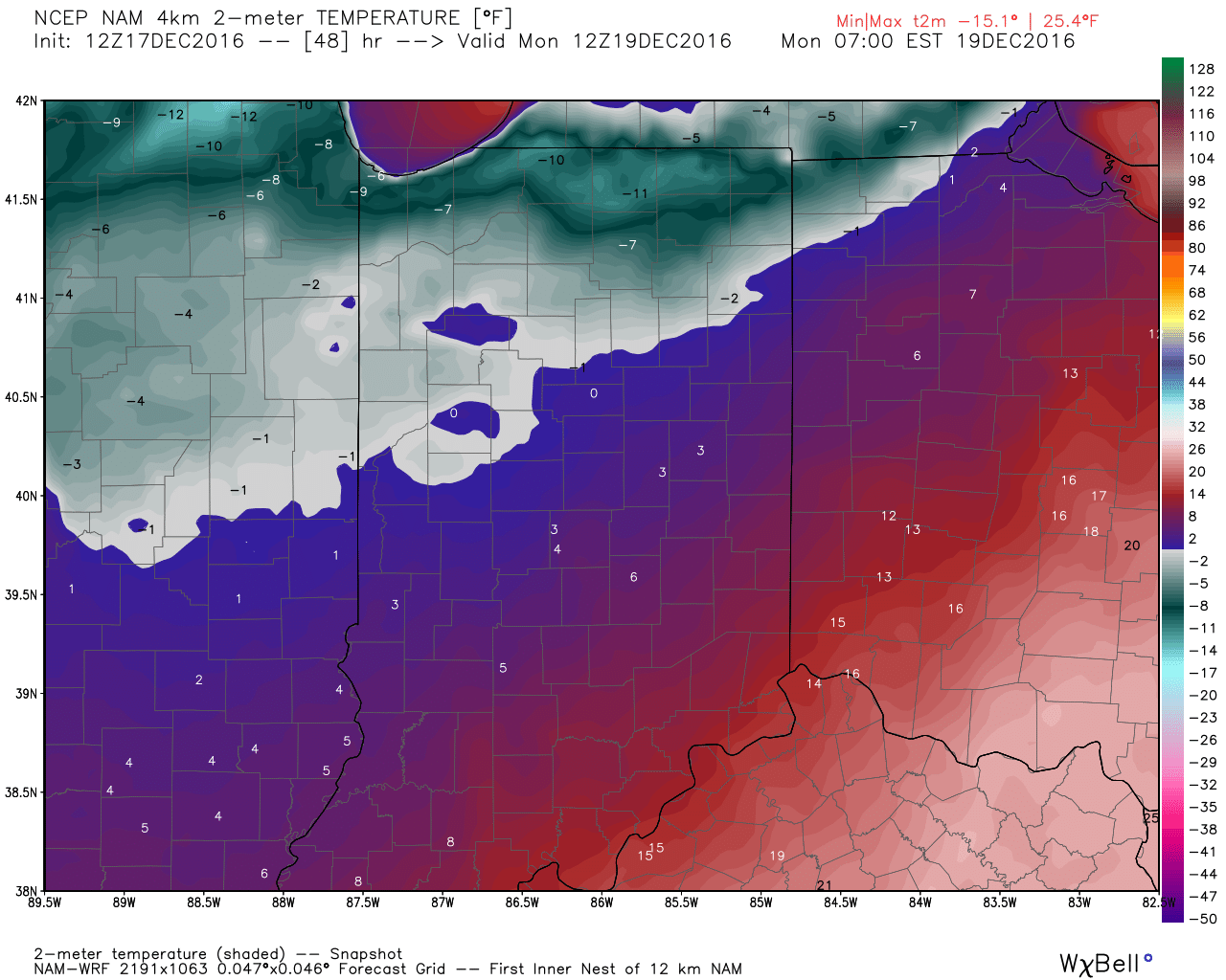
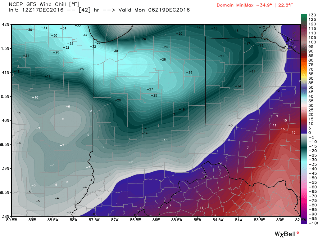
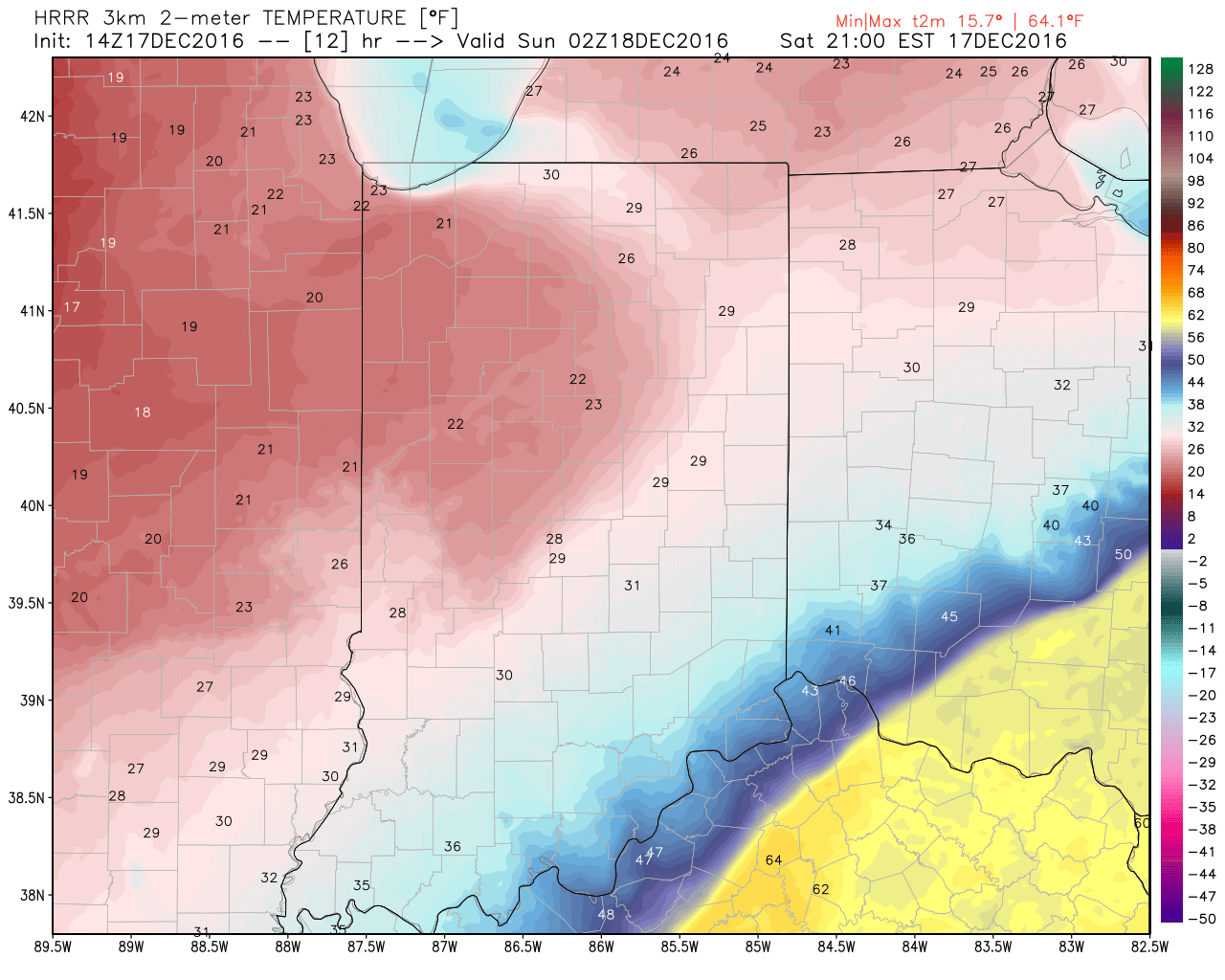 Temperatures will continue to fall through the day Sunday and by Monday morning central Indiana will be in the single digits, with below zero readings across northern parts of the state.
 Wind chill values of 10 to 20 degrees below zero will be common by Sunday night into Monday morning across central Indiana.
 Areas of drizzle and freezing drizzle will continue across the region into the early afternoon, but begin to expand in coverage and intensity once again by evening. Note the area of freezing rain expand across central IN, including Indianapolis, between 4p and 7p.
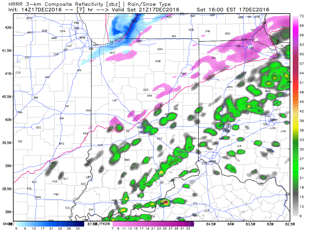
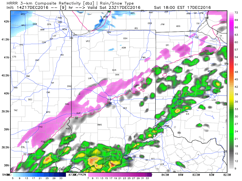
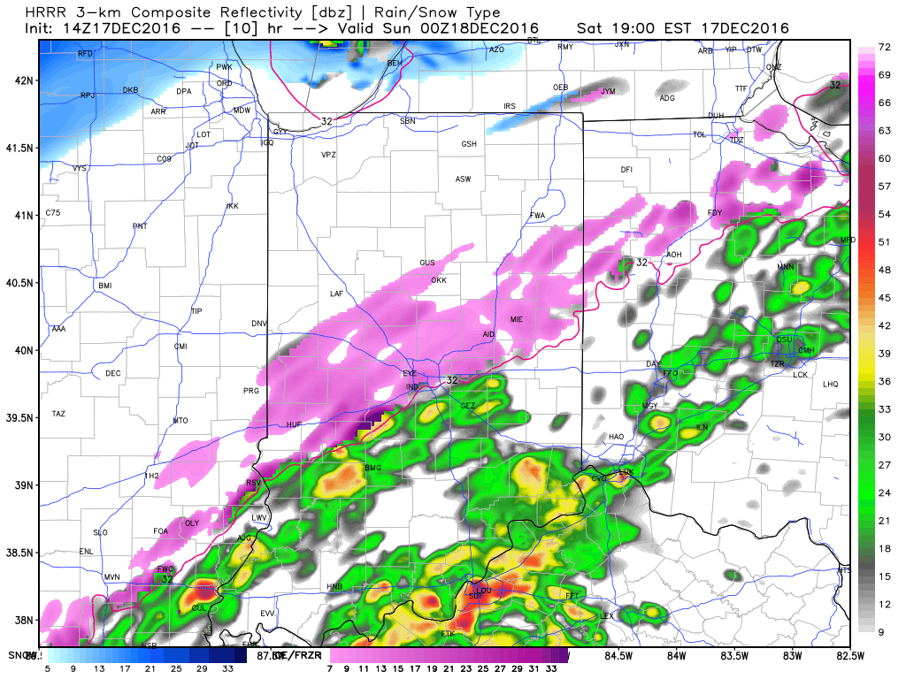 Freezing rain will eventually begin to mix with sleet and eventually transition to light snow during the overnight from northwest to southeast. A coating of snow to less than 1″ is a good bet on the new icy glaze that develops tonight.
When you factor in the current hazardous conditions in place along with the fresh push of arctic air and precipitation tonight, it’s a good idea to hunker down inside and remain off area roadways. We have big concerns of new travel problems developing by evening across central Indiana. By this time tomorrow, our attention will turn to the bitterly cold air and dangerous wind chill values developing.
More later, including prospects of snow around Christmas. As always, you can follow our updates on social media by following us on Twitter (@indywx) and Facebook. Stay safe!
 Highlights:
Heavy Winter Gear Required…An arctic cold front slammed into central IN Wednesday evening with plummeting temperatures, strong and gusty (40 MPH) winds, blowing snow, and just a downright “rude” feel. Those bitter conditions will remain through the close of the work week, including dangerous wind chills Thursday. In fact, we still expect wind chills to fall into the 10-20 degree below zero range through the morning, and remain below zero most of the day.
We’ll flip the page and turn our attention to our next storm system as we rumble into the weekend. Clouds will increase Friday and moisture will begin to override the cold air locked in place at the surface by the evening and nighttime. With sub-freezing air still present, this moisture will likely fall as a combination of sleet and freezing rain across central Indiana Friday night. Eventually, temperatures will warm (briefly) above freezing Saturday morning and allow precipitation to transition to light rain. Before that takes place, slick road conditions could develop Friday night from the sleet/ freezing rain mixture. Needless to say, we’ll keep a close eye on the latest data as it comes in.
Almost as fast as we go above freezing Saturday, temperatures will begin to fall once again during the afternoon and evening as heavy, dense, arctic air “oozes” southeast. As this is happening, a second wave of moisture will ride northeast along the pressing arctic cold front. We expect precipitation to break out yet again Saturday evening and night, and fall as a wintry mix before ending as snow. (Additional light ice and snow accumulation potential).
Temperatures will fall through the day Sunday along with strong and gusty NW winds. Wind chills will once again fall below zero Sunday evening into Monday morning…
While the frigid conditions will “relax” as we go into the middle of Christmas week, we have an eyebrow raised for the potential of “fun and games” just beyond the current 7-day period. Far too early for specifics, but the potential of wintry prospects around Christmas are alive and kicking…
Upcoming 7-Day Precipitation Forecast:
1.) Talk about number-busting cold. With a fresh snowpack and clear skies overnight, temperatures plummeted (even colder than some high resolution data suggested yesterday evening). Officially, it’s the coldest December morning in Indianapolis since Christmas Eve 2013. We note even a few communities below zero (talking about you Crawfordsville, Zionsville, and Greenfield).
Even colder air rushes in tonight behind a secondary arctic cold front. Expect an increase in cloudiness, scattered snow flurries, and strengthening NW winds by late afternoon and early evening. As the reinforcing bitter air pours into the region, wind chill values will fall to 10-20 below zero tonight into Thursday morning. That’s dangerous stuff, friends, and requires limited time outdoors. The National Weather Service has issued a *Wind Chill Advisory* 10p this evening until 11a Thursday.
 2.) Our next storm will approach Friday evening. Clouds will increase and thicken as the day gives way to evening and a wintry mix of snow, sleet, and freezing rain will overspread central IN Friday night. With snow on the ground and the recent bitter blast, we have concerns the cold air won’t be “dislodged” as quickly as last weekend. The end result may be a period of accumulating freezing rain/ sleet Friday night into early Saturday morning. We’ll keep a close eye on things.
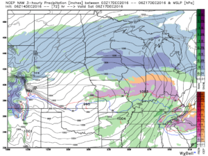 Regardless, icy precipitation will transition to rain during the day Saturday as temperatures briefly surge above freezing. “Brief” is the key word there as temperatures plummet Saturday night, courtesy of fresh arctic air oozing back in. A secondary wave of moisture may result in additional wintry issues Saturday night. Additionally, with sharply colder air returning, “flash freeze” concerns loom Saturday night, as well.
3.) Another “lobe” of arctic air will plunge into the area Saturday night and help set-up a frigid close to the weekend. We’ll have to be on sub-zero watch again.
 4.) Our attention then shifts to what may very well be an active Christmas week in the weather department. We continue to think the frigid times of this week will relax. That said, it’ll remain cold enough with a favorable storm track to result in wintry issues as Christmas nears. Far too early for specifics with this 10+ days out, but keep it in the back of your mind that the weather pattern continues to look active and at least present a threat of wintry precipitation at times Christmas week.
 Highlights:
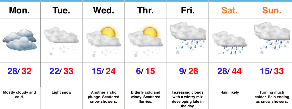
Bitterly Cold Week Ahead…We’ll kick off the work week with mostly dry, but mostly cloudy and continued cold conditions. Be careful if traveling early in the morning as some refreezing may take place across central IN during the overnight.
Reinforcing arctic air will begin to blow into town mid week and an area of light snow may precede this next arctic punch to the gut Tuesday. Scattered snow showers and flurries will fly in the bitterly cold, arctic, air mass Wednesday and Thursday. Along with highs only in the teens Thursday, expect below zero wind chills.
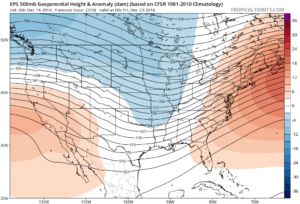
Eyes will then shift to the end of the week as our next storm of significance approaches. This storm appears to be stronger than this past weekend’s system, but similar to this weekend’s overall pattern, we expect a “mild up” and mostly a liquid event across central parts of the state. The primary reason? Lack of high latitude blocking to keep the storm track south (more on that in another post later tonight or Monday). Add in a “feisty” southeast ridge that keeps flexing it’s muscle and you have the makings for what’s likely another cutter to the Lakes. Unlike this current event, we will have to keep an eye on a potential second wave of moisture moving along the front Sunday as the arctic air returns.
Upcoming 7-Day Precipitation Forecast: