Big Changes Loom…
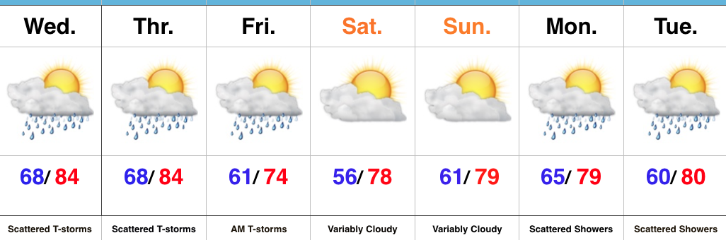 Highlights:
- Wet and stormy at times to close the work week
- Much cooler air ahead
- Pleasant weekend on deck
Summer Weather Gives Way To An Early Fall Feel…Seasonably warm and humid conditions will help power widely scattered afternoon and evening thunderstorms again Wednesday. More widespread showers and thunderstorms will arrive Thursday evening into early Friday as a cold front sweeps through the state. Winds will shift around to the northwest and turn gusty Friday afternoon, helping usher in an unseasonably cool air mass for the first Friday of August. This cooler regime will remain with us through the weekend. A quick-moving light shower is possible over the weekend, but most of the area will remain rain-free with mixed clouds and sun.
Temperatures will remain below seasonal norms early next week (and really throughout the majority of the first half of August) with scattered rain chances returning to our forecast. Looking beyond the current 7-day period shows our next storm system of significance approaching mid-to-late next week.
Upcoming 7-Day Precipitation Forecast:
- Snowfall: 0.00″
- Rainfall: 0.50″ – 1.00″ (locally heavier amounts)
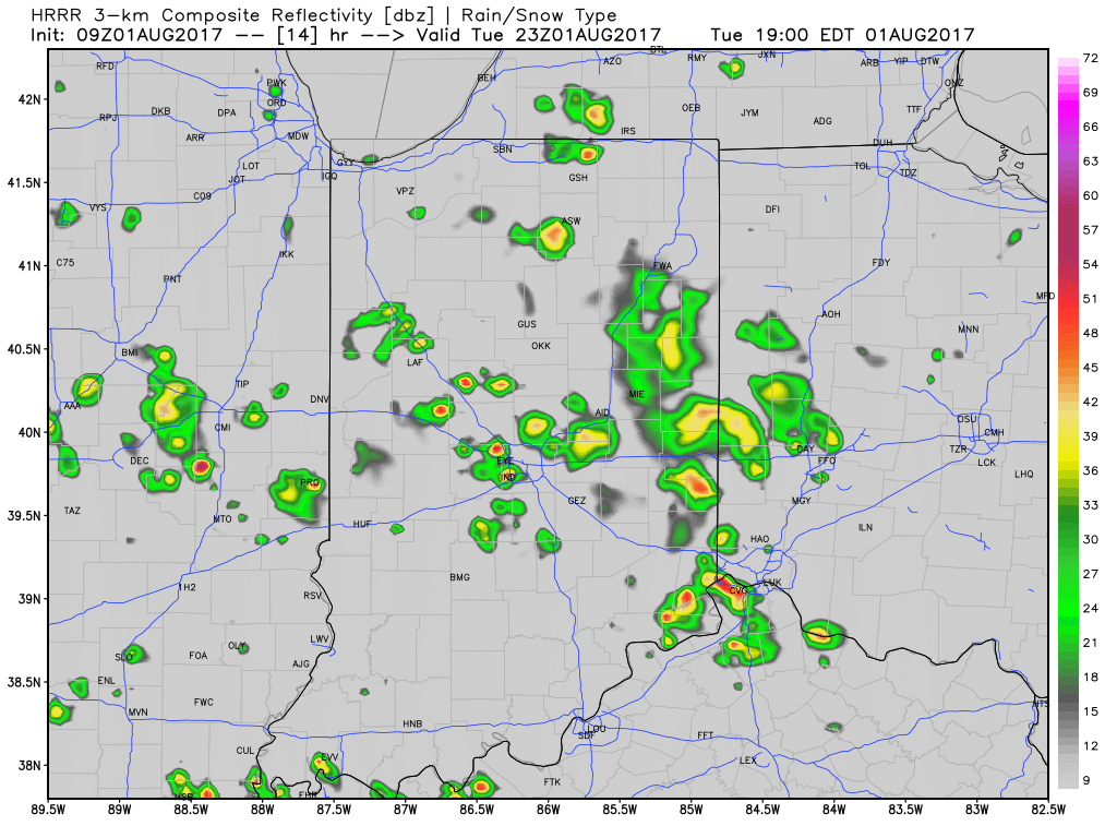
 4.) As surface low pressure wraps up over the Great Lakes Friday, it’ll help pull unseasonably cool air south into the state, along with gusty northwest winds. In fact, temperatures will remain steady or slowly fall as we move through the day Friday. It sure won’t feel like the first weekend of August as temperatures tumble into the 50s area-wide Saturday morning.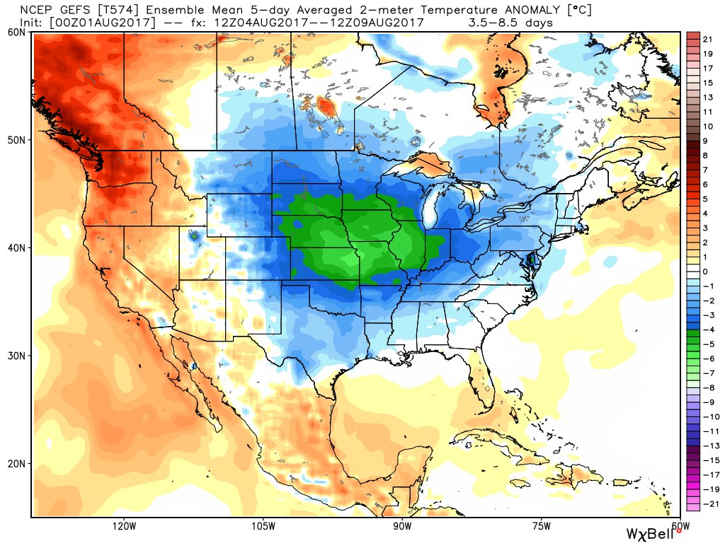
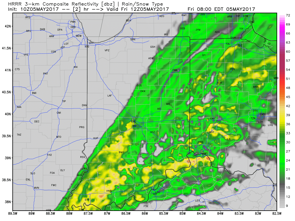
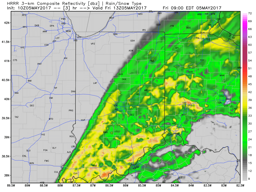
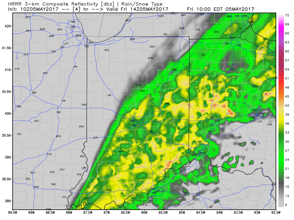 Additional rainfall of 1″-1.5″ is likely from Indianapolis and points south and east with this band of rain before drier weather finally works in here this afternoon and evening. Otherwise, expect continued windy, cold, and raw conditions today as temperatures remain in the 40s this afternoon, including wind chills in the 30s.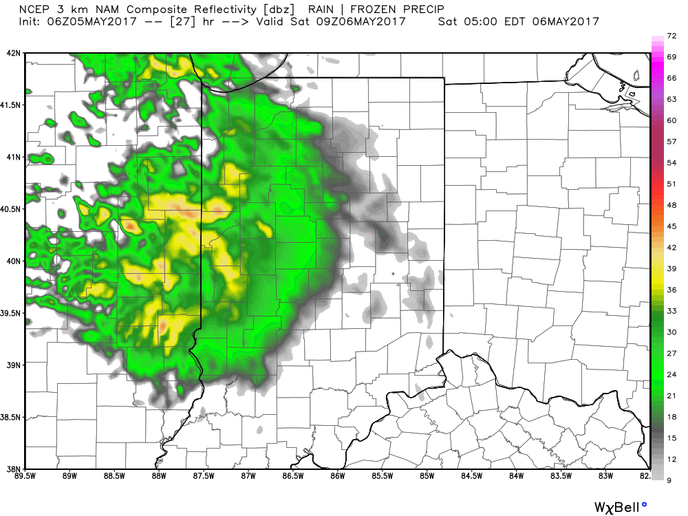
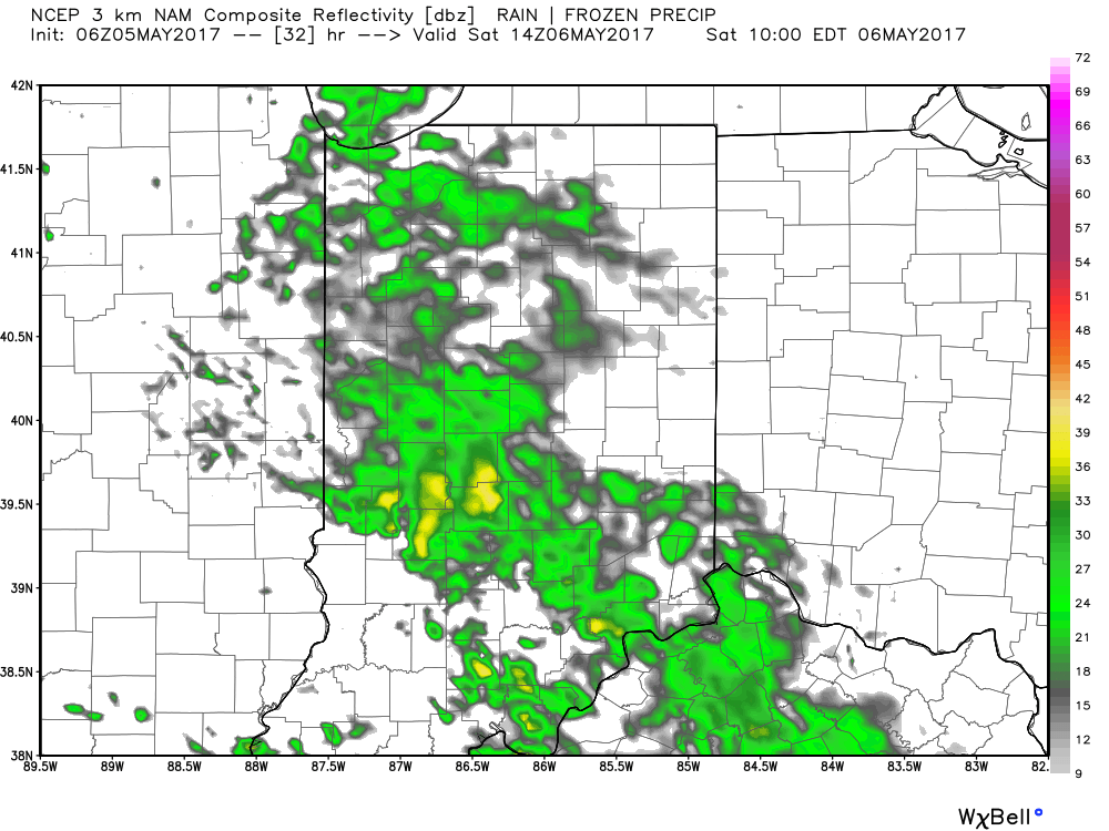 We’ll finally get rid of the rain and introduce a drier regime Saturday afternoon into Sunday, including a sunny close to the weekend. With the drier air, overnight lows will fall to frosty levels Sunday and Monday mornings (lower to middle 30s).