Sun-filled Weekend; Colder Next Week…
High pressure is building in and will supply a gorgeous early-March weekend. Look for plentiful sunshine. Gusty winds this morning will begin to diminish as we rumble into the weekend. While a bit chilly today, that increasingly powerful early-March sun angle will have things feeling mighty nice over the weekend. We suggest finding a patio and enjoying!
 Our next storm system will arrive Monday. Clouds will increase overnight and showers (mostly light) will arrive on the scene during the day. Rainfall amounts aren’t expected to be significant this go around (in general, 0.25″ to 0.40″ for most). Winds will turn strong and gusty during the day Monday, continuing Tuesday and Wednesday.
 Colder air will get pulled into the Ohio Valley Tuesday evening and as upper level energy moves overhead, mixed rain and snow showers will develop Tuesday night through Thursday morning.

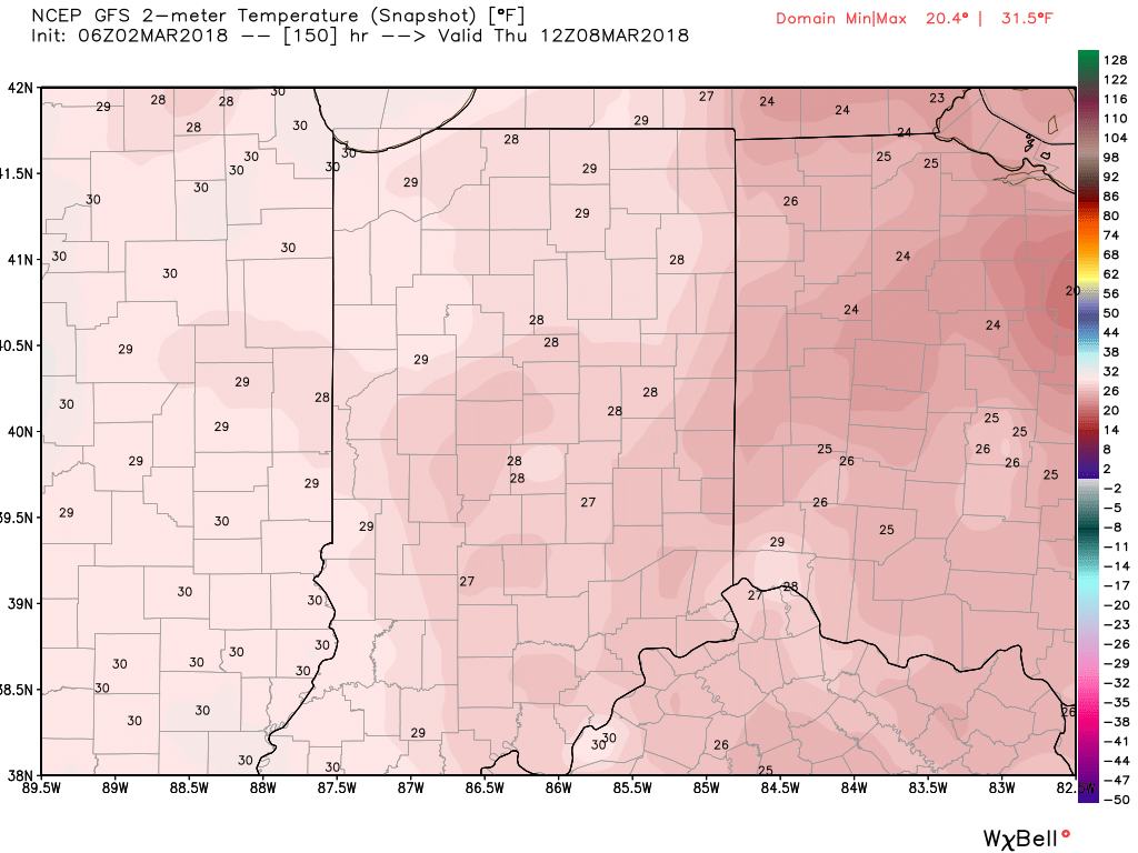
 By next Thursday morning, widespread lows in the 20s can be expected.
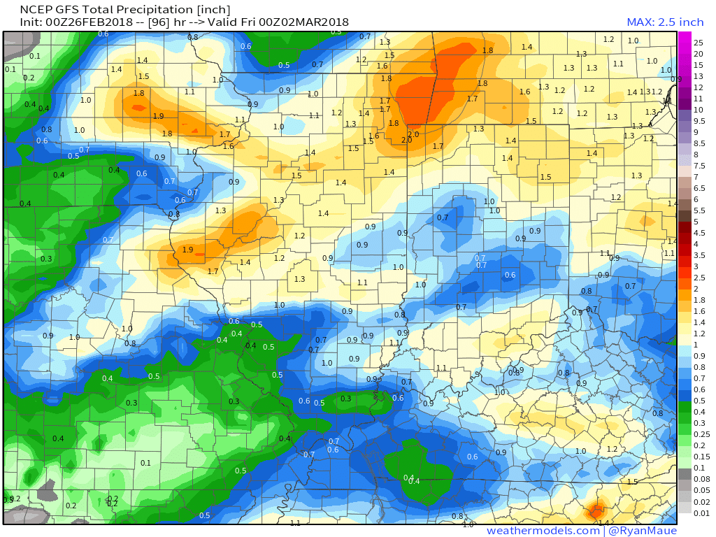
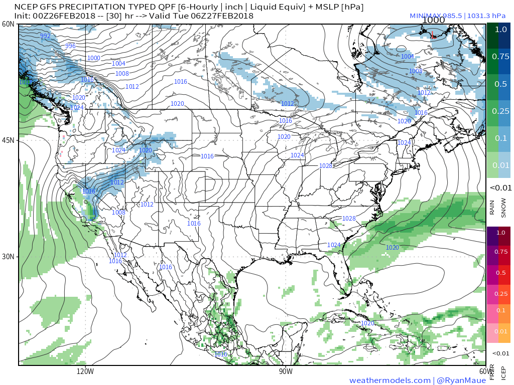 II. Our next weather maker will arrive midweek and provide a few showers Wednesday (not a huge deal from a precipitation perspective). However, as a deepening surface low tracks into the Great Lakes Thursday morning, a period of heavier rain and even thunder is possible. In general, this looks like a 0.50″ to 1.00″ type event.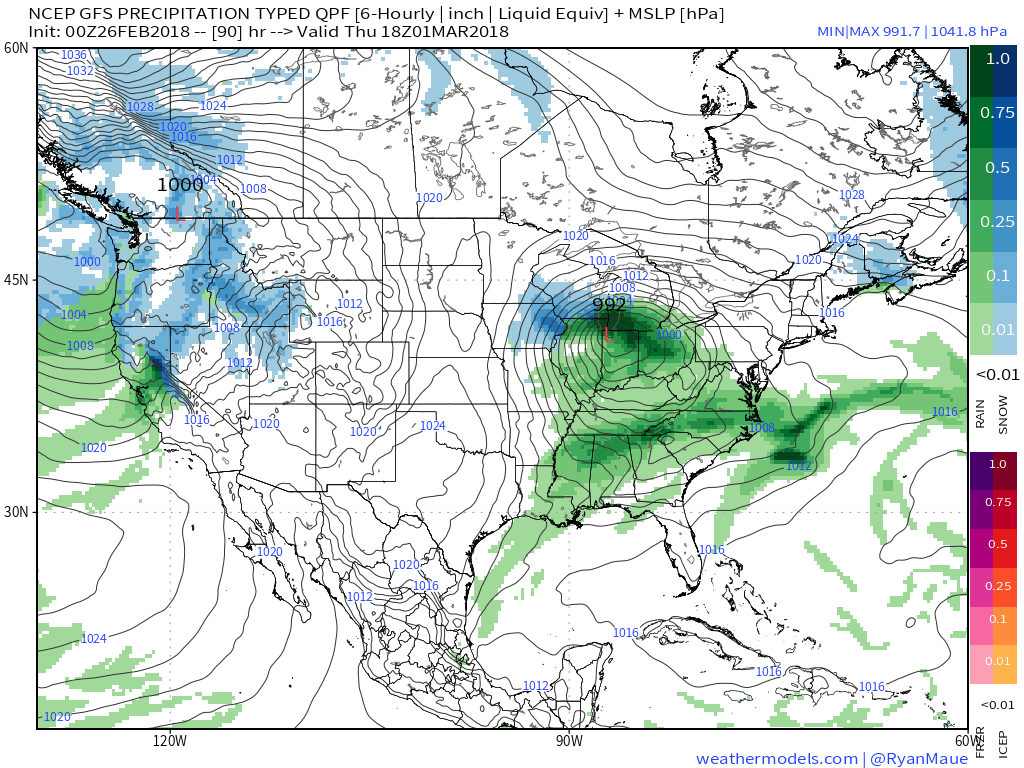
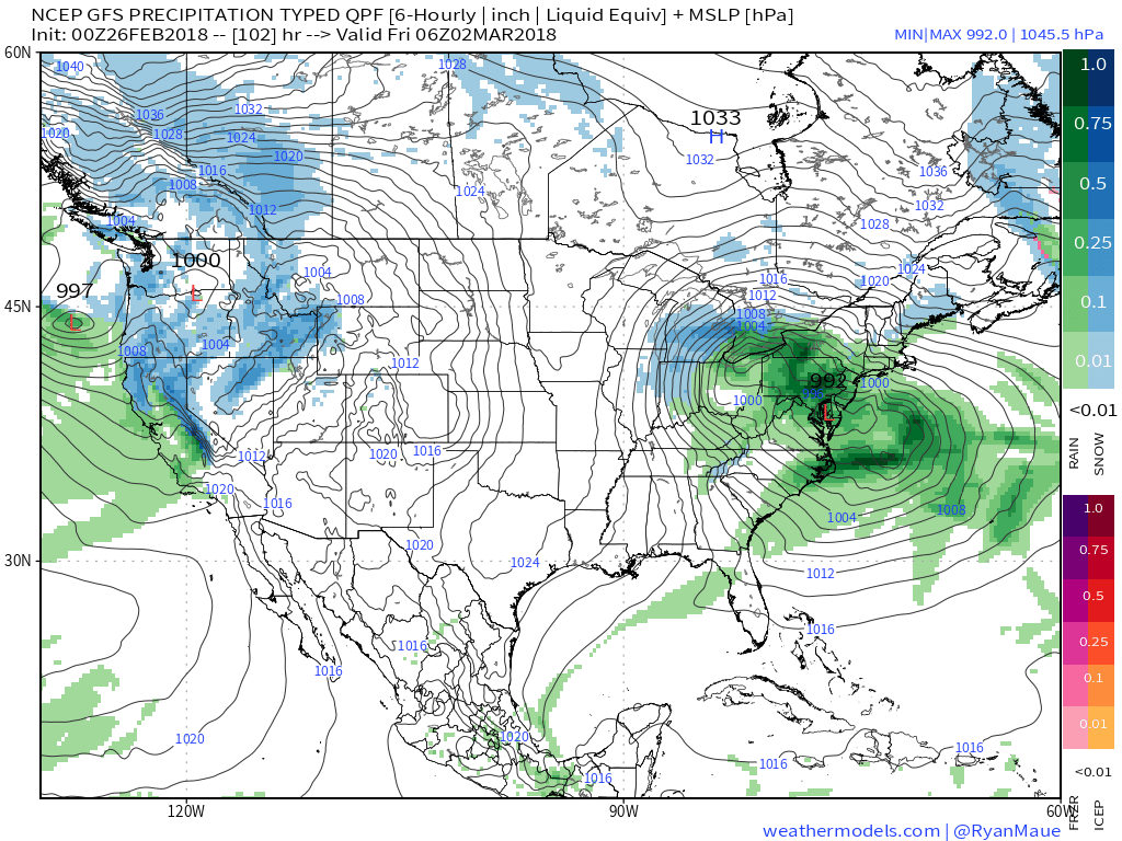
 III. Somewhat cooler air will whip in behind the low, allowing leftover precipitation to end as a couple wet snowflakes across the northern half of the state Friday morning. The bigger story will be the “bumpy” start to Friday with strong and gusty north winds.
 IV. High pressure returns for the weekend and with it will come a return of sunny skies. Though the mornings will be frosty, afternoon temperatures will “warm” to pleasant levels, especially with the increasingly strong early-March sun angle.
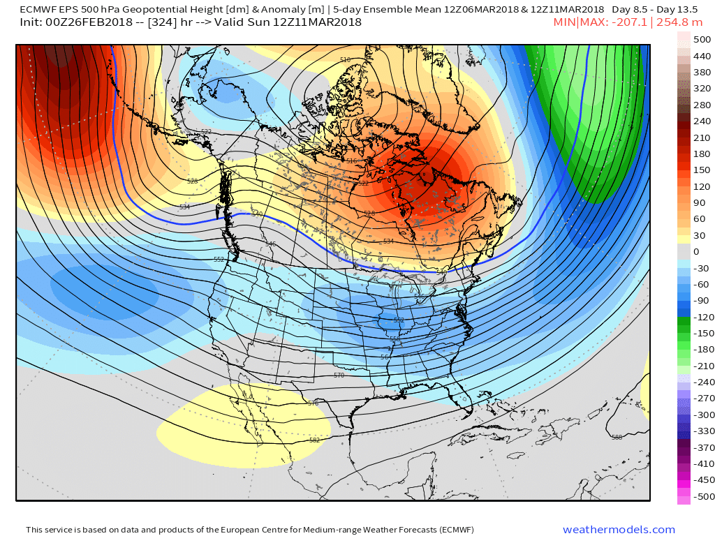
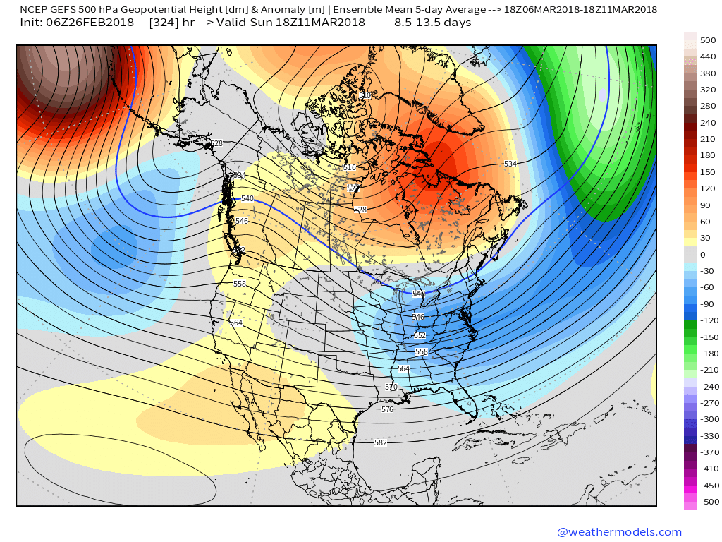
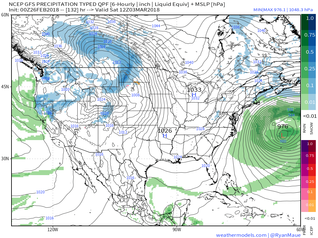 V. Looking ahead, let’s keep a close eye on the second week of March. Potential is present for a stormy period to emerge under the block. We note the GEFS and EPS (respective ensembles of the GFS and European models) are in relative agreement on a stormy, cold look during this time frame. While far too early for specifics, the potential is there for a rather widespread wintry event from the Plains into the Northeast.