VIDEO: Cold And Snowy Open To The Work Week…
You must be logged in to view this content. Click Here to become a member of IndyWX.com for full access. Already a member of IndyWx.com All-Access? Log-in here.
You must be logged in to view this content. Click Here to become a member of IndyWX.com for full access. Already a member of IndyWx.com All-Access? Log-in here.
A significant spring storm system will continue to grab headlines through the short-term. In addition to a raging blizzard across the northern tier into the Great Lakes, severe weather will be an issue across the deep South today. Here on the home front, morning rain will give way to drier conditions for the afternoon and evening hours only to return yet again tonight and into Sunday morning.
 At times, rain will fall at a moderate to heavy intensity tonight into Sunday, especially across the eastern half of the state. Additional rainfall totals of 1″ to 2″ can be expected in and around the city, itself, and points east.
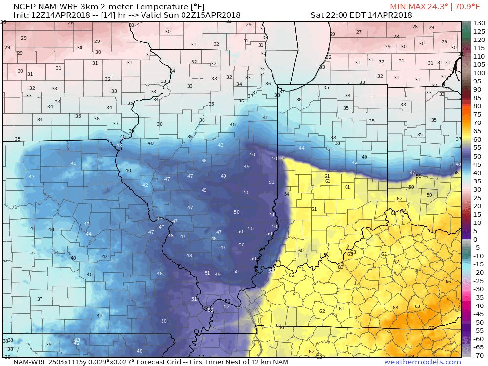
 The other item of interest tonight will be the tight temperature gradient across the state. Don’t be surprised by perhaps as much of a 30° spread from north to central parts of the state this evening as the “backdoor” cold front begins to drop south. You’ll certainly notice once the front passes.
 Eventually, cold will overwhelm and the second half of the weekend will wrap up on a downright “raw” note. As precipitation wraps around the area of low pressure Sunday night and Monday, it’ll fall as snow here. In fact, snowfall intensity is likely to be great enough to put down a coating in spots Monday morning across central Indiana.
 Drier weather returns Tuesday before a weak weather system deliver gusty winds and a possible shower Wednesday (not a big deal). The majority of the upcoming week will run well below average- highlighted by the coldest day on Monday and reinforcing chill Thursday and Friday.
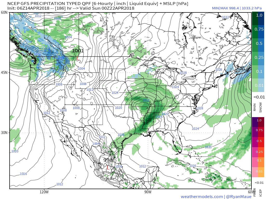
 Our next storm system of significance will be slated for an arrival next weekend. While we’ll have to fine tune timing as we get closer, plan on increasing rain chances as the day progresses next Saturday.
You must be logged in to view this content. Click Here to become a member of IndyWX.com for full access. Already a member of IndyWx.com All-Access? Log-in here.
The weekend will end with more April snow. As we look ahead deeper into next week, a transient, but significant, push of warmth will arrive Thursday and Friday.
You must be logged in to view this content. Click Here to become a member of IndyWX.com for full access. Already a member of IndyWx.com All-Access? Log-in here.
You must be logged in to view this content. Click Here to become a member of IndyWX.com for full access. Already a member of IndyWx.com All-Access? Log-in here.