Highlights:
- Bitter feel
- Weekend storm
- Reinforcing arctic air to open Christmas week
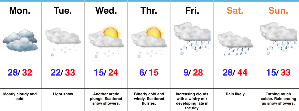
Heavy Winter Gear Required…An arctic cold front slammed into central IN Wednesday evening with plummeting temperatures, strong and gusty (40 MPH) winds, blowing snow, and just a downright “rude” feel. Those bitter conditions will remain through the close of the work week, including dangerous wind chills Thursday. In fact, we still expect wind chills to fall into the 10-20 degree below zero range through the morning, and remain below zero most of the day.
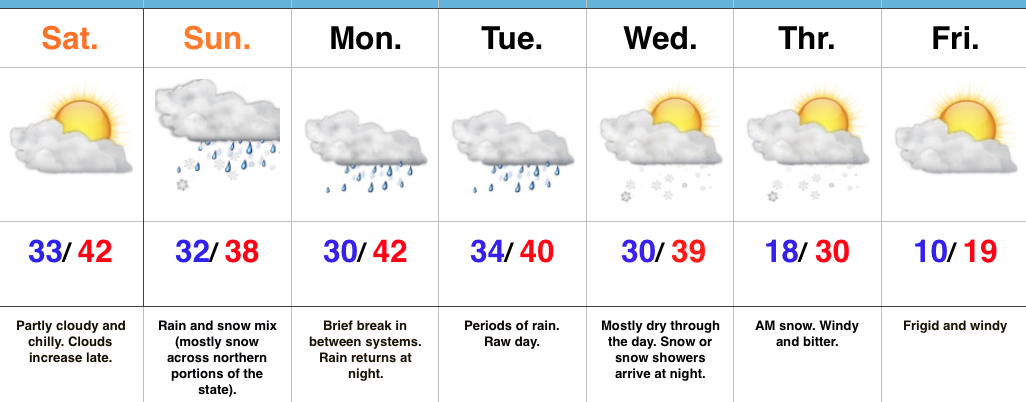
We’ll flip the page and turn our attention to our next storm system as we rumble into the weekend. Clouds will increase Friday and moisture will begin to override the cold air locked in place at the surface by the evening and nighttime. With sub-freezing air still present, this moisture will likely fall as a combination of sleet and freezing rain across central Indiana Friday night. Eventually, temperatures will warm (briefly) above freezing Saturday morning and allow precipitation to transition to light rain. Before that takes place, slick road conditions could develop Friday night from the sleet/ freezing rain mixture. Needless to say, we’ll keep a close eye on the latest data as it comes in.
Almost as fast as we go above freezing Saturday, temperatures will begin to fall once again during the afternoon and evening as heavy, dense, arctic air “oozes” southeast. As this is happening, a second wave of moisture will ride northeast along the pressing arctic cold front. We expect precipitation to break out yet again Saturday evening and night, and fall as a wintry mix before ending as snow. (Additional light ice and snow accumulation potential).
Temperatures will fall through the day Sunday along with strong and gusty NW winds. Wind chills will once again fall below zero Sunday evening into Monday morning…
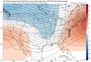
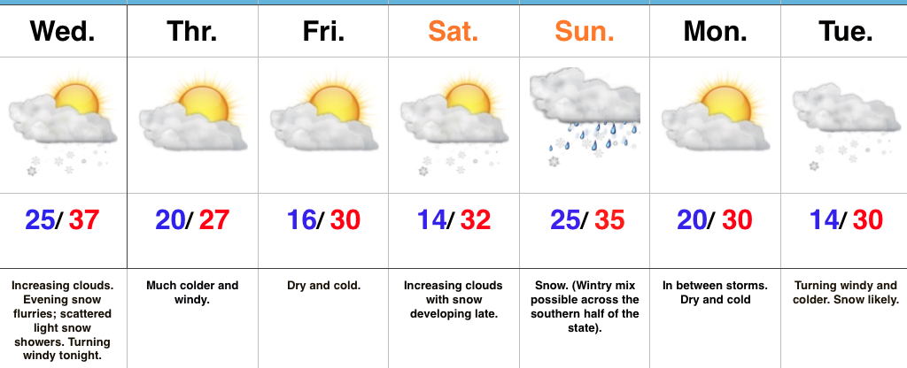
While the frigid conditions will “relax” as we go into the middle of Christmas week, we have an eyebrow raised for the potential of “fun and games” just beyond the current 7-day period. Far too early for specifics, but the potential of wintry prospects around Christmas are alive and kicking…
Upcoming 7-Day Precipitation Forecast:
- Rainfall: 0.25″ – 0.50″
- Snowfall: 1″ – 2″
 2.) Our next storm will approach Friday evening. Clouds will increase and thicken as the day gives way to evening and a wintry mix of snow, sleet, and freezing rain will overspread central IN Friday night. With snow on the ground and the recent bitter blast, we have concerns the cold air won’t be “dislodged” as quickly as last weekend. The end result may be a period of accumulating freezing rain/ sleet Friday night into early Saturday morning. We’ll keep a close eye on things.
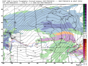 Regardless, icy precipitation will transition to rain during the day Saturday as temperatures briefly surge above freezing. “Brief” is the key word there as temperatures plummet Saturday night, courtesy of fresh arctic air oozing back in. A secondary wave of moisture may result in additional wintry issues Saturday night. Additionally, with sharply colder air returning, “flash freeze” concerns loom Saturday night, as well.
 4.) Our attention then shifts to what may very well be an active Christmas week in the weather department. We continue to think the frigid times of this week will relax. That said, it’ll remain cold enough with a favorable storm track to result in wintry issues as Christmas nears. Far too early for specifics with this 10+ days out, but keep it in the back of your mind that the weather pattern continues to look active and at least present a threat of wintry precipitation at times Christmas week.