Merry Christmas! The Weather Pattern Takes On A More Active Look To Close The Year…
You must be logged in to view this content. Click Here to become a member of IndyWX.com for full access. Already a member of IndyWx.com All-Access? Log-in here.
You must be logged in to view this content. Click Here to become a member of IndyWX.com for full access. Already a member of IndyWx.com All-Access? Log-in here.
Our weekend will wrap up on a pleasant note. Though clouds will be on the increase, temperatures will rise to much warmer than normal levels by early-December standards. Highs today will top out in the lower to middle 50s with increasing cloudiness.

Those clouds will eventually give way to rain during the overnight hours. A few sprinkles are possible this evening, but it’s not until midnight and into the predawn hours that the more concentrated rain will arrive.
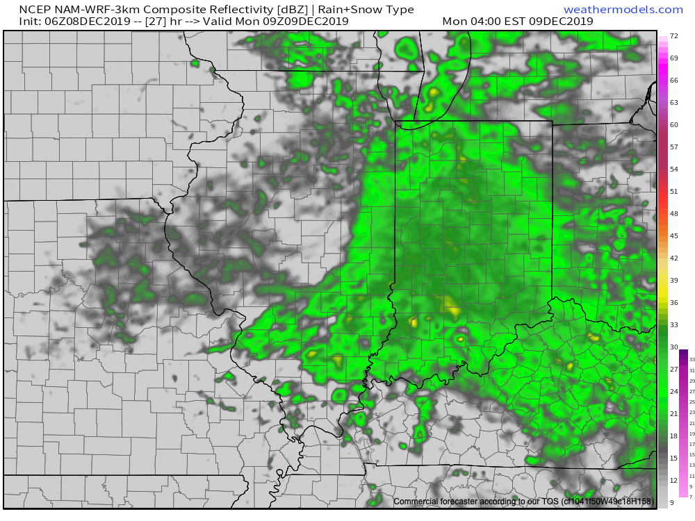
Most of central Indiana can expect rainfall totals between 0.50″ and 1.00″ Monday. The steady rain Monday morning will taper to showers during the afternoon hours.
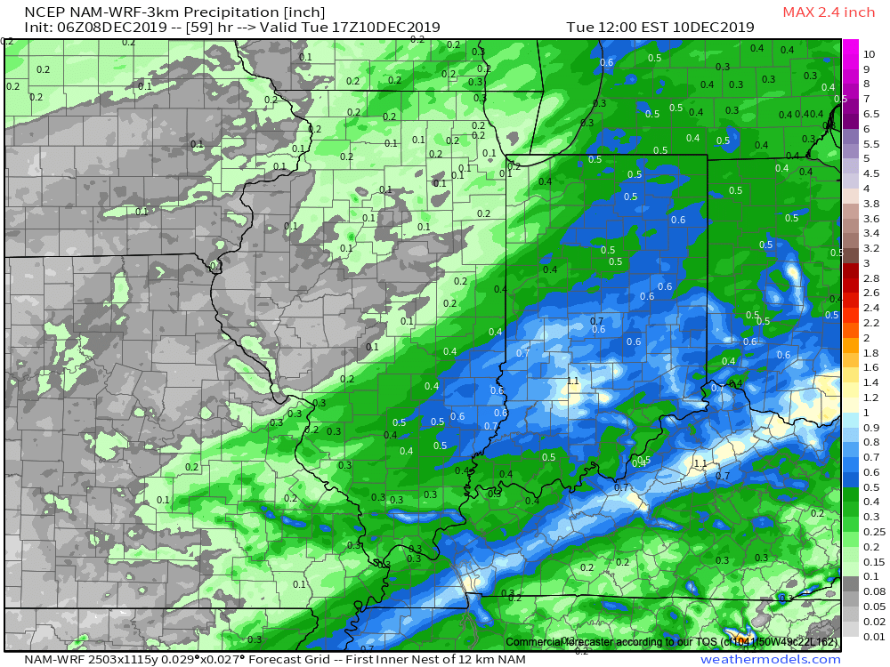
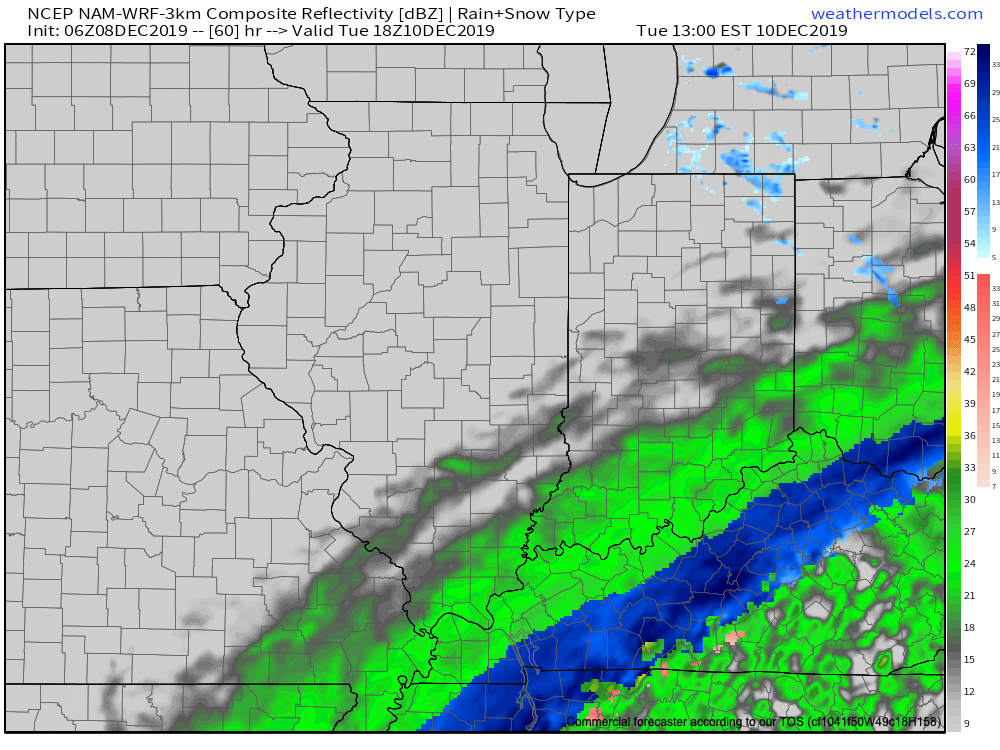
Colder air will pour into the state Monday night and gusty northwest winds. This cold air mass will eventually “catch up” with the moisture to our southeast and lead to a flip to snow for places from central and eastern KY into the Appalachians Tuesday. Meanwhile, lake effect snow showers will develop across northeast Indiana. For the most part, despite some light snow showers Tuesday morning, central Indiana shouldn’t expect anything “exciting” in the winter weather department.
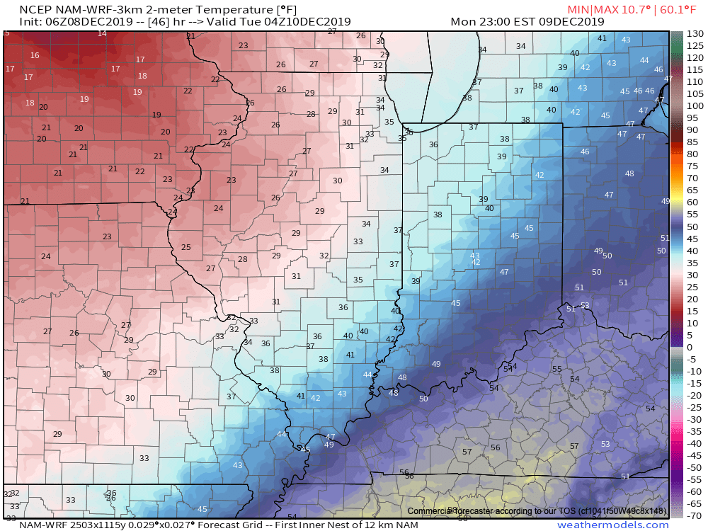
High pressure will settle overhead through the midweek stretch with sunshine returning along with seasonably cold conditions.
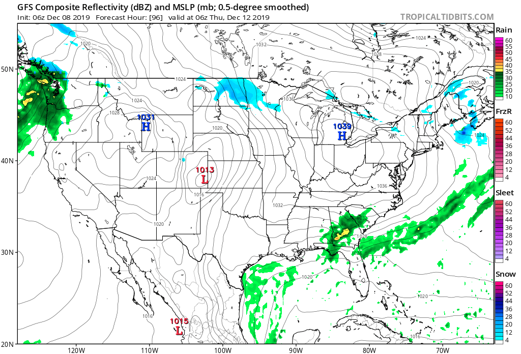
Thereafter, a developing storm system in the Gulf of Mexico will lead to an active close to the week. Low pressure will form in the central Gulf Friday afternoon before tracking up along the Appalachian chain into the weekend. With a lack of cold air and retreating high (orientation of the cold air supply/ high pressure system is critical this time of year), this should be another mostly wet and not white weather maker.
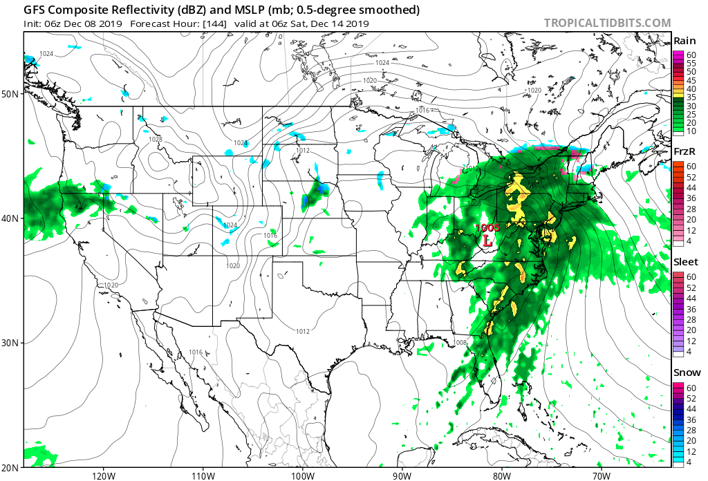
Cold air will eventually wrap into the system from the west late in the weekend and could lead to precipitation ending as wet snow, but this idea is far from being “etched in stone.”

Video update will come a bit later with fresh 12z thoughts, along with a look-ahead to Christmas. Make it a great Sunday, friends!
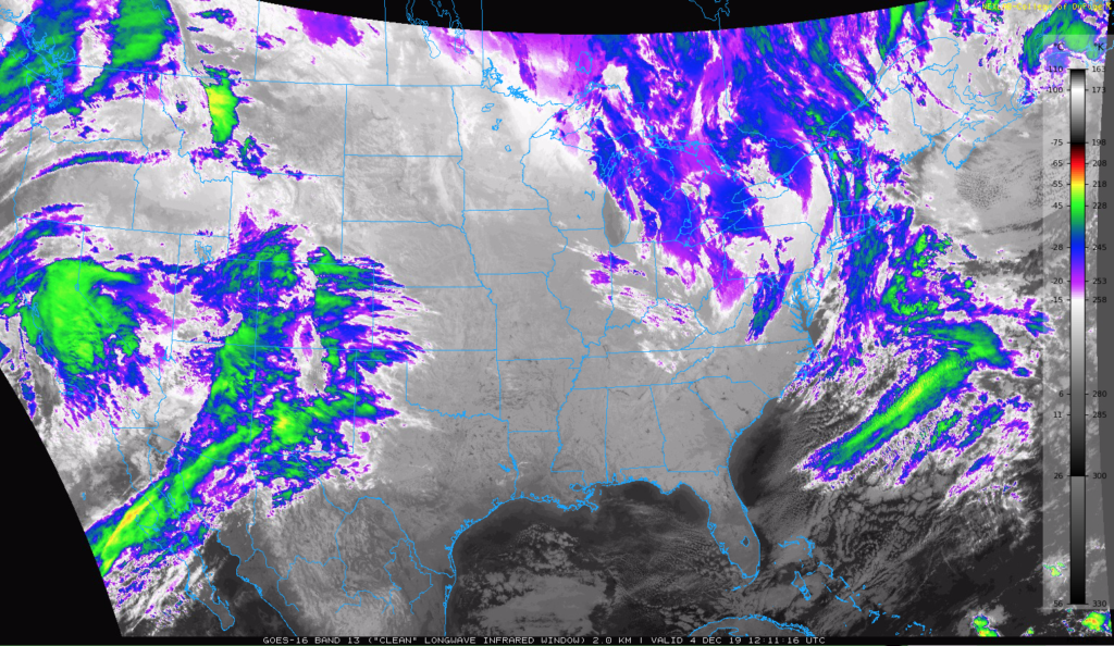
After a gloomy stretch of weather, the sunshine will make a return appearance today.
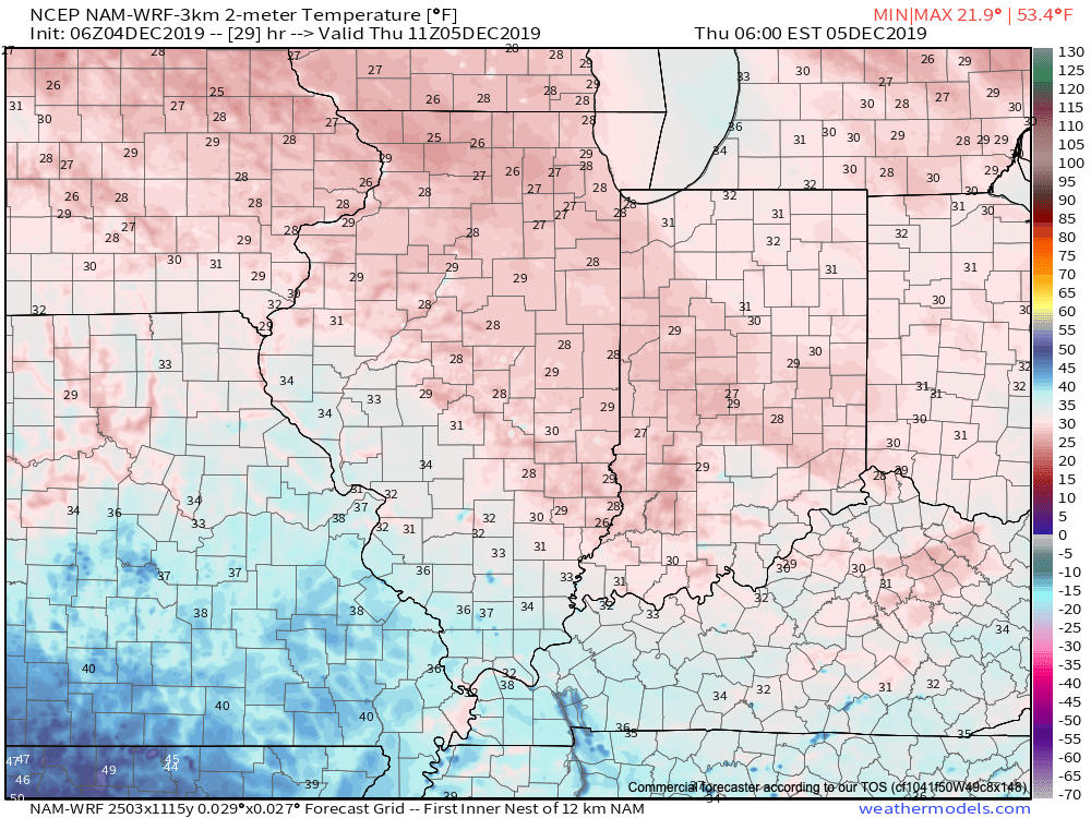
While some patchy freezing fog is possible tonight (lows will fall into the upper 20s to around 30°), this shouldn’t be a widespread problem into Thursday morning.
Our quiet stretch of weather will continue into the weekend. A fast moving system will scoot off to our south Thursday evening into Friday while reinforcing chilly air blows by to our northeast. We’ll be in between both systems and the end result will be a continued stretch of dry weather along with moderating temperatures into the weekend.

As high pressure nudges southeast into Saturday, this will be the better of the 2 weekend days, including the most sunshine. Highs will top out in the lower to middle 40s.
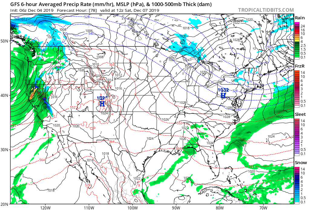
With a return southwesterly air flow developing Sunday, temperatures will be even milder (highs in the low to mid 50s), but clouds will increase and drizzle/ light rain will follow by evening.
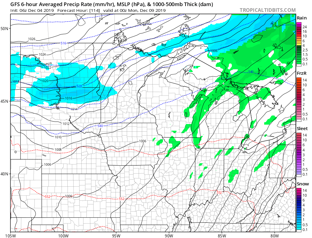
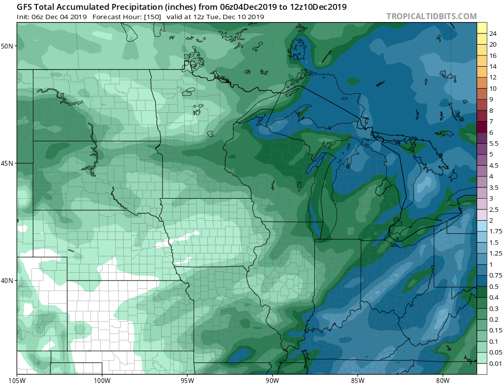
Light showers will continue into Monday morning, but this won’t be a significant event. Rainfall totals should be heaviest across the eastern sections of the Ohio Valley (amounts greater than 0.50″) with lighter totals for immediate central Indiana of generally less than one half inch.
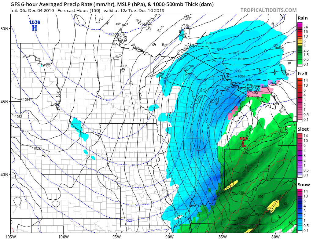
That’s when things get a little more interesting. A secondary area of low pressure will move across the Ohio Valley Tuesday. As this takes place, colder air will be pouring into the state on gusty northwest winds. The “backside” precipitation will likely transition to light snow Tuesday before ending. While early indications don’t suggest this will be a significant event, we’ll keep an eye on it. The bigger story will be the transient shot of arctic air. Temperatures will fall into the 10s Tuesday with those gusty winds.
With unfavorable teleconnections and the MJO rumbling into Phase 3, this cold shot won’t hold and a milder pattern will likely return by the second half of next week. That’s when we’ll be track our next wet weather maker…
Make it a great Wednesday! We’ll have our next video update posted later this evening!
You must be logged in to view this content. Click Here to become a member of IndyWX.com for full access. Already a member of IndyWx.com All-Access? Log-in here.
You must be logged in to view this content. Click Here to become a member of IndyWX.com for full access. Already a member of IndyWx.com All-Access? Log-in here.