Tuesday Evening Check-Up On Wednesday’s Snow Event…
During a month that’s running 2.5° above normal, many across central Indiana will be sitting at “average” snowfall once to Thursday morning (with the potential of some “bonus” snow for some Friday). Not too shabby, heh?! Let’s dig into some of the latest data. In short, our going forecast remains in good shape and now it’s time to watch the event unfold.
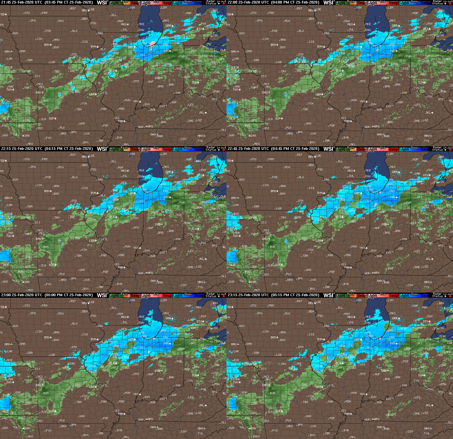
As we type this around 6:30p Tuesday evening, snow is increasing in intensity across northern Indiana and precipitation will continue to become more organized across IL throughout the evening. The bulk of central Indiana is only dealing with drizzle and light rain this evening. It’s a damp, chilly night, but there’s no threat to travel if you’re heading out to dinner or other events with the family.
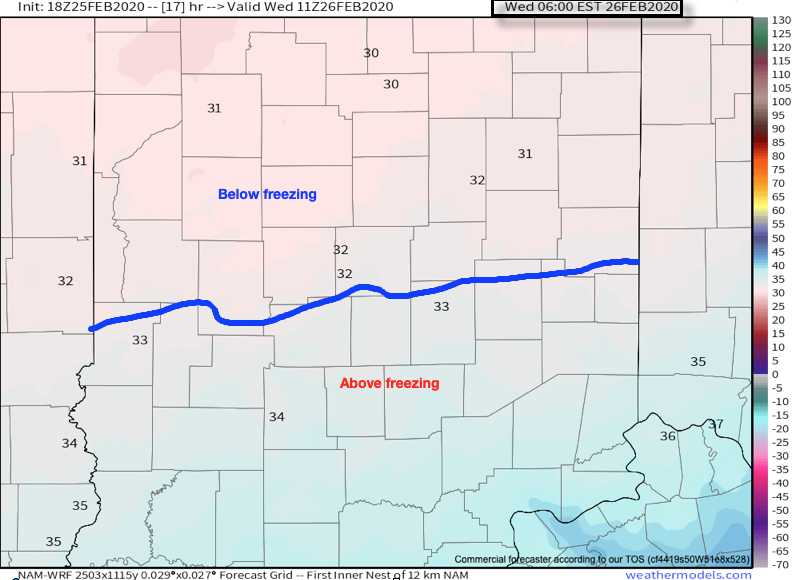
Colder air will continue to “ooze” into central Indiana throughout the night and as this takes place, a surface wave will develop south of the Ohio River. By 6a, the freezing line is expected to be just south of Indianapolis.
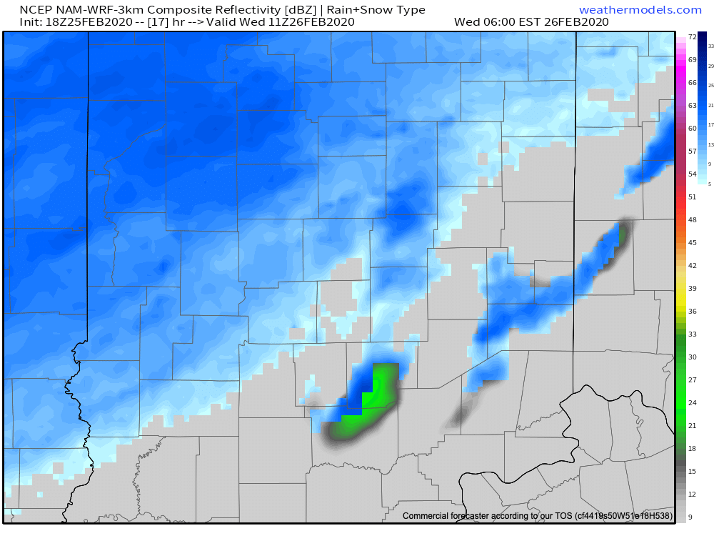
Light to moderate snow is expected to begin overspreading central Indiana in earnest around this time frame (earlier further north).
Snow will increase in overall intensity late morning into the afternoon hours (this is when we anticipate the greatest snowfall rates).
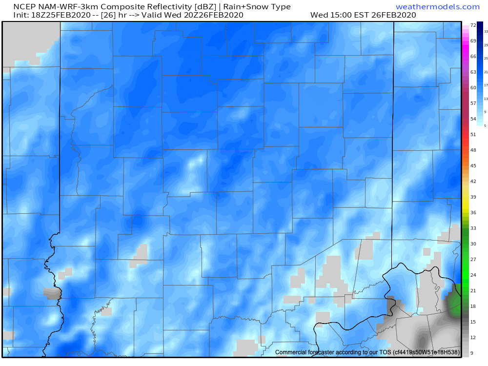
“System” snow will begin to diminish across central Indiana between 5p (west) and 7p (east), but we’ll have to monitor whether or not lake effect snow bands can make it as far south as portions of central Indiana tomorrow night as the wind flow backs around to the northwest and much colder air drives south.

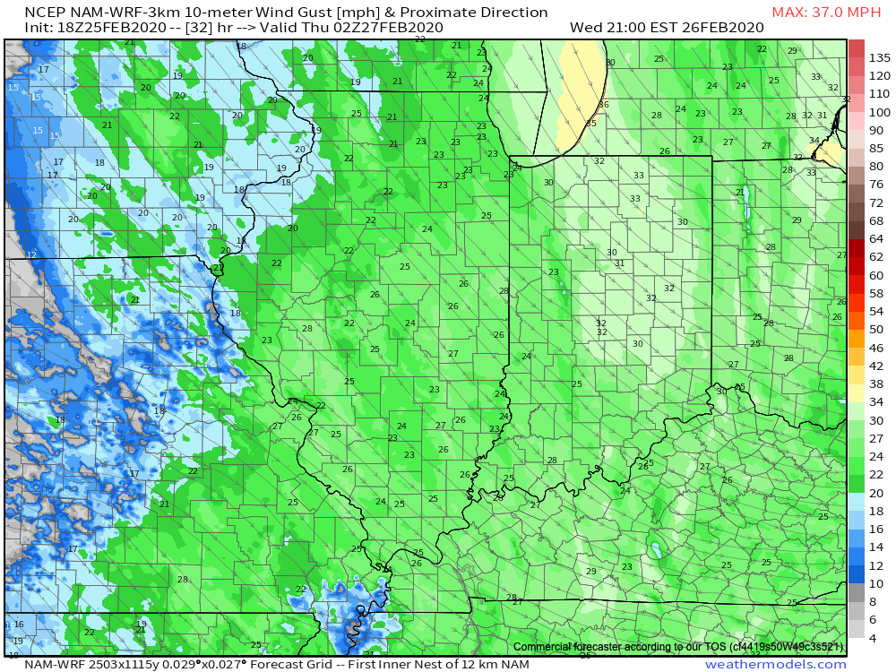
Speaking of wind, we still anticipate northwest winds to increase to 30 MPH+ Wednesday evening across the area. This will lead to considerable blowing and drifting tomorrow night of what should become an increasingly dry/ powdery snow towards the 2nd half of the event.
Things should quieten down through the day Thursday, but cold air (well below normal) will rule into the 1st half of the weekend. We continue to believe the coldest morning of the bunch will come Saturday with widespread middle 10s. Before that, and as mentioned above, we’ll have to monitor some additional snow prospects for some Friday (more on that in the AM :-))!
Until then, enjoy our midweek snow. Our ongoing snowfall forecast first issued last night remains in place.