You must be logged in to view this content. Click Here to become a member of IndyWX.com for full access. Already a member of IndyWx.com All-Access? Log-in here.
Category: Windy
Permanent link to this article: https://indywx.com/bitter-cold-today-gives-way-to-rain-tuesday-evening-wintry-close-to-the-week/
Jan 20
Thank You And Looking Ahead To Another Busy Week Of Winter Weather…
You must be logged in to view this content. Click Here to become a member of IndyWX.com for full access. Already a member of IndyWx.com All-Access? Log-in here.
Permanent link to this article: https://indywx.com/thank-you-and-looking-ahead-to-another-busy-week-of-winter-weather/
Jan 19
VIDEO: Saturday Night Winter Storm Update…
You must be logged in to view this content. Click Here to become a member of IndyWX.com for full access. Already a member of IndyWx.com All-Access? Log-in here.
Permanent link to this article: https://indywx.com/video-saturday-night-winter-storm-update/
Jan 19
Blizzard-Like Conditions Develop This Afternoon Into Tonight…
While warm air advection (WAA) created an added challenge this morning (freezing rain north of the city, itself, and rain south of I-70), colder air is working south late this morning and will result in a changeover from freezing rain/ rain to snow over the next couple hours from north to south.
We expect the transition to snow to take place in and around Indianapolis between 1p and 2p.
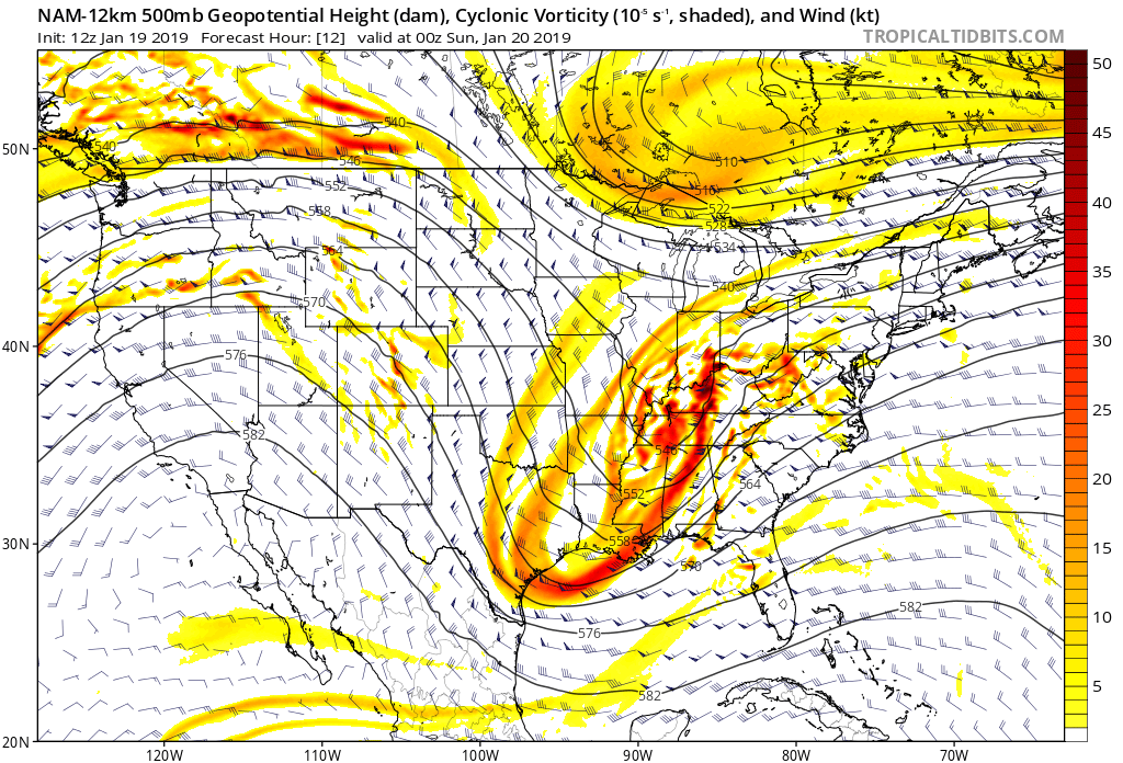
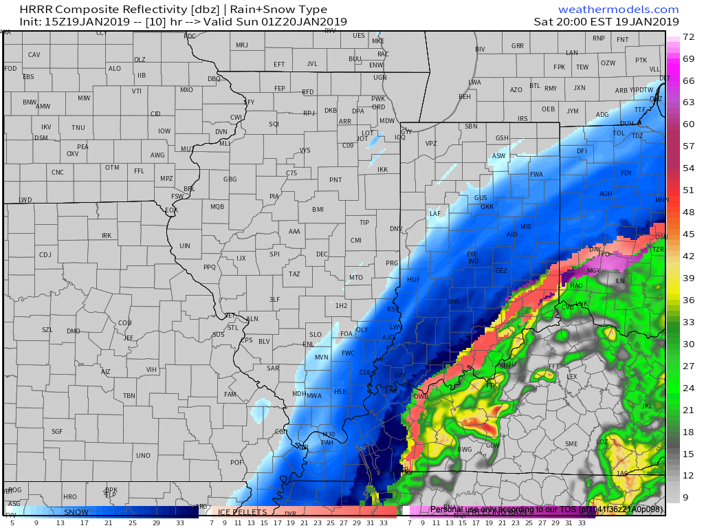
 As upper level energy tracks northeast this evening, strong frontogenesis will help a “deformation band” expand in coverage and intensify across the state. This will lead to elevated snowfall intensity as the afternoon gives way to evening. In fact, snowfall rates will likely approach 1″/ hour across central and eastern portions of the state at times during the mid-to-late afternoon and into the evening hours.


8p forecast radar.
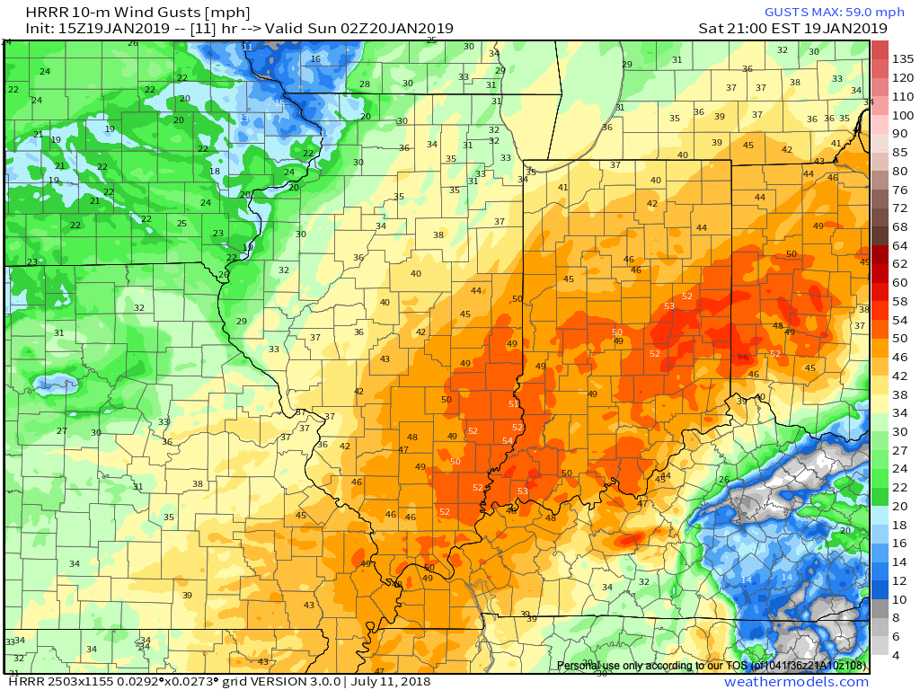
As this is taking shape, winds will also begin to crank this afternoon and evening. Gusts in excess of 50 MPH are expected across central and eastern regions- including Indianapolis.
 Obviously this will create concerns for power outages, but the other major worry is for developing blizzard-like conditions and whiteouts through the late afternoon into tonight.
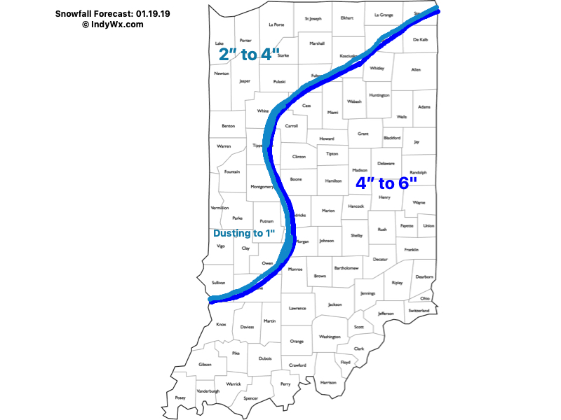
As for snowfall totals, the consensus of latest 12z data continues to support our updated snowfall forecast from this morning.
 We’ll have additional updates later this afternoon here on IndyWx.com and on our social media accounts.
To close, we highly encourage not traveling this afternoon. Conditions are expected to rapidly deteriorate as we move through the next several hours. For many across central and east-central Indiana, roads will likely become impassable by evening with the combination of severe wind gusts and increasing snowfall rates. Major problems from blowing and drifting snow are expected.
More here in a bit! Stay safe!
Permanent link to this article: https://indywx.com/blizzard-like-conditions-develop-this-afternoon-into-tonight/
Jan 19
Winter Storm Update: Significant Impacts Still Expected Later Today…
While the “1st half” of the storm certainly has been a challenge, we still anticipate a high impact situation to develop this afternoon into tonight across the region.
Our updated snowfall forecast:

Saturday morning video update breaking down the details:
Permanent link to this article: https://indywx.com/winter-storm-update-significant-impacts-still-expected-later-today/
