Cool Late Week Stretch…

Thr.

Fri.

Sat.

Sun.

Mon.

Tue.

Wed.

 Status-weather-showers-day-icon

 Status-weather-showers-day-icon

 Status-weather-showers-day-icon

 Status-weather-showers-day-icon

 Status-weather-showers-day-icon

 Status-weather-showers-day-icon

 Status-weather-clouds-icon

42/ 52

41/ 53

43/ 67

49/ 63

45/ 71

56/ 73

58/ 81 

Light

Light

Light

Light

Light

Light

– – –

The region will remain under the influence of a chilly and, at times, damp upper low as we wrap up the work week.  While we’ll keep mention of an isolated to scattered shower into the weekend, most of the weekend will remain rain-free. A warm front will lift north through the region early next week, helping temperatures reach the warmest of the season so far.  We think the years first 80 degree reading will be registered by the middle part of the week.  A new storm system promises another round of active weather beyond the forecast period.

– We’re experiencing technical issues with our video recorder software.  We’ve cut two videos for today’s forecast, but neither will publish correctly.  We’ll continue to work on this and try to post a video briefing later this evening.


Monday Night Severe Weather Update.

Good evening and welcome in to IndyWx.com!

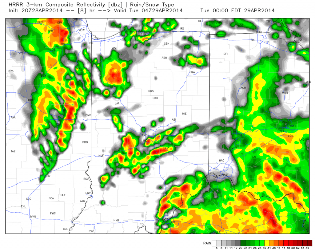
We continue to closely monitor radar and satellite trends tonight and keep a close eye on severe developments to our west.  As the video discusses, the clouds and rain from earlier today have helped in a big way from at least limiting what today “could have been” from a severe perspective.

That’s not saying we’re signaling the all-clear by any stretch of the imagination, it’s just saying that the clouds and rain from earlier have helped to keep us from really destabilizing the local atmosphere and the clearing we’re seeing now may be too little too late in regards to widespread severe weather here.

All of that said, keep a close eye on local radar tonight and remain weather aware.  The dynamics at play could result in a thunderstorm turning severe rather rapidly tonight and we’ll continue to closely monitor.

Strong to potentially severe thunderstorms will impact central Indiana during the overnight period:
hrrr_ref_indy_9

The video below has more details: