Beauty Of A Race Weekend Underway; Warmth And Humidity Builds Memorial Day And Beyond.

Here’s a video update discussing the next few days and looking at increasing warmth and humidity (and storm chances) as we move into the short work week ahead.

You must be logged in to view this content. Click Here to become a member of IndyWX.com for full access.  Already a member of IndyWx.com All-Access?  Log-in here.

Severe Weather Video Brief Tonight-Wednesday

The region remains under fire for severe weather potential, primarily for damaging straight line wind and hail per latest thinking.  The video uncovers when you can expect this and looks ahead to the all-important Memorial Day and Indianapolis 500 weekend!

The region is under fire for severe potential Wednesday.

Thursday Evening Update; Repeat In The Pattern Coming To End May?

Many central Indiana neighborhoods are still in the 40s as of this update.  Officially, the high so far today at IND has reached 50 and is more than 20 degrees below where we should be for this date.

The upper low continues to swirl over Iowa this afternoon and will help push a band of showers into central Indiana during the wee morning hours Friday.  Additionally, the threat is there that a couple of the stronger showers Friday afternoon include some small hail with added instability and the very cold air aloft.

20140515_2045_sm_EVV_vis


As we look ahead to the second half of May, don’t be surprised by a repeat performance in this weather pattern.  We think brief ridging will be responsible for highs above the 80 degree mark the middle of next week, but the stage may be set for another stretch of unseasonably cool air to wrap up the month…. Additional details can be found in the video!

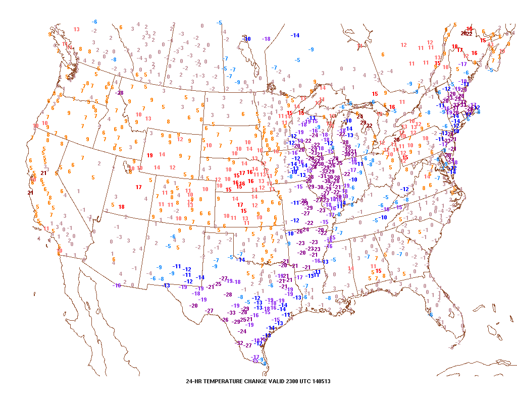
Tuesday Evening Video Brief; The Cool Down Is On!

Note how dramatic of a temperature shift is occurring to our west- temperatures are down more than 30 degrees from this same time last night.

t0

That cool air will filter into our region tonight and Wednesday.  As a matter of fact, we still think Thursday has the potential to remain in the 40s for the better part of the day.  The video below has more details on this and a look ahead to continued rainy times.

Monday Evening Video Update

It’s a warm and muggy evening across central Indiana and showers and thunderstorms are in your forecast.  More on this and the long advertised BIG cool down looming inside the…

You must be logged in to view this content. Click Here to become a member of IndyWX.com for full access.  Already a member of IndyWx.com All-Access?  Log-in here.