Wednesday Evening Update; No Reason To Think Any Sort Of Sustained Heat Is In Our Future.

Good evening. The video covers some of the short and mid range details as we move forward.  Dry and cool air will give way to a more humid regime over the weekend.  An active and biased cooler than normal pattern remains in the mid to long range, per the GFS (and European, as well) ensembles below.
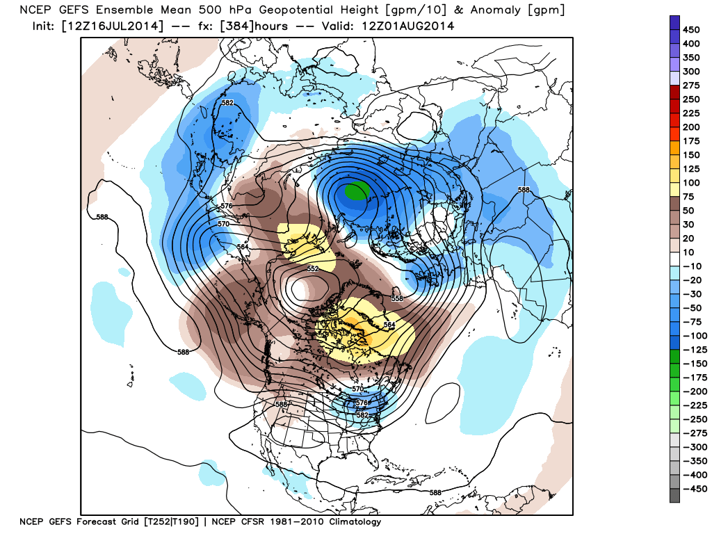
gefs_z500anom_nh_65

Monday Evening Video Update!

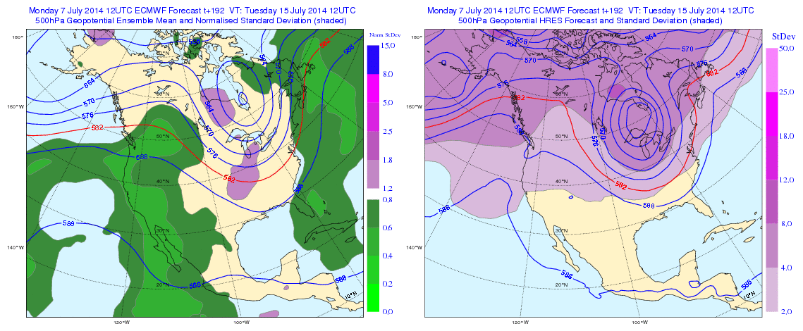
This evening’s video covers a potential round of thunderstorms Tuesday morning and takes a deeper look at the mid range.  Yet ANOTHER unseasonably cool blast of air awaits on deck for mid-month and will provide a hint of early fall, per the EC ensemble run below for next week.  This is just one piece of data amongst several pieces pointing towards a big mid-month cool down.  Much more in the video update below!

Geopotential32at32500hPa_North32America_192


Two Rounds Of Storms Ahead.

Good evening friends!  I hope this finds you having a nice Wednesday.  Our video update this evening looks at a couple rounds of strong, to potentially severe, thunderstorms ahead.

You must be logged in to view this content. Click Here to become a member of IndyWX.com for full access.  Already a member of IndyWx.com All-Access?  Log-in here.