Category: Weather Videos
I-70 and points south will be the focal point today for shower and thunderstorm development. The video covers this and takes a look at that all-important weekend! Make it a great Thursday!
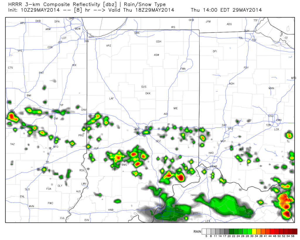
T-storms will ignite this afternoon, primarily south of the I-70 corridor.
Permanent link to this article: https://indywx.com/thursday-morning-video-update/
-
Filed under 7-Day Outlook, Canadian Model, Forecast, Forecast Discussion, Forecast Models, GFS, Heavy Rain, Long Range Discussion, Rain, Summer, T-storms, Unseasonably Warm, Weather Rambles, Weather Videos
-
May 27, 2014
The upcoming 7-10 days looks unsettled overall and quite wet. That said, we’re set to enjoy another beautiful weekend with a refreshing northeast breeze in play. We discuss this and look deeper into the month of June in this evening’s video update below!
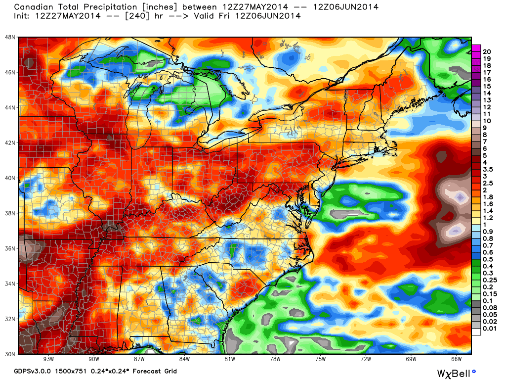
Latest model data suggests widespread 2-3″ of rain could fall across central Indiana over the course of the upcoming 7-10 days.
Permanent link to this article: https://indywx.com/another-nice-weekend-in-the-middle-of-an-unsettled-pattern/
Here’s a video update discussing the next few days and looking at increasing warmth and humidity (and storm chances) as we move into the short work week ahead.
You must be logged in to view this content. Click Here to become a member of IndyWX.com for full access. Already a member of IndyWx.com All-Access? Log-in here.
Permanent link to this article: https://indywx.com/beauty-of-a-race-weekend-underway-warmth-and-humidity-builds-memorial-day-and-beyond/
-
Filed under 7-Day Outlook, Forecast Discussion, Forecast Models, Hail, NAM Model, Race Weekend, Rain, Severe Weather, T-storms, Unseasonably Warm, Weather Videos, Windy
-
May 20, 2014
The region remains under fire for severe weather potential, primarily for damaging straight line wind and hail per latest thinking. The video uncovers when you can expect this and looks ahead to the all-important Memorial Day and Indianapolis 500 weekend!

The region is under fire for severe potential Wednesday.
Permanent link to this article: https://indywx.com/severe-weather-video-brief-tonight-wednesday/
Many central Indiana neighborhoods are still in the 40s as of this update. Officially, the high so far today at IND has reached 50 and is more than 20 degrees below where we should be for this date.
The upper low continues to swirl over Iowa this afternoon and will help push a band of showers into central Indiana during the wee morning hours Friday. Additionally, the threat is there that a couple of the stronger showers Friday afternoon include some small hail with added instability and the very cold air aloft.

As we look ahead to the second half of May, don’t be surprised by a repeat performance in this weather pattern. We think brief ridging will be responsible for highs above the 80 degree mark the middle of next week, but the stage may be set for another stretch of unseasonably cool air to wrap up the month…. Additional details can be found in the video!
Permanent link to this article: https://indywx.com/thursday-evening-update-repeat-in-the-pattern-coming-to-end-may/

