Category: Weather Videos
|
Thr.
|
Fri.
|
Sat.
|
Sun.
|
Mon.
|
Tue.
|
Wed.
|
|

|

|

|

|

|

|

|
|
42/ 52
|
41/ 53
|
43/ 67
|
49/ 63
|
45/ 71
|
56/ 73
|
58/ 81
|
|
Light
|
Light
|
Light
|
Light
|
Light
|
Light
|
– – –
|
The region will remain under the influence of a chilly and, at times, damp upper low as we wrap up the work week. While we’ll keep mention of an isolated to scattered shower into the weekend, most of the weekend will remain rain-free. A warm front will lift north through the region early next week, helping temperatures reach the warmest of the season so far. We think the years first 80 degree reading will be registered by the middle part of the week. A new storm system promises another round of active weather beyond the forecast period.
– We’re experiencing technical issues with our video recorder software. We’ve cut two videos for today’s forecast, but neither will publish correctly. We’ll continue to work on this and try to post a video briefing later this evening.
Permanent link to this article: https://indywx.com/2014/04/30/cool-late-week-stretch-more-on-the-longer-term/
Quick evening update to discuss the overnight period and look at the cooler pattern moving in for late week.
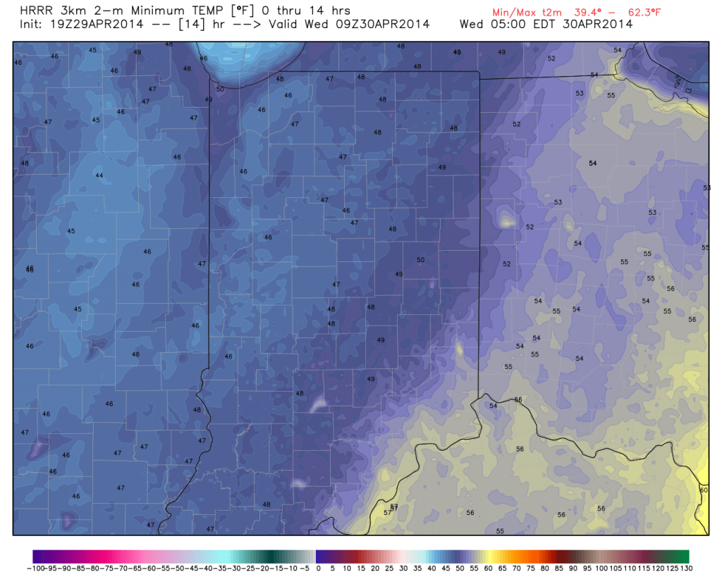
Showers will diminish during the overnight and gusty northwest winds will deliver a cooler air mass that will hang on as we put a wrap on the work week:

The video below has more details! Have a great evening!
Permanent link to this article: https://indywx.com/2014/04/29/tuesday-evening-update/
Good evening and welcome in to IndyWx.com!
We continue to closely monitor radar and satellite trends tonight and keep a close eye on severe developments to our west. As the video discusses, the clouds and rain from earlier today have helped in a big way from at least limiting what today “could have been” from a severe perspective.
That’s not saying we’re signaling the all-clear by any stretch of the imagination, it’s just saying that the clouds and rain from earlier have helped to keep us from really destabilizing the local atmosphere and the clearing we’re seeing now may be too little too late in regards to widespread severe weather here.
All of that said, keep a close eye on local radar tonight and remain weather aware. The dynamics at play could result in a thunderstorm turning severe rather rapidly tonight and we’ll continue to closely monitor.
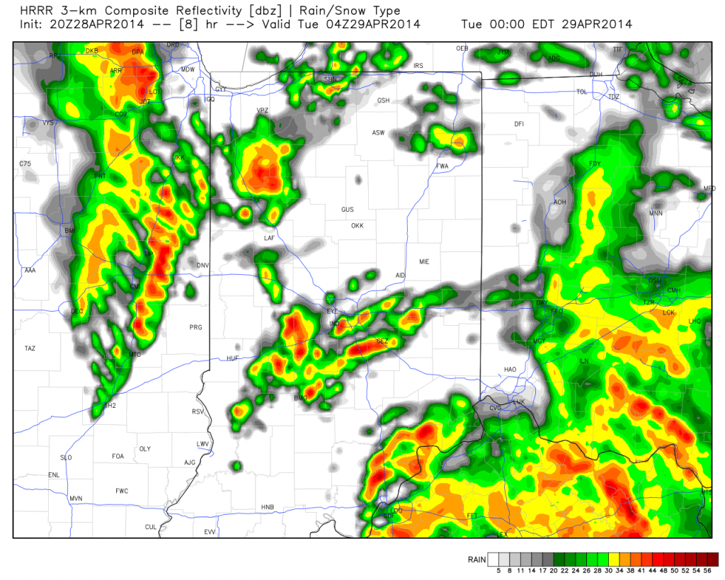
Strong to potentially severe thunderstorms will impact central Indiana during the overnight period:

The video below has more details:
Permanent link to this article: https://indywx.com/2014/04/28/monday-night-severe-weather-update/
Good morning and happy Saturday! A beautiful day is underway and we’ll keep mostly sunny skies and warm temperatures for the better part of the day. Clouds increase tonight and…
You must be logged in to view this content. Click Here to become a member of IndyWX.com for full access. Already a member of IndyWx.com All-Access? Log-in here.
Permanent link to this article: https://indywx.com/2014/04/26/saturday-morning-video-update/
-
Filed under 7-Day Outlook, Forecast Models, Heavy Rain, Rain, Severe Weather, T-storms, Unseasonably Cool Weather, Unseasonably Warm, Weather Videos, Windy
-
April 25, 2014
|
Fri.
|
Sat.
|
Sun.
|
Mon.
|
Tue.
|
Wed.
|
Thr.
|
|

|

|

|

|

|

|

|
|
52/ 65
|
48/ 72
|
46/ 70
|
52/ 70
|
60/ 76
|
50/ 60
|
43/ 58
|
|
Light
|
– – –
|
– – –
|
Moderate
|
Severe
|
Light
|
Light
|
Video discussing today’s custom built IndyWx.com Forecast issued at 7:44am:
Permanent link to this article: https://indywx.com/2014/04/25/clearing-and-windy-after-morning-rain/
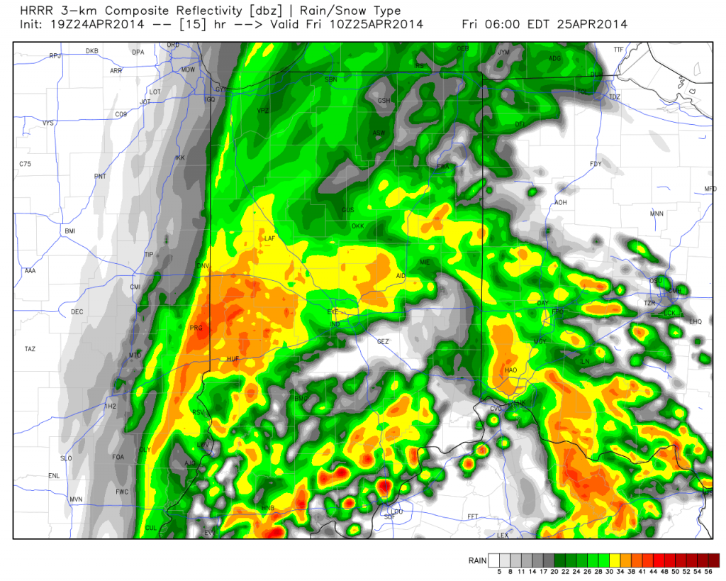
Showers and embedded thunderstorms will roll into the state late tonight through Friday morning. Here’s a look at what the radar may look like as you’re getting ready to leave the house in the morning! The video below has more details…

Permanent link to this article: https://indywx.com/2014/04/24/thursday-evening-weather-update-storms-roll-in-tonight/
This morning’s video discusses rain and storm chances late tonight and again late Thursday night. We also talk about a big storm brewing for later this weekend into next week.…
You must be logged in to view this content. Click Here to become a member of IndyWX.com for full access. Already a member of IndyWx.com All-Access? Log-in here.
Permanent link to this article: https://indywx.com/2014/04/23/wednesday-video-update/
-
Filed under Arctic Cold, Canadian Model, Forecast, Forecast Discussion, GFS, Rain, snow, T-storms, Unseasonably Cool Weather, Unseasonably Warm, Weather Videos, Windy
-
April 13, 2014
Today will be a beauty of a day- partly to mostly cloudy, windy, and warm. We’re forecasting an official IND high of 76. Clouds thicken this evening and showers and…
You must be logged in to view this content. Click Here to become a member of IndyWX.com for full access. Already a member of IndyWx.com All-Access? Log-in here.
Permanent link to this article: https://indywx.com/2014/04/13/from-76-today-to-snow-monday-night/
What a pleasant evening underway! Get out there and enjoy it! More details about what lies ahead can be found in the video below…
You must be logged in to view this content. Click Here to become a member of IndyWX.com for full access. Already a member of IndyWx.com All-Access? Log-in here.
Permanent link to this article: https://indywx.com/2014/04/11/friday-evening-weather-update/
You must be logged in to view this content. Click Here to become a member of IndyWX.com for full access. Already a member of IndyWx.com All-Access? Log-in here.
Permanent link to this article: https://indywx.com/2014/04/09/wednesday-evening-video-update/

