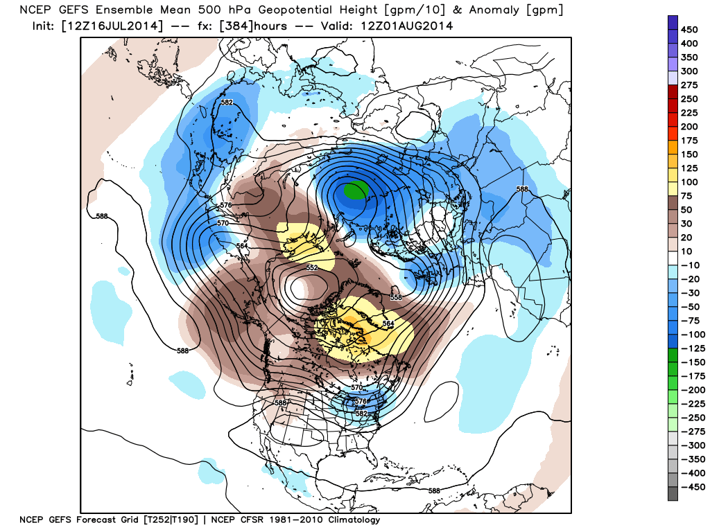
Good evening. The video covers some of the short and mid range details as we move forward. Dry and cool air will give way to a more humid regime over the weekend. An active and biased cooler than normal pattern remains in the mid to long range, per the GFS (and European, as well) ensembles below.
Category: Weather Videos
Permanent link to this article: https://indywx.com/2014/07/16/wednesday-evening-update-no-reason-to-think-any-sort-of-sustained-heat-is-in-our-future/
Jul 07
Monday Evening Video Update!
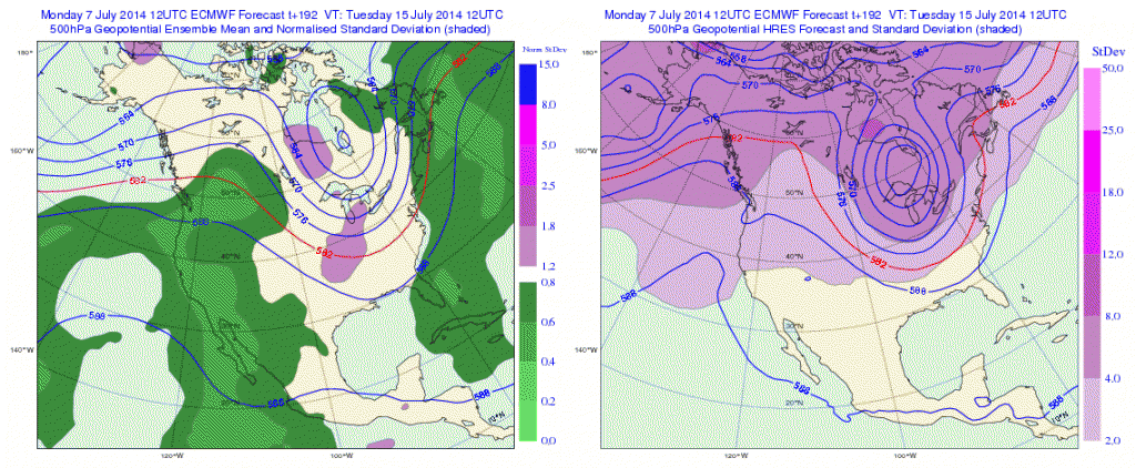
This evening’s video covers a potential round of thunderstorms Tuesday morning and takes a deeper look at the mid range. Yet ANOTHER unseasonably cool blast of air awaits on deck for mid-month and will provide a hint of early fall, per the EC ensemble run below for next week. This is just one piece of data amongst several pieces pointing towards a big mid-month cool down. Much more in the video update below!
Permanent link to this article: https://indywx.com/2014/07/07/monday-evening-video-update-2/
Jul 02
Wednesday Evening Video Update: Cooler Air Moving In!
Cooler air is moving in and with it comes just an absolute delightful stretch of weather across central Indiana! Open up those windows! Also, we discuss Arthur, an active time…
You must be logged in to view this content. Click Here to become a member of IndyWX.com for full access. Already a member of IndyWx.com All-Access? Log-in here.
Permanent link to this article: https://indywx.com/2014/07/02/wednesday-evening-video-update-cooler-air-moving-in/
Permanent link to this article: https://indywx.com/2014/06/19/serious-flood-threat-evolving/
Jun 18
Two Rounds Of Storms Ahead.
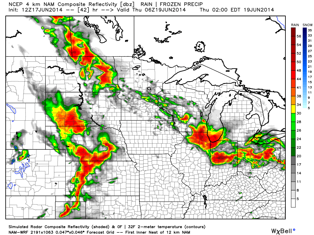
Good evening friends! I hope this finds you having a nice Wednesday. Our video update this evening looks at a couple rounds of strong, to potentially severe, thunderstorms ahead.
You must be logged in to view this content. Click Here to become a member of IndyWX.com for full access. Already a member of IndyWx.com All-Access? Log-in here.
Permanent link to this article: https://indywx.com/2014/06/18/two-rounds-of-storms-ahead/
Permanent link to this article: https://indywx.com/2014/06/17/focusing-on-wednesday-evening-severe-potential/
Jun 16
Monday Evening Video Update; Feeling Very Much Like Summer…
Quick video update tonight discusses some of our thoughts as we progress through the week ahead!
You must be logged in to view this content. Click Here to become a member of IndyWX.com for full access. Already a member of IndyWx.com All-Access? Log-in here.
Permanent link to this article: https://indywx.com/2014/06/16/monday-evening-video-update-feeling-very-much-like-summer/
Jun 13
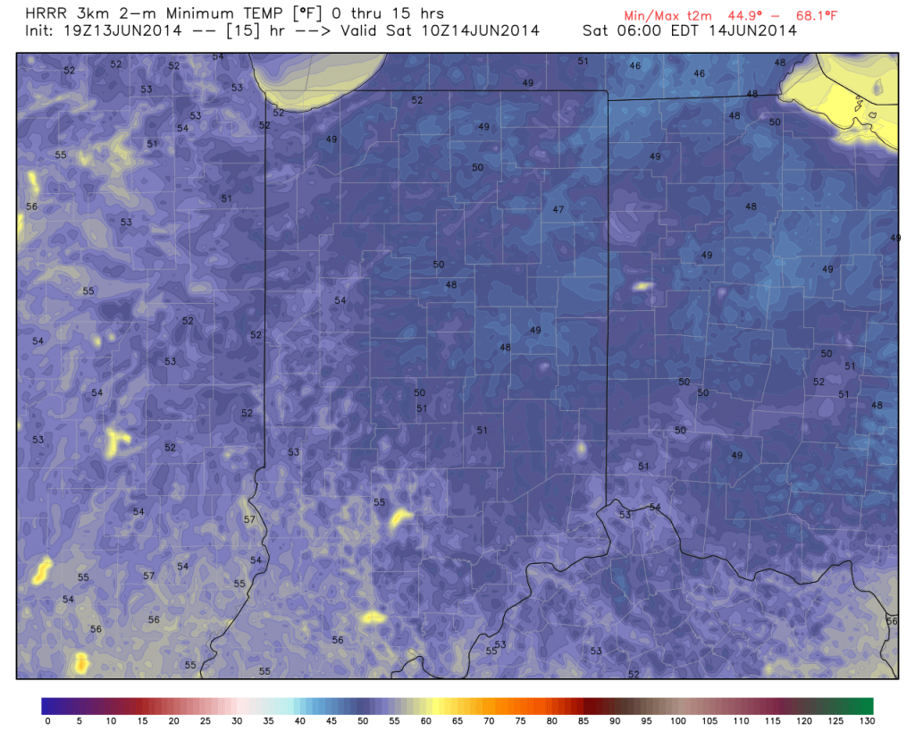
Friday Evening Video Update
Permanent link to this article: https://indywx.com/2014/06/13/friday-evening-video-update-2/
Jun 10
Tuesday Evening Video Update!
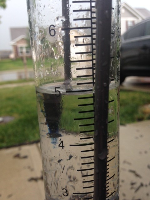
Good evening and thank you for logging onto IndyWx.com! Tonight’s video covers the unsettled time of things tonight into Wednesday morning as low pressure continues to have a hold on our area’s weather. Also, we talk long range weather and give you an idea of what you can expect for the rest of the month of June, temperature-wise! While we didn’t get into the precipitation side of things in tonight’s video for late month, I will say it continues to look very unsettled with above average rainfall anticipated to wrap up the month of June. Anywhere from an additional 3-5″ of rain is possible as we go through the rest of the month here across central Indiana.
Permanent link to this article: https://indywx.com/2014/06/10/tuesday-evening-video-update/
Jun 08
Sunday Morning Video Update!
A beautiful Sunday is underway, including strong north breezes and cooler than normal temperatures. Open the windows and enjoy!
You must be logged in to view this content. Click Here to become a member of IndyWX.com for full access. Already a member of IndyWx.com All-Access? Log-in here.
Permanent link to this article: https://indywx.com/2014/06/08/sunday-morning-video-update/

