VIDEO: Tracking Snow Tonight Followed By A Quick Warm-Up And Storms Next Week…

Updated 02.23.24 @ 7:34a

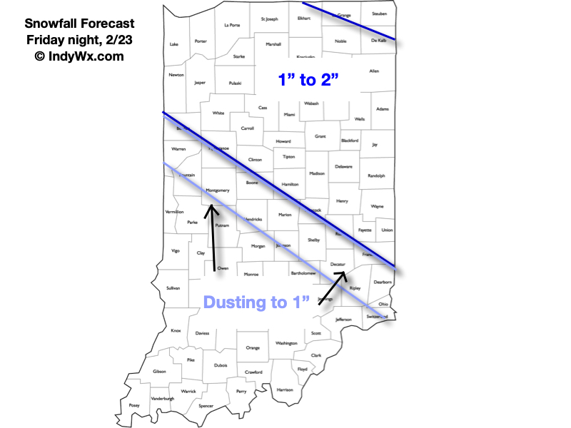
A fast moving clipper system will offer up a round of snow tonight across northern and central IN. Here’s our latest thinking with respect to accumulation numbers. Snow lovers, we recommend getting out to enjoy early Saturday as an increasingly powerful late February sun angle will have many asking “what snow?!” as early as the afternoon.
A quick warm-up is on deck for the 2nd half of the weekend and we’re eyeing the potential of a couple rounds of storms Tuesday. A few of these storms could become severe, with damaging straight line winds the biggest concern from this distance with any of the severe activity that potentially develops.
VIDEO: Stunner Of A Wednesday Gives Way To A Wet, Stormy Thursday; Spring-Like Pattern Early March…

Updated 02.21.24 @ 7:31a A gorgeous day is on tap with sunshine and unseasonably warm temperatures into the middle 60s. Find a way to get out there and enjoy before…

You must be logged in to view this content. Click Here to become a member of IndyWX.com for full access.  Already a member of IndyWx.com All-Access?  Log-in here.

Evening VIDEO: Mild Pattern Comes With Heavy Rain/ Storm Risk In The Days (And Weeks) Ahead…

Updated 02.20.24 @ 6:22p With the exception of a couple cooler (can’t even call it “cold” by late February/ early March standards) days, the pattern over the upcoming couple weeks…

You must be logged in to view this content. Click Here to become a member of IndyWX.com for full access.  Already a member of IndyWx.com All-Access?  Log-in here.

VIDEO: Spring-Like Pattern To Close February And Open March…

Updated 02.19.24 @ 8:37a An upper level ridge will expand across the eastern portion of the country as we close February and open March. The result will be an increasingly…

You must be logged in to view this content. Click Here to become a member of IndyWX.com for full access.  Already a member of IndyWx.com All-Access?  Log-in here.

VIDEO: Snow Overspreads The Region And Becomes Moderate-Heavy At Times; Bitter Open To The Weekend Gives Way To A Milder Week Ahead…

Updated 02.16.24 @ 6:40a

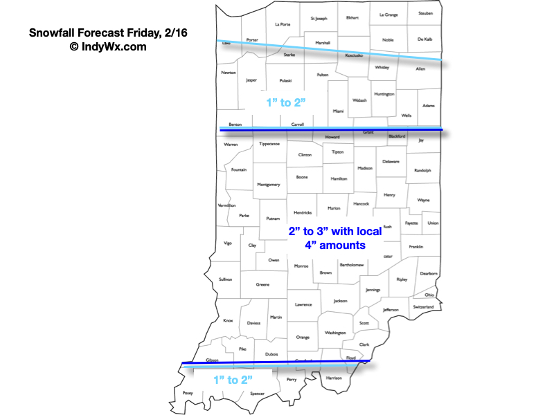
A widespread accumulating snow event will get underway over the coming few hours across all of central IN. At times, localized moderate to heavy snow intensity is anticipated this afternoon before diminishing this evening. A brief, but bitter jab of arctic air will flow into the region tonight and Saturday, including wind chill values that fall into the single digits. Sunshine returns over the weekend.

Snowfall forecast- most of which will accumulate on grassy and elevated surfaces. Slushy pavement conditions will develop during times of more intense snow this afternoon. Salting and plowing will be required throughout most of central IN today.