Category: Weather Rambles

Monday Evening Video Brief

Additional showers will rotate through central Indiana during the overnight, followed by a colder mid week stretch.  All eyes remain on the weekend for an impactful winter weather event across…

You must be logged in to view this content. Click Here to become a member of IndyWX.com for full access.  Already a member of IndyWx.com All-Access?  Log-in here.

Permanent link to this article: https://indywx.com/monday-evening-video-brief/

Sunday Morning Rambles…

1.) It’s nice to see the sun for once.  While we’ll still have mid and high level cloudiness to deal with later today, we’ll gladly take what we can get of the good ole vitamin D this time of the year!

20141207_1445_EVV_vis

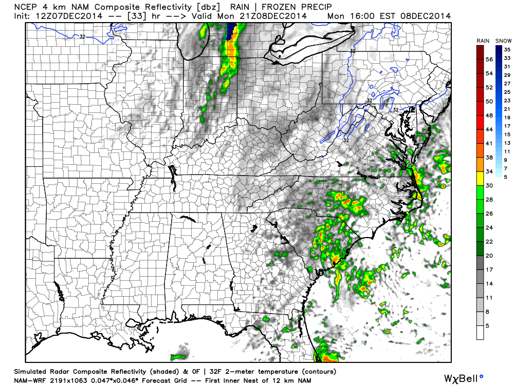
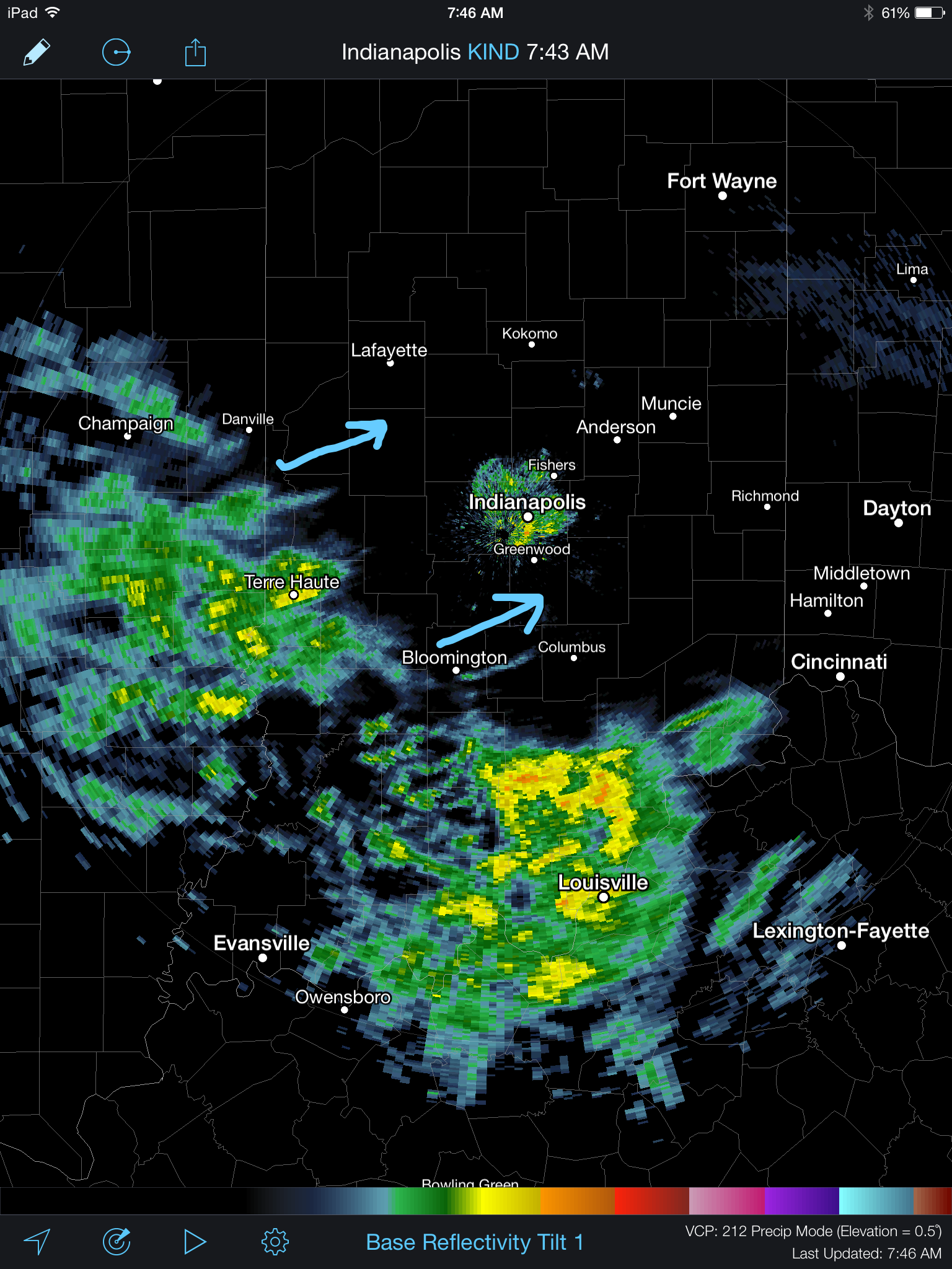
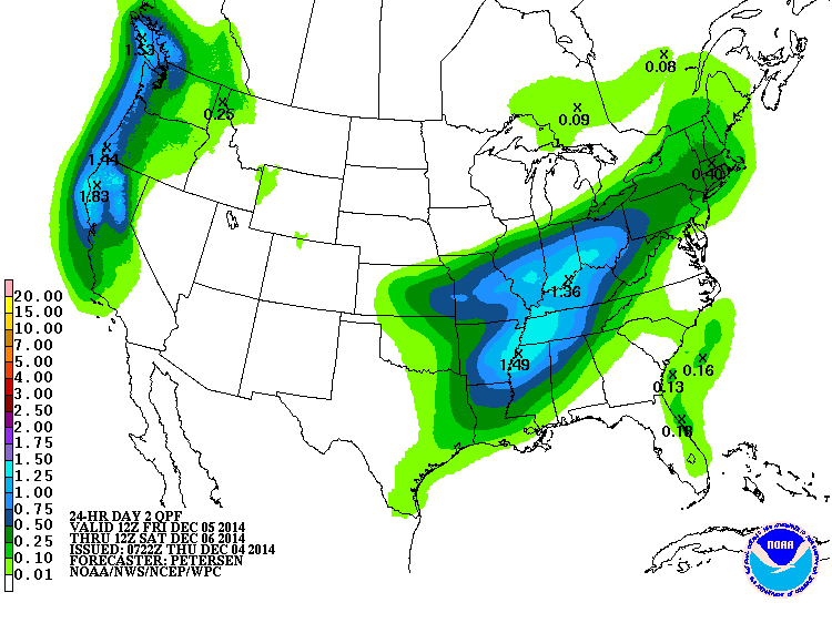
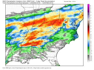
2.) Rain over the Thursday-Friday period followed along very closely to what modeling suggested.  Heaviest rains fell central and south.

nws_precip_ky_3

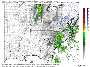
3.) A cold front will move through Monday evening with a few showers, gusty winds, and set up a cold week, overall.

hires_ref_ky_34

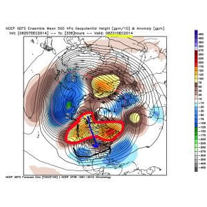
4.) In the long range, we continue to really like the looks of things from a winter weather lover’s point of view.  Undercutting jet supplying storm potential, arctic intrusion, and a blocky look… Details will have to be sorted through as time draws closer, but from this perspective, the pattern continues to look like it’s heading towards one capable of widespread colder than normal air and winter storm potential Christmas week.

122014SetUp

Permanent link to this article: https://indywx.com/sunday-morning-rambles-3/

Thursday Morning Rambles…

A wintry mix of sleet and freezing rain continues to advance slowly northeast this morning. Thankfully, most of the rush hour should be over by the time any of this wintry precipitation arrives and we have a couple things going for us this morning: 1.) Drier air is giving this precipitation a tough time advancing northeast and 2.) by the time the precipitation arrives, temperatures will be marginal for many road problems, if any.  By far the more concerning issues are off to the southwest of Indianapolis, including places like Terre Haute (where moderate snow was reported at 9am).

IMG_1948.PNG

The HRRR slowly pushes the wintry mix along the I-70 corridor this morning.

IMG_1950.GIF

Attention then turns to a heavy rain event Friday into Saturday morning. Widespread 1-2″ amounts are expected.

IMG_1949.GIF

Forecast radar shows periods of heavy rain overnight Friday into Saturday morning.

hires_ref_indy_49

Much more this evening!

Permanent link to this article: https://indywx.com/thursday-morning-rambles/

Another Bout Of Rush Hour Wintry Mix; Longer Range Talk…

We think we’re dealing with another round of light freezing drizzle and a wintry mix for the Thursday morning commute.  Plan to allow extra travel time.

Forecast radar Thursday morning suggests freezing drizzle and a light wintry mix is in play across central Indiana.

Forecast radar Thursday morning suggests freezing drizzle and a light wintry mix is in play across central Indiana.

There’s some longer term data that’s in stark contrast from what a positive PNA should produce (yet alone a strong positive PNA).  Typical positive PNA pattern should promote an eastern trough and associated colder than normal pattern as drawn below:

PositivePNA

Needless to say, we disagree strongly with the NAEFS and GFS ensembles:

2014120312_054@007_E1_north@america_I_NAEFS@TEMPERATURE_anomaly@probability@combined@week2_186

Regardless, the future will tell!  

Permanent link to this article: https://indywx.com/another-bout-of-rush-hour-wintry-mix-longer-range-talk/

Catching Up And Looking Ahead…

From the IndyWx.com family to yours, we wish you a very happy Thanksgiving! Thank you for taking the time to read our content daily and for all of your support…

You must be logged in to view this content. Click Here to become a member of IndyWX.com for full access.  Already a member of IndyWx.com All-Access?  Log-in here.

Permanent link to this article: https://indywx.com/catching-up-and-looking-ahead/