We wanted to take a quick opportunity to discuss the weekend snow threat. While certainly on the table, it’s far from etched in stone. We note the models doing their usual “herky-jerky” moves 5-6 days out. At the end of the day, there’s a notable threat present, but we prefer to watch things unfold over the next few days before beginning to get too excited.
Subtle differences between the European model (image 1) and GFS (image 2) are seen in the handling of the 500mb pattern. The GFS is quicker to phase the upper energy and leads to a more robust system. The European isn’t nearly as excited and instead dampens the energy coming east. These seemingly minute differences can make all the difference when it comes to the sensible weather that may (or may not) impact your weekend plans. If the European is correct, this is a rather non-event, locally. However, should the GFS idea be correct, this will be a widespread Ohio Valley snow event that’ll require gassing up the snow plows…

The European model weakens the energy coming east needed to fuel a more substantial storm Friday into Saturday.

The GFS model bundles the upper energy and phases things- leading to a more significant wintry threat by Saturday.
Stay tuned as we’re still a few days out from having confidence needed to begin to sound the alarm. 😉
In the longer range, tonight’s data continues to head in the direction where winter will make up for lost time to close January and head on into February. Delayed, but not denied…


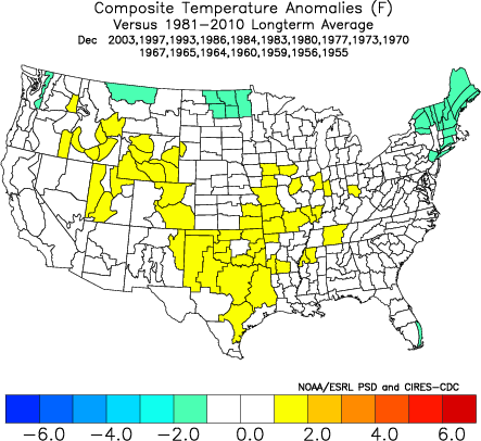
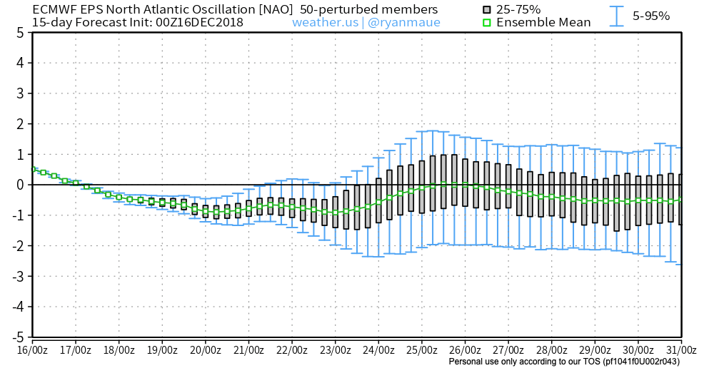
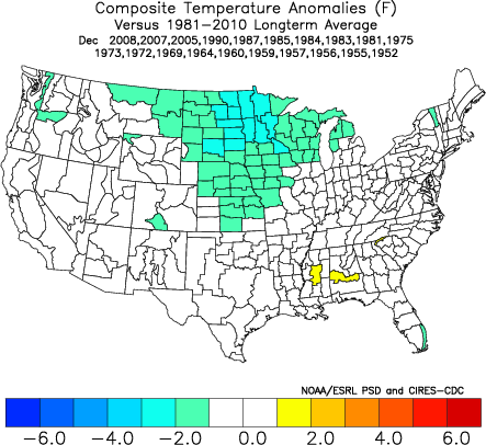

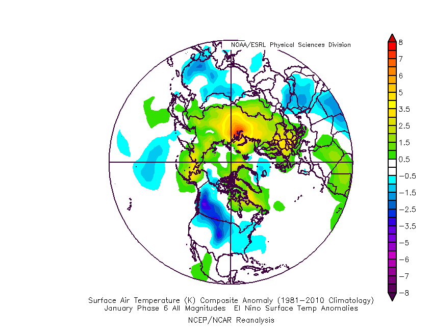
 The basis of our late-December forecast is built from the MJO, or Madden-Julian Oscillation. We note the MJO is expected to rumble through Phase 4 before heading into Phase 5 around Christmas. Phase 4 (image 2 below) is a warm phase and correlates well to what the week ahead will provide. However, Phase 5 (image 3 below) is a colder phase and could “up the ante” for the potential of wintry weather around Christmas.
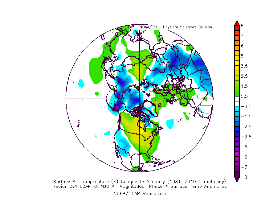
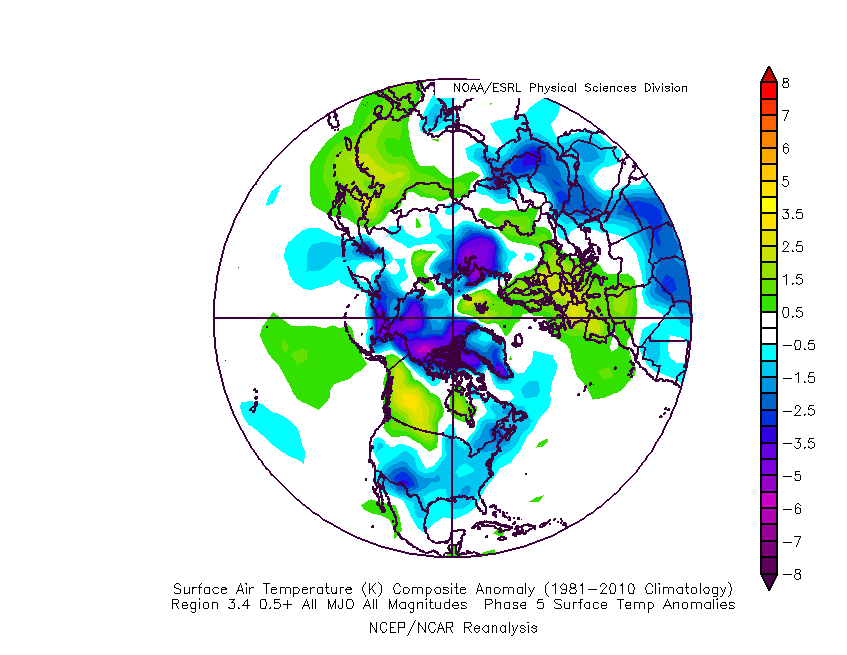 If the MJO amplitude remains, it’ll roll into Phase 6 to close the month and open January. Here’s how that would correlate in the temperature department:
 The upcoming week will run milder than normal- lining up perfectly with MJO Phase 4.
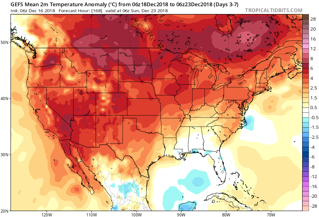 The first of our targeted holiday storm systems will come at the tail end of the warm Phase 4 and will likely deliver a wind-whipped rain in here as early as Wednesday night and Thursday morning. However, as the storm pulls northeast along the Ohio River, it’ll deepen on its journey into the eastern Great Lakes region. This will help pull colder air into the region, likely resulting in rain transitioning to snow Friday. Given the path of the storm, this doesn’t favor some sort of prolonged backlash snow event, but it could be enough to result in accumulating snow across eastern Ohio Valley sections and downwind of the snow belt regions of northern IN, OH, and MI.
 The pattern, as a whole, appears to be one of transition to close the month and open January and it’s not really until we get to mid-January where we think all of the drivers “align” to create more of a lock and hold cold pattern. With that said, a stormy late December pattern can present problems, even in the midst of relatively mild times. We’ll be here to dissect the storms as they come throughout the holiday season…