You must be logged in to view this content. Click Here to become a member of IndyWX.com for full access. Already a member of IndyWx.com All-Access? Log-in here.
Category: Unseasonably Warm
Permanent link to this article: https://indywx.com/2020/06/09/video-details-on-the-severe-threat-this-afternoon-evening-turning-much-cooler-and-drier-late-week/
Jun 08
Gorgeous Open To The Work Week Gives Way To Cristobal Remnants Tuesday…
You must be logged in to view this content. Click Here to become a member of IndyWX.com for full access. Already a member of IndyWx.com All-Access? Log-in here.
Permanent link to this article: https://indywx.com/2020/06/08/gorgeous-open-to-the-work-week-gives-way-to-cristobal-remnants-tuesday/
Jun 04
VIDEO: How Cristobal May Indirectly Influence Our Weather Next Week; Cooler Pattern Builds In For Mid-Month…
You must be logged in to view this content. Click Here to become a member of IndyWX.com for full access. Already a member of IndyWx.com All-Access? Log-in here.
Permanent link to this article: https://indywx.com/2020/06/04/video-how-cristobal-may-indirectly-influence-our-weather-next-week-cooler-pattern-builds-in-for-mid-month/
Jun 02
VIDEO: Monitoring Storm Potential Wednesday; Updated Summer Thoughts…
You must be logged in to view this content. Click Here to become a member of IndyWX.com for full access. Already a member of IndyWx.com All-Access? Log-in here.
Permanent link to this article: https://indywx.com/2020/06/02/video-monitoring-storm-potential-wednesday-updated-summer-thoughts/
Jun 01
VIDEO: Things Turn More Active; Changeable Pattern…
You must be logged in to view this content. Click Here to become a member of IndyWX.com for full access. Already a member of IndyWx.com All-Access? Log-in here.
Permanent link to this article: https://indywx.com/2020/06/01/video-things-turn-more-active-changeable-pattern/
May 31
VIDEO: Switching Gears In The Week Ahead…
You must be logged in to view this content. Click Here to become a member of IndyWX.com for full access. Already a member of IndyWx.com All-Access? Log-in here.
Permanent link to this article: https://indywx.com/2020/05/31/video-switching-gears-in-the-week-ahead/
May 29
VIDEO: Ready For A Refreshing Change? Discussing Precipitation Chances Next Week…
You must be logged in to view this content. Click Here to become a member of IndyWX.com for full access. Already a member of IndyWx.com All-Access? Log-in here.
Permanent link to this article: https://indywx.com/2020/05/29/video-ready-for-a-refreshing-change-discussing-precipitation-chances-next-week/
May 28
Thursday Morning Rambles: Tropical Air Gets The Boot; Eyeing A Warm Stretch Of Weather Through The 1st Half Of June?
Our short-term weather pattern will be dominated by an upper level low (this morning) and a cold front (tomorrow). High pressure will build into the region over the weekend and help supply gorgeous conditions.
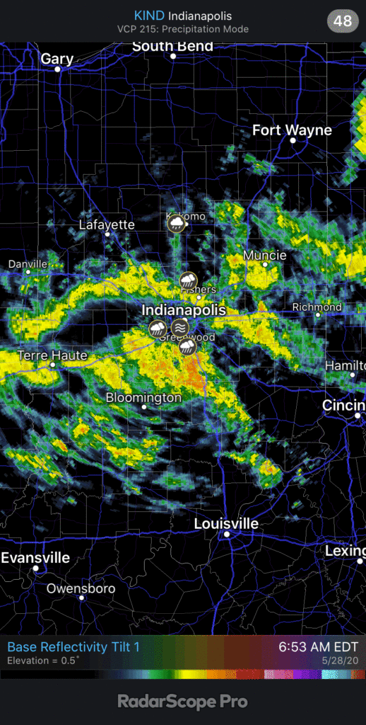
The best opportunity for widespread rain over the next week will take place today as the upper low impacts the region. With a tropical airmass in place, this feature will be able to produce a good soaking for most of central Indiana. Widespread moderate rain this morning will continue for the next few hours before being replaced with more scattered activity during the afternoon/ evening.

The next feature we’ll contend with is the cold front itself and it’s still slated for a Friday passage. Scattered showers and storms will remain possible ahead of the boundary but coverage shouldn’t be nearly as widespread as what we’re seeing this morning. Once the front blows through tomorrow afternoon, much drier and cooler air will arrive and stick around for a few days.


Dry conditions will stick around through the weekend and into early next week to result in perfect weather to get some of those outdoor chores knocked out before the warm, muggy stuff returns.
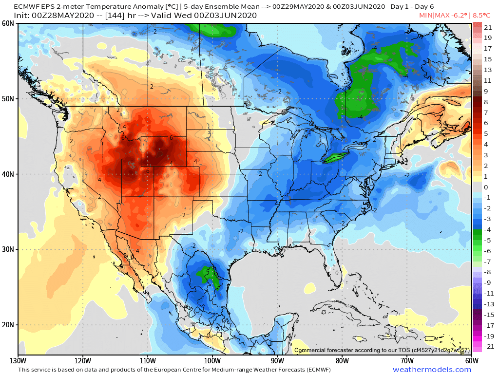
Speaking of that, as we look ahead, we’ll replace the refreshing air with a return of warmth and humidity during the 2nd half of next week. Note how the European ensemble shows the transition.


The JMA Weeklies (fresh in this morning) also show the warmth that looms through the better part of the 1st half of June.

We’ll have to keep close tabs on exactly where the upper level ridge sets up in the Week 2 time period. This will mean the difference between “splash and dash” storm coverage as the mugginess returns vs. more widespread, organized activity in what would be a northwest flow around the periphery of the ridge. Stay tuned.
Permanent link to this article: https://indywx.com/2020/05/28/thursday-morning-rambles-tropical-air-gets-the-boot-eyeing-a-warm-stretch-of-weather-through-the-1st-half-of-june/
May 27
VIDEO: Better Short-Term Storm Chances; Meteorological Summer Looms…
You must be logged in to view this content. Click Here to become a member of IndyWX.com for full access. Already a member of IndyWx.com All-Access? Log-in here.
Permanent link to this article: https://indywx.com/2020/05/27/video-better-short-term-storm-chances-meteorological-summer-looms/
May 26
Sticky Now; Big Changes Arrive By The Weekend…
A warm and humid airmass will remain intact through the next 72 hours. Little impulses of energy scooting across the area will be all that’s needed to ignite scattered showers and thunderstorms, but not all will see rain. Due to the moisture content, those that do find themselves under a shower or storm can expect locally heavy totals. Thursday will likely offer up the best chance of more widespread thunderstorm activity.

Friday will continue to offer up scattered showers and thunderstorms courtesy of a cold front moving through the Ohio Valley. Once this front slides south, MUCH drier and cooler air will filter into central Indiana, leading to a fantastic weekend. A northeasterly flow around high pressure will create a much more refreshing feel. Lows in the 40s and highs in the upper 60s to lower 70s are a good bet this weekend.

The cooler, more refreshing air won’t stick around for more than a few days before warmth rebuilds. This is in association with the MJO moving into Phase 1 (a phase favoring widespread warmth across the Lower 48 this time of year). Drier conditions should prevail as temperatures warm early June.

An interesting item to keep tabs on has to do with the potential of tropical “mischief” in the Gulf towards mid-late month. If you have beach plans down to those beautiful Gulf Coast beaches, this is something I’d recommend keeping a close eye on over the next 2-3 weeks. Should something develop, the pattern would favor the central/ eastern Gulf it would appear from this distance.
Permanent link to this article: https://indywx.com/2020/05/26/sticky-now-big-changes-arrive-by-the-weekend/
