Significant Flood Situation Ahead…

Your latest 7-Day video forecast can be found in the video player to the right of this post.

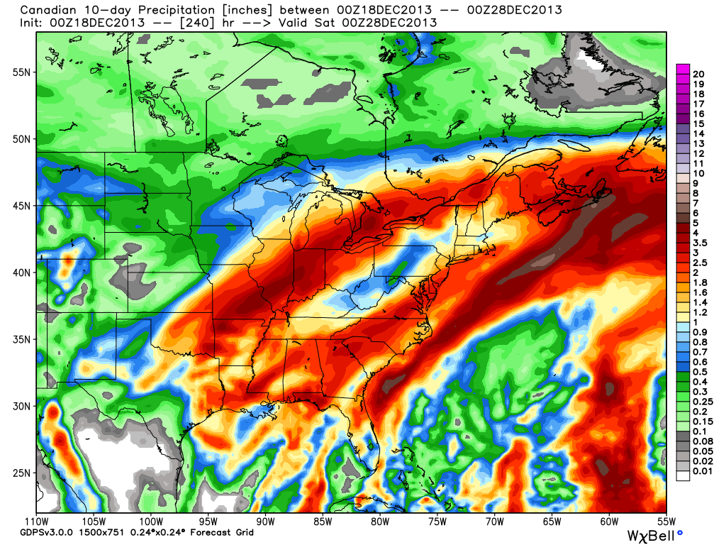
We’ve known for over a week now that we’ll have to deal with a pre-Christmas storm. Latest guidance suggests our region undergoes a 3-4 day thaw with a decidedly warmer southwest flow ahead of this storm.  Additionally, with the more northern track of the surface low, we’re looking at nearly all of the precipitation associated with this storm falling as rain.  Combine our frozen ground with a significant early-season snow pack and multiple inches of rain ahead in the Thursday night through Sunday time period and the stage is set for a significant flood situation this weekend.

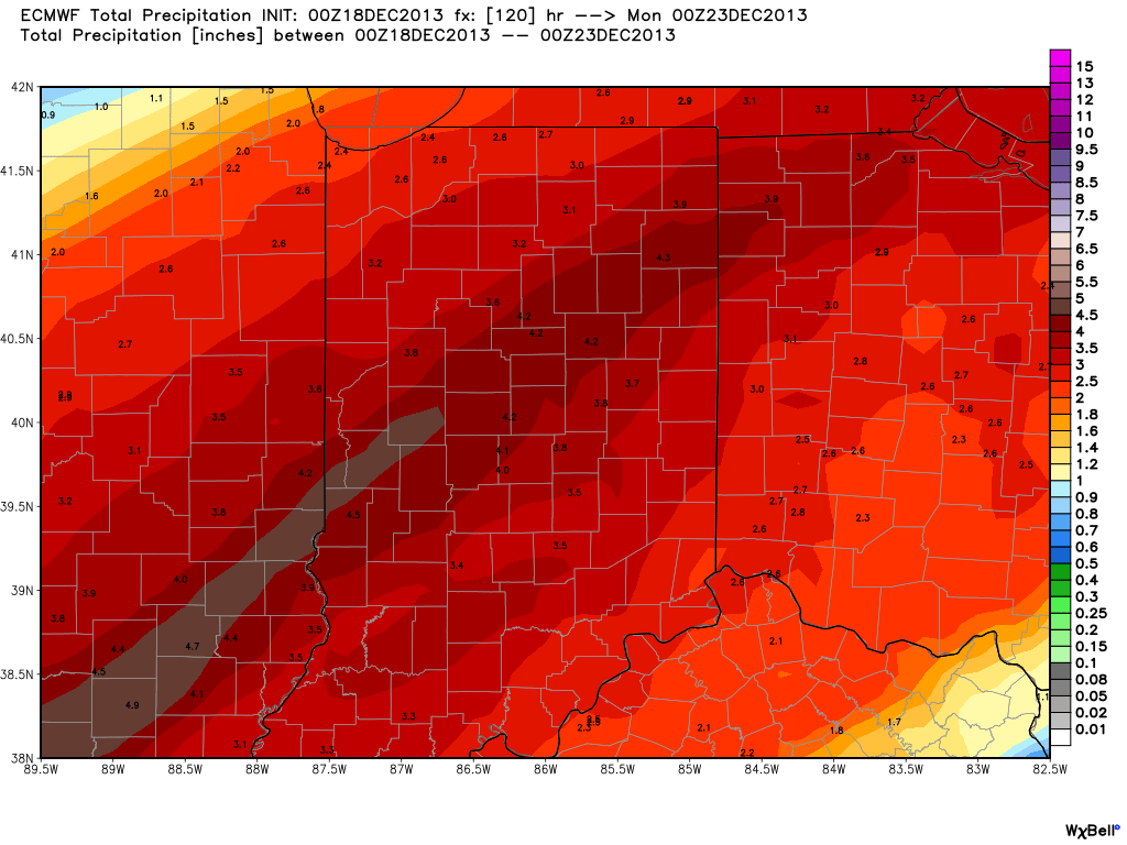
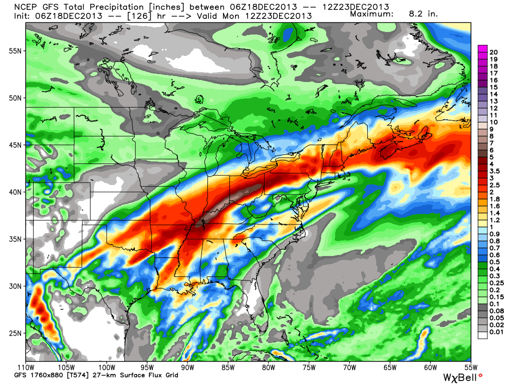
Here’s a look at what the latest forecast models show.  We’ve posted the GFS, Canadian, and European models below to display total rainfall between Thursday through Sunday.  The majority of this rain falls in two waves- Friday and again late Saturday into early Sunday.

gfs_total_precip_east_22cmc_precip_by10_east_1ecmwf_tprecip_indy_21

If the rainfall numbers are even half of what is projected above, we’re looking at a significant flood situation.  Needless to say, if your property is in a low-lying area, or one that is prone to flooding, I would begin to prepare now for major water rise in the days to come.

Much more later!

Wednesday Forecast: A Bitterly Cold Start

Updated 11.12.13 @ 8:50p

Zionsville, IN After waking up to half an inch of snow, sunshine engulfed most of the region Tuesday. The vitamin D didn’t help temperatures moderate much as highs were more like mid to late December as opposed to mid November. We discuss a warming trend below, after a frigid start to your Wednesday.

Status-weather-clear-iconWednesday: Mostly sunny; 19/ 39

A strong area of high pressure will move overhead Wednesday and help supply a mostly sunny sky.  Despite the sun, it’ll be another unseasonably cold day.  Many outlying communities will begin the day in the upper teens before rising into the upper 30s to near 40 by afternoon- a solid 15 degrees below normal.

Status-weather-clouds-iconThursday: Partly cloudy; 28/ 49

The same high pressure that will be directly overhead Wednesday will begin to move east Thursday. This will put our region in a southwesterly air flow and allow temperatures to begin moderating. After another cold start, highs will push towards the 50 degree mark Thursday afternoon.

Status-weather-clouds-iconFriday: Partly cloudy; 35/ 52

We’ll wrap the work week up with a few more clouds and temperatures still slightly cooler than normal, though much milder than those we’re dealing with now.


Status-weather-showers-day-iconSaturday:  Turning cloudy with PM showers (0.20″); 40/ 59

Model data continues to hint at increasing clouds and the threat of afternoon light rain. We’ll initially have to overcome the dry air mass in place, but by afternoon/ evening we should have scattered showers beginning to impact central portions of the state.

Status-weather-showers-scattered-iconSunday: Cloudy with rain likely (0.45″); 52/ 60

More widespread rain will arrive for the second half of your weekend.  Highs will approach 60 and should we see any sunshine (not looking likely at this point), temperatures could go into the lower to middle 60s. While temperatures will be much warmer we’ll have to contend with rain Sunday.

Status-weather-storm-night-iconMonday: Showers and possibly a thunderstorm (0.50); 34/ 63

A strong cold front will blow through the state Monday evening. Out ahead of the front, an impressive surge of warmer and more humid air will move north and encompass central Indiana during the day. In fact, latest model data suggests dew points reach the lower 60s Monday. The combination between the warmer, more humid air in place and an impressive surge of arctic air behind the front could team up to produce a clap or two of thunder with the moderate to heavy rain threat Monday afternoon as the front moves through. Temperatures will then crash Monday night.

Status-weather-snow-scattered-day-iconTuesday: Scattered snow flurries; 24/ 34

The big story Tuesday will be the much colder air mass rushing into the state on strong and gusty northwest winds. Just enough moisture may linger to create the chance of scattered snow flurries.
Closer Look At Saturday!

Happy college football Saturday!  Here’s a quick post before the fun begins this afternoon!  War Eagle!

Today will be a beautiful day, albeit windy.  Winds will gust out of the southwest up to 30 MPH at times. Partly cloudy skies are on tap as highs reach the upper 50s to lower 60s, courtesy of that mild southwest air flow.

Enjoy the warmth while you have it, as the next 7 days will be MUCH colder than average.  By Tuesday, highs will remain in the 30s with AM light snow. Overnight lows by Wednesday morning?  How do the lower 20s sound?

hrrr_t2m_max_indy_16

Two Totally Different Solutions For Next Week!

I wanted to quickly post on two totally different scenarios for next week.  Two of the more powerful forecast models we use to look into the mid-long range are in separate worlds when it comes to the weather pattern the middle to latter part of next week.

Here’s a look at the GFS upper air pattern:

gfs_z500_sig_east_38

Note the eastern ridging which would lead to well above normal temperatures during the middle to latter part of next week (by as much as 10 degrees above average), along with dry conditions.

HOWEVER, here’s a look at the European’s forecast upper air pattern late next week:

ecm_z500_anom_east_11

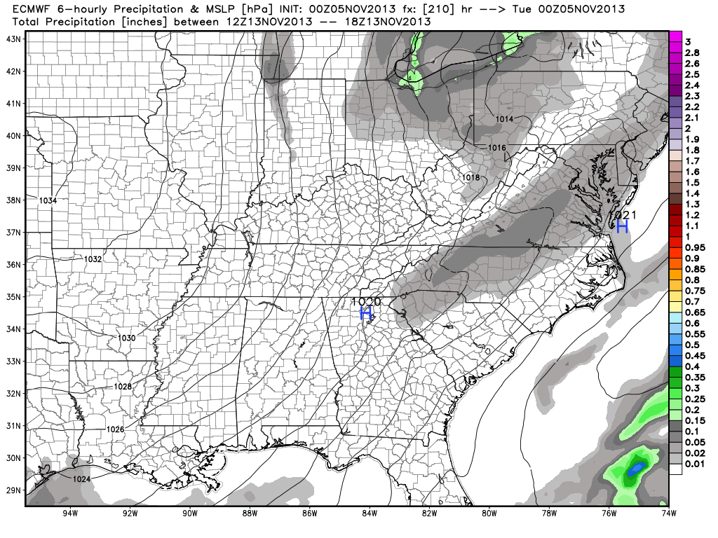
This would certainly be quite the significant storm for the Northeast, but the implications here are vastly different from that which the GFS shows above.  Instead of warmth and dry conditions, we’d deal with highs in the middle 30s and overnight lows in the lower to middle 20s.  Additionally, we’d also “enjoy” (okay, some folks would “enjoy”) snow showers and snow squalls the middle to latter portion of next week, as noted per the European below, including a lake Michigan connection.

ecmwf_slp_precip_ky_36


Needless to say, we have a lot to sort out in the coming days.  We’ll be here to do just that.  Make it a great Tuesday!

Changes Brewing?

After an unseasonably cool summer, the pattern flipped to a warmer regime during the month of September.  That same warm pattern continues presently, but are changes brewing?

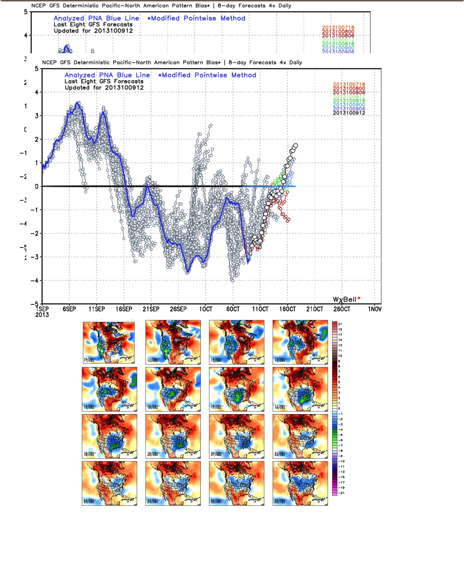
We note the PNA (Pacific North American pattern) is trending positive and this could help promote more of a sustained trough and associated cooler than normal pattern to wrap up October.  Would it be enough to offset the very warm first half of October?  Too early to tell.  However, I will say that with the PNA trending positive, it does suggest we’ll be looking at more sustained chilly conditions, as opposed to the “in and out” flirtations of cool air as of late.

The GEFS suggests a trough sets up shop across the eastern part of the country for the back half of October.

IMG_0889