Changeable Weather This Week…

Mon.

Tue.

Wed.

Thr.

Fri.

Sat.

Sun.

 Status-weather-clouds-icon

 Status-weather-showers-day-icon

 Status-weather-clouds-icon

 Status-weather-clouds-icon

 Status-weather-showers-day-icon

 Status-weather-clouds-icon

 Status-weather-clouds-icon

19/ 43

30/ 56

35/ 50

30/ 51

42/ 65

30/ 45

22/ 37

– – –

Light

– – –

– – –

Light

– – –

– – –

Forecast Updated 03.17.14 @ 12:00p

Quiet, Brighter Start To The Work Week. . .After a “ridiculously” cold, windy, and gloomy Sunday, it’ll be nice to see the sunshine return as we kick off another work week.  Temperatures will remain much colder than average, but with that late March sun working through later this afternoon (once these pesky clouds move east), it’ll feel somewhat better.

Fast Moving Storm System. . .Most of Tuesday will be sunny and dry, but a frontal boundary will race towards central Indiana Tuesday evening and we note some of our high resolution model data trying to bring a thin line of showers and thunderstorms through in association with this frontal passage.  After a mainly dry day, clouds will increase and we’ll forecast quick-moving showers and embedded thunder Tuesday night into Wednesday morning.  Rainfall amounts will remain light.

Dry, blustery weather will return Wednesday afternoon with temperatures just a few degrees below normal.

Late Week Storm. . .After a dry and pleasant Thursday, southwest breezes will kick into high gear and allow temperatures to jump into the middle to perhaps upper 60s Friday (dependent upon how much sunshine we see).  That said, another cold front will have it’s eyes set on our area and clouds will increase during the afternoon and evening hours with showers and thunderstorms developing Friday night as the front pushes southeast.

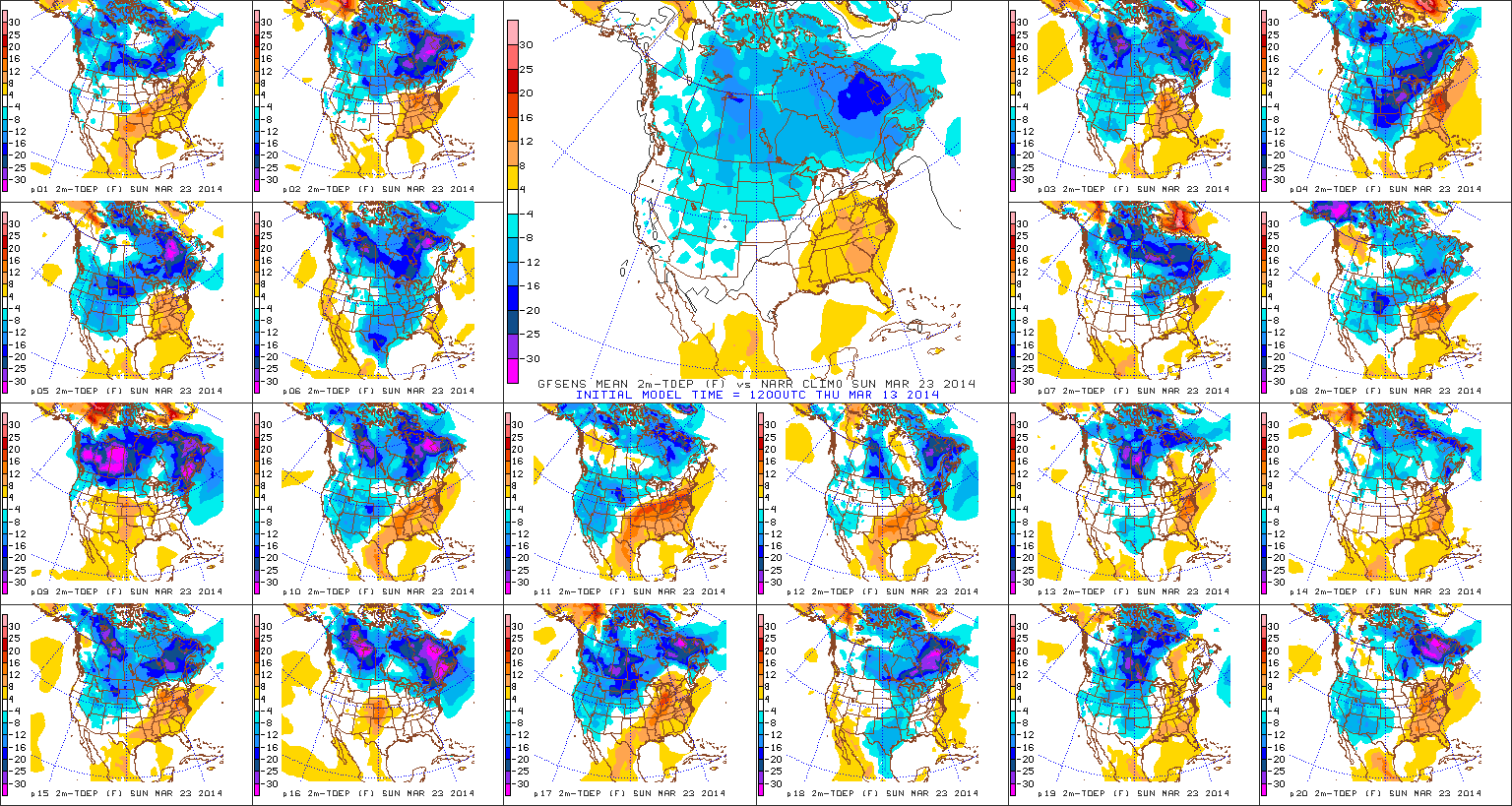
This will then set the stage for another cold weekend ahead.  While we’re trending next weekend (especially Sunday) MUCH colder, it’s possible we’ll have to lower temperatures even further in the days ahead.

Upcoming 7-Day Precipitation Forecast:

  • 7-Day Snowfall Forecast: 0.00″
  • 7-Day Rainfall Forecast:  0.25″

twic

For weather updates and more “behind the scenes” data on the go, be sure to Follow Us on Twitter @indywx or become a Friend of IndyWx.com on Facebook!

images

After a long winter, sunshine and pleasant temperatures provided a great day to get outside and enjoy the conditions last Saturday in Zionsville!  Thanks to John Salewicz for this shot!

photo-2

Dry Today; Windy And MUCH Colder Sunday…

Sat.

Sun.

Mon.

Tue.

Wed.

Thr.

Fri.

 Status-weather-clouds-icon

 images

 Status-weather-clouds-icon

 Status-weather-showers-day-icon

 Status-weather-clouds-icon

 Status-weather-clouds-icon

 Status-weather-clouds-icon

32/ 52

24/ 30

17/ 42

27/ 54

39/ 50

32/ 53

33/ 62

– – –

– – –

– – –

Light

– – –

– – –

– – –

Forecast Updated: 03.15.14 @ 8:53a

Nice Today; MUCH Colder Sunday. . .Today will easily be the pick of the weekend as mostly sunny skies dominate along with seasonable temperatures.  Get outside and enjoy!

We continue to watch a southern storm system for the second half of the weekend and while model data trended north Thursday, the common theme most of Friday into this morning has been back south.  As such, we’ll lean towards a less snowy forecast Sunday for central Indiana, but note if you have travel plans to the southern third of the state that accumulating snow and ice will greet you Sunday.  Here across central Indiana look for a rather cloudy and MUCH colder day.  In fact, temperatures won’t even make it to the freezing mark with a very strong east to northeast wind in play.  Winds may gust as high as 35 MPH Sunday afternoon, making it feel like the single digits and teens.

Relatively Quiet Week. . .Modeling continues to struggle with the timing and strength of storm systems in the week ahead, but current thinking takes the storm track primarily north of our area next week, meaning less impact (from rain or snow chances) here.  We caution that this can change and we’ll keep a close eye on things, but we’re trending our forecast towards a quieter one for now.  The next system of note will be a fast moving low pressure area and associated cold front that will pass here Tuesday into Wednesday.  A scattered shower and wind shift will occur with this system, but, as stated above, the majority of the more significant “weather” will lie to our north.

A brief warming trend to well above normal temperatures may carry us to close out the work week before the next systems eyes our area later next weekend.

Upcoming 7-Day Precipitation Forecast

  • 7-Day Snowfall Forecast: 0.00″
  • 7-Day Rainfall Forecast: 0.25″

twic

For weather updates and more “behind the scenes” data on the go, be sure to Follow Us on Twitter @indywx or become a Friend of IndyWx.com on Facebook!

images

I know many are saying thankfully we aren’t dealing with this kind of weather today.  After a harsh winter, it’s always nice to see the sunshine and milder temperatures return.  Today we take you back to a snowy Zionsville from February 17th.  This shot was taken by Janet Baker.  Thanks, Janet!

SnowFeb17Zionsville

70 Degree + Type Weather Coming?

While we remain in a overall colder than normal pattern, spring, obviously, has to get here one day, right?!  The past week has seen an increase in spring at least “flirting” with the region for brief 24-36 hour time periods and this will continue over the upcoming week.

We remain concerned about a potential shot of well below normal cold to open April, but we thought it would be nice to talk about something pleasant for a change.  🙂  We’re keeping a close eye on next weekend, March 22nd and 23rd, for the potential first 70 degree + type day at IND this year.

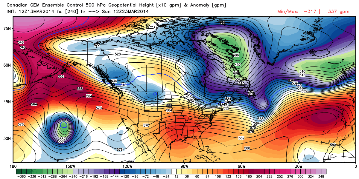
The latest ensembles aren’t shying away from a significant, though transient, ridge building in during this time period.

12

Note the GFS showing the transient, though significantly, warmer than normal air that would likely occur in this type pattern.  70 degrees + would certainly be attainable.

3

See, we don’t just provide doom and gloom (though this past winter may seem that way) at IndyWx.com!

A Look At Where We’ve Been And Where We’re Going…

The region has been under the influence of a cold eastern trough month to date with a brief relaxation taking place presently. The frigid March start and anomalously cold east…

You must be logged in to view this content. Click Here to become a member of IndyWX.com for full access.  Already a member of IndyWx.com All-Access?  Log-in here.

Saturday Morning Thoughts…

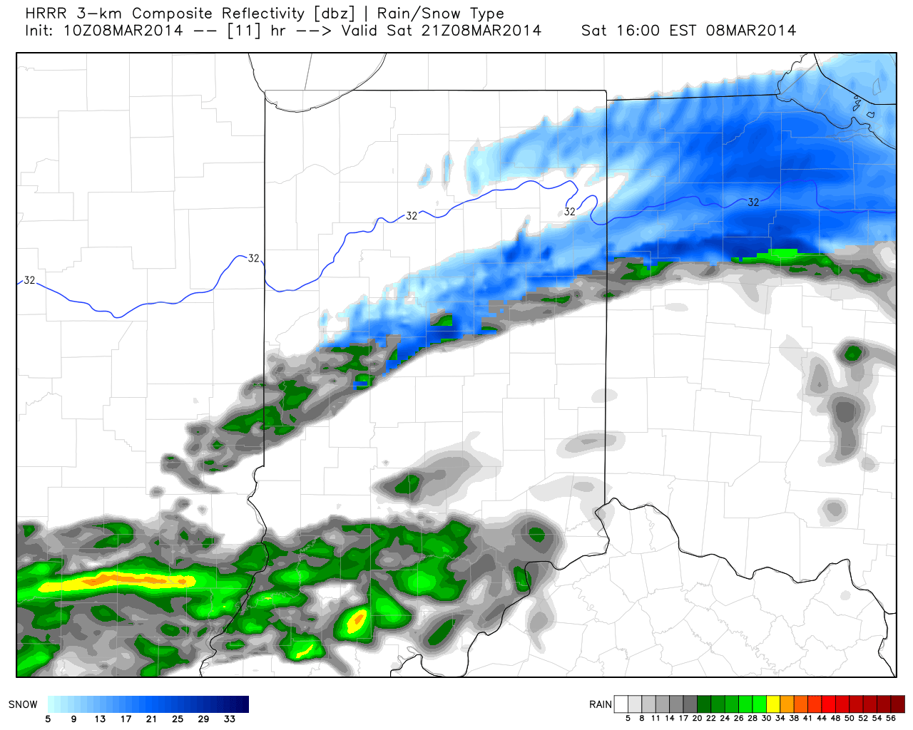
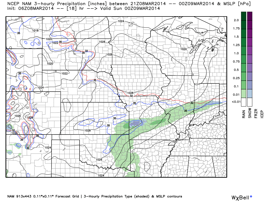
Good morning and happy Saturday!  A weak weather system will move through the region and produce a couple of light showers this afternoon, but won’t be a big deal.  Rain will end as a couple of snow flakes.  Overall precipitation totals look less and less impressive with each model run, which wasn’t impressive to begin with.  Needless to say, don’t be concerned by any sort of significant rain or snow today.

Latest simulated radar off the NAM and HRRR shows the band of light precipitation pushing through the state this afternoon.

hrrr_ref_indy_12nam_ptype_slp_mc_7

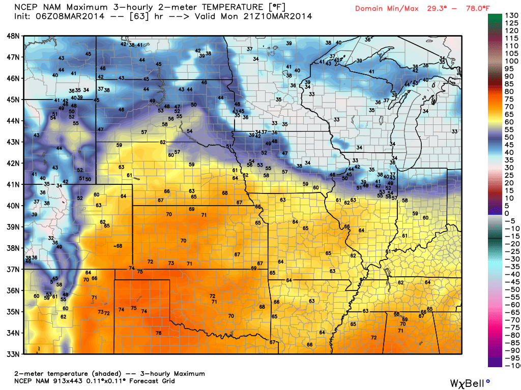
While we’ll have a brief “set back” in the temperature department this weekend, early next week continues to look downright mild and very spring like.  Note our region flirting with 60s.  Impressively, a budding area of 70-degree warmth is expanding to our west.

nam_t2m_max_mc_22

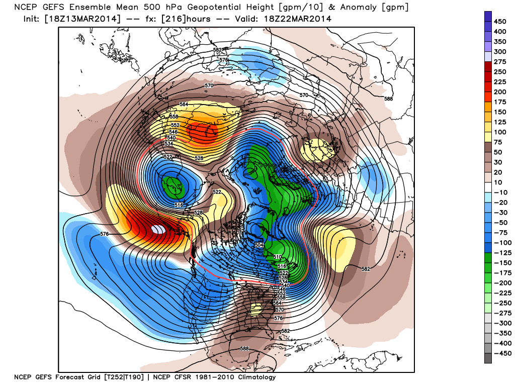
Details remain quite sketchy in regards to nailing down the storm the middle of next week with any sort of confidence.  While we’ll continue to sort through the data and gain a better understanding of things over the weekend, we’re confident on a colder regime returning by the middle of next week.  Note the trough per the GFS ensembles returning to the east.  Much more later!

gefs_z500anom_nh_21