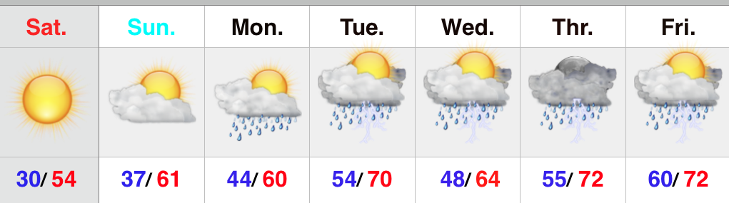
 Keep The Rain Gear Handy…A stationary boundary remains draped across the Ohio Valley and will serve as the focal point for scattered showers and thunderstorms through Wednesday. Some of the storms may be strong and include torrential downpours. That said, there will be many dry hours, as well.
We shift our focus to the chance of severe weather Thursday as surface low pressure moves into the Great Lakes and swings a cold front into a warm, humid, and relatively unstable air mass locally. As of now, damaging straight line winds and large hail are the biggest concerns, but there’s also the chance of a tornado. Stay tuned.
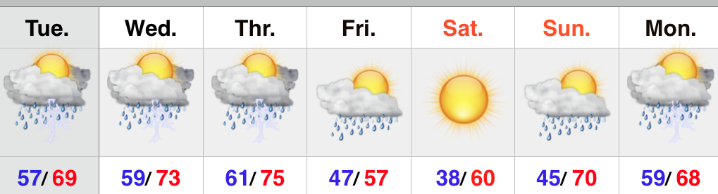
After an early shower Friday, we’ll clear things out nicely to wrap up the work week and head into the weekend. Friday will be much cooler, but that April sun will help temperatures recover quickly Saturday. Most of Sunday will be dry, but we’ll introduce showers Sunday evening. This will set up a stormy open to next week.
Upcoming 7-Day Precipitation Forecast:
- 7-Day Rainfall Forecast: 2.00″ – 2.50″
- 7-Day Snowfall Forecast: 0.00″