Category: Unseasonably Warm

Hot Weekend Coming, But We’re Set To Cool Going Into The Holiday…

The pattern continues to look as if it’ll evolve in a way that will assist in delivering the hottest air so far this year during the course of the upcoming weekend into early next week.  That said, the seeds are once again being planted that should promote a trough and associated cooler than normal pattern returning as we head closer to the Independence Day holiday.

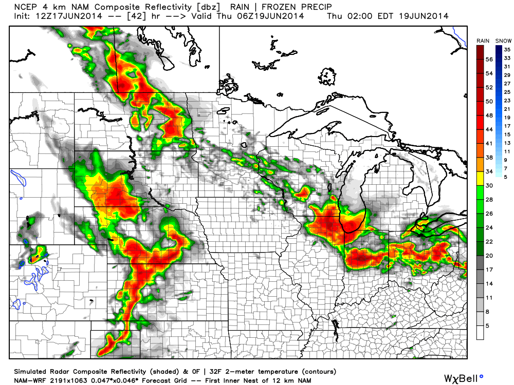
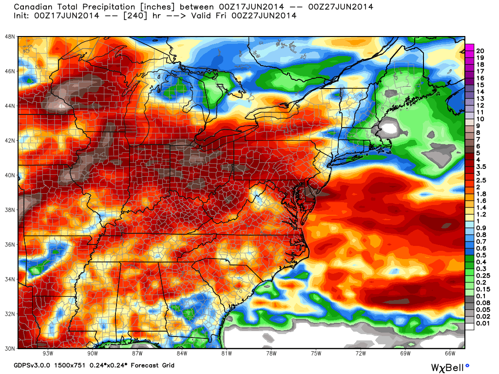
In short, an active and progressive pattern is set to continue across our immediate neck of the woods.  This promises a continuation of above average precipitation and while shots of hot air will invade from time to time, it’s going to be mighty tough to get any sort of hot pattern to stick around for any sort of staying power over the course of the upcoming couple weeks.

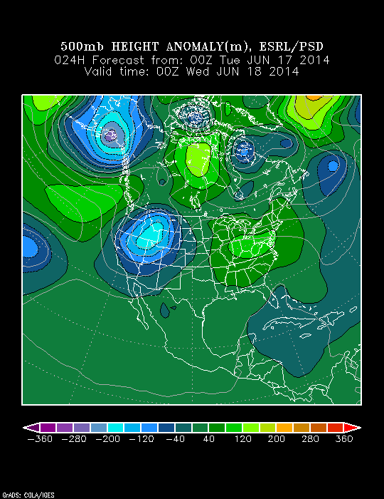
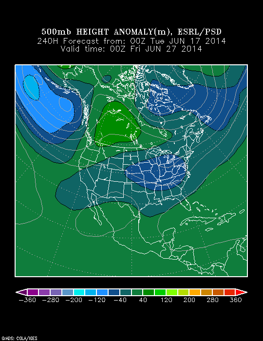
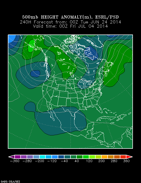
In the short-term, we’ll enjoy a couple of cooler, drier days for the mid week stretch, but ridging will build this weekend into the middle part of next week and we should have no problem reaching the hottest levels of the year so far.  Note, however, how the upper pattern reverses and allows a trough to develop over the Lakes and Ohio Valley by Day 10, or the Independence Day holiday.

z500_anom_f144_ussm

z500_anom_f240_ussm


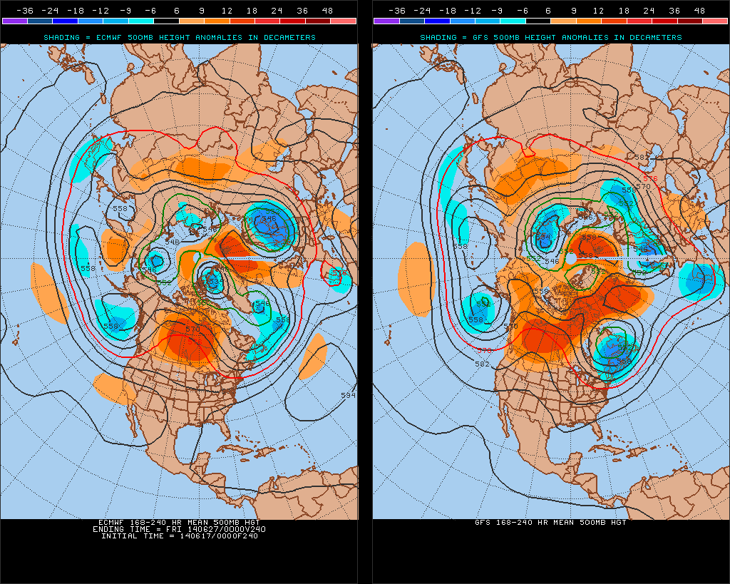
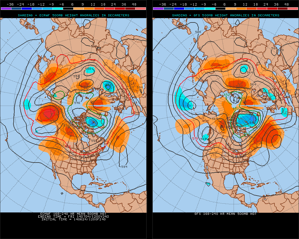
There’s relatively good agreement between the GFS and European during the 8-10 day period with the trough and associated cooler pattern returning.

test8

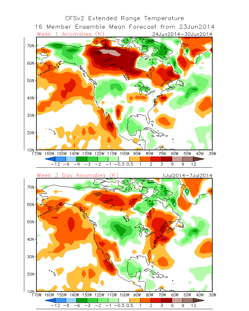
The NAEFS and CFSv2 highlight the warmer than normal pattern giving way to cooling week 2.

2014062412_054@007_E1_north@america_I_NAEFS@TEMPERATURE_anomaly@probability@combined@week2_186


wk1.wk2_20140623.NAsfcT


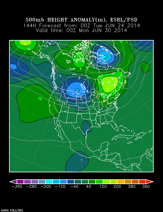
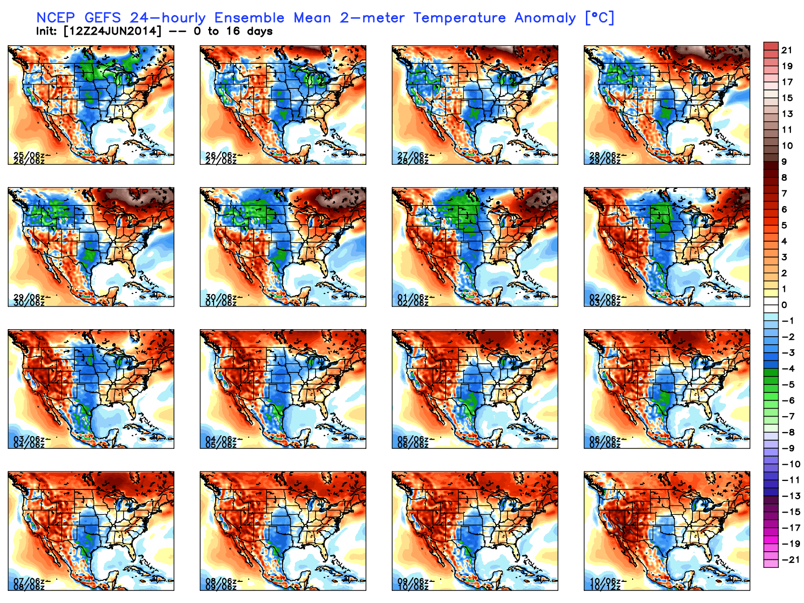
The GFS ensembles show the transient regime ahead.  Note the warming giving way to cooling and then warming again towards week 3.  Again, this is a good indication of wetter than normal conditions as well across a good portion of the Mid West and Ohio Valley.

gefs_t2anom_16_conus_1

To sum things up, the hottest air so far this year will likely move into the Hoosier state early next week and feature a day or two of 90 degrees +.  The heat won’t have staying power as a trough and associated cooler air mass will return heading into the Independence Day holiday, and could potentially be highlighted by a round of gusty storms as the heat gives way to cooling.  We’ll have to keep an eye on this as we draw closer.

Permanent link to this article: https://indywx.com/hot-weekend-coming-but-were-set-to-cool-going-into-the-holiday/

Focusing On Wednesday Evening Severe Potential…

Good afternoon!  We wanted to cut a video discussing our thinking around timing and primary threats from any severe weather that gets going across central Indiana tomorrow evening.

4km NAM forecast radar suggests a stormy time of things Wednesday evening. We discuss in your afternoon video update!

4km NAM forecast radar suggests a stormy time of things Wednesday evening. We discuss in your afternoon video update!


Permanent link to this article: https://indywx.com/focusing-on-wednesday-evening-severe-potential/

Still Anticipate Late June Changes…

We asked this question on our Twitter account earlier this morning.  Do you prefer heat and humidity or frigid and snowy?  Here’s a look out the back door from the IndyWx.com HQ from this morning and then back to right after the early January winter storm.  Note the snow depth on the fence line.  Amazing stuff!

BqVrtazCQAAKGVy.jpg-largeBqVrtMxCYAA-OdA.jpg-large


Anyway…as we look ahead, we still anticipate an overall regime change as we progress through the upcoming weekend and into next week.

Model data remains in rather good agreement on the evolution of the upper air pattern over the course of the upcoming 7-10 day period.  The GFS is a touch more aggressive on the eastern trough when compared to the European, but both agree on week 2 cooling, as do we.

test8


This won’t be tremendously cool air (such as last weekend), but when compared to averages, we’re likely to cool things back to slightly below normal.

The PSD shows the changes, as well.  Note the current eastern ridge is replaced by the Day 10 eastern trough.

z500_anom_f024_ussmz500_anom_f240_ussm


The precipitation idea is one that is continued wet.  Our three primary mid range global models (GFS, Canadian, Euro) agree on widespread rainfall totals of 1.5″-3″ (locally heavier totals where stronger thunderstorms move) over the next 10 days.  Here’s a closer look at the Canadian, thanks to the model suite at Weatherbell Analytics.

cmc_total_precip_ma_41

Permanent link to this article: https://indywx.com/still-anticipate-late-june-changes/

Hot And Humid…

Tue.

Wed.

Thr.

Fri.

Sat.

Sun.

Mon.

 Status-weather-clouds-icon

 Status-weather-clouds-icon

 Status-weather-showers-day-icon

 Status-weather-showers-day-icon

 Status-weather-showers-day-icon

 Status-weather-showers-day-icon

 Status-weather-showers-day-icon

70/ 90

71/ 89

71/ 89

70/ 86

70/ 86

70/ 84

67/ 80 

– – –

– – –

Light

Light

Light

Light

Light

Hot and humid will sum things up nicely over the next 48 hours.  Prepare to sweat as temperatures approach 90 both days and dew points remain between 65 and 70- oppressive!  Better rain and storm chances enter the picture late Wednesday night and remain in our forecast into the upcoming weekend. Periods of locally heavy rainfall can be expected and we’ll also have to monitor for severe potential Wednesday night/ Thursday- with the big concerns being strong winds and large hail.  Rainfall potential between tomorrow night and Sunday will reach 1.5″-2″ with locally heavier amounts.  Looking further ahead…we still forecast a cooler pattern to develop next week.  Much more later!

Permanent link to this article: https://indywx.com/hot-and-humid/

Monday Evening Video Update; Feeling Very Much Like Summer…

Quick video update tonight discusses some of our thoughts as we progress through the week ahead!

You must be logged in to view this content. Click Here to become a member of IndyWX.com for full access.  Already a member of IndyWx.com All-Access?  Log-in here.

Permanent link to this article: https://indywx.com/monday-evening-video-update-feeling-very-much-like-summer/