Timing Sunday Severe Potential…

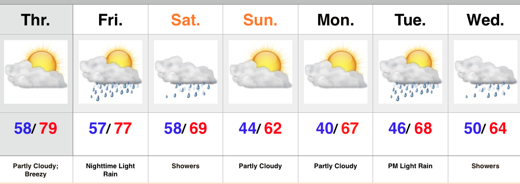
A cold front will slice into a hot and humid air mass Sunday evening.  The daytime hours Sunday are expected to provide plenty of sunshine to go along with that hot and increasingly humid air mass (courtesy of strong southwest winds), but things will turn stormy Sunday night.  We’re growing close enough now to begin to bracket the most likely time for potentially strong to severe thunderstorms and focusing in on the hours between 10p and 2a.  Damaging straight line winds are of greatest concern, but large hail and a quick spin-up tornado can’t be totally ruled out.  It’ll be important to set those weather radios before going to bed tomorrow night, or have a means of getting the latest watches and warnings.

Forecast radar 11p Sunday

11pForecast radar 2a Monday

2aForecast radar 8a Monday

8aThe line of storms will weaken in rather dramatic fashion as they continue to push south into the lower Ohio Valley and Tennessee Valley Monday morning.

Stay tuned.

Chilly Now, But Warmer Days Coming…

Screen Shot 2015-06-01 at 10.16.25 PMHighlights:

  • Unseasonably chilly air begins to moderate
  • Dry weather returns
  • Eyeing the next cold front late in the weekend

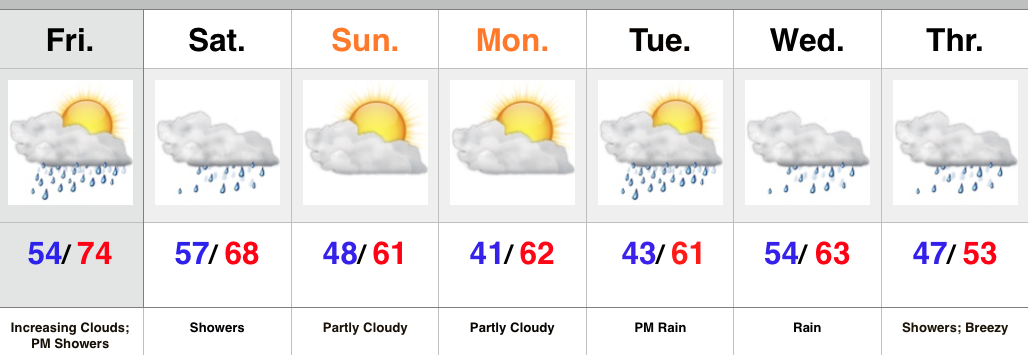
The past couple of days have felt more like late spring or fall rather than the first day of meteorological summer (June, July, August).  No need to fret, however, as milder air will return beginning Tuesday afternoon…after another very chilly start.  The next couple of days will feature plenty of sunshine!  Enjoy!  Moisture will slowly begin to increase to end the week and an isolated to widely scattered storm chance will accompany the warmer, more humid air.  Best rain and storm chances look to come Sunday as a cold front moves closer.  Drier and cooler air will work back into the region Monday evening.

Upcoming 7-Day Rainfall Potential: 0.50″ – 0.75″

Friday Morning: Already Sticky Out There…

A quick step out of the door this morning and you’ll note the significant uptick in humidity overnight. A very warm, humid day is on tap with an isolated or…

You must be logged in to view this content. Click Here to become a member of IndyWX.com for full access.  Already a member of IndyWx.com All-Access?  Log-in here.