Rambling Around On An Early November Morning…

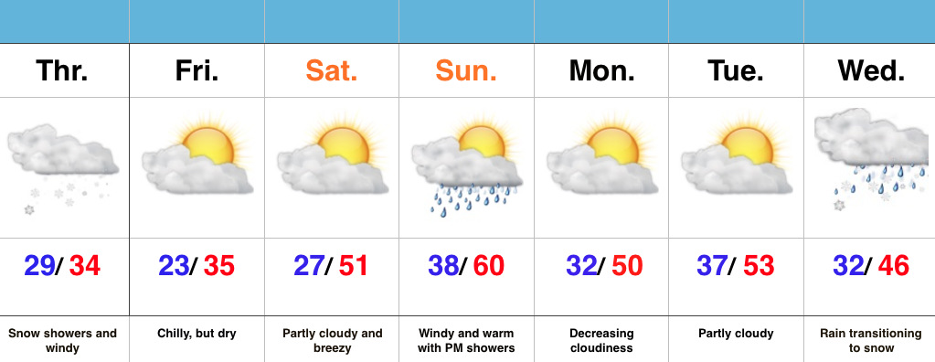
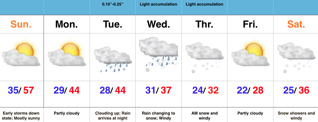
The latest SST configuration has to continue putting a smile on the face of central and eastern winter lovers for the upcoming season.    We’re not going to feel anything…

You must be logged in to view this content. Click Here to become a member of IndyWX.com for full access.  Already a member of IndyWx.com All-Access?  Log-in here.

We’re Getting Spoiled…

Screen Shot 2015-11-02 at 7.31.53 AMHighlights:

  • Stretch of beautiful weather continues
  • Breezy winds arrive Thursday
  • Stormy end to the work week
  • Cooler weekend

In the short term there’s no reason to waste a bunch of pixels on our forecast.  High pressure will supply beautiful conditions and a building ridge will only promote warmer days ahead.  Look for lots of sunshine and well above normal, near-record, warmth.

Southwest winds will become gusty Thursday and this is in advance of an approaching cold front that will deliver showers and thunderstorms Friday morning.  The cold front will move through Friday afternoon and usher in much cooler air for the upcoming weekend.

Upcoming 7-Day Rainfall Forecast: 0.50″ – 1.00″

Beautiful Weather…

Screen Shot 2015-11-01 at 8.24.24 AMHighlights:

  • Lots of sunshine to open November
  • Unseasonably warm weather
  • Late week storms with a cold front

We couldn’t ask for better weather to open November.  Look for an extended stretch of unseasonably warm, tranquil conditions.  It’ll be perfect to finish last minute yard clean up or get an early start on putting those Christmas decorations up.  Enjoy!

The next weather system of note will arrive Friday in the form of a cold front.  While timing issues are present, we’re keeping an eye on the possibility of scattered showers and thunderstorms (some strong).  A drier and cooler air mass will build in next weekend.  An early look at weather next Sunday would suggest frosty conditions for many…

Upcoming 7-Day Rainfall Forecast: 0.25″ – 0.50″

Unseasonably Warm Open To November…

Screen Shot 2015-10-31 at 8.56.22 AMHighlights:

  • Windy and showery Halloween
  • Dry time returns with warmth
  • Watching a more substantial storm at the end of the week

Good morning and happy Halloween, friends!  We’re off to a cold and blustery start.  Temperatures in the 40s, along with a stiff east breeze is presenting a chill in the air!  A rather gloomy day is on deck with “showery” conditions at times, but there will be more dry time than not.

The second half of the weekend will turn brighter and very pleasant, and this will really set the tone for what will be a very tranquil first few days of November (where is time going)?!  Unseasonably warm conditions will be with us for the balance of the upcoming work week and provide a great opportunity to get those yard chores taken care of or Christmas lights put up.

A more substantial storm system will arrive late week with showers and thunderstorms followed by colder air next weekend…

Upcoming 7-Day Rainfall Forecast: 0.50″ – 1″

Thursday Morning Weather Rambles…

1.) We’re running 15°-20° colder this morning than this time yesterday. Wind chills in the upper 20s-lower 30s are being felt as winds remain gusty this morning.         2.)…

You must be logged in to view this content. Click Here to become a member of IndyWX.com for full access.  Already a member of IndyWx.com All-Access?  Log-in here.