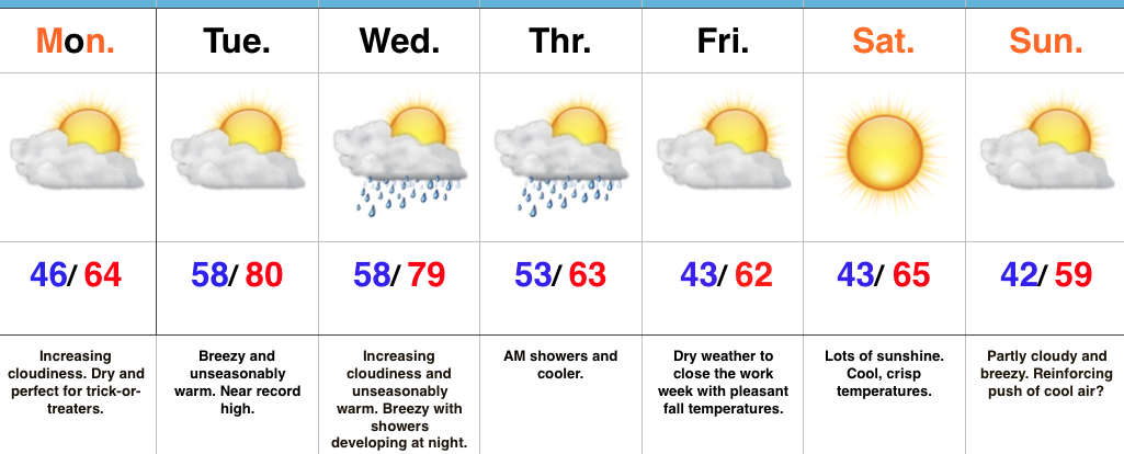
One More Warm Day; T-storm Chances Tonight…
 The 2016-2017 IndyWx.com Winter Outlook is now available.
Highlights:
- Unseasonably warm Wednesday
- T-storms tonight
- Cooler close to the work week
Cold Front Arrives Late Tonight…The majority of today will be dry (and warm), but we do note some of the high resolution model data suggest we deal with an initial round of scattered showers and thunderstorms this evening (in the 4p-7p time frame). This would be in advance of more widespread showers and thunderstorms tonight into the wee morning hours Thursday.
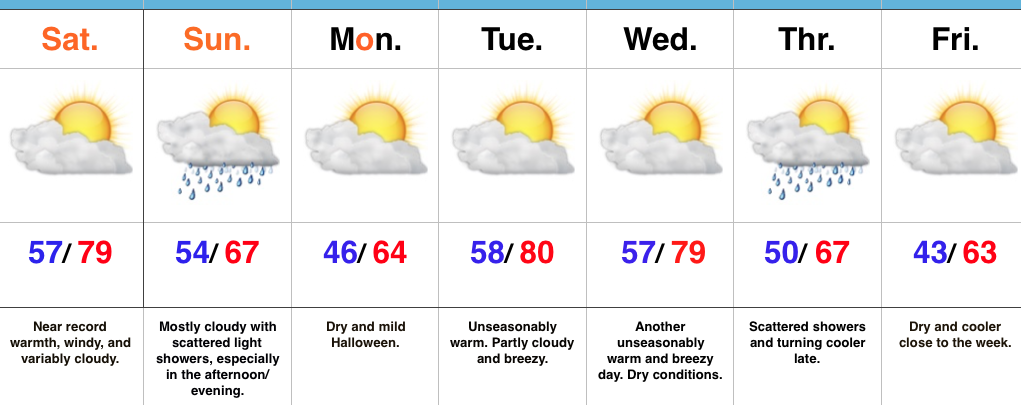
Cooler air will flow into the region to wrap up the work week and dry conditions will prevail through the upcoming weekend. We note patchy frost potential Saturday morning away from the city.
Our next storm system will approach early next week. From this distance, Election Day looks mostly dry through the daytime hours, but shower chances will begin to increase by evening.
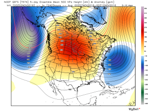
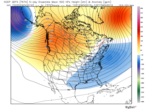
Longer term, model data continues to suggest we’re in line for a mid-month pattern change to cooler conditions. While this will initially be a “step-down” (back and forth) process, the potential is on the table for a downright wintry pattern to develop by late month. We note the GEFS (GFS ensembles) keying in on this (images courtesy of weatherbell):
Days 1-5
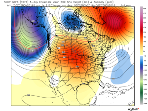
Days 6-10
Days 10-15
Upcoming 7-Day Precipitation Forecast:
- Snowfall: 0.00″
- Rainfall: 0.50″ – 0.75″