Warm Easter Weekend…
 Highlights:
- Warm Easter weekend
- Scattered storms, but more dry time than wet
- Bigger storm system looms late next week
Summer-Feel This Weekend…The big weather story for the Easter weekend will be the unseasonably warm temperatures, including a “touch” of humidity for the first time this spring. That warmth and humidity will aid in storm development, at times, this weekend, but the balance of the holiday weekend will be rain-free.
We think best storm coverage comes this evening (primarily after the evening rush) and again on Easter Sunday. While an isolated storm is possible Saturday, most of the day should be dry.
A cold front will sweep through the state Easter evening and help set-up a dry, slightly cooler regime to open the new work week. Dry conditions remain Tuesday before scattered storms return to the forecast Wednesday. A bigger, more significant storm system looms by the end of next week and could result in heavy rainfall totals. We’ll keep an eye on things.
Upcoming 7-Day Precipitation Forecast:
- Snowfall: 0.00″
- Rainfall: 0.50′ – 1.00″
 Temperatures will rise from the upper 30s and lower 40s into the middle 60s by evening.
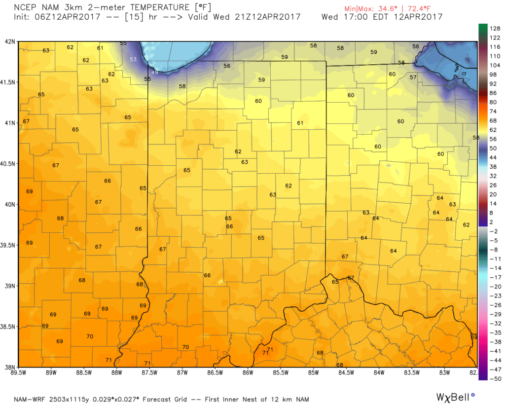 As we push into Thursday, moisture will return and will lead to an increase in cloud cover, along with scattered showers, especially across northern regions. It won’t rain the entire day by any means, and some neighborhoods likely won’t see a drop of rain Thursday, but we need to be prepared for a passing shower, especially from mid-morning into the evening.
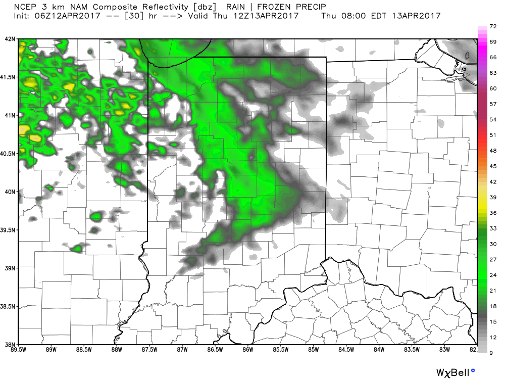
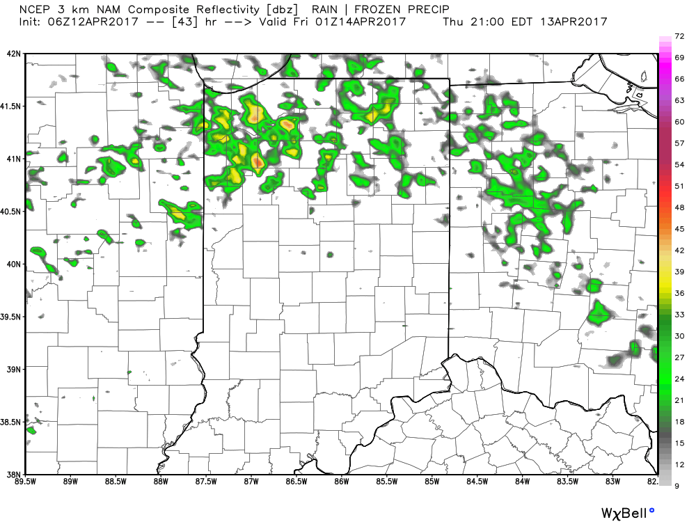 Looking ahead to Easter weekend, unsettled weather is still expected with scattered showers and thunderstorms associated with a warm front lifting north through the region Friday into Saturday before a cold front sweeps through Easter Sunday with additional thunderstorm chances. That said, there will be plenty of rain-free hours this Easter weekend and warmth will dominate. In fact, highs will flirt with 80° Friday and Saturday. More on the Easter weekend forecast and our full 7-day later today!
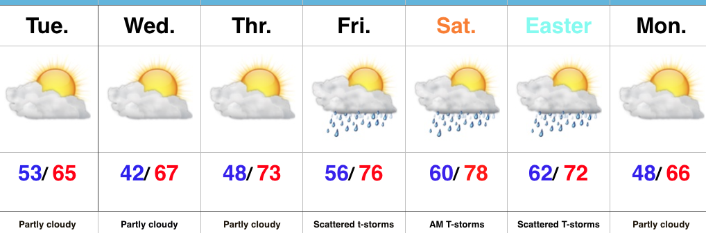 Highlights:
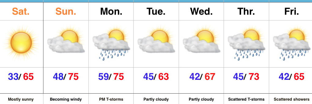 Highlights:
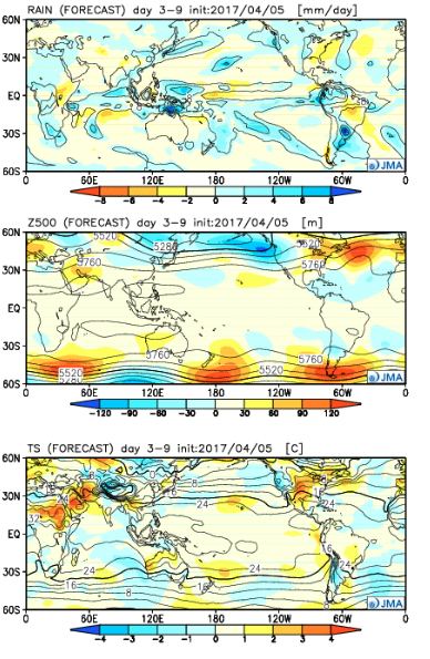 Week 2:
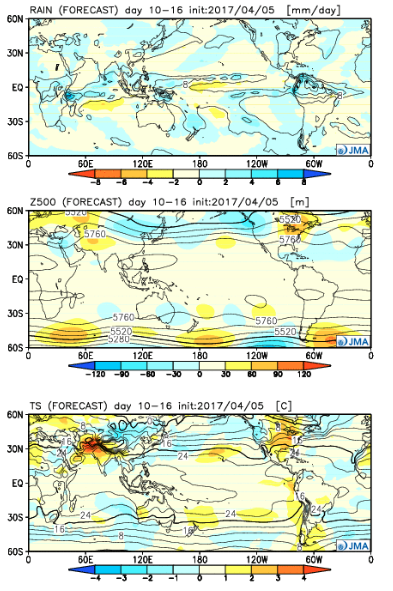 Weeks 3-4:
 The big picture is one that shows a drier pattern developing across the East during Week 1, but we caution that this drier regime doesn’t look to “lock” in. Data suggests we get back to an active pattern between Week’s 2-4, biased wetter than normal in the Mid West and Plains. The other screaming message is that a busy severe season should continue through the period. Cold sets up across the Pacific Northwest, associated with the “mean” trough position, while spring-like warmth continues to build across our region in overall terms. We know what that means as storms eject off the Rockies and track east…