Enjoy The Mild Weather While You Have It…
 Highlights:
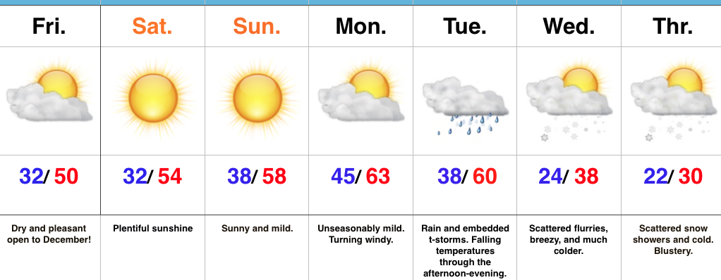
- Mild open to December
- Early week rain and storms
- Hello winter
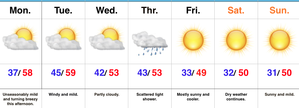
Great Weekend By December Standards…High pressure will build in overnight and provide beautiful weather to open December. We’ll enjoy plentiful sunshine and well above average temperatures through the weekend and on into early next week. Take our word for it: Enjoy it while you have it!
An approaching storm system will lead to increasing clouds later Monday along with an increasingly gusty southwest breeze Monday afternoon into the evening. A cold front will move through the state Tuesday with widespread rain and embedded thunderstorms. Strong and gusty winds will continue. Once the front sweeps through the state, falling temperatures can be expected Tuesday evening.
The true shift to winter will begin the middle of next week, complete with MUCH colder air, gusty northwest winds, and scattered snow showers. Speaking of winter, if you’re a fan of the cold and snow for the holiday season, the upcoming pattern change will put a smile on your face. A prolonged stretch of cold and wintry conditions should continue through the holidays and into the new year…
Upcoming 7-Day Precipitation Forecast:
- Snowfall: Trace – Dusting
- Rainfall: 1″ – 2″
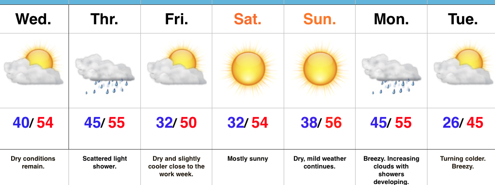 Highlights:
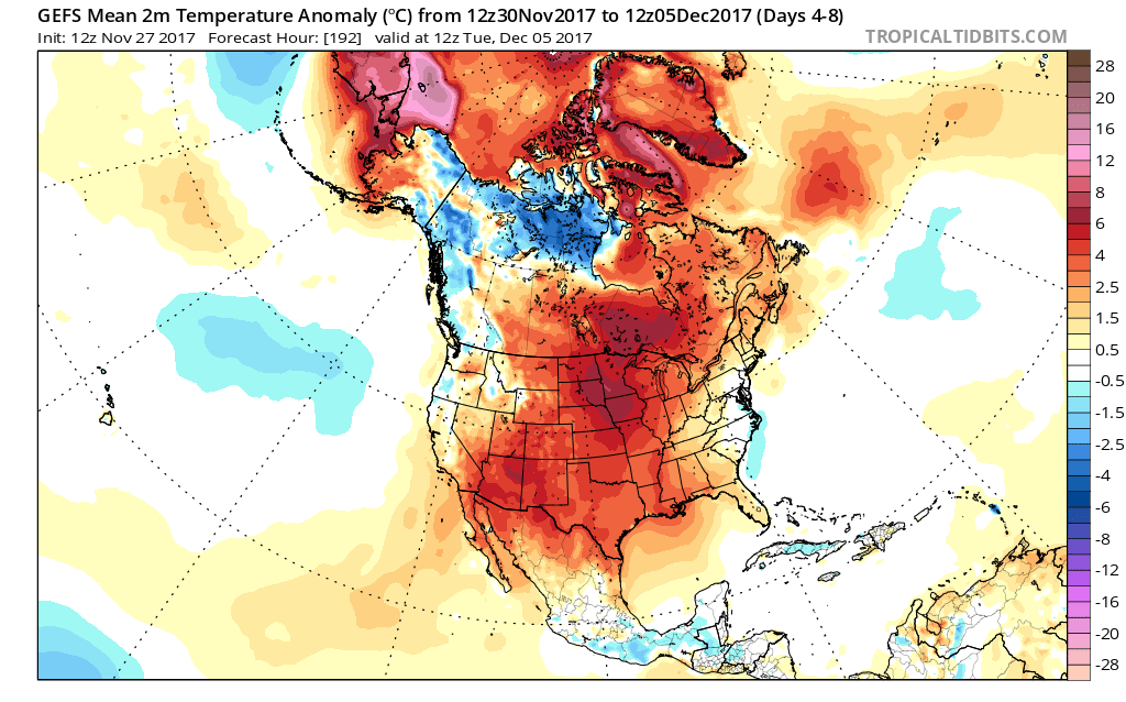 When we look ahead, the shelf life of this warmth is certainly limited. The GEFS showcases this shift in the pattern from a warm open to the month towards a much colder pattern very nicely. The GEFS has other model support, as well.
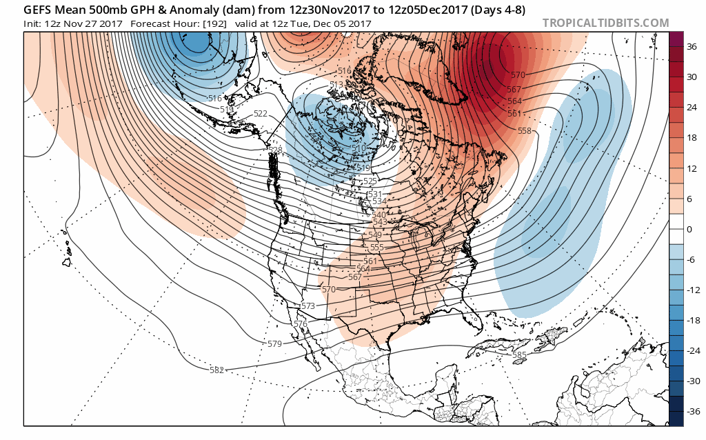 This is the type of dramatic shift in the overall pattern that not only threatens to “lock in” a colder than average regime, but potentially lead to plenty of wintry mischief to boot, and just in time for the holiday season.
 To summarize, while unseasonably quiet and mild conditions will rule in the short-term, Mother Nature sure seems to have an attitude of making up for “lost time” in the medium to longer range. This is the type pattern that we’ll have to monitor the potential of some sort of leader-follower scenario as the transition from warm to cold takes place, and given the blocky nature of the pattern, it sure seems like we’re heading into a busy time of things from a wintry perspective mid and late month.
 Highlights: