VIDEO: Foggy Open To August; Discussing Rain Chances Ahead…
You must be logged in to view this content. Click Here to become a member of IndyWX.com for full access. Already a member of IndyWx.com All-Access? Log-in here.
You must be logged in to view this content. Click Here to become a member of IndyWX.com for full access. Already a member of IndyWx.com All-Access? Log-in here.
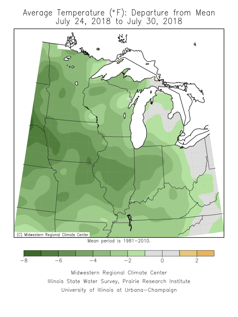
The past (10) days have been particularly pleasant across central Indiana, especially by late-July standards. 80% of the period has featured temperatures at, or below, normal, and the past couple of days have been impressively cool. Hat tip to Sean Ash (@SeanWTHR) for the most recent stat: “Just the 12th time in 147 years of back-to-back July days in Indianapolis with a high of 72° or below.” Rainfall has been plentiful across central Indiana, including widespread amounts of 1″ to 2″ with some reports of 3″ to 5″ over the past 48 hours.
As we rumble into August, you knew that summer feel had to return, right?! 🙂
Forecast models are in agreement that an upper level ridge will expand across the Great Lakes region in the 6-10 day period. This will deliver a return of warm-to-hot and muggy conditions to central Indiana- beginning this weekend into next week.
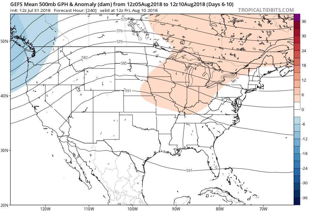
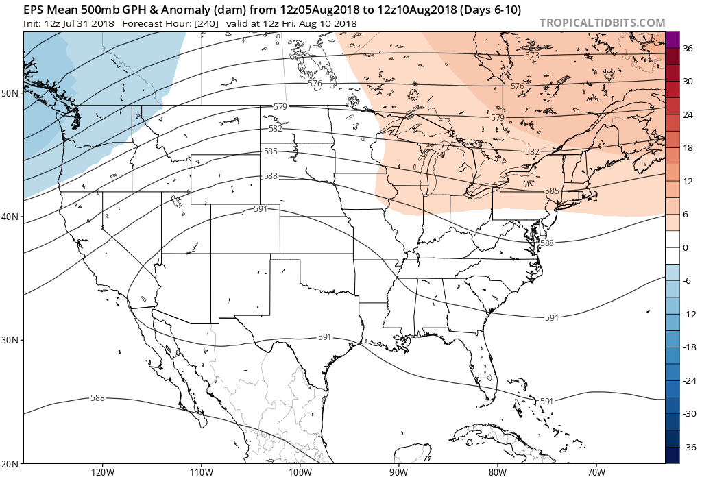
While the next couple of days will continue the cooler than normal theme, temperatures will return to a “summery” feel over the weekend, continuing into next week. Along with the warmer air will also come increasing humidity. In short, we recommend incorporating a pool visit (or two) into your weekend schedule. Highs will return into the upper 80s to around 90° and overnight lows will dip into the upper 60s to around 70°. While warmer and certainly more humid than we’ve been, we still believe the hottest of the season is behind us (highs of 94° on July 4th and 14th).

While a more summer-like feel will replace the unseasonably cool close to the month and open to August, it sure looks like the hotter regime will be transitional. The general consensus from data points towards a return of seasonable to below average temperatures along with a continuation of active times as mid-month approaches…
You must be logged in to view this content. Click Here to become a member of IndyWX.com for full access. Already a member of IndyWx.com All-Access? Log-in here.
You must be logged in to view this content. Click Here to become a member of IndyWX.com for full access. Already a member of IndyWx.com All-Access? Log-in here.
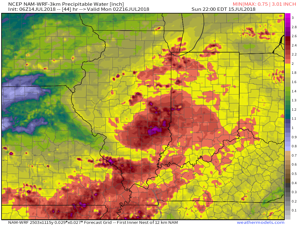
Our Saturday morning is dawning with pleasant conditions- filtered sunshine and temperatures in the mid and upper 60s for most. We’ll notice a couple of items today: 1.) increasing humidity as the day progresses and 2.) increasing storm chances later this evening. While most of the daytime hours should remain dry across central Indiana, that begins to change tonight. A cold front lies off to our northwest this morning and this front will slowly push southeast between now and Monday, passing the region Monday evening. Until the front passes, a more unsettled pattern can be expected. While it won’t storm the entire time over the next (3) days, a couple of rounds of hefty shower and thunderstorm activity can be expected. With a tropical air mass in place (PWATs flirting with 2″), locally heavy rain will accompany the storms.
The big story through the daytime today will be the heat. Most central Indiana neighborhoods will top out in the lower to middle 90s with heat indices approaching 105° at times. Take the heat seriously this afternoon and evening and ensure you have means to take frequent breaks if planning any time outdoors.
 We’ll notice thunderstorms becoming more numerous for our friends in Illinois through the afternoon and evening, but central Indiana should remain mostly dry until tonight. Forecast radar products want to bring these storms into the state after the 7p to 8p time frame. We’ll keep close tabs on radar trends this afternoon.

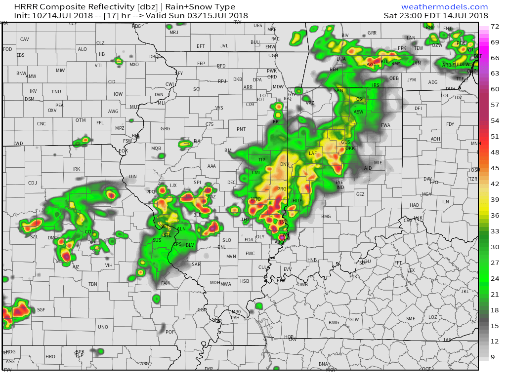 (Again, with high moisture content, any thunderstorm that passes through your neighborhood will be capable of producing torrential rainfall). For that matter, the same story can be said with storms that develop Sunday and Monday, as precipitable water values will remain around 2″ until the front sweeps through the state.
Finally, the aforementioned cold front will sweep the state Monday evening. This will put an end to rain chances through midweek and allow for a refreshing air mass to blow into the region. How do highs in the upper 70s to lower 80s sound with low humidity? Overnight lows will be allowed to fall into the 50s during this time frame.
 Overall, dry conditions should prevail until late next weekend when a secondary, even stronger, front will make a run at the region. We’ll ramp storm chances back up ahead of this expected front and the air mass behind the boundary in the Week 2 time period will be even cooler than we we’ll enjoy the middle part of the upcoming week.
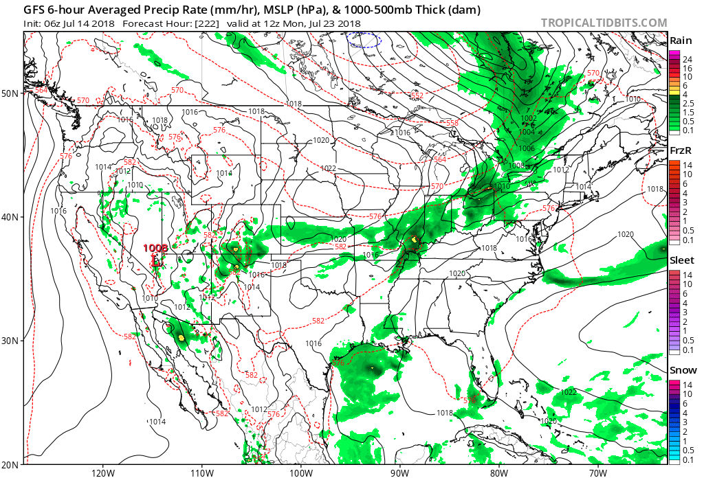 Speaking of cool, the pattern continues to look vastly different as we put a wrap on the month than what we’ve grown accustomed to over the past couple of weeks. Note the dominant trough the models show setting up shop over the Mid West…
