All-Access Long Range Update: Walking Through March…
Recently, a “transient” pattern has dominated. This has kept any sort of long-lasting cold at bay and resulted in above normal precipitation. As we get set to close out February and welcome in a new month, a pattern change is on the horizon.
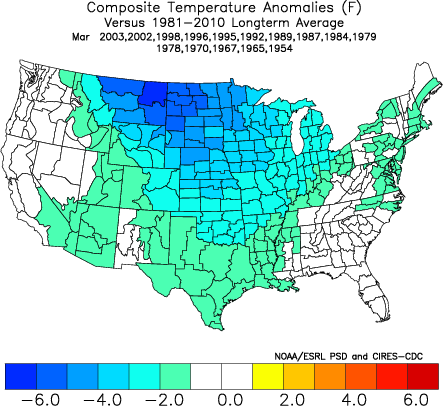
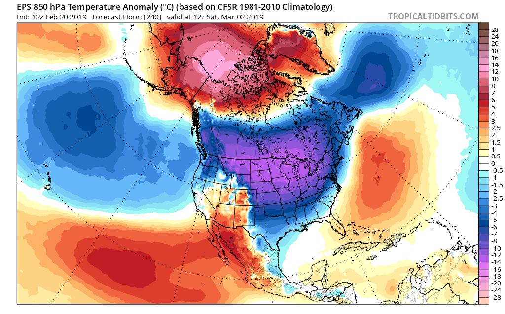
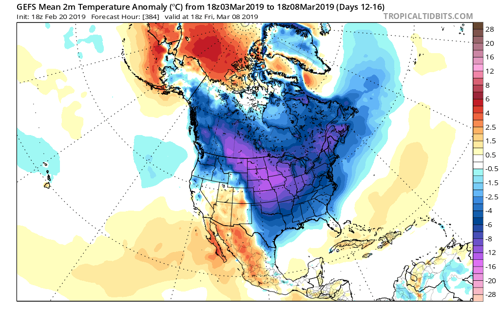
This overall shift in the pattern will drive a more sustained and significantly colder than normal regime southeast. In short, cold is set to “overwhelm” the pattern through the first couple of weeks of March. In the most extreme case (especially if we can get snow down), we will be able to challenge records at some point during the 1st (10) days of the month.
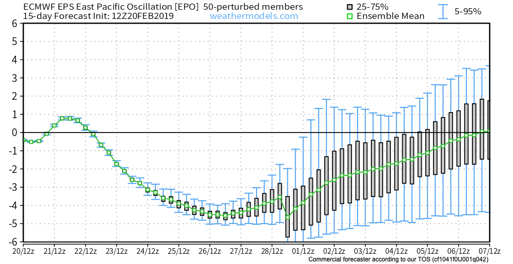
In spite of a neutral to positive AO and NAO, a significantly negative EPO and MJO rumbling through the cold late Feb and early March phases look to trump the otherwise warm signals. We also can’t forget about the significant SOI crash. Let’s dig into some of the latest data:
CFSv2

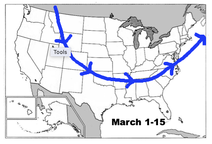
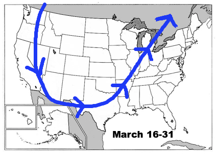
Note the modeling spreading the cold out during the Weeks 2-3 time period before gradually modifying things as we move into the middle and latter portion of March. The mean storm track shifts to the east during the first couple of weeks of the month (pattern will likely be dominated by more snow vs. rain events during this time period) before wetter than normal conditions return for the 2nd half of the month.
JMA Weeklies
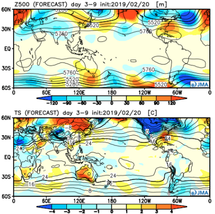
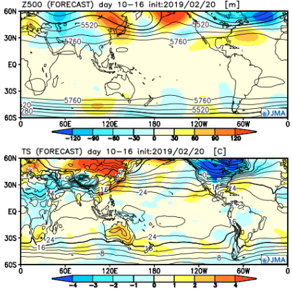
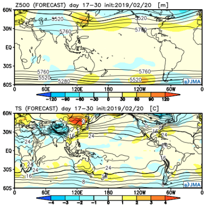
Like the CFSv2, the model overwhelms the pattern with cold during the Week 2 time period. Also similar to the CFSv2, the JMA Weeklies bring ridging back into the East and associated warmth by mid-month. While we haven’t included the precipitation anomalies in this post, the model does bring wetter than normal conditions back into the area by mid-March.
European Weeklies
The NEW European Weeklies remain consistent from Monday’s update (and data above) in delivering a very cold 1st half of March. The core of the cold looks to be centered over the upper Midwest and Northern Plains, but temperatures for the balance of the first couple weeks of the month will likely resemble what we’d expect in late January or early February vs. March. While precipitation will likely run below normal (thanks to the cold pattern), the model deliver above normal snowfall during the period. As we move into the 2nd half of the month, warmer (and wetter) conditions are shown to return.
Given all of the above, we expect the primary upper air pattern to feature a central and eastern trough through the 1st half of March before that trough settles into the West during the 2nd half of the month. This will open up the eastern portion of the country for not only warmer air, but a return of moisture-laden storm systems and the potential of strong-severe storms at times.