 Highlights:
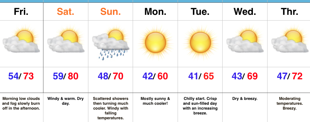
- Weekend Warmup
- Scattered showers Sunday morning
- Gusty winds and falling temperatures
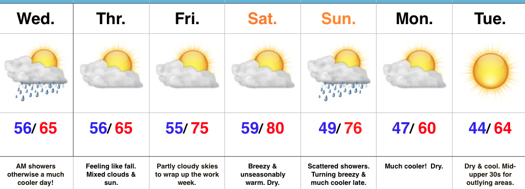
Weekend Changes…Before we discuss our weekend weather, we should finally see the “doom and gloom” depart later this afternoon as enough of a southwest breeze and drier air helps scour out the low clouds, drizzle, and fog. Improvements will come slowly, but surely as we progress into the afternoon hours.
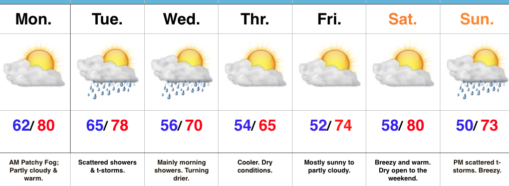
A delightful Saturday is dialed up, including what’s very likely to be our last 80° reading until next spring. Northern portions of the state will get in on some shower activity Saturday, but we’ll remain dry and windy here on the home front. As the cold front draws closer to the region, scattered showers and embedded thunder will blow into town Sunday morning. This won’t be a significant rain event and the much bigger deal will be the falling afternoon temperatures and gusty northwest breeze. You’ll need a jacket before the sun sets Sunday.
The cooler ending to the weekend is a harbinger of things to come as we open the new work week. In fact, temperatures will fall low enough to warrant a patchy frost risk for outlying areas away from the metro Monday and Tuesday mornings. Sun-filled skies and cool, crisp afternoons are on tap next week.
Upcoming 7-Day Precipitation Forecast:
- Snowfall: 0.00″
- Rainfall: 0.10″ – 0.25″

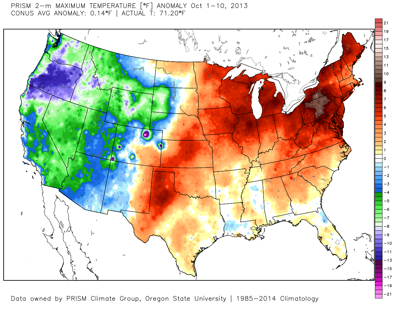
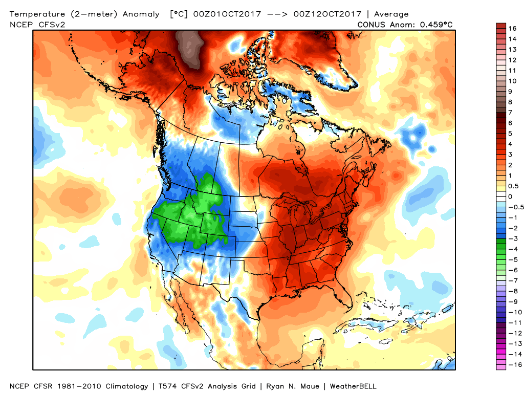 In coffee shops and my travels around the great state of Indiana, I’ve overheard lots of talk centered on because October has been so warm, another lackluster snow season awaits. Let us remind you that the infamous snow season of ’13-’14 featured a very warm first half of October.
 The upcoming 7-10 days will feature more of a transitional period of weather that we’ve come to know and love around these parts. Warmth will spread northeast this weekend ahead of an approaching cold front (around 80° Saturday) before falling temperatures Sunday afternoon behind the frontal passage. The chilliest air so far this season will descend upon the region early next week. That said, the chill won’t hold and another surge of above normal warmth will spread northeast by the latter parts of next week.
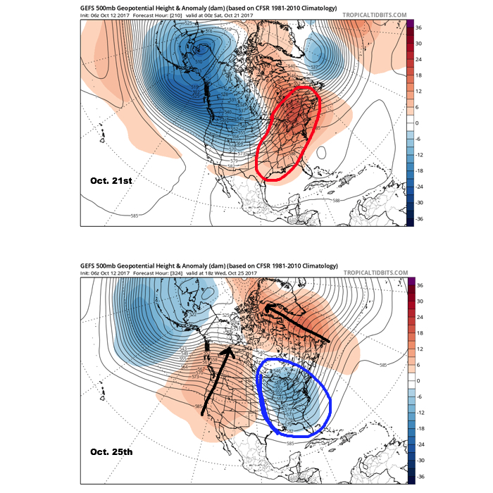 It should also be noted that analog data and research also would lean heavily in the cold direction to wrap up October and these findings also favor a chilly November… More on that later! Speaking of later, an updated 7-day will be posted this evening. Make it a great day!
 Highlights:
 Highlights:
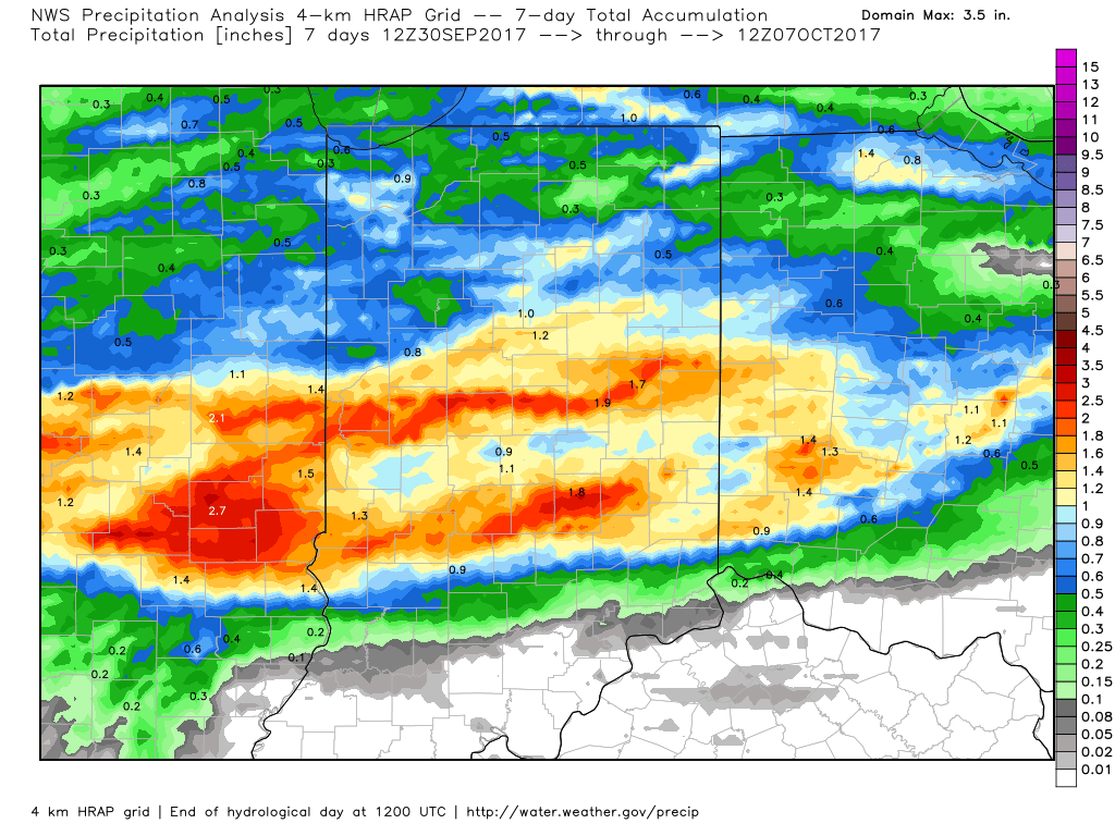
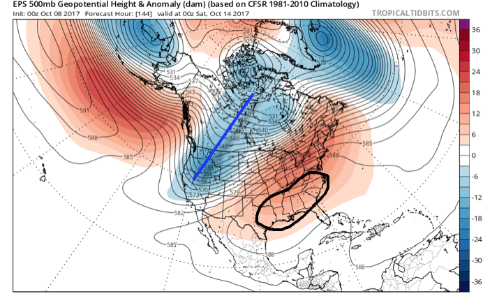
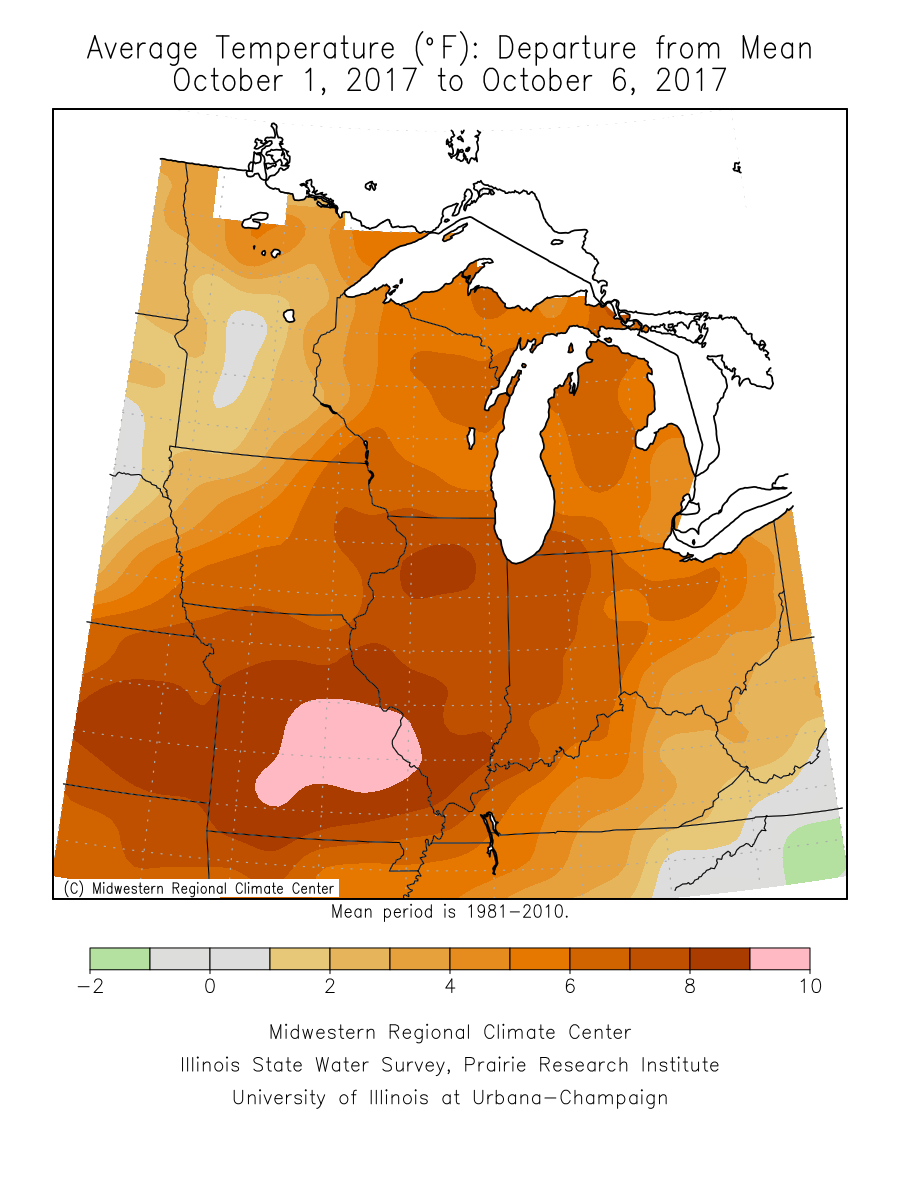 An all-too-familiar pattern engulfs the country late week. This will showcase more “bonus” summer-like conditions, locally, that will include highs approaching 80° next weekend with a strong southerly flow in place. Additionally, early winter-like conditions will continue to impact the western high ground. The pattern definitely represents a Nina look.
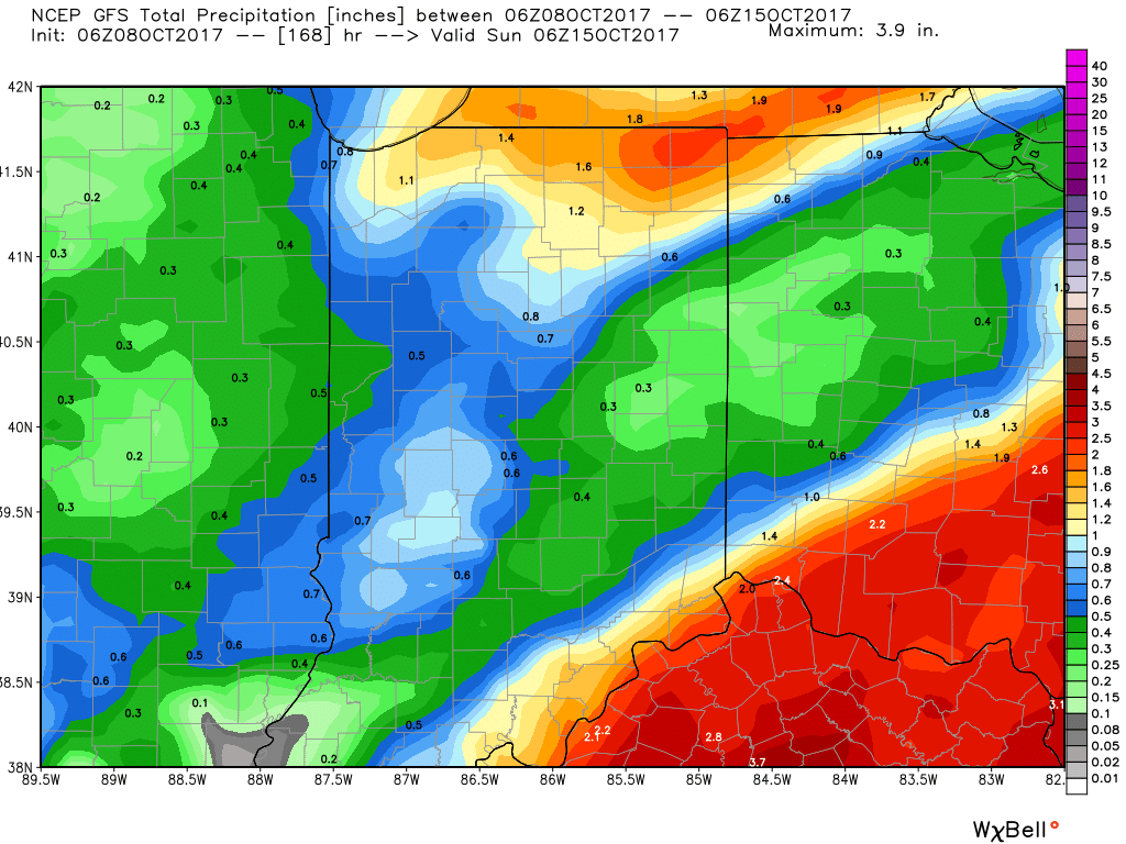 Thereafter, dry times will settle in along with slightly cooler temperatures. Let’s remember it was only a few days ago where modeling suggested a “pop” of the season’s coldest air thus far. No longer is that the case, and while it will turn briefly cooler, temperatures will still remain above average.