February 2020 Outlook: Watching The Battle Play Out…

Before we dig into the reasoning behind our February forecast, here’s what a few of the longer range models are suggesting the month will provide:

JMA
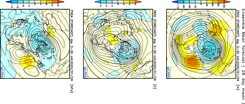
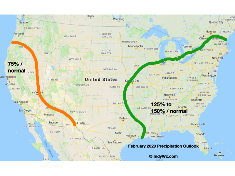
The JMA keeps the most persistent warmth confined to the southern and southeastern regions. The model would suggest our immediate area will be in a “battle zone,” including heavier than normal precipitation for the month.

CFSv2

The CFSv2 is bullish on a warm eastern half of the country with cold confined to the west. The modeled mean southwesterly air flow would result in well above average precipitation across our region, including an active storm track.

European Weeklies

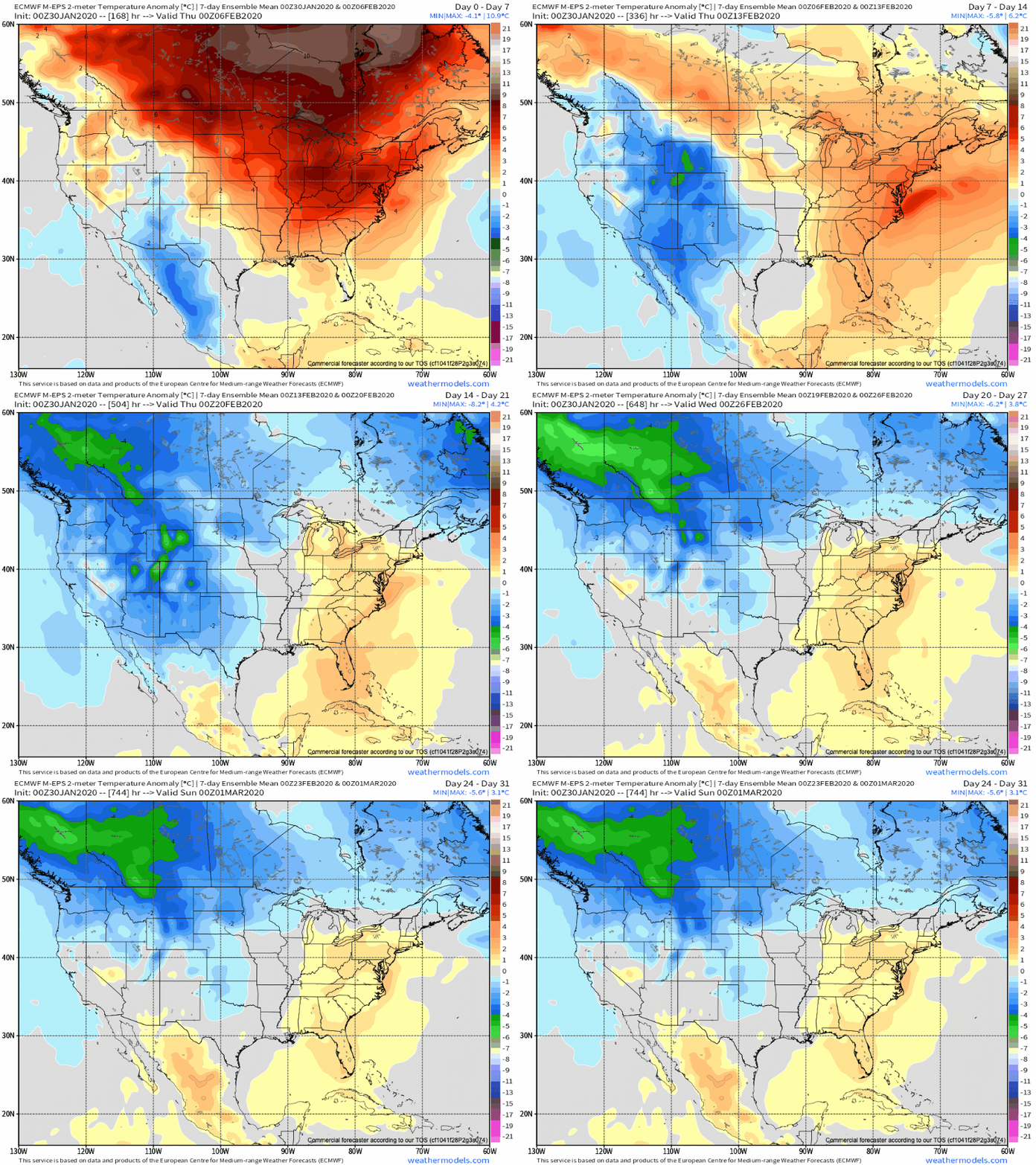
Similar to the data above, the new European Weeklies show the most persistent cold west with warmth dominating the southeast and at times into the Ohio Valley for the month of February.

February features “average” temperatures rising from a high of 37° on the 1st to 45° on the 29th. Average lows rise from 21° to 28° by the end of the month. IND averages 2.32″ of rainfall and 6.5″ of snow during the month.

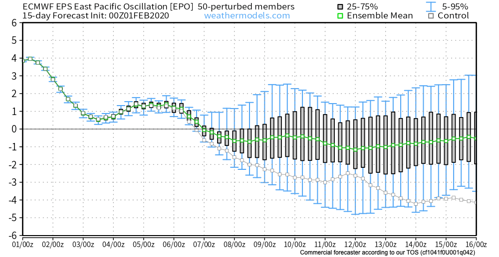
As we look at February 2020, we have an interesting battle on our hands. Latest EPO trends are negative and that is a cold signal, potentially significantly so if the current trends continue. That said, it’s also important to note that many times throughout January, medium to long range negative EPO trends didn’t materialize, and, accordingly, warmth dominated.
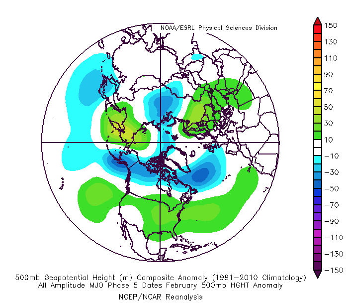
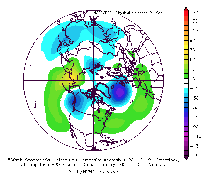
To make things more complicated, the latest MJO plots are bullish on warmth persisting, overall, for the the better part of the month. Note the trends to take things back into Phases 4-5. This would promote the tendency towards more of a persistent eastern ridge (similar to what the European and CFSv2 show above).

While our forecast will show a significantly warmer than average month, we also believe snowfall will run near average. The reason has to do with a battle ground that we anticipate sets up across the Ohio Valley throughout the majority of the month. At times, even marginally cold air will create challenges. Case in point will be the middle and latter part of this upcoming week. This will likely set the tone for the month ahead: warmer than average with well above average precipitation/ near normal snowfall. The other concern has to do with the threat of sleet/ freezing rain events. Late winter and early spring can prove to be troublesome with the kind of ‘mean’ pattern that lies ahead as shallow cold air at the surface undercuts. This will be something to keep close tabs on moving forward.

IndyWx.com February Outlook…

Things Turn More Active Early Next Week…

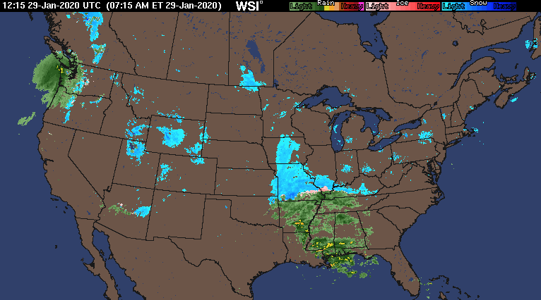
The short-term weather pattern will remain largely uneventful here across central Indiana. This morning, widespread precipitation is falling to our southwest, including accumulating snow across MO. This system will weaken significantly as it pushes east.

Some upper level energy is still capable of developing some light snow across central Indiana tonight into Thursday morning, but this won’t be a big deal and some neighborhoods won’t see any snow at all.

A ribbon of upper level energy will move across the state tonight.

An additional upper level disturbance will track southeast, skirting far northeastern parts of the area, and help generate a mixed rain or snow shower Saturday (again, not expected to be a big deal, locally).

Behind this system, a significant warm up will engulf the Ohio Valley, including a couple of days with highs between 50° and 55° early next week.

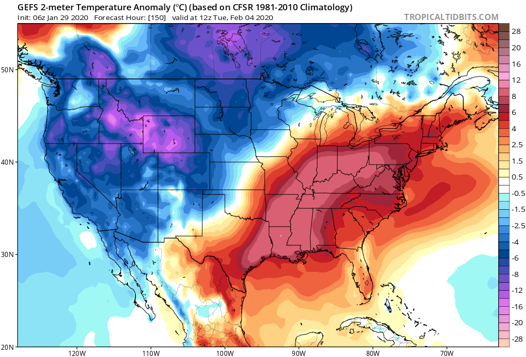
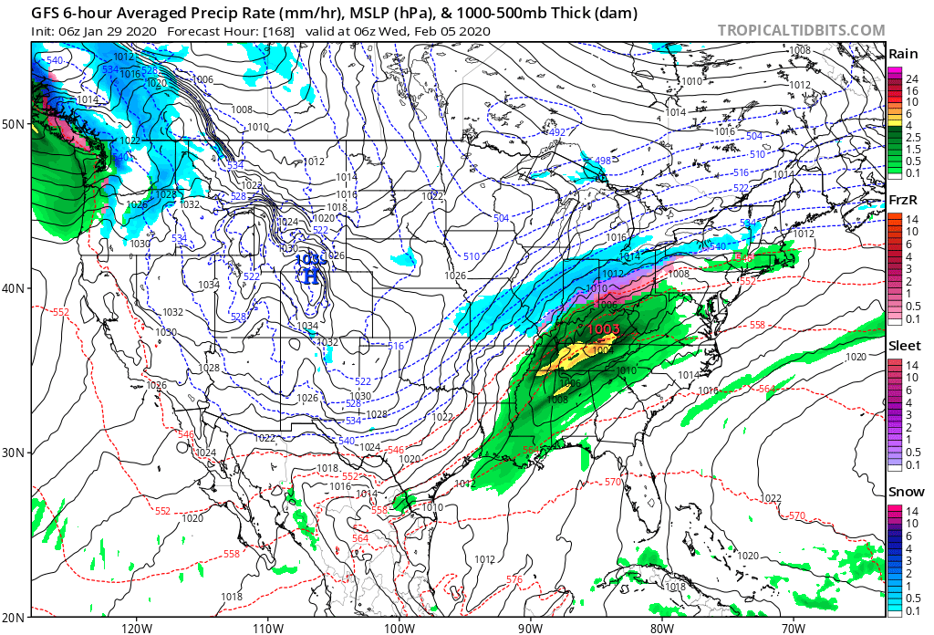
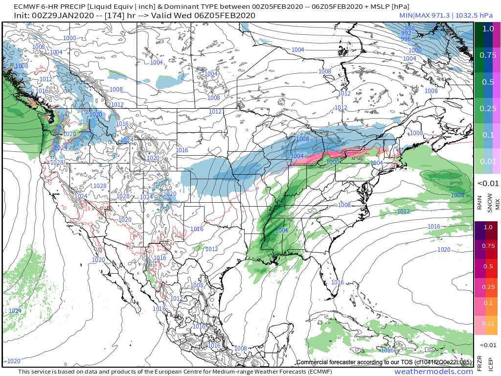
These spring-like temperatures will be in advance of a pressing cold front that will arrive on the scene during the middle part of the work week. As we’d imagine from this distance, modeling is handling the timing and specifics of the frontal system differently (image 1- GFS is more progressive and colder while image 2-the European is much slower/ warmer). We’ll take the next couple of days to sort through the details and have a higher level of confidence going into the weekend.

We’ll also have our February Outlook posted here tomorrow as part of Thursday’s long range video update.