Stormy Pattern Returns Next Week: Walking Through Two Different Possibilities…
A much colder air mass will push into the Ohio Valley region today, taking up residence into the latter part of the work week. The good news? After we get rid of the clouds today, plentiful sunshine is expected through the remainder of the week and into the weekend as sprawling high pressure dominates.
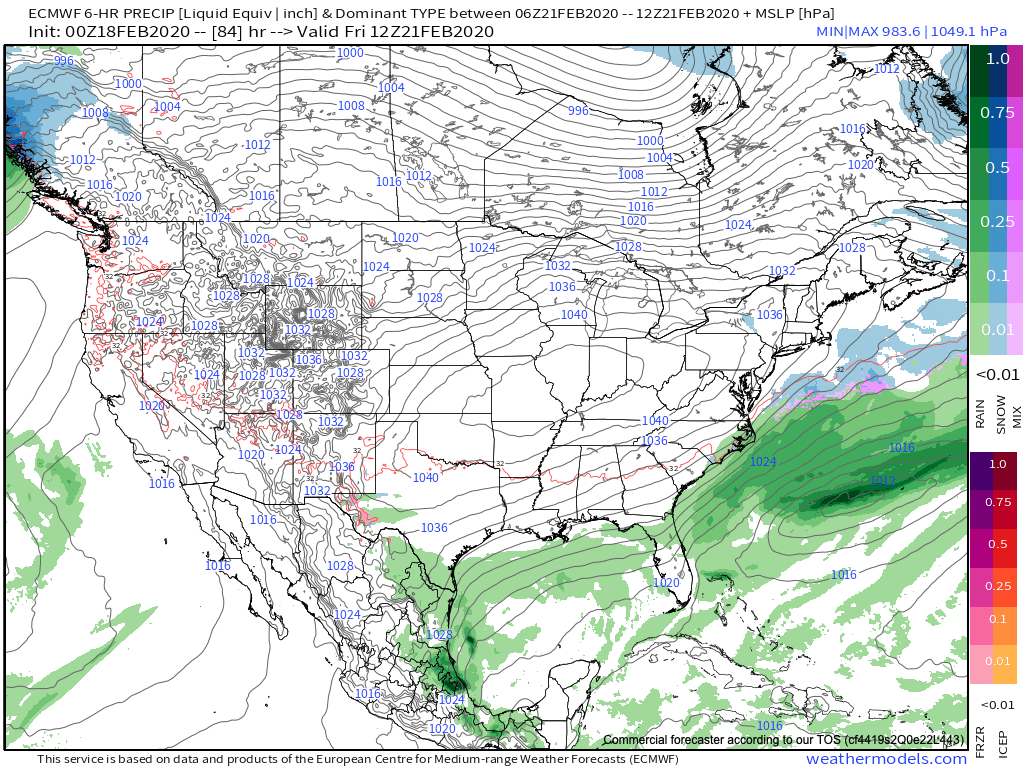
This week’s quiet weather will quickly shift to a return of a stormy regime as we push into next week. From this distance, there’s really (2) camps the majority of modeling falls into. The European paints a pattern will undercutting storms beneath a developing block across Ontario and Quebec. This would present multiple opportunities for wintry weather next week across not only central Indiana, but a large chunk of the Ohio Valley. Meanwhile the GFS says the primary storm track will be northwest of our area, allowing a milder southwesterly flow to take hold and primarily rain.

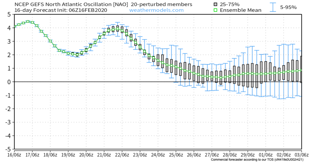
So what’s more likely to happen? We’re leaning more towards the European solution with an evolving cold pattern (that begins stormy) as we close February and open March. Note the blocking next week across Quebec and Ontario eventually give way towards more of a wholesale eastern North America trough as we welcome in meteorological spring. This continues to raise our confidence on March opening much colder than normal.
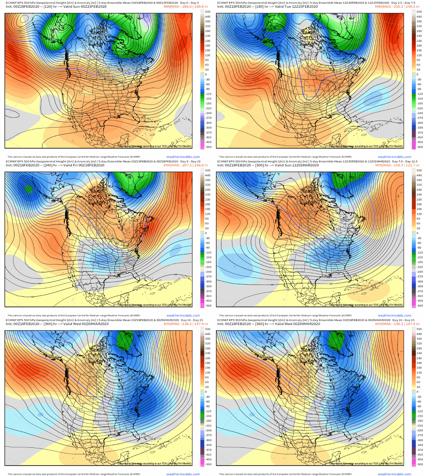
The GFS ensemble also sees this colder pattern evolving to close February and open March.

Stay tuned as we get set for another active stretch of weather around these parts next week.
As for the shift back to cold, the longevity of said cold pattern lies solely on the progression of the MJO and EPO. More to come on that with our long range Thursday update.