VIDEO: Looking Ahead Over The Next Couple Weeks…
You must be logged in to view this content. Click Here to become a member of IndyWX.com for full access. Already a member of IndyWx.com All-Access? Log-in here.
You must be logged in to view this content. Click Here to become a member of IndyWX.com for full access. Already a member of IndyWx.com All-Access? Log-in here.
You must be logged in to view this content. Click Here to become a member of IndyWX.com for full access. Already a member of IndyWx.com All-Access? Log-in here.
You must be logged in to view this content. Click Here to become a member of IndyWX.com for full access. Already a member of IndyWx.com All-Access? Log-in here.
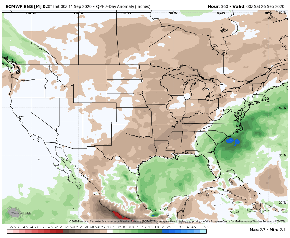
Unfortunately there likely won’t be any significant changes to our precipitation pattern until late autumn and winter. Until then, we’ll have to take any drop of rain we can find. Once the pattern flips though, it may do so in quick and rather dramatic fashion (still expecting a wet winter).
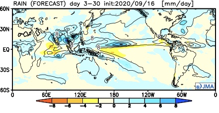
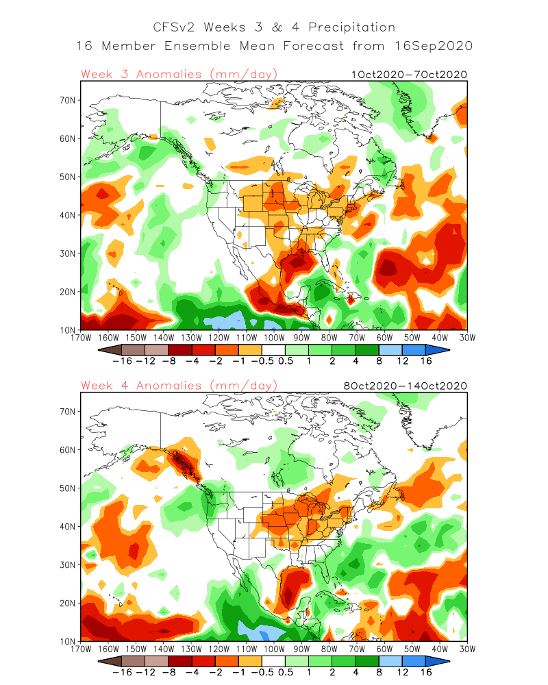
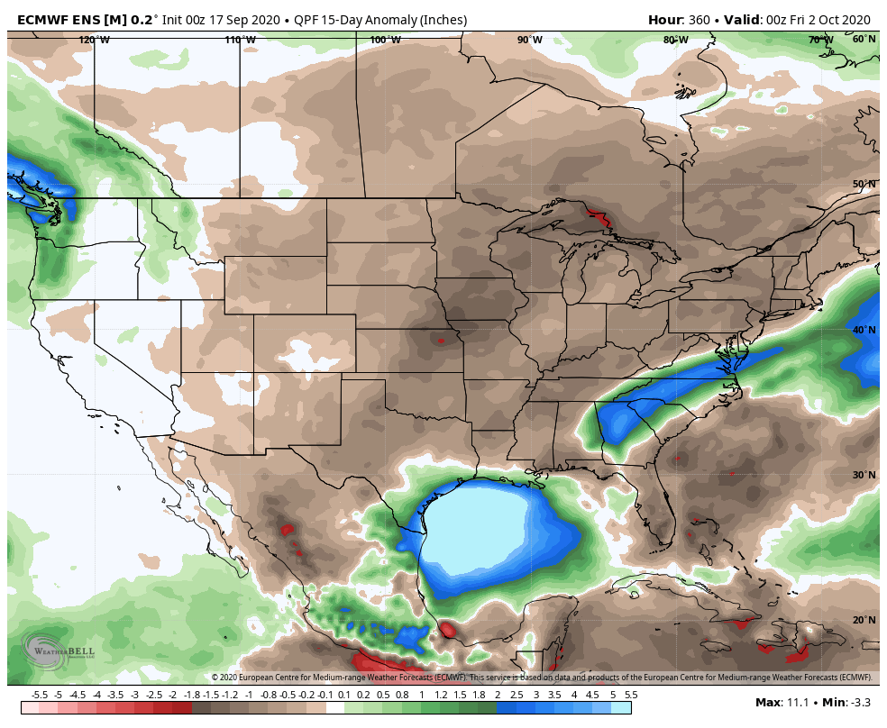
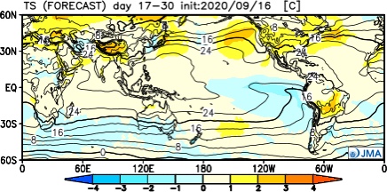
The consensus of long range data shows the dry pattern continuing over the upcoming few weeks, including the JMA Weeklies, CFSv2 Weeklies, and ensemble products.

Analogs and other teleconnections support this dry theme. At least in the immediate range (through mid October) the only way to bust up this dry pattern is to get tropical moisture involved.
The new JMA Weeklies maintain the ‘mean’ ridge position across the West for the majority of the upcoming few weeks, but there will likely be attempts to expand the ridge across the northern tier Week 2 and 3 that would lead to at least transitional periods of much warmer air, after the cool period in the short term.
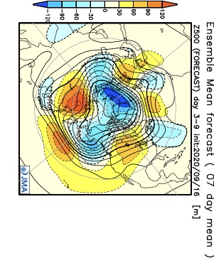


The model sees the ridge expanding Weeks 3-4 and the associated warmth that spreads east after the chilly regime.

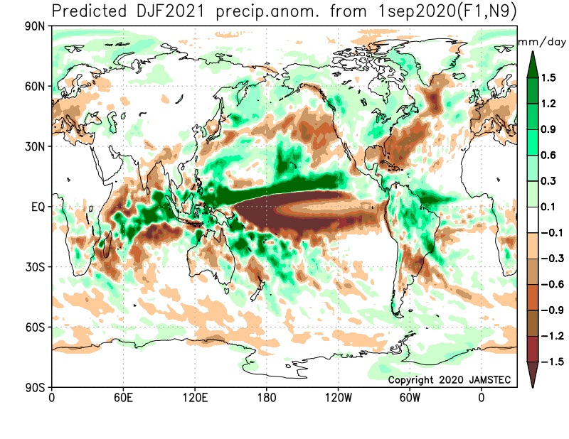
The new JAMSTEC seasonal data is also in and maintains a warm look this winter. A lot of this has to do with an expected persistent southeastern ridge. We agree with this but, as is the case each winter, there will be challenges that have to be dealt with.
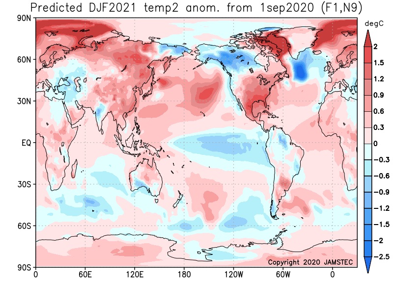
We also agree with the active storm track through the Ohio Valley and associated well above normal precipitation in the December through February period.
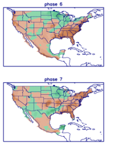
We believe the pattern during the 2nd half of the month will be driven by the MJO and PNA. The MJO is forecast into Phase 6 and 7 by the 18th-24th time frame.

Phase 6 is quite warm, but notice how the chilly air begins to push during Phase 7.
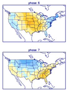
Neither phase is overly wet, but there’s hope compared to how dry it’s been over the past 2-3 weeks.
Interestingly enough, after a “neutral” phase with the PNA, both the GFS and European ensemble products predict a strong positive shift just after the 20th. This suggests to me that the week starting around that point should feature more widespread and stronger chill, compared to normal.


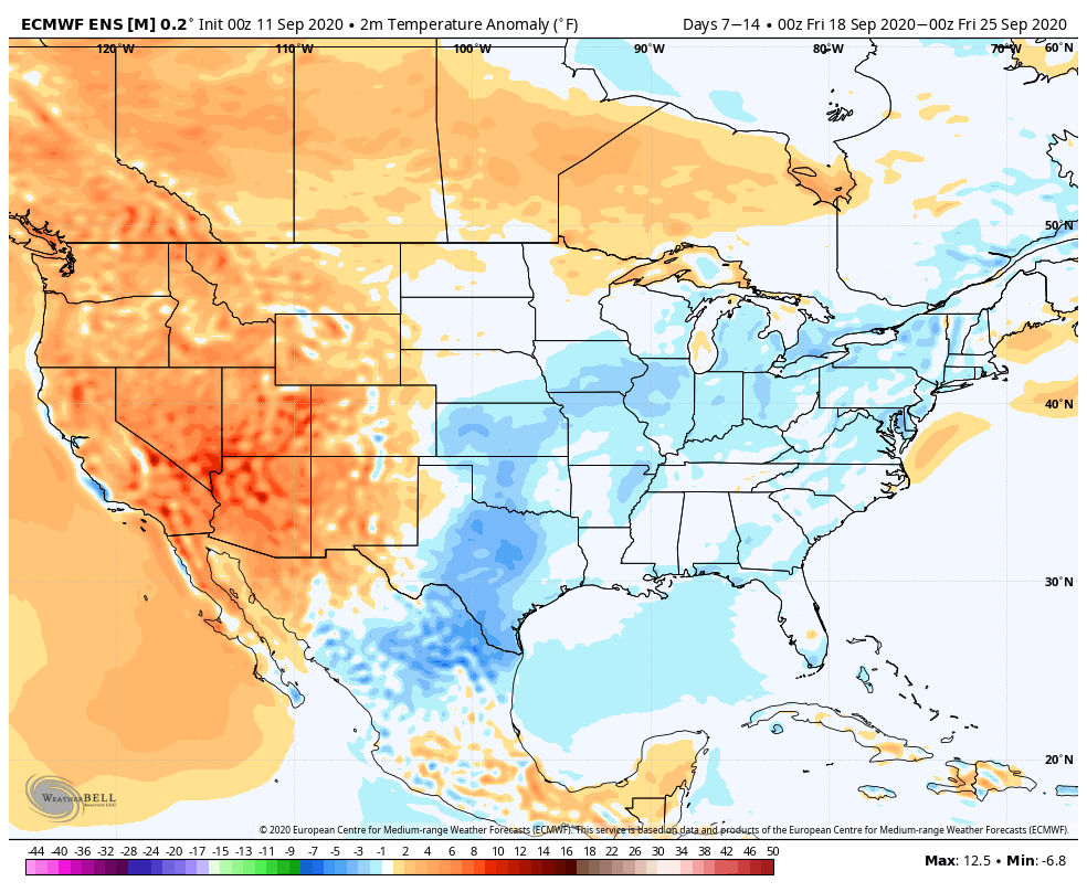
Let’s look at the latest model guidance, starting with the European ensemble:
Week 1 is still warmer than normal across our region, but notice the strong cooling by Week 2 (Sept. 18th-25th time frame).

The GFS ensemble is similar during the Week 1 and Week 2 time frame.

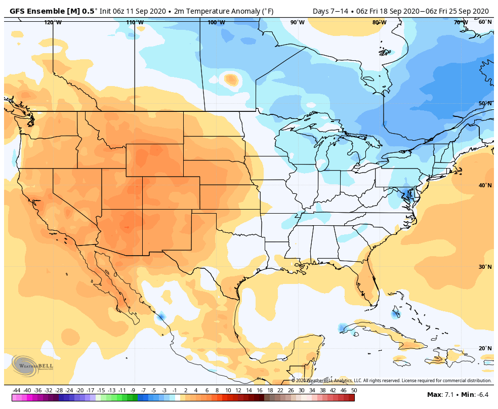
Given that strong PNA by late month, it wouldn’t surprise me to see these anomalies grow cooler as time gets closer during that Week 2 period.
Overall, the pattern continues to look dry, although there should be a better shot of rain/ storms as the cold front moves into the region that will ultimately deliver the much cooler air late month.