VIDEO: Tracking Multiple Systems In The Week Ahead…
Updated 12.29.21 @ 8:17a
You must be logged in to view this content. Click Here to become a member of IndyWX.com for full access. Already a member of IndyWx.com All-Access? Log-in here.
Updated 12.29.21 @ 8:17a
You must be logged in to view this content. Click Here to become a member of IndyWX.com for full access. Already a member of IndyWx.com All-Access? Log-in here.
Updated 12.26.21 @ 7:38a
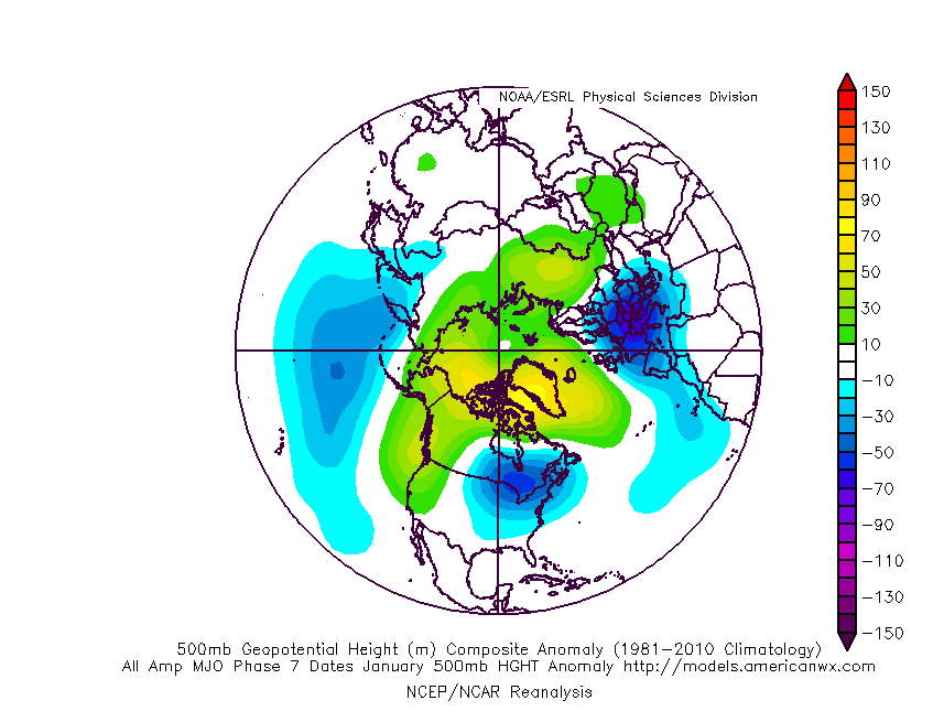
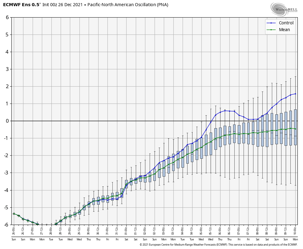
Over the past couple of weeks, several of the teleconnections (EPO, AO, and NAO) have been in favorable phases for cold air to take up residence in our neck of the woods. However the combination of Phase 6 of the MJO (image 1 below) and a deeply negative PNA (image 2 below) have fought off any sustained or significant cold.


As we look ahead, there are changes in both of these critical pattern drivers. First, the MJO looks to continue progressing deeper into Phase 7. This is significant as today, though while officially in 7, we’re really still feeling the effects of 6. There’s a lean from guidance that Phase 8 is also within reach as we get towards mid-January, but we won’t get greedy. 🙂 If we can at least get deeper into 7, that will greatly lessen the influence of the warmth that continues to linger with Phase 6.

Note how the trough likes to settle into the eastern portion of the country during these phases.

That then brings us to the PNA. Guidance is trending things closer to neutral towards Day 10. This is significant as it would allow the southeastern ridge to at least get beaten down (not totally squashed as long as we remain negative), but certainly enough to allow the cold currently bottled up out west to bleed east.
This can be illustrated best by looking at the 500mb pattern evolution over the next couple weeks per the latest GFS ensemble below.
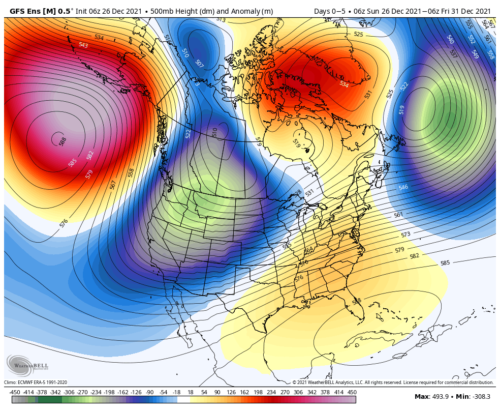
To summarize, while we still have warm days ahead of us, there does at least appear to be a couple trends heading in the right direction for all of those longing for colder and potentially more wintry times as we get past the new year.
Hang in there you snow lovers. It’s far too early to jump off the ship…
Updated 12.25.21 @ 11:27a
First and foremost, from our family to yours, we want to wish you a very merry Christmas and the warmest of holiday wishes during this season!
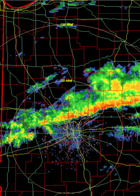
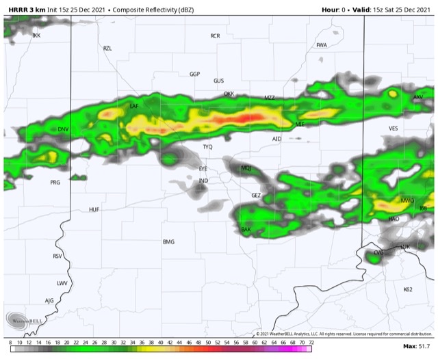
A line of rain and embedded thunder continues to plague portions of central Indiana late Christmas morning. Localized training of heavy downpours has led to this being an “overachiever” in spots across the region (closing in on 2” in a narrow strip from Frankfort over to Elwood, for example).
The trend should be a drier one through the afternoon as temperatures slowly begin to fall (how weird was it to walk outside on Christmas morning with temperatures in the lower and middle 60s?!).
With that said, the damp theme this Christmas morning can serve as a hint to what lies ahead as we put a bow of 2021 and open up the new year. A very Niña-like pattern will force the storm track into the Ohio Valley, leading to multiple storms of significance as we go through the upcoming week to 10 days.
Sunday night into Monday, Monday night and Tuesday, followed by next Saturday into Sunday all appear to provide a good soaking to central Indiana.
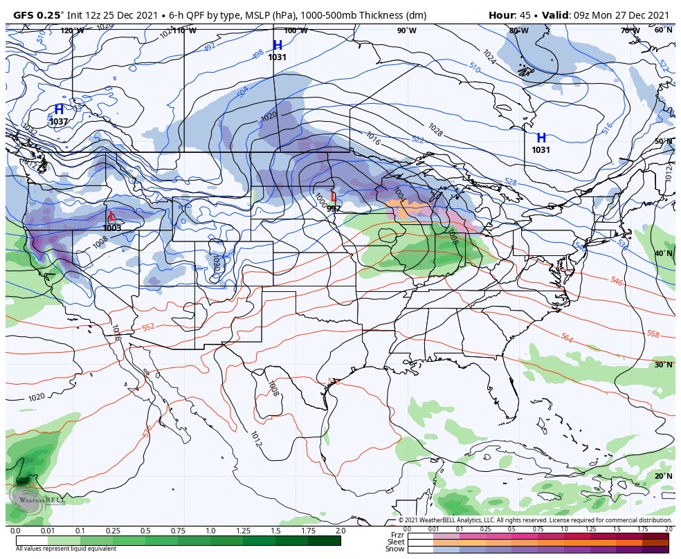

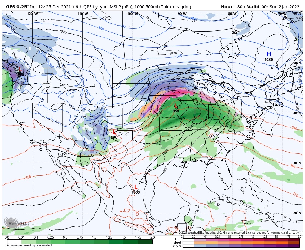
Certainly by the time all is said and done, widespread hefty totals are likely. We’ll have to hone in on specific numbers as we get closer, but it’s safe to say amounts in local rain gauges may approach 3”+ by Jan. 2nd. The heaviest rain appears slated with the storm Tuesday and again next Saturday.
Updated 12.24.21 @ 7:35a
You must be logged in to view this content. Click Here to become a member of IndyWX.com for full access. Already a member of IndyWx.com All-Access? Log-in here.
Updated 12.23.21 @ 5:32a
You must be logged in to view this content. Click Here to become a member of IndyWX.com for full access. Already a member of IndyWx.com All-Access? Log-in here.