The Expected November Transition…
Updated 10.25.22 @ 5:08p
(A friendly reminder that our annual Winter Outlook will be posted Friday morning).
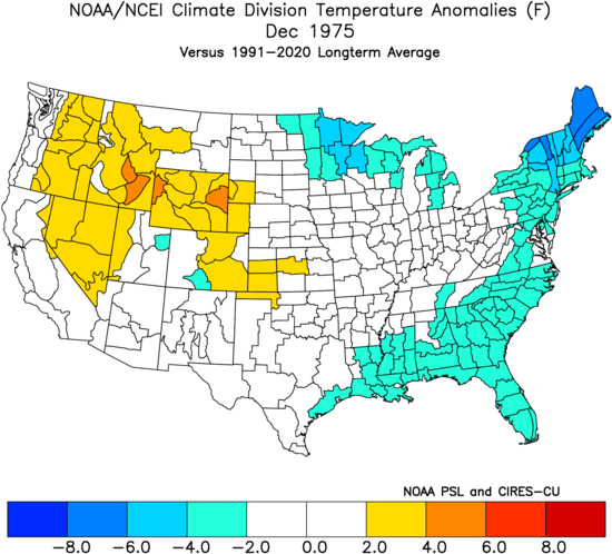
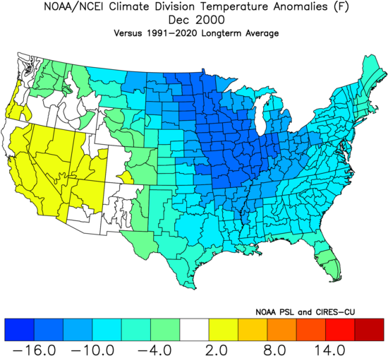
When we look at our top 2 analog years (’75-’76 and ’00-’01), we note a couple of common themes in November: cooler than normal anomalies were favored across the West while the East was favored warmer than normal. Note the temperature scale differences at the key on the bottom of both images.
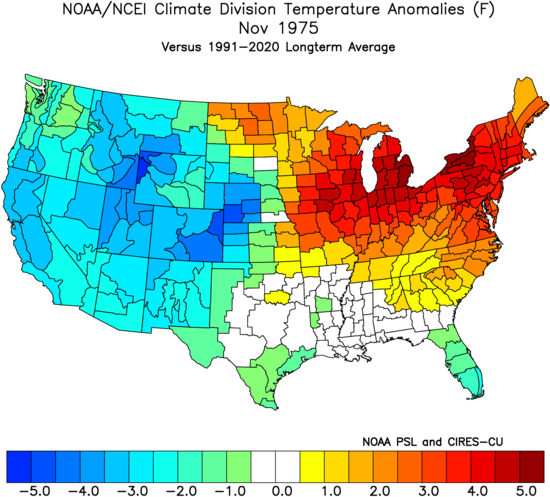
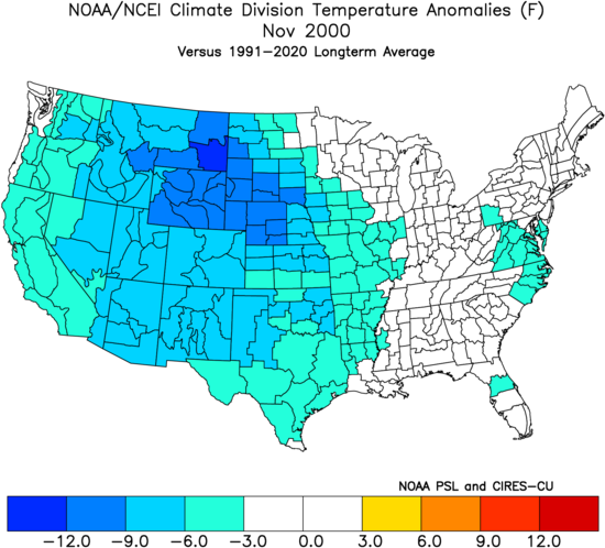
Another common theme in these Novembers? Cold started bleeding east mid and late month, which eventually set up cold, wintry Decembers and a fast start to winter across the Mid West, Great Lakes, and East.
The new European Weeklies hold the ridge east through the 1st half of November. Given the EPO, PNA, and MJO (not to mention analogs above), there’s no reason to disagree with this. In fact, early November will likely still include some 70° days, if not flirt with 75°+.


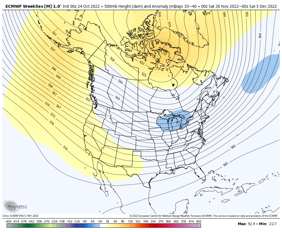
Notice what transpires as we rumble into late November and early December: A totally different look at 500mb as a trough begins to form in the exact same place the persistent ridge will reside to open the month. Winter enthusiasts have to also love the look of high latitude blocking.
Wholesale pattern “transitions” can be finicking and will require close attention as we get to mid month and closer to Thanksgiving. From this distance, there’s no reason not to think our longstanding idea of a mid month colder shift has merit. Then, it’ll be time to understand how the vastly different sea surface temperature anomalies (SSTs) may impact the December and quick start to winter idea.
More on this and the winter as a whole Friday morning!