Sunday Afternoon Rambles…

Updated 03.05.23 @ 5:08p

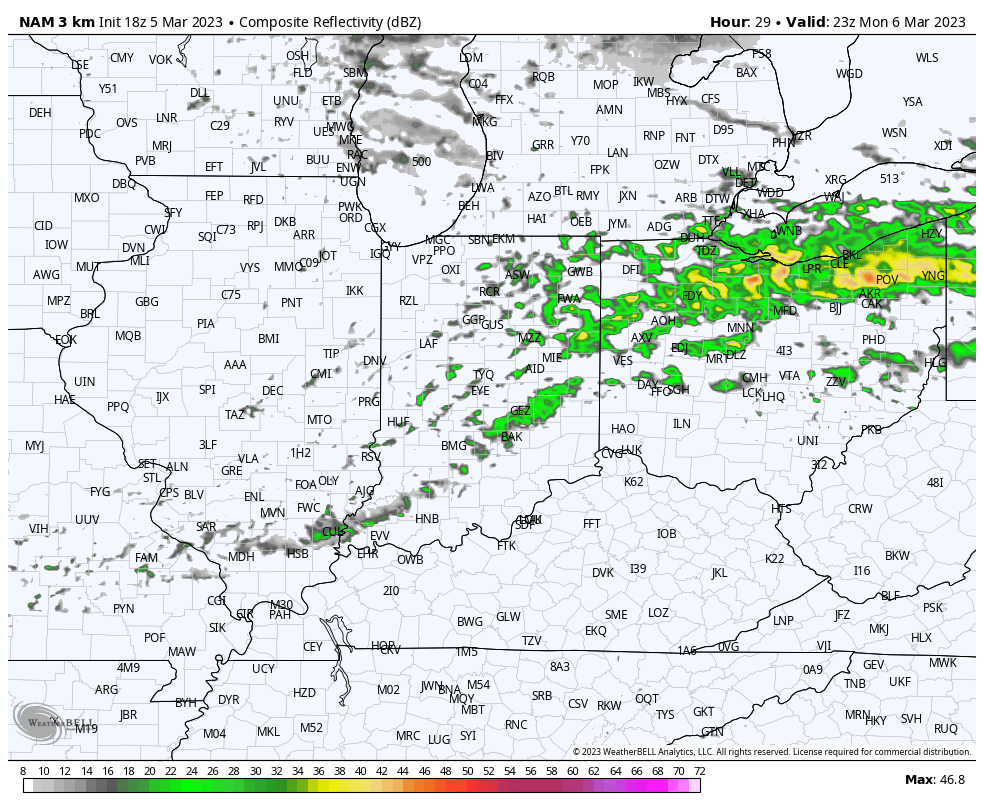
I. If you can, be sure to spend some time outside this afternoon or Monday. Highs into the 50s this afternoon will be replaced with mid to upper 60s across central IN Monday afternoon. While shower chances will return across northern parts of the state Monday morning, most of the day should be dry, locally. A few showers could sneak in here tomorrow evening (shown below) but not before what should otherwise be an unseasonably pleasant open to the work week.
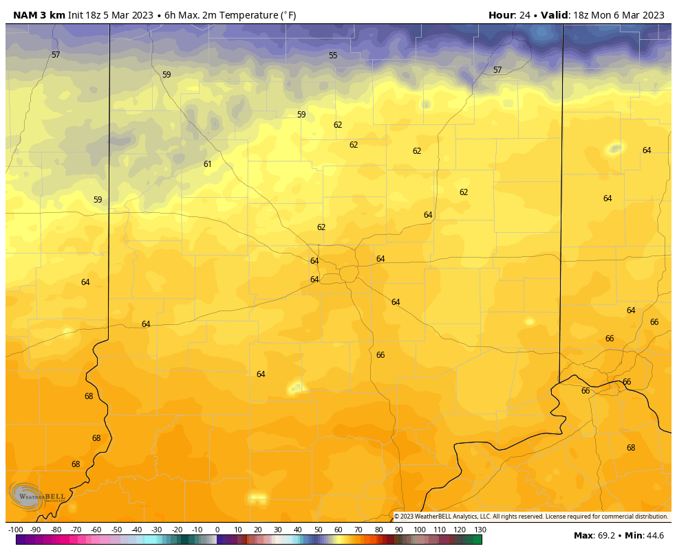
Highs should zoom into the middle 60s Monday.
A few light showers may move in towards 5p, or so, Monday. Eastern and northern portions of the area appear at greatest risk of a passing shower Monday evening.

II. A colder airmass will settle south into the region for midweek. We’re talking about lows falling back below freezing and highs in the 40s with a gusty northerly breeze at times, but we should stay on the dry side.

III. Our next system of significance is slated to impact the area as we close out the work week. Models are struggling mightily with respect on how they handle upper level energy transferring to the east coast. As such, operational guidance ranges anywhere from more of a “white to wet” solution in the Thursday evening and Friday time frame. We still have time to watch things unfold but the initial thought is that this won’t be a big deal from a wintry perspective, locally. At this point, I’m not even confident enough to say this will be a heavy precipitation producer, but can see a scenario where that changes should the energy phase a little sooner. Stay tuned, but as of now, it appears as if the pattern will be too progressive to allow this to become a big event for our immediate region.
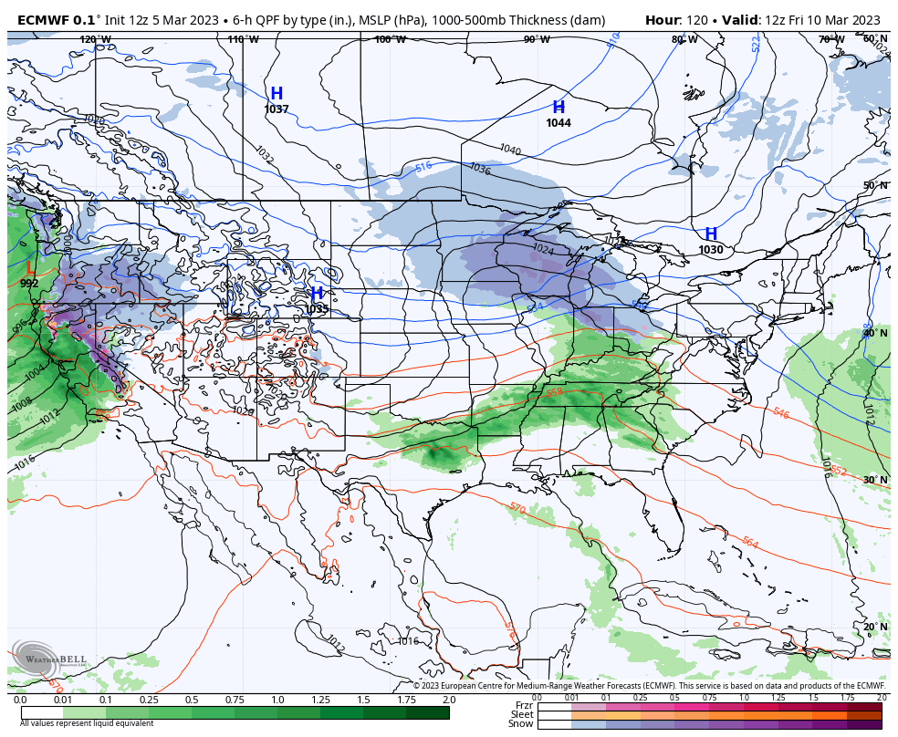
IV. Another system appears likely to open up early next week, but similar to our late week system, there are more questions than answers at this distance. While confidence remains high on a continued active pattern and one that also turns progressively colder (compared to normal), the all-important specific details are up for great debate.

Spring “Tease” Just That; Long, Long Road Ahead…

Updated 02.27.23 @ 6:15p

Temperatures are running around 7° above normal at IND February to-date, and the first few days of March will also get off to a well above normal start. Winter, as a whole, aside from the bitter pre-Christmas blast, has been absolutely forgettable to most winter weather enthusiasts. I suppose it only makes sense that just as most are ready for “stick and hold” spring weather to show itself, we are seeing the best alignment and most bullish signal for persistent anomalous cold from a variety of pattern drivers all winter long. 😉

Long time IndyWx viewers know that this is the time of year we lean heaviest of NAO impacts, particularly if in a negative state. Latest long range data places the NAO in a negative state for the better part of the upcoming (6) weeks:

This strongly argues for more of a persistent eastern trough, including below normal temperatures and an active storm track, thanks to the busy Pacific pattern.

Secondly, and we really should have started with this one, the Madden-Julian Oscillation is finally set to rotate into the traditionally cold phases (8 and then 1) as we flip the page to the 2nd week of March and beyond. This should eventually translate into a widespread cold pattern, including the East, with an active coast-to-coast storm track continuing. Also note the high latitude blocking emerging as we transition into Phase 1.

Throw in a negative WPO, and this further backs up the widespread cold, active pattern. Similar to the NAO chart to open this piece, the majority of the (6) week period is spent in a negative state. Pattern alignment…

Add in all of this and there’s no wonder the most updated (as of this afternoon) European Weeklies are banging the drum, quite loudly I might add, for a prolonged period of colder than normal weather from mid-March through mid-April. Don’t put away that cold weather gear- or snow shovels just yet…

VIDEO: Window For Severe Weather Late Morning Into Early Afternoon; Late Week Storm On Deck…

Updated 02.27.23 @ 7:40a

You must be logged in to view this content. Click Here to become a member of IndyWX.com for full access.  Already a member of IndyWx.com All-Access?  Log-in here.