October got off to a warm start, but unseasonably chilly conditions have dominated over the past couple of weeks. In fact, we’re on a stretch of (12) consecutive days below average after the summer-like start. The other common theme? Dry, dry, dry. Officially, IND is running close to 1″ below average through the first few weeks of the month. Changes loom- at least to some extent.
 We notice the ensemble data (both the European and GFS) is painting a more active, wetter regime as we move through early November. Given the upper air pattern, we would tend to agree.
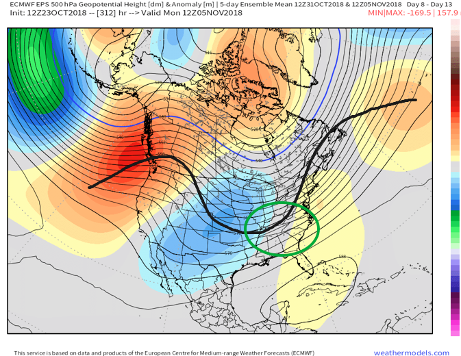

European data, courtesy of Weathermodels.com, paints a much more active picture early November.

GFS data, courtesy of Tropicaltidbits.com, shows the return of a wetter pattern for early November.
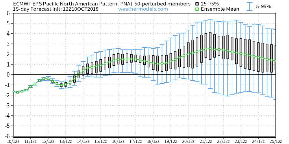
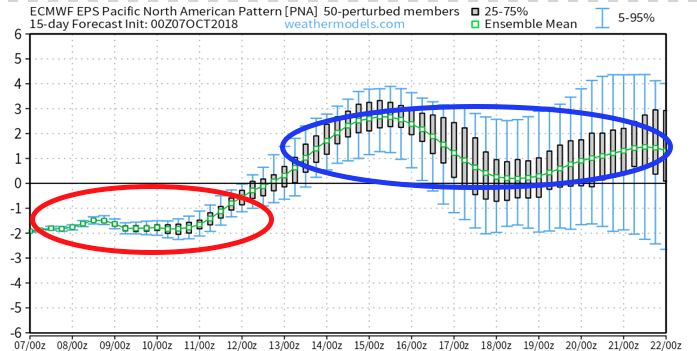
While confident on the return of wet conditions as we traverse the first week or two of November, data is struggling to get a handle on the PNA past the short-term. The PNA, or Pacific North American Pattern, teleconnection is one of our favorites this time of year to “key in” on the medium range pattern. While the NAO and AO get a lot of attention the deeper we get into the cold season, the PNA can be a tremendous tool during transition seasons. We note latest data is trending significantly more towards a positive PNA (compared to previous runs)- which is a colder signal.
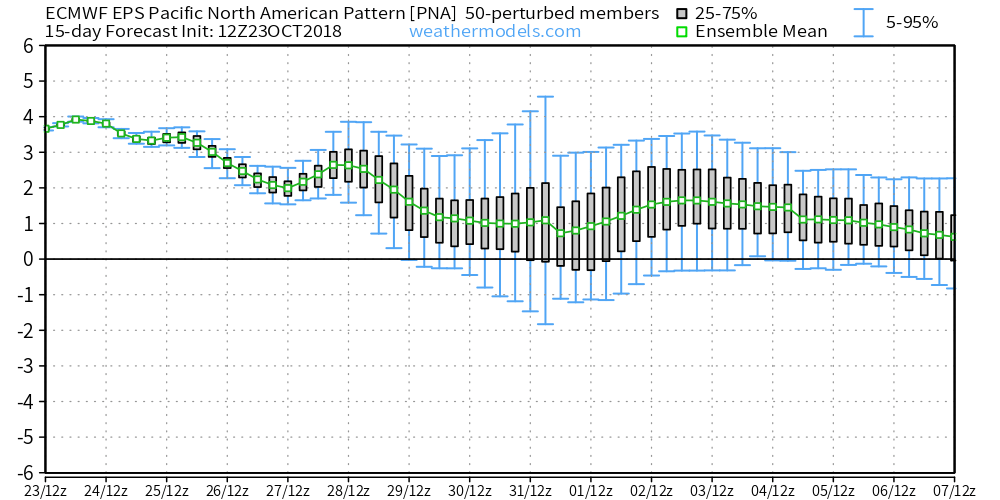 To no surprise, data has trended chillier during today’s 12z update.
 To close, bank on a return of the wet conditions as we move into the mighty month of November. From a temperature perspective, the forecast is much tougher for the first half of November. As things stand now, we continue to favor a relaxation of the anomalous chill overall, but can certainly see where “pops” of cold air can easily sweep in behind what should be an active storm track from the mid-south up into the Mid West and Ohio Valley. Stay tuned.

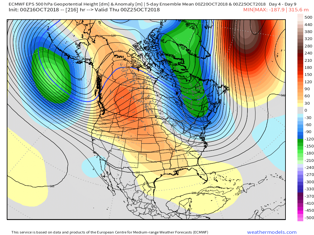


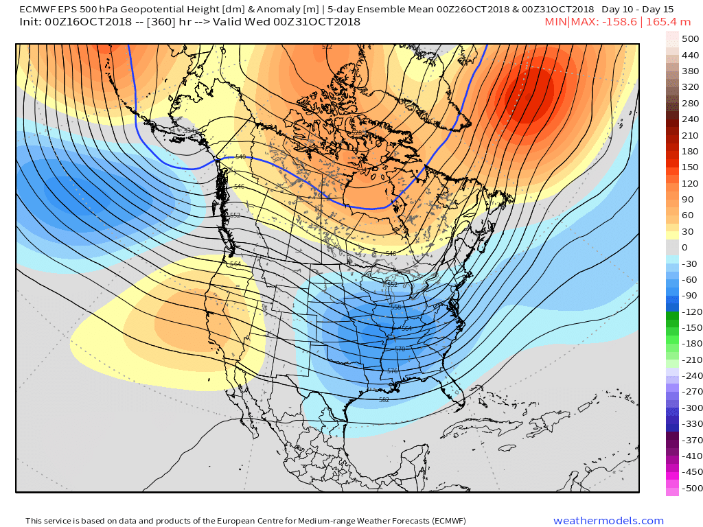
 A series of cold fronts will sweep through the Ohio Valley over the upcoming couple of weeks and each will likely feature progressively cooler conditions.
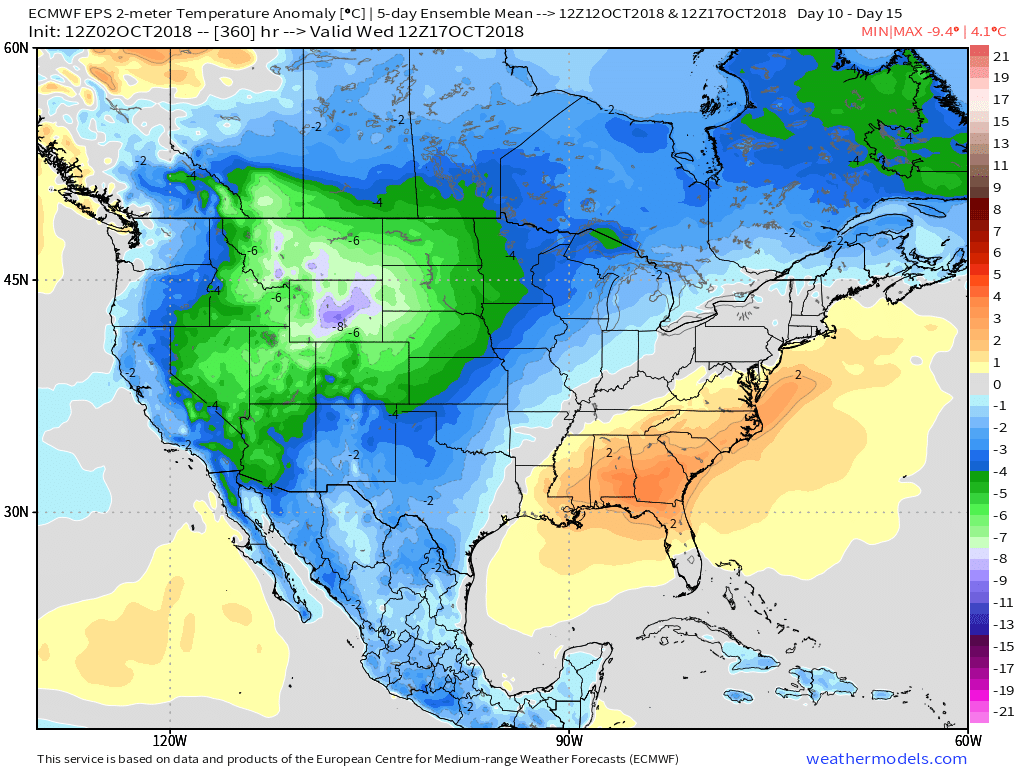
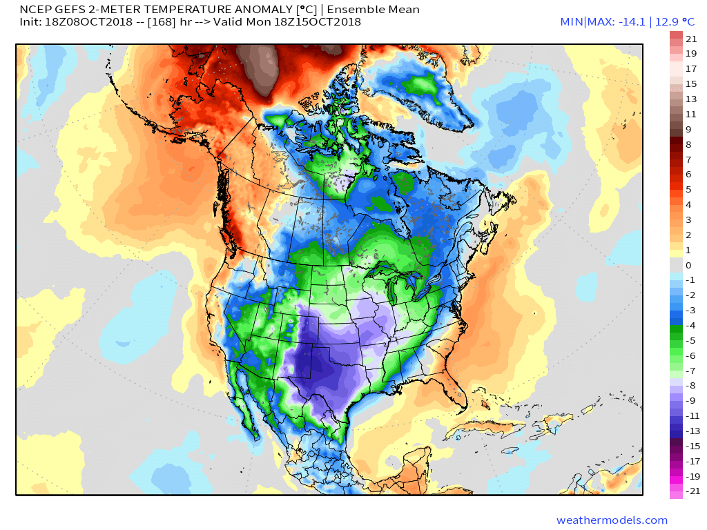
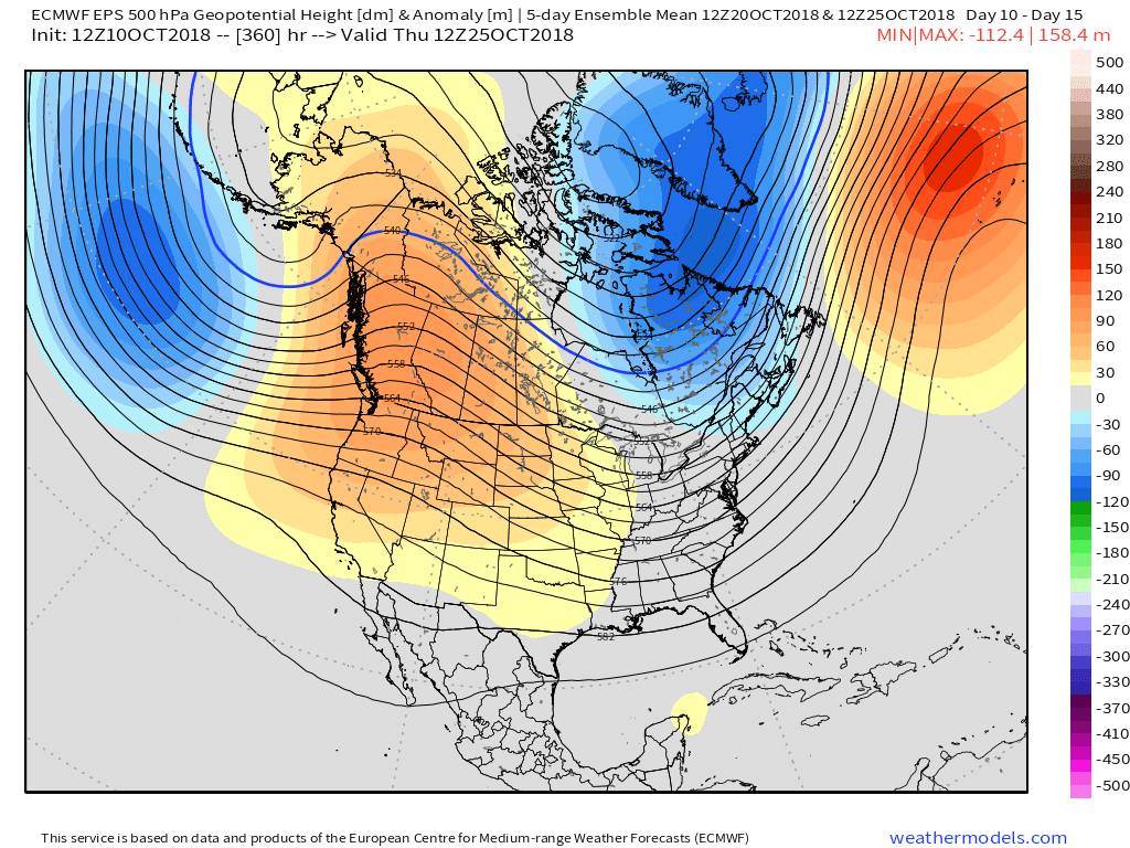 At the surface, we see the cool pattern taking hold into not only the short-term, but the 10-15 day range, as well.
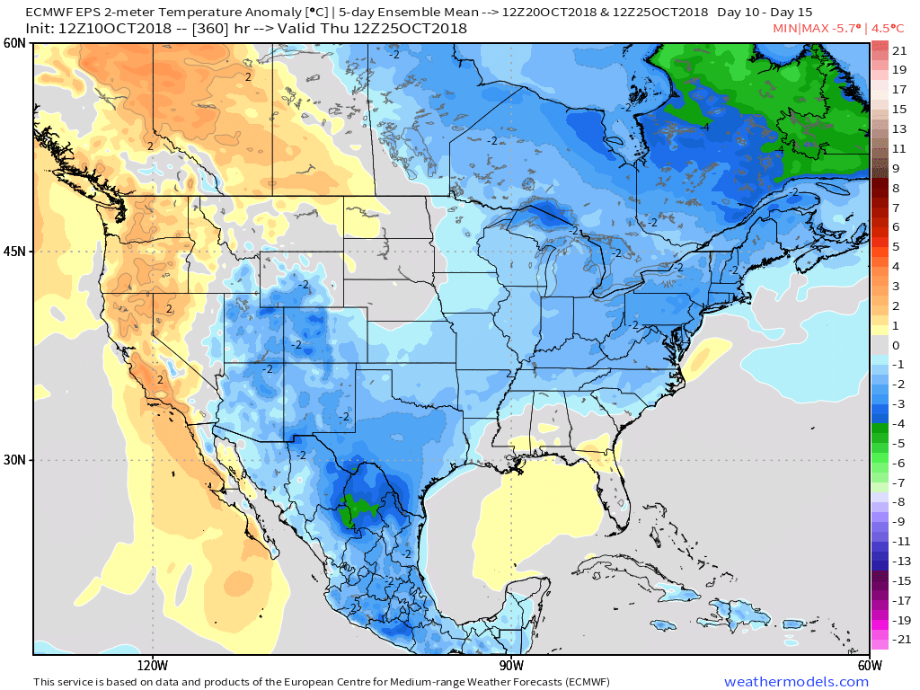
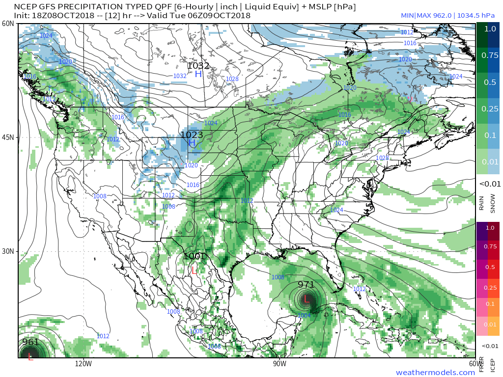
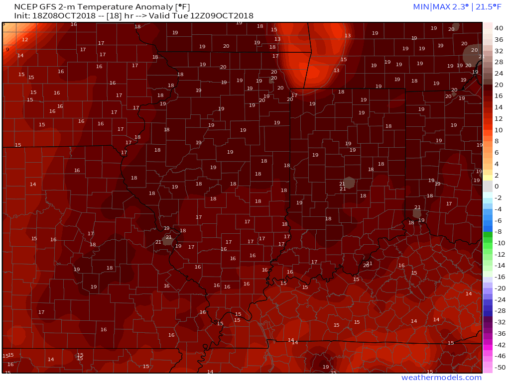 A cold front will sweep through the region Wednesday evening and will lead to a better chance of more concentrated showers and thunderstorms for our hump day. Precipitable water values (PWATs) will approach 2″ Wednesday afternoon which is almost unheard of by October standards. As a result, a couple of the storms may be accompanied by locally heavy rainfall.
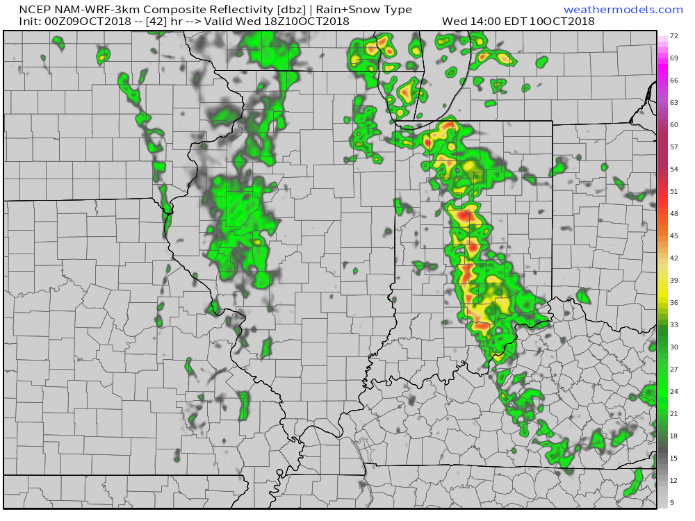 Winds of change will be blowing in earnest Wednesday night and Thursday morning and a legit fall feel will greet us out the door! Most of central Indiana can expect temperatures to be falling into the 40s Thursday morning along with a nice northwest breeze.
 Longer term, a new storm system (including remnant moisture from Sergio) is expected to impact our weekend weather. We’ll trend our forecast wetter with reviewing some of the latest data. Sunday appears to be the wettest day.
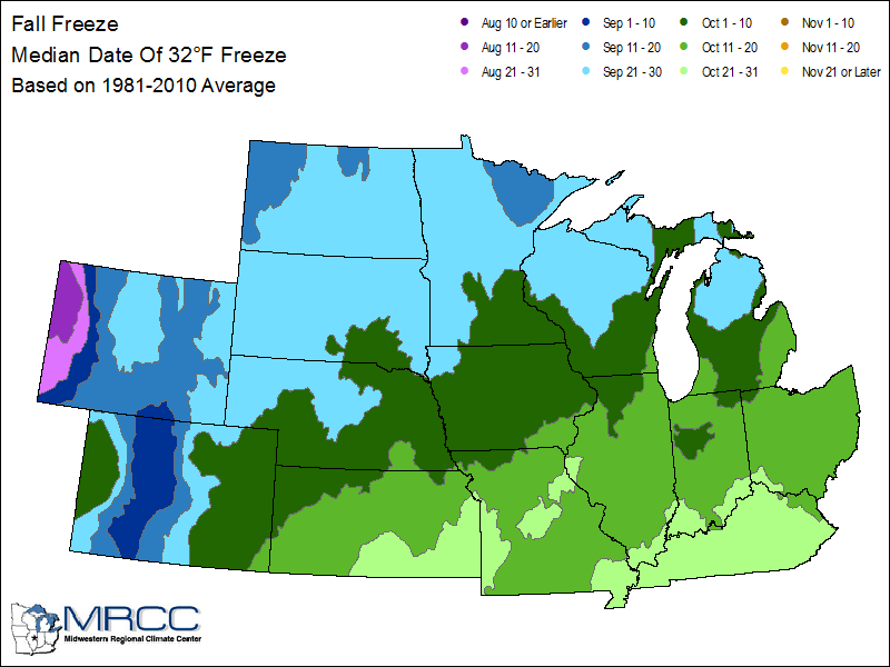
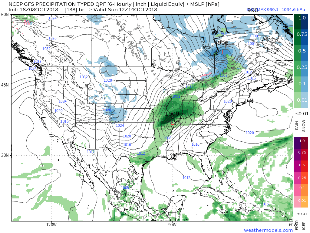 An even more impressive push of fall air will follow on the heels of Sergio’s remnants early next week, including the potential of frost for more of the Ohio Valley, including central Indiana.
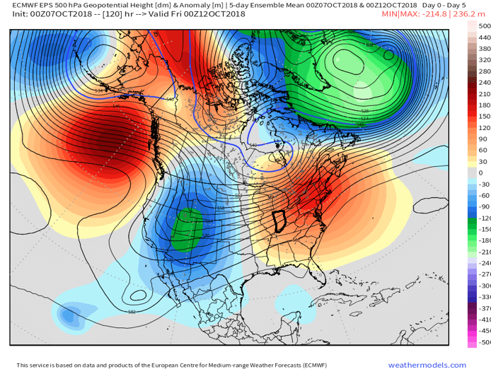 II. TD 14 will strengthen into Tropical Storm Michael later today and eventually a hurricane before making landfall along the Florida panhandle during the middle of the week. The remnant moisture of Michael will then race northeast and impact the flood-ravaged Carolinas during the latter stages of the work week.
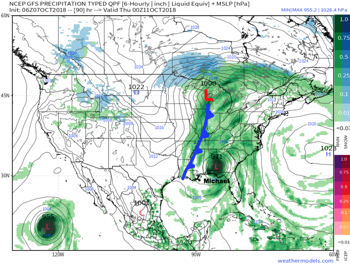
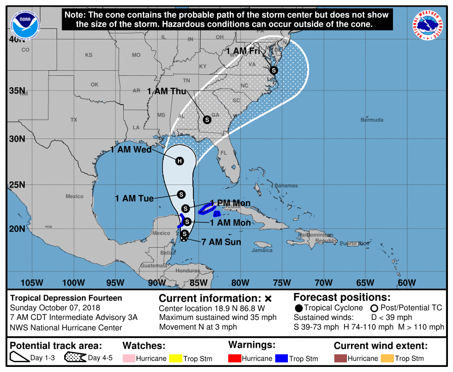 III. As Michael’s remnant moisture tracks northeast into the Carolinas, a strong cold front will sweep through the Mid West and Ohio Valley. Better chances of organized showers and thunderstorms will arrive ahead of the front Wednesday. Once the front passes, a dramatic wind shift to the northwest will push a MUCH cooler and drier air mass into the region.
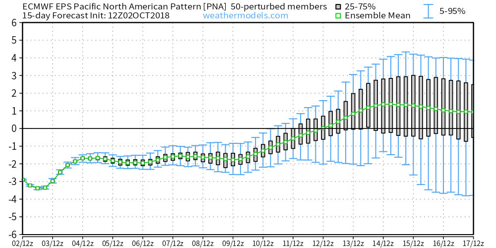
 IV. We note the PNA (Pacific North America pattern) is flipping to a positive state and that will drive a more sustained period of colder air during the medium and longer range period- or mid and late October.
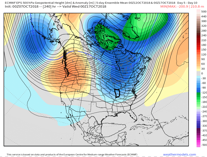
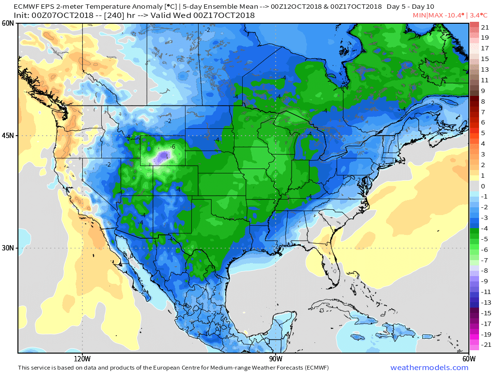 The air will grow cold enough to support the potential of frost during the 5-10 day period on at least a couple of nights. Additionally, reinforcing chilly air may ignite the lake effect to our north and northeast during Week 2… “Times, they are a changing!”
 II.) After a windy and warm Wednesday, scattered showers and thunderstorms will return Thursday. Not everyone will get wet, but a few locally heavy downpours can be expected.
 III.) The ridge will “flex its muscle” into early and middle parts of next week and promote an extended (and unusual) stretch of 80s. Don’t put those shorts away just yet…
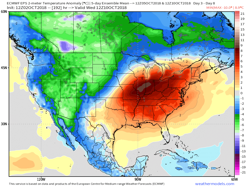 IV.) A “game changer” of a cold front will approach late next week with better chances of organized rain and storms followed by a return of more seasonal times…
 V.) Ingredients are in place for a significant shift in the pattern around the middle of October and colder times continue to look like they will return as we flip the page into Weeks 2-3.