Shower Chance This Evening…
|
Wed. |
Thr. |
Fri. |
Sat. |
Sun. |
Mon. |
Tue. |
|
|
|
|
|
|
|
|
|
56/ 77 |
56/ 78 |
53/ 80 |
60/ 85 |
65/ 84 |
67/ 82 |
63/ 83 |
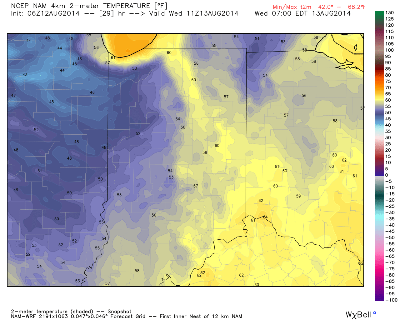
Evening Shower Chance…A frontal boundary will push through the region this evening and while moisture will be limited overall, don’t be surprised by an increase in cloudiness and an isolated shower as the front moves through. Overall, we’re looking at a beautiful day, along with continued below normal temperatures.
Nice Late Week Stretch…The late week stretch will be dominated by high pressure and slowly moderating temperatures. We’ll start well below normal, but temperatures will creep back to seasonable levels over the weekend.
Unsettled Times Ahead…More unsettled times are ahead late in the weekend into next week. We still have details to iron out, but we’ve introduced rain into the forecast as early as Sunday. Some of the rain may become heavy at times early next week. Stay tuned.
7-Day Precipitation Outlook:
- 7-Day Rainfall Forecast: 0.50″-1.00″
- 7-Day Snowfall Forecast: 0.00″
John Salewicz captured this shot of an autumn looking sky Tuesday morning as unseasonably cool air was pouring in. Thank you, John!

